| |||||||||||||||||||||||||||||||||||||||||||||||||||||||||||||
| |||||||||||||||||||||||||||||||||||||||||||||||||||||||||||||
| Rwy | Rwy | |||||||
| 3503x75 | 3503' | 3503x75 | 3503' | |||||
| Runway ID | Single Wheel | Double Wheel | Double Tandem Wheel | Dual Double Wheel |
| 07/25 | 12,500 | N/A | N/A | N/A |
| These numbers are Advisory and are not limits. The Airport Manager should have more accurate Weight Limits | ||||
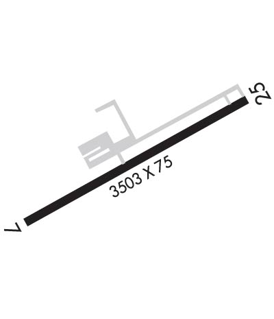 Airport Diagram might not be current. | |
| Facility Name: | COLUMBIANA COUNTY |
| City Name: | EAST LIVERPOOL |
| County: | COLUMBIANA |
| State abbrev: | OH |
| State Name: | OHIO |
| Ownership: | PUBLICLY OWNED |
| Use: | OPEN TO THE PUBLIC |
| Owner's Name: | COLUMBIANA CO ARPT AUTH |
| Address: | PO BOX 81 |
| EAST LIVERPOOL, OH 43920-5081 | |
| Owner's Phone: | 330-397-5769 |
| Manager's Name: | JAMES PUSATERI |
| Address: | PO BOX 81 |
| EAST LIVERPOOL, OH 43920-5081 | |
| Phone: | 330-397-5769 |
| FAA Region: | GREAT LAKES |
| FAA Field Office: | DET |
| Date | Sunrise | Sunset |
|---|---|---|
| 04/23/24 Tuesday | 6:31 | 20:11 |
| 04/24/24 Wednesday | 6:30 | 20:12 |
| 04/25/24 Thursday | 6:28 | 20:13 |
| 04/26/24 Friday | 6:27 | 20:14 |
| 04/27/24 Saturday | 6:26 | 20:15 |
| 04/28/24 Sunday | 6:24 | 20:16 |
| 04/29/24 Monday | 6:23 | 20:17 |
| 04/30/24 Tuesday | 6:22 | 20:18 |
| 05/01/24 Wednesday | 6:20 | 20:19 |
| 05/02/24 Thursday | 6:19 | 20:20 |
| 05/03/24 Friday | 6:18 | 20:22 |
| 05/04/24 Saturday | 6:17 | 20:23 |
| 05/05/24 Sunday | 6:15 | 20:24 |
| 05/06/24 Monday | 6:14 | 20:25 |
| Airport Attendance Schedule | UNATTENDED |
| Airport Status | OPERATIONAL (This Status can change at any time - please check NOTAMS) |
| Airport Lighting Schedule | ACTVT REIL RWY 07 & 25; PAPI RWY 25; MIRL RWY 07/25 - CTAF. |
| Airport Storage Available | Tie Downs |
| Extra Services Available | NONE |
| Wind Indicator | YES - (lighted) |
| Control Tower | NO |
| CTAF Frequency | 123.000 |
| Unicom Frequency | 123.000 |
| Rotating Beacon Color | WG |
| Segmented Circle | NO |
| Landing Fee | NO |
| Airport Inspected | STATE - performed by STATE AERONAUTICAL PERSONNEL |
| Inspection Date | 06/26/2023 |
| Type of Fuel Available | Grade 100LL; -10100LL AVBL H24 SELF SVC VIA CREDIT CARD. |
| Airframe Repair Service | NONE |
| Power Plant Repair Service | NONE |
| Latitude | N4040.4 |
| Longitude | W08038.5 (ESTIMATED) |
| Arpt Elevation | 1160ft (SURVEYED) |
| Magnetic Variation | 08W |
| 4 miles NW | of EAST LIVERPOOL |
| Traffic Pattern Altitude | |
| Sectional Chart | DETROIT |
| Operations (Reported) | Yearly | Avg. Daily |
|---|---|---|
| General Aviation Transient | 4620 | 13 |
| General Aviation Local | 26400 | 72 |
| Air Taxi | 50 | 0 |
| Commerical | 0 | 0 |
| Commuter | 0 | 0 |
| Military | 30 | 0 |
| Aircraft based on Field | |
|---|---|
| General Aviation Singles | 31 |
| General Aviation Multi | 3 |
| Jet Aircraft | 0 |
| General Aviation Helicopters | 0 |
| Military Aircraft | 0 |
| Gliders | 0 |
| Ultralights | 0 |
| FSS on field | NO |
| FSS tie-in | CLEVELAND |
| FSS Phone | 1-800-WX-BRIEF |
| Who issues Notams | CLE |
| Notam D service at airport | YES |
| ARTCC Name | CLEVELAND |
| Airport Certification | |
| Aircraft Rescue & Firefighting Index | None |
| Airport of Entry | No |
| Custom Landing Rights | No |
| Joint Civil/Military | No |
| Military Landing rights | YES |
| NATIONAL PLAN OF INTEGRATED AIRPORT SYSTEMS (NPIAS) |
| GRANT AGREEMENTS UNDER FAAP/ADAP/AIP |
| ADVANCE PLANNING AGREEMENT UNDER FAAP |
| ASSURANCES PURSUANT TO TITLE VI, CIVIL RIGHTS ACT OF 1964 |
| LGTD OBSTN HI TENSION LINE 1.5 NM NW. |
| DEER, BIRDS, & OTR WILDLIFE ON & INVOF ARPT. |
| FOR CD CTC PITTSBURGH APCH AT 412-472-5591. |
Airport Communications & Frequencies:
| ||||||||||||||||||
| Runway: 07 | Runway: 25 | ||
| Mag heading: | 69° | Mag heading: | 249° |
| Rwy Slope: | .50% Up | Rwy Slope: | -.50% Down |
| Approach: | Approach: | ||
| Pattern: | Left Traffic | Pattern: | Left Traffic |
| Markings: | NONPRECISION INSTRUMENT | Markings: | NONPRECISION INSTRUMENT |
| Marking Condition: | GOOD | Marking Condition: | GOOD |
| Arresting Dev: | Arresting Dev: | ||
| Lat & Long: | N4040.3 W08038.8 | Lat. & Long.: | N4040.5 W08038.2 |
| Elev: | 1142.7 ft. MSL | Elev: | 1160.3 ft. MSL |
| TCH: | TCH: | 26 ft. AGL | |
| Visual Glide Path: | Visual Glide Path: | 3.00 degrees | |
| Displaced Threshold: | No | Displaced Threshold: | No |
| Touchdown Zone: | YES | Touchdown Zone: | YES |
| Touchdown Elev.: | 1159.1 feet | Touchdown Elev.: | 1160.5 feet |
| Visual Glide Slope: | Visual Glide Slope: | 4-Light PAPI on LEFT side of Runway | |
| RVR Equipment: | RVR Equipment: | ||
| RVV Equipment: | NO | RVV Equipment: | NO |
| Approach Lights: | Approach Lights: | ||
| REIL: | YES | REIL: | YES |
| Centerline Lights: | NO | Centerline Lights: | NO |
| Touchdown lights: | NO | Touchdown lights: | NO |
| Runway Category: | Runway with a Visual Approach | Runway Category: | Runway with a Non-precision Approach |
| Declared Distances: | Declared Distances: | ||
| Obstructions: | TREE | Obstructions: | TREES |
| Marked: | NOT Marked/Lighted | Marked: | NOT Marked/Lighted |
| Clearance slope: | 15:1 | Clearance slope: | 18:1 |
| Obstruction height: | 8 feet AGL | Obstruction height: | 60 feet AGL |
| Dist. from runway: | 321 feet | Dist. from runway: | 1325 feet |
| Centerline offset: | 58 right of centerline | Centerline offset: | 105 feet left of centerline |
| Comments: | Comments: |