Click here for more info on on SMS!

ID40

SUNRISE SKYPARK (PRIVATE)
MARSING
ID
Time Zone: Mountain
Lat: N 4325.1
Long: W 11642.4
Elev: 2240
Var: -16
Longest Runway: 2892

FBO & Flight Services info for ID40

FBOs: Update your Fuel Prices

AIRPORT (PRIVATE)Ph: 208-495-2120
-
-
If you are an FBO, call 1-203-262-1700 to update your info or email: FltPlan.Advertising@garmin.com
Advertise your FBO on FltPlan.com

Runway & Approach Info for ID40
Rwy
Length
Land Dist**
Approach*
  Rwy
Length
Land Dist**
Approach*
12
2892x40  2392'          
 
  
30
  2892x40  2392'          
 
 * only ILS, LOC, LDA, and SDF approaches to a specific runway are shown
** For any Declared Landing Distance Available, please see A/FD or Approach plates
Runway Weight Capability (lbs.) Help
Runway IDSingle WheelDouble WheelDouble Tandem WheelDual Double Wheel
12/30N/AN/AN/AN/A
These numbers are Advisory and are not limits.   The Airport Manager should have more accurate Weight Limits
Approach Charts
FltPlan does not have IFR approach charts available for ID40.
Current Weather/Notams
Customs Information Send updates to Support@FltPlan.com
Customs Not Available
A/FD
No A/FD Information
Database effective 05/16/2024
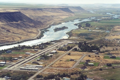
Facility Name: SUNRISE SKYPARK
City Name: MARSING
County: OWYHEE
State abbrev: ID
State Name: IDAHO
   
Ownership: PRIVATELY OWNED
Use: PRIVATE
Owner's Name: SUNRISE SKY PARK HOMEOWNERS ASSN
Address: 11158 STATE HWY 78
 MELBA, ID 83641
Owner's Phone:
  
Manager's Name: DAVE MACHADO
Address: 11158 STATE HWY 78
 MELBA, ID 83641
Phone: (208) 495-3641
   
FAA Region: NORTHWEST MOUNTAIN
FAA Field Office: HLN


Sunrise / Sunset times for SUNRISE SKYPARK

DateSunriseSunset
04/22/24 Monday6:5220:39
04/23/24 Tuesday6:5020:40
04/24/24 Wednesday6:4920:42
04/25/24 Thursday6:4720:43
04/26/24 Friday6:4620:44
04/27/24 Saturday6:4420:45
04/28/24 Sunday6:4320:46
04/29/24 Monday6:4120:47
04/30/24 Tuesday6:4020:49
05/01/24 Wednesday6:3920:50
05/02/24 Thursday6:3720:51
05/03/24 Friday6:3620:52
05/04/24 Saturday6:3420:53
05/05/24 Sunday6:3320:54

Airport Facilities

Airport Attendance ScheduleCONTINUOUS
Airport Status OPERATIONAL (This Status can change at any time - please check NOTAMS)
Airport Lighting ScheduleFOR MIRL RY 12/30 ACTIVATE RUNWAY LIGHTS 122.9
Airport Storage AvailableNONE
Extra Services AvailableNONE
Wind IndicatorYES - (unlit)
Control TowerNO
CTAF Frequency
Unicom Frequency
Rotating Beacon Color
Segmented CircleYES; SE END OF RY.AROUND BASE OF WINDSOCK POLE
Landing FeeNO

Airport Inspection Data

Airport Inspected5010-2 PRIVATE USE MAILOUT PROGRAM - performed by the OWNER
Inspection DateUnknown

Airport Services

Type of Fuel AvailableNone
Airframe Repair ServiceNone
Power Plant Repair ServiceNone

Geographic Data

LatitudeN4325.1
LongitudeW11642.4 (ESTIMATED)
Arpt Elevation2240ft (ESTIMATED)
Magnetic Variation16E
9 miles SEof MARSING
Traffic Pattern Altitude
Sectional ChartSALT LAKE CITY

Aircraft Data

Operations (Reported)YearlyAvg. Daily
General Aviation Transient 00
General Aviation Local 00
Air Taxi 00
Commerical 00
Commuter 00
Military 00
Aircraft based on Field
General Aviation Singles 40
General Aviation Multi 1
Jet Aircraft 0
General Aviation Helicopters 0
Military Aircraft 0
Gliders 0
Ultralights 3

FAA Services

FSS on field NO
FSS tie-in BOISE
FSS Phone 1-800-WX-BRIEF
Who issues Notams
Notam D service at airport No
ARTCC Name SALT LAKE CITY

Federal Status

Airport Certification
Aircraft Rescue & Firefighting IndexNone
Airport of EntryNo
Custom Landing RightsNo
Joint Civil/MilitaryNo
Military Landing rightsNo

Remarks

NO VSBY BETWEEN RWY ENDS.
FOR CD CTC BIG SKY APCH AT 208-364-5860/5861.
Runway Identifications
Runway Identification: 12/30
Length: 2892 ft
Width: 40 ft
Surface: ASPHALT
Edge lights: Low Intensity

Treatment: NONE

 Runway: 12   Runway: 30
Mag heading: 121°Mag heading: 301°
Approach: Approach:
Pattern: Right TrafficPattern: Left Traffic
Markings: Markings:
Marking Condition: Marking Condition:
Arresting Dev: Arresting Dev:
Lat & Long: N4325.2  W11642.6Lat. & Long.: N4324.9  W11642.2
Elev: N/AElev: N/A
TCH: TCH:
Visual Glide Path: Visual Glide Path:
Displaced Threshold: 500 feetDisplaced Threshold: 500 feet
Touchdown Zone: NOTouchdown Zone: NO
Touchdown Elev.: Touchdown Elev.:
Visual Glide Slope: Visual Glide Slope:
RVR Equipment: RVR Equipment:
RVV Equipment: NORVV Equipment: NO
Approach Lights: Approach Lights:
REIL: NOREIL: NO
Centerline Lights: NOCenterline Lights: NO
Touchdown lights: NOTouchdown lights: NO
Runway Category: Runway with a Visual ApproachRunway Category: Runway with a Visual Approach
Declared Distances: Declared Distances:
Obstructions: FENCEObstructions: FENCE
Marked: MARKEDMarked: NOT Marked/Lighted
Clearance slope: Clearance slope:
Obstruction height: 4 feet AGLObstruction height: 4 feet AGL
Dist. from runway: 50 feetDist. from runway: 50 feet
Centerline offset: Centerline offset:
Comments: Comments:
C:/P: