
| |||||
|
| Rwy | Rwy | |||||||
| 4500x50 | 4500' | 4500x50 | 4500' | |||||
| Runway ID | Single Wheel | Double Wheel | Double Tandem Wheel | Dual Double Wheel |
| 10/28 | N/A | N/A | N/A | N/A |
| These numbers are Advisory and are not limits. The Airport Manager should have more accurate Weight Limits | ||||
| FltPlan does not have IFR approach charts available for 20GA. |
| Facility Name: | EARL L SMALL JR FLD/STOCKMAR |
| City Name: | VILLA RICA |
| County: | DOUGLAS |
| State abbrev: | GA |
| State Name: | GEORGIA |
| Ownership: | PRIVATELY OWNED |
| Use: | PRIVATE |
| Owner's Name: | RHONDA R. SMALL |
| Address: | P.O. BOX 880 |
| VILLA RICA, GA 30180 | |
| Owner's Phone: | 770-459-5145 |
| Manager's Name: | RHONDA R. SMALL |
| Address: | P.O. BOX 880 |
| VILLA RICA, GA 30180 | |
| Phone: | 770-459-5145 |
| FAA Region: | SOUTHERN |
| FAA Field Office: | ATL |
| Date | Sunrise | Sunset |
|---|---|---|
| 04/18/24 Thursday | 7:04 | 20:14 |
| 04/19/24 Friday | 7:03 | 20:14 |
| 04/20/24 Saturday | 7:02 | 20:15 |
| 04/21/24 Sunday | 7:01 | 20:16 |
| 04/22/24 Monday | 7:00 | 20:17 |
| 04/23/24 Tuesday | 6:59 | 20:17 |
| 04/24/24 Wednesday | 6:57 | 20:18 |
| 04/25/24 Thursday | 6:56 | 20:19 |
| 04/26/24 Friday | 6:55 | 20:20 |
| 04/27/24 Saturday | 6:54 | 20:20 |
| 04/28/24 Sunday | 6:53 | 20:21 |
| 04/29/24 Monday | 6:52 | 20:22 |
| 04/30/24 Tuesday | 6:51 | 20:23 |
| 05/01/24 Wednesday | 6:50 | 20:24 |
| Airport Attendance Schedule | 7 Days A Week DALGT |
| Airport Status | OPERATIONAL (This Status can change at any time - please check NOTAMS) |
| Airport Lighting Schedule | ACTVT VASI RWY 10 & 28; LIRL RWY 10/28 - CTAF. |
| Airport Storage Available | NONE |
| Extra Services Available | NONE |
| Wind Indicator | YES - (unlit) |
| Control Tower | NO |
| CTAF Frequency | 122.900 |
| Unicom Frequency | |
| Rotating Beacon Color | WG |
| Segmented Circle | NO |
| Landing Fee | NO |
| Airport Inspected | 5010-2 PRIVATE USE MAILOUT PROGRAM - performed by the OWNER |
| Inspection Date | Unknown |
| Type of Fuel Available | Grade 100LL; -10AVBL 24 HRS WITH CREDIT CARD. |
| Airframe Repair Service | None |
| Power Plant Repair Service | None |
| Latitude | N3345.4 |
| Longitude | W08453.1 (ESTIMATED) |
| Arpt Elevation | 1110ft (ESTIMATED) |
| Magnetic Variation | 03W |
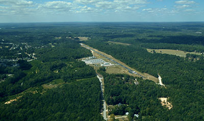
| 2 miles NE | of VILLA RICA |
| Traffic Pattern Altitude | 720; ALL TFC SHD RMN N OF RWY 10/28 FOR NOISE ABATEMENT OF HOUSES S OF ARPT. |
| Sectional Chart | ATLANTA |
| Operations (Reported) | Yearly | Avg. Daily |
|---|---|---|
| General Aviation Transient | 200 | 1 |
| General Aviation Local | 1000 | 3 |
| Air Taxi | 0 | 0 |
| Commerical | 0 | 0 |
| Commuter | 0 | 0 |
| Military | 0 | 0 |
| Aircraft based on Field | |
|---|---|
| General Aviation Singles | 50 |
| General Aviation Multi | 0 |
| Jet Aircraft | 0 |
| General Aviation Helicopters | 1 |
| Military Aircraft | 0 |
| Gliders | 0 |
| Ultralights | 1 |
| FSS on field | NO |
| FSS tie-in | MACON |
| FSS Phone | 1-800-WX-BRIEF |
| Who issues Notams | FDC |
| Notam D service at airport | No |
| ARTCC Name | ATLANTA |
| Airport Certification | |
| Aircraft Rescue & Firefighting Index | None |
| Airport of Entry | No |
| Custom Landing Rights | No |
| Joint Civil/Military | No |
| Military Landing rights | No |
| TRANSIENT ACFT LAND AT OWN RISK |
| FOR CD CTC ATLANTA APCH AT 678-364-6131. |
Airport Communications & Frequencies:
| ||||||||||||
| Runway: 10 | Runway: 28 | ||
| Mag heading: | N/A | Mag heading: | N/A |
| Rwy Slope: | .67% Up | Rwy Slope: | -.67% Down |
| Approach: | Approach: | ||
| Pattern: | Left Traffic | Pattern: | Right Traffic |
| Markings: | Markings: | ||
| Marking Condition: | Marking Condition: | ||
| Arresting Dev: | Arresting Dev: | ||
| Lat & Long: | N3345.4 W08453.5 | Lat. & Long.: | N3345.4 W08452.7 |
| Elev: | 1064.0 ft. MSL | Elev: | 1094.0 ft. MSL |
| TCH: | TCH: | ||
| Visual Glide Path: | Visual Glide Path: | ||
| Displaced Threshold: | No | Displaced Threshold: | No |
| Touchdown Zone: | YES | Touchdown Zone: | YES |
| Touchdown Elev.: | 1064.0 feet | Touchdown Elev.: | 1094.0 feet |
| Visual Glide Slope: | 2-Box VASI on LEFT side of Runway | Visual Glide Slope: | 2-Box VASI on LEFT side of Runway |
| RVR Equipment: | RVR Equipment: | ||
| RVV Equipment: | NO | RVV Equipment: | NO |
| Approach Lights: | Approach Lights: | ||
| REIL: | YES | REIL: | YES |
| Centerline Lights: | NO | Centerline Lights: | NO |
| Touchdown lights: | NO | Touchdown lights: | NO |
| Runway Category: | Runway with a Visual Approach | Runway Category: | Runway with a Visual Approach |
| Declared Distances: | Declared Distances: |