
| ||||||||||||||||||||||||||||||||
| ||||||||||||||||||||||||||||||||
| ||||||||||||||||||||||||||||||||
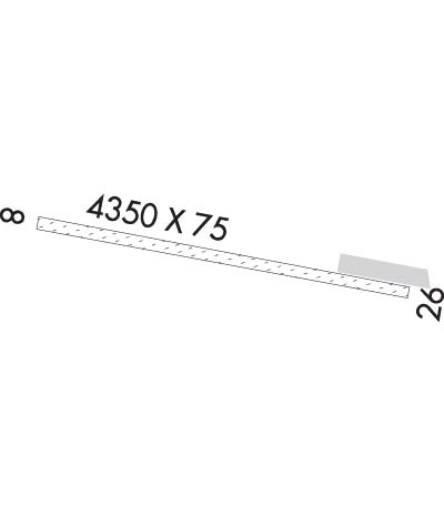
| Rwy | Rwy | |||||||
| 4350x75 | 4350' | 4350x75 | 4350' | |||||
| Runway ID | Single Wheel | Double Wheel | Double Tandem Wheel | Dual Double Wheel |
| These numbers are Advisory and are not limits. The Airport Manager should have more accurate Weight Limits | ||||
| FltPlan does not have IFR approach charts available for 0AA1. |
 Airport Diagram might not be current. | |
| Facility Name: | YAKATAGA |
| City Name: | YAKATAGA |
| County: | CORDOVA-MCCARTHY |
| State abbrev: | AK |
| State Name: | ALASKA |
| Ownership: | PUBLICLY OWNED |
| Use: | PRIVATE |
| Owner's Name: | FEDERAL AVIATION ADMINISTRATION |
| Address: | 222 W. 7TH AVE. #14 |
| ANCHORAGE, AK 99513-7587 | |
| Owner's Phone: | 907-271-5849 |
| Manager's Name: | US GOV, FAA TURNAGAIN SSC |
| Address: | 301 E 56TH STREET |
| ANCHORAGE, AK 99518 | |
| Phone: | 907-271-2216 |
| FAA Region: | ALASKA |
| FAA Field Office: | NONE |
| Date | Sunrise | Sunset |
|---|---|---|
| 04/23/24 Tuesday | 5:47 | 21:11 |
| 04/24/24 Wednesday | 5:44 | 21:13 |
| 04/25/24 Thursday | 5:41 | 21:16 |
| 04/26/24 Friday | 5:38 | 21:18 |
| 04/27/24 Saturday | 5:36 | 21:21 |
| 04/28/24 Sunday | 5:33 | 21:23 |
| 04/29/24 Monday | 5:30 | 21:26 |
| 04/30/24 Tuesday | 5:27 | 21:28 |
| 05/01/24 Wednesday | 5:25 | 21:31 |
| 05/02/24 Thursday | 5:22 | 21:33 |
| 05/03/24 Friday | 5:19 | 21:36 |
| 05/04/24 Saturday | 5:17 | 21:38 |
| 05/05/24 Sunday | 5:14 | 21:41 |
| 05/06/24 Monday | 5:11 | 21:43 |
| Airport Attendance Schedule | UNATTENDED |
| Airport Status | OPERATIONAL (This Status can change at any time - please check NOTAMS) |
| Airport Lighting Schedule | |
| Airport Storage Available | NONE |
| Extra Services Available | NONE |
| Wind Indicator | YES - (unlit) |
| Control Tower | NO |
| CTAF Frequency | 122.900 |
| Unicom Frequency | |
| Rotating Beacon Color | |
| Segmented Circle | NO |
| Landing Fee | NO |
| Airport Inspected | STATE - performed by PRIVATE CONTRACT PERSONNEL |
| Inspection Date | 05/22/2013 |
| Type of Fuel Available | None |
| Airframe Repair Service | NONE |
| Power Plant Repair Service | NONE |
| Latitude | N6004.9 |
| Longitude | W14229.7 (ESTIMATED) |
| Arpt Elevation | 16ft (ESTIMATED) |
| Magnetic Variation | 27E |
| 0 miles S | of YAKATAGA |
| Traffic Pattern Altitude | |
| Sectional Chart | ANCHORAGE |
| Operations (Reported) | Yearly | Avg. Daily |
|---|---|---|
| General Aviation Transient | 150 | 0 |
| General Aviation Local | 0 | 0 |
| Air Taxi | 150 | 0 |
| Commerical | 0 | 0 |
| Commuter | 0 | 0 |
| Military | 50 | 0 |
| Aircraft based on Field | |
|---|---|
| General Aviation Singles | 0 |
| General Aviation Multi | 0 |
| Jet Aircraft | 0 |
| General Aviation Helicopters | 0 |
| Military Aircraft | 0 |
| Gliders | 0 |
| Ultralights | 0 |
| FSS on field | NO |
| FSS tie-in | JUNEAU |
| FSS Phone | 1-800-866-297-2236 |
| Who issues Notams | |
| Notam D service at airport | YES |
| ARTCC Name | ANCHORAGE |
| Airport Certification | |
| Aircraft Rescue & Firefighting Index | None |
| Airport of Entry | No |
| Custom Landing Rights | No |
| Joint Civil/Military | No |
| Military Landing rights | YES |
| MTNS N THRU NE TO ESE; 2258 FT HILL 3 NM E. |
| ARPT NOT MAINT CTC JUNEAU RDO FOR LATEST FLD CONDS. |
| WX CAMERA AVBL ON INTERNET AT HTTP://AVCAMS.FAA.GOV |
| USE OF HVY ACFT OVER 4K GROSS NOT RECOMMENED DURING FALL, WINTER, & SPRING DUE TO SOFT FLD COND & RUTTING. |
| ERRATIC WINDS ON FINAL APCH FM OCEAN & MOUNTAINS. |
| EAGLES CONGREGATE AT STREAMS ON BOTH THLDS. |
| RWY 08/2 6 RY 08/26 SOFT WHEN WET. PUDDLES 3 IN DEEP MIDFIELD NW SIDE 25 FT X 35 FT WIDE. 3 IN RUTS LENGTH OF RY. GRASS ON RY SFC UP TO 12 IN TALL. |
| RWY 08/2 6 1EXTREMELY SOFT WHEN WET. LONGITUDINAL RUTS TO 3 IN FOR SEVERAL 100 FT NEAR MIDFIELD. |
| Runway: 08 | Runway: 26 | ||
| Mag heading: | N/A | Mag heading: | N/A |
| Rwy Slope: | -.21% Down | Rwy Slope: | .21% Up |
| Approach: | Approach: | ||
| Pattern: | Right Traffic | Pattern: | Left Traffic |
| Markings: | NONSTANDARD | Markings: | NONSTANDARD |
| Marking Condition: | RY 08/26 NSTD; RY HAS DILAPIDATED THLD PANELS. | Marking Condition: | |
| Arresting Dev: | Arresting Dev: | ||
| Lat & Long: | N6004.9 W14230.4 | Lat. & Long.: | N6004.8 W14229.0 |
| Elev: | 16.0 ft. MSL | Elev: | 7.0 ft. MSL |
| TCH: | TCH: | ||
| Visual Glide Path: | Visual Glide Path: | ||
| Displaced Threshold: | No | Displaced Threshold: | No |
| Touchdown Zone: | NO | Touchdown Zone: | NO |
| Touchdown Elev.: | Touchdown Elev.: | ||
| Visual Glide Slope: | Visual Glide Slope: | ||
| RVR Equipment: | RVR Equipment: | ||
| RVV Equipment: | NO | RVV Equipment: | NO |
| Approach Lights: | Approach Lights: | ||
| REIL: | NO | REIL: | NO |
| Centerline Lights: | NO | Centerline Lights: | NO |
| Touchdown lights: | NO | Touchdown lights: | NO |
| Runway Category: | Runway with a Visual Approach | Runway Category: | Runway with a Visual Approach |
| Declared Distances: | Declared Distances: | ||
| Obstructions: | TREE | Obstructions: | TREE |
| Marked: | NOT Marked/Lighted | Marked: | NOT Marked/Lighted |
| Clearance slope: | Clearance slope: | ||
| Obstruction height: | 31 feet AGL | Obstruction height: | 28 feet AGL |
| Dist. from runway: | 0 feet | Dist. from runway: | 0 feet |
| Centerline offset: | 98 right of centerline | Centerline offset: | 78 feet right of centerline |
| Comments: | Comments: |