NOTICE: Information listed below may not be current.Airport Ident: KZUN
| Airport Name: BLACK ROCK, NEW MEXICO
Latitude: N3505.0 Longitude: W10847.5
Field Elevation: 6454' Variation: E11° as of 01/06
Daylight Savings: First Sunday in April at 0200 to last Sunday in October at 0200 local time (Exception Arizona and that portion of Indiana in the Eastern Time Zone)
Customs: N/A
|
|
| DISTANCE from: | KTEB to KZUN = 1667 nm
| KMIA to KZUN = 1569 nm
| KORD to KZUN = 1060 nm
| KDAL to KZUN = 608 nm
| KSEA to KZUN = 958 nm
| KLAX to KZUN = 481 nm
|
|
| AIRPORT TYPE: | | Active airports having permanent type surface runways with less than the minimum facilities. |
|
Rotating Beacon: YES
|
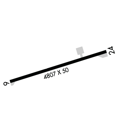
| RUNWAY INFORMATION: | Runway Ident: 24 /06
Runway Length: 4807
Runway Width: 50
Runway Surface: ASPHALT, ASPHALTIC CONCRETE, TAR MACADAM, OR BITUMEN BOUND MACADAM (INCLUDING ANY OF THESE SURFACE TYPES WITH CONCRETE ENDS).
Runway PCN Rating: -
Runway PCN Evaluation Method: N/A
Runway Open: YES
| Runway 24 Information
Runway True Heading: 252°
Takeoff Distance Available: 4807
Landing Distance Available: 4807
Runway Latitude: N3505.1
Runway Longitude: W10847.0
Runway Elevation: 6449'
Runway Slope: -.3°
Runway TDZE: 6454'
Runway Lighting: LIRL
| Runway 06 Information
Runway True Heading: 72°
Takeoff Distance Available: 4807
Landing Distance Available: 4807
Runway Latitude: N3504.9
Runway Longitude: W10848.0
Runway Elevation: 6434'
Runway Slope: .3°
Runway TDZE: 6454
Runway Lighting: LIRL
|
|
|
COMMUNICATION INFORMATION
AIR ROUTE TRAFFIC CONTROL CENTER - ALBUQUERQUE CNTR
124.325 288.25
COMMON TRAFFIC ADVISORY FREQUENCY - CTAF
122.9
RADIO - ALBUQUERQUE RDO
122.05 255.4
|
COMMUNICATION REMARKS
AIR ROUTE TRAFFIC CONTROL CENTER - (APP/DEP svc)
RADIO - (ZUNI RCO)
|
AIRPORT NAVAIDS
ZUN - ZUNI (VORTAC) - Bearing: 54° Distance: 19.2 nm
|