
| BELLE GLADE STATE MUNI BELLE GLADE FL |
| |
| Lat: N 2641.9 Long: W 08039.6 Elev: 14 Var: +03 Longest Runway: 3455 | ||
| CTAF: 122.9 | ||
| ||||||||||||||||||||||||||||||||
| ||||||||||||||||||||||||||||||||
| Rwy | Rwy | |||||||
| 3455x50 | 3455' | 3455x50 | 3455' | |||||
| Runway ID | Single Wheel | Double Wheel | Double Tandem Wheel | Dual Double Wheel |
| 09/27 | N/A | N/A | N/A | N/A |
| These numbers are Advisory and are not limits. The Airport Manager should have more accurate Weight Limits | ||||
| FltPlan does not have IFR approach charts available for KX10. |
 Airport Diagram might not be current. | |
| Facility Name: | BELLE GLADE STATE MUNI |
| City Name: | BELLE GLADE |
| County: | PALM BEACH |
| State abbrev: | FL |
| State Name: | FLORIDA |
| Ownership: | PUBLICLY OWNED |
| Use: | OPEN TO THE PUBLIC |
| Owner's Name: | CITY OF BELLE GLADE; CONTACT PERSON: LOMAX HARRELLE 561-992-1601 |
| Address: | 110 DR. MARTIN LUTHER KING JR. BLVD |
| BELLE GLADE, FL 33430-3900 | |
| Owner's Phone: | 561-996-0100 |
| Manager's Name: | LARRY TIBBS |
| Address: | 110 DR. MARTIN LUTHER KING JR. BLVD |
| BELLE GLADE, FL 33430 | |
| Phone: | (561) 992-1610 |
| FAA Region: | SOUTHERN |
| FAA Field Office: | ORL |
| Date | Sunrise | Sunset |
|---|---|---|
| 09/24/21 Friday | 7:12 | 19:17 |
| 09/25/21 Saturday | 7:12 | 19:16 |
| 09/26/21 Sunday | 7:13 | 19:15 |
| 09/27/21 Monday | 7:13 | 19:14 |
| 09/28/21 Tuesday | 7:14 | 19:13 |
| 09/29/21 Wednesday | 7:14 | 19:11 |
| 09/30/21 Thursday | 7:15 | 19:10 |
| 10/01/21 Friday | 7:15 | 19:09 |
| 10/02/21 Saturday | 7:15 | 19:08 |
| 10/03/21 Sunday | 7:16 | 19:07 |
| 10/04/21 Monday | 7:16 | 19:06 |
| 10/05/21 Tuesday | 7:17 | 19:05 |
| 10/06/21 Wednesday | 7:17 | 19:04 |
| 10/07/21 Thursday | 7:18 | 19:03 |
| Airport Attendance Schedule | UNATTENDED |
| Airport Status | OPERATIONAL (This Status can change at any time - please check NOTAMS) |
| Airport Lighting Schedule | ACTVT LIRL RWY 09/27 -CTAF. |
| Airport Storage Available | NONE |
| Extra Services Available | Crop Dusting |
| Wind Indicator | YES - (lighted) |
| Control Tower | NO |
| CTAF Frequency | 122.900 |
| Unicom Frequency | |
| Rotating Beacon Color | |
| Segmented Circle | NO |
| Landing Fee | NO |
| Airport Inspected | STATE - performed by STATE AERONAUTICAL PERSONNEL |
| Inspection Date | 01/12/2018 |
| Type of Fuel Available | None |
| Airframe Repair Service | NONE |
| Power Plant Repair Service | NONE |
| Latitude | N2641.9 |
| Longitude | W08039.6 (ESTIMATED) |
| Arpt Elevation | 14ft (ESTIMATED) |
| Magnetic Variation | 03W |
| 1 miles NE | of BELLE GLADE |
| Traffic Pattern Altitude | |
| Sectional Chart | MIAMI |
| Operations (Reported) | Yearly | Avg. Daily |
|---|---|---|
| General Aviation Transient | 600 | 2 |
| General Aviation Local | 1200 | 3 |
| Air Taxi | 0 | 0 |
| Commerical | 0 | 0 |
| Commuter | 0 | 0 |
| Military | 0 | 0 |
| Aircraft based on Field | |
|---|---|
| General Aviation Singles | 5 |
| General Aviation Multi | 0 |
| Jet Aircraft | 0 |
| General Aviation Helicopters | 0 |
| Military Aircraft | 0 |
| Gliders | 0 |
| Ultralights | 0 |
| FSS on field | NO |
| FSS tie-in | MIAMI |
| FSS Phone | 1-800-WX-BRIEF |
| Who issues Notams | MIA |
| Notam D service at airport | YES |
| ARTCC Name | MIAMI |
| Airport Certification | |
| Aircraft Rescue & Firefighting Index | None |
| Airport of Entry | No |
| Custom Landing Rights | No |
| Joint Civil/Military | No |
| Military Landing rights | No |
| NATIONAL PLAN OF INTEGRATED AIRPORT SYSTEMS (NPIAS) |
| RY 09 NIGHT LNDGS NOT ADVISED DUE TO UNLGTD POWER LINES IN APCH. |
| BERM FULL LENGTH OF RY 113 FT N OF CNTRLN, RY 09/27. |
| FOR CD CTC PALM BEACH APCH AT 561-275-1430 |
| Runway: 09 | Runway: 27 | ||
| Mag heading: | 93° | Mag heading: | 273° |
| Rwy Slope: | -.09% Down | Rwy Slope: | .09% Up |
| Approach: | Approach: | ||
| Pattern: | Left Traffic | Pattern: | Left Traffic |
| Markings: | BASIC | Markings: | BASIC |
| Marking Condition: | GOOD | Marking Condition: | GOOD |
| Arresting Dev: | Arresting Dev: | ||
| Lat & Long: | N2641.9 W08039.9 | Lat. & Long.: | N2641.9 W08039.3 |
| Elev: | 14.0 ft. MSL | Elev: | 11.0 ft. MSL |
| TCH: | TCH: | ||
| Visual Glide Path: | Visual Glide Path: | ||
| Displaced Threshold: | No | Displaced Threshold: | No |
| Touchdown Zone: | NO | Touchdown Zone: | NO |
| Touchdown Elev.: | Touchdown Elev.: | ||
| Visual Glide Slope: | Visual Glide Slope: | ||
| RVR Equipment: | RVR Equipment: | ||
| RVV Equipment: | NO | RVV Equipment: | NO |
| Approach Lights: | Approach Lights: | ||
| REIL: | NO | REIL: | NO |
| Centerline Lights: | NO | Centerline Lights: | NO |
| Touchdown lights: | NO | Touchdown lights: | NO |
| Runway Category: | Runway with a Visual Approach | Runway Category: | Runway with a Visual Approach |
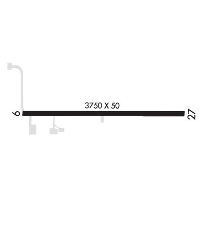
| Declared Distances: | TORA:3750' TODA:3750' | Declared Distances: | TORA:3750' TODA:3750' |
| Obstructions: | TREE | Obstructions: | POLE |
| Marked: | NOT Marked/Lighted | Marked: | NOT Marked/Lighted |
| Clearance slope: | 20:1 | Clearance slope: | 23:1 |
| Obstruction height: | 36 feet AGL | Obstruction height: | 50 feet AGL |
| Dist. from runway: | 915 feet | Dist. from runway: | 1342 feet |
| Centerline offset: | 20 left of centerline | Centerline offset: | 20 feet left of centerline |
| Comments: | Comments: |
Thanks for using FltPlan.com
all rights reserved © 1999-2021 by Flight Plan LLC
