
| BARROW COUNTY WINDER GA |
| |
| Lat: N 3359.0 Long: W 08340.0 Elev: 934 Var: +05 Longest Runway: 5202 | ||
| AWOS: 118.57 CTAF: 123.0 | ||
| ||||||||||||||||||||||||||||||
| ||||||||||||||||||||||||||||||
| ||||||||||||||||||||||||||||||
| Rwy | Rwy | |||||||
| 3607x100 | 3607' | 3607x100 | 3607' | |||||
| 5202x100 | 5202' | 5202x100 | 4600' | 111.50 - 316° | ||||
| Runway ID | Single Wheel | Double Wheel | Double Tandem Wheel | Dual Double Wheel |
| 05/23 | 20,000 | N/A | N/A | N/A |
| 13/31 | 20,000 | N/A | N/A | N/A |
| These numbers are Advisory and are not limits. The Airport Manager should have more accurate Weight Limits | ||||
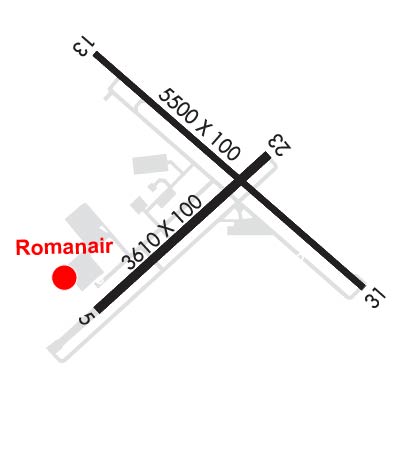 Airport Diagram might not be current. | |
| Facility Name: | BARROW COUNTY |
| City Name: | WINDER |
| County: | BARROW |
| State abbrev: | GA |
| State Name: | GEORGIA |
| Ownership: | PUBLICLY OWNED |
| Use: | OPEN TO THE PUBLIC |
| Owner's Name: | BARROW COUNTY ARPT AUTH. |
| Address: | 841 RONALD WOOD ROAD |
| WINDER, GA 30680 | |
| Owner's Phone: | 770-307-3013 |
| Manager's Name: | WANDA MITCHELL |
| Address: | 841 RONALD WOOD RD |
| WINDER, GA 30680 | |
| Phone: | 770-307-3013 |
| FAA Region: | SOUTHERN |
| FAA Field Office: | ATL |
| Date | Sunrise | Sunset |
|---|---|---|
| 09/24/21 Friday | 7:24 | 19:29 |
| 09/25/21 Saturday | 7:25 | 19:28 |
| 09/26/21 Sunday | 7:25 | 19:26 |
| 09/27/21 Monday | 7:26 | 19:25 |
| 09/28/21 Tuesday | 7:27 | 19:23 |
| 09/29/21 Wednesday | 7:27 | 19:22 |
| 09/30/21 Thursday | 7:28 | 19:21 |
| 10/01/21 Friday | 7:29 | 19:19 |
| 10/02/21 Saturday | 7:30 | 19:18 |
| 10/03/21 Sunday | 7:30 | 19:17 |
| 10/04/21 Monday | 7:31 | 19:15 |
| 10/05/21 Tuesday | 7:32 | 19:14 |
| 10/06/21 Wednesday | 7:33 | 19:12 |
| 10/07/21 Thursday | 7:33 | 19:11 |
| Airport Attendance Schedule | M-F 0900-1800, SAT 0900-1700, SUN 1100-1700 |
| Airport Status | OPERATIONAL (This Status can change at any time - please check NOTAMS) |
| Airport Lighting Schedule | HIRL RWY 13/31 PRESET LOW INTST; TO INCR INTST AND ACTVT MALSR RWY 31; PAPI RWYS 05, 23, 13, & 31; MIRL RWY 05/23; AND TWY LGTS - CTAF. |
| Airport Storage Available | Tie Downs |
| Extra Services Available | Avionics, Flight Instruction, Aircraft Rental |
| Wind Indicator | YES - (lighted) |
| Control Tower | NO |
| CTAF Frequency | 123.000 |
| Unicom Frequency | 123.000 |
| Rotating Beacon Color | CLEAR-GREEN (Light Land Airport) |
| Segmented Circle | YES |
| Landing Fee | NO |
| Airport Inspected | STATE - performed by STATE AERONAUTICAL PERSONNEL |
| Inspection Date | 04/22/2021 |
| Type of Fuel Available | Grade 100LL, JET A |
| Airframe Repair Service | MAJOR |
| Power Plant Repair Service | MAJOR |
| Latitude | N3359.0 |
| Longitude | W08340.0 (ESTIMATED) |
| Arpt Elevation | 934ft (SURVEYED) |
| Magnetic Variation | 05W |
| 3 miles E | of WINDER |
| Traffic Pattern Altitude | |
| Sectional Chart | ATLANTA |
| Operations (Reported) | Yearly | Avg. Daily |
|---|---|---|
| General Aviation Transient | 15000 | 41 |
| General Aviation Local | 20000 | 55 |
| Air Taxi | 0 | 0 |
| Commerical | 0 | 0 |
| Commuter | 0 | 0 |
| Military | 5000 | 14 |
| Aircraft based on Field | |
|---|---|
| General Aviation Singles | 81 |
| General Aviation Multi | 17 |
| Jet Aircraft | 2 |
| General Aviation Helicopters | 4 |
| Military Aircraft | 5 |
| Gliders | 0 |
| Ultralights | 0 |
| FSS on field | NO |
| FSS tie-in | MACON |
| FSS Phone | 1-800-WX-BRIEF |
| Who issues Notams | WDR |
| Notam D service at airport | YES |
| ARTCC Name | ATLANTA |
| Airport Certification | |
| Aircraft Rescue & Firefighting Index | None |
| Airport of Entry | No |
| Custom Landing Rights | No |
| Joint Civil/Military | No |
| Military Landing rights | YES |
| NATIONAL PLAN OF INTEGRATED AIRPORT SYSTEMS (NPIAS) |
| GRANT AGREEMENTS UNDER FAAP/ADAP/AIP |
| ASSURANCES PURSUANT TO TITLE VI, CIVIL RIGHTS ACT OF 1964 |
| AGREEMENT UNDER DLAND OR DCLA HAS EXPIRED. |
| DEER ON AND INVOF ARPT. |
| CTC NG OPS 240.4. |
| FOR CD CTC ATLANTA APCH AT 678-346-6131, WHEN APCH CLSD CTC ATLANTA ARTCC AT 770-210-7696. |
| MAX CLIMB, TURN OUT EARLIER IF POSSIBLE TO MINIMIZE NOISE OVER RESIDENTIAL AREAS. |
Airport Communications & Frequencies:
| |||||||||||||||||||||
| Runway: 05 | Runway: 23 | ||
| Mag heading: | 51° | Mag heading: | 231° |
| Rwy Slope: | -.50% Down | Rwy Slope: | .50% Up |
| Approach: | Approach: | ||
| Pattern: | Left Traffic | Pattern: | Left Traffic |
| Markings: | NONPRECISION INSTRUMENT | Markings: | NONPRECISION INSTRUMENT |
| Marking Condition: | GOOD | Marking Condition: | GOOD |
| Arresting Dev: | Arresting Dev: | ||
| Lat & Long: | N3358.7 W08340.4 | Lat. & Long.: | N3359.1 W08339.9 |
| Elev: | 934.3 ft. MSL | Elev: | 916.3 ft. MSL |
| TCH: | 22 ft. AGL | TCH: | 40 ft. AGL |
| Visual Glide Path: | 3.00 degrees | Visual Glide Path: | 3.00 degrees |
| Displaced Threshold: | No | Displaced Threshold: | No |
| Touchdown Zone: | YES | Touchdown Zone: | YES |
| Touchdown Elev.: | 934.3 feet | Touchdown Elev.: | 928.5 feet |
| Visual Glide Slope: | 2-Light PAPI on LEFT side of Runway | Visual Glide Slope: | 2-Light PAPI on LEFT side of Runway |
| RVR Equipment: | RVR Equipment: | ||
| RVV Equipment: | NO | RVV Equipment: | NO |
| Approach Lights: | Approach Lights: | ||
| REIL: | NO | REIL: | NO |
| Centerline Lights: | NO | Centerline Lights: | NO |
| Touchdown lights: | NO | Touchdown lights: | NO |
| Runway Category: | Runway with a Visual Approach | Runway Category: | Runway with a Non-precision Approach |
| Declared Distances: | Declared Distances: | ||
| Obstructions: | TREES | Obstructions: | TREES |
| Marked: | NOT Marked/Lighted | Marked: | NOT Marked/Lighted |
| Clearance slope: | 20:1 | Clearance slope: | 20:1 |
| Obstruction height: | 59 feet AGL | Obstruction height: | 98 feet AGL |
| Dist. from runway: | 1380 feet | Dist. from runway: | 2160 feet |
| Centerline offset: | 300 left of centerline | Centerline offset: | 313 feet left of centerline |
| Comments: | Comments: |
| Runway: 13 | Runway: 31 | ||
| Mag heading: | 134° | Mag heading: | 314° |
| Rwy Slope: | -.48% Down | Rwy Slope: | .48% Up |
| Approach: | Approach: | ILS/DME | |
| Pattern: | Left Traffic | Pattern: | Left Traffic |
| Markings: | NONPRECISION INSTRUMENT | Markings: | PRECISION INSTRUMENT |
| Marking Condition: | GOOD | Marking Condition: | GOOD |
| Arresting Dev: | Arresting Dev: | ||
| Lat & Long: | N3359.3 W08340.4 | Lat. & Long.: | N3358.8 W08339.6 |
| Elev: | 932.8 ft. MSL | Elev: | 907.7 ft. MSL |
| TCH: | 30 ft. AGL | TCH: | 45 ft. AGL |
| Visual Glide Path: | 3.00 degrees | Visual Glide Path: | 3.00 degrees |
| Displaced Threshold: | No | Displaced Threshold: | 602 feet |
| Touchdown Zone: | YES | Touchdown Zone: | YES |
| Touchdown Elev.: | 932.8 feet | Touchdown Elev.: | 921.9 feet |
| Visual Glide Slope: | 4-Light PAPI on LEFT side of Runway | Visual Glide Slope: | 4-Light PAPI on LEFT side of Runway |
| RVR Equipment: | RVR Equipment: | ||
| RVV Equipment: | NO | RVV Equipment: | NO |
| Approach Lights: | Approach Lights: | MALSR - 1,400 foot medium intensity approach lighting system with runway alignment indicator lights | |
| REIL: | NO | REIL: | YES |
| Centerline Lights: | NO | Centerline Lights: | NO |
| Touchdown lights: | NO | Touchdown lights: | NO |
| Runway Category: | Runway with a Non-precision Approach having visibility minimums greater than 3/4 mile | Runway Category: | Precision Instrument Runway |
| Declared Distances: | TORA:5202' TODA:5202' ASDA:5100' LDA:5100' | Declared Distances: | TORA:5202' TODA:5202' ASDA:5202' LDA:4600' |
| Obstructions: | TREES | Obstructions: | RR |
| Marked: | NOT Marked/Lighted | Marked: | NOT Marked/Lighted |
| Clearance slope: | 7:1 | Clearance slope: | RWY 31 APCH RATIO 50:1 TO DSPLCD THLD. |
| Obstruction height: | 26 feet AGL | Obstruction height: | 20 feet AGL |
| Dist. from runway: | 382 feet | Dist. from runway: | 201 feet |
| Centerline offset: | 530 left of centerline | Centerline offset: | 270 feet left of centerline |
| Comments: | Comments: | RAILROAD BETWEEN 350-500 FT LEFT FROM 0-200 FT FROM RY END. TREES 315 FT LEFT AT RY END. |
Thanks for using FltPlan.com
all rights reserved © 1999-2021 by Flight Plan LLC


