
| NEW KENT COUNTY QUINTON VA |
| |
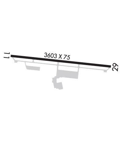
| Lat: N 3730.2 Long: W 07707.6 Elev: 121 Var: +10 Longest Runway: 3602 | ||
| AWOS: 119.87 CTAF: 122.8 | ||
| ||||||
| ||||||
|
| Rwy | Rwy | |||||||
| 3602x75 | 3602' | 3602x75 | 3602' | |||||
| Runway ID | Single Wheel | Double Wheel | Double Tandem Wheel | Dual Double Wheel |
| 11/29 | 12,500 | N/A | N/A | N/A |
| These numbers are Advisory and are not limits. The Airport Manager should have more accurate Weight Limits | ||||
 Airport Diagram might not be current. | |
| Facility Name: | NEW KENT COUNTY |
| City Name: | QUINTON |
| County: | NEW KENT |
| State abbrev: | VA |
| State Name: | VIRGINIA |
| Ownership: | PUBLICLY OWNED |
| Use: | OPEN TO THE PUBLIC |
| Owner's Name: | COUNTY OF NEW KENT |
| Address: | P. O. BOX 150, 12007 COURT HOUSE CIRCLE |
| NEW KENT, VA 23124 | |
| Owner's Phone: | 804-966-9683 |
| Manager's Name: | RUSS PEADEN |
| Address: | 6901 TERMINAL RD |
| QUINTON, VA 23141-2427 | |
| Phone: | 804-932-3984 |
| FAA Region: | EASTERN |
| FAA Field Office: | DCA |
| Date | Sunrise | Sunset |
|---|---|---|
| 06/08/26 Monday | 5:47 | 20:28 |
| 06/09/26 Tuesday | 5:47 | 20:29 |
| 06/10/26 Wednesday | 5:47 | 20:29 |
| 06/11/26 Thursday | 5:47 | 20:29 |
| 06/12/26 Friday | 5:47 | 20:30 |
| 06/13/26 Saturday | 5:47 | 20:30 |
| 06/14/26 Sunday | 5:47 | 20:31 |
| 06/15/26 Monday | 5:47 | 20:31 |
| 06/16/26 Tuesday | 5:47 | 20:32 |
| 06/17/26 Wednesday | 5:47 | 20:32 |
| 06/18/26 Thursday | 5:47 | 20:32 |
| 06/19/26 Friday | 5:47 | 20:32 |
| 06/20/26 Saturday | 5:47 | 20:33 |
| 06/21/26 Sunday | 5:48 | 20:33 |
| Airport Attendance Schedule | 7 Days A Week 0900-1700 |
| Airport Status | OPERATIONAL (This Status can change at any time - please check NOTAMS) |
| Airport Lighting Schedule | ACTVT REIL RWY 11 & 29; MIRL RWY 11/29 - CTAF. |
| Airport Storage Available | Tie Downs, Hanger |
| Extra Services Available | NONE |
| Wind Indicator | YES - (lighted) |
| Control Tower | NO |
| CTAF Frequency | 122.800 |
| Unicom Frequency | 122.800 |
| Rotating Beacon Color | WG; ROTG BCN NOT VISIBLE WHEN APPROACHING FM THE NORTH. |
| Segmented Circle | YES |
| Landing Fee | NO |
| Airport Inspected | STATE - performed by STATE AERONAUTICAL PERSONNEL |
| Inspection Date | 05/17/2023 |
| Type of Fuel Available | Grade 100LL; -10FUEL AVBL 24 HRS, CREDIT CARD REQUIRED WHEN UNATTENDED. |
| Airframe Repair Service | MINOR |
| Power Plant Repair Service | MINOR |
| Latitude | N3730.2 |
| Longitude | W07707.6 (ESTIMATED) |
| Arpt Elevation | 120ft (SURVEYED) |
| Magnetic Variation | 10W |
| 8 miles W | of QUINTON |
| Traffic Pattern Altitude | 800 |
| Sectional Chart | WASHINGTON |
| Operations (Reported) | Yearly | Avg. Daily |
|---|---|---|
| General Aviation Transient | 0 | 0 |
| General Aviation Local | 0 | 0 |
| Air Taxi | 0 | 0 |
| Commerical | 0 | 0 |
| Commuter | 0 | 0 |
| Military | 0 | 0 |
| Aircraft based on Field | |
|---|---|
| General Aviation Singles | 0 |
| General Aviation Multi | 0 |
| Jet Aircraft | 0 |
| General Aviation Helicopters | 0 |
| Military Aircraft | 0 |
| Gliders | 0 |
| Ultralights | 0 |
| FSS on field | NO |
| FSS tie-in | LEESBURG |
| FSS Phone | 1-800-WX-BRIEF |
| Who issues Notams | DCA |
| Notam D service at airport | YES |
| ARTCC Name | WASHINGTON |
| Airport Certification | |
| Aircraft Rescue & Firefighting Index | None |
| Airport of Entry | No |
| Custom Landing Rights | No |
| Joint Civil/Military | No |
| Military Landing rights | YES |
| NATIONAL PLAN OF INTEGRATED AIRPORT SYSTEMS (NPIAS) |
| GRANT AGREEMENTS UNDER FAAP/ADAP/AIP |
| ASSURANCES PURSUANT TO TITLE VI, CIVIL RIGHTS ACT OF 1964 |
| DEER ON & INVOF ARPT. |
| FOR CD CTC POTOMAC APCH AT 866-640-4124. |
Airport Communications & Frequencies:
| ||||||||||||||
| Runway: 11 | Runway: 29 | ||
| Mag heading: | 106° | Mag heading: | 286° |
| Rwy Slope: | -.37% Down | Rwy Slope: | .37% Up |
| Approach: | Approach: | ||
| Pattern: | Left Traffic | Pattern: | Left Traffic |
| Markings: | NONPRECISION INSTRUMENT | Markings: | NONPRECISION INSTRUMENT |
| Marking Condition: | FAIR | Marking Condition: | FAIR |
| Arresting Dev: | Arresting Dev: | ||
| Lat & Long: | N3730.2 W07708.0 | Lat. & Long.: | N3730.2 W07707.2 |
| Elev: | 120.7 ft. MSL | Elev: | 107.5 ft. MSL |
| TCH: | 45 ft. AGL | TCH: | 45 ft. AGL |
| Visual Glide Path: | 4.00 degrees | Visual Glide Path: | 4.00 degrees |
| Displaced Threshold: | No | Displaced Threshold: | No |
| Touchdown Zone: | YES | Touchdown Zone: | YES |
| Touchdown Elev.: | 120.7 feet | Touchdown Elev.: | 120.1 feet |
| Visual Glide Slope: | 2-Light PAPI on RIGHT side of Runway | Visual Glide Slope: | 2-Light PAPI on LEFT side of Runway |
| RVR Equipment: | RVR Equipment: | ||
| RVV Equipment: | NO | RVV Equipment: | NO |
| Approach Lights: | Approach Lights: | ||
| REIL: | YES | REIL: | YES |
| Centerline Lights: | NO | Centerline Lights: | NO |
| Touchdown lights: | NO | Touchdown lights: | NO |
| Runway Category: | Runway with a Non-precision Approach | Runway Category: | Runway with a Non-precision Approach |
| Declared Distances: | Declared Distances: | ||
| Obstructions: | ROAD | Obstructions: | TREES |
| Marked: | NOT Marked/Lighted | Marked: | NOT Marked/Lighted |
| Clearance slope: | 11:1 | Clearance slope: | 11:1 |
| Obstruction height: | 5 feet AGL | Obstruction height: | 20 feet AGL |
| Dist. from runway: | 258 feet | Dist. from runway: | 438 feet |
| Centerline offset: | 9B | Centerline offset: | 165 feet right of centerline |
| Comments: | RWY 11 - ROADWAY +15 FT 260 FT FM RWY END. | Comments: | 13 FT BRUSH, 101 FT RIGHT OF CTRLN ON APCH AT THLD. |
Thanks for using FltPlan.com
all rights reserved © 1999-2026 by Flight Plan LLC
