
| POTOMAC AIRPARK BERKELEY SPRINGS WV |
| |
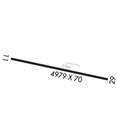
| Lat: N 3941.6 Long: W 07810.0 Elev: 413 Var: +10 Longest Runway: 4979 | ||
| CTAF: 122.9 | ||
| ||||||||||||||||||||||||||||||||
| ||||||||||||||||||||||||||||||||
| Rwy | Rwy | |||||||
| 4979x70 | 4979' | 4979x70 | 4979' | |||||
| Runway ID | Single Wheel | Double Wheel | Double Tandem Wheel | Dual Double Wheel |
| 11/29 | N/A | N/A | N/A | N/A |
| These numbers are Advisory and are not limits. The Airport Manager should have more accurate Weight Limits | ||||
 Airport Diagram might not be current. | |
| Facility Name: | POTOMAC AIRPARK |
| City Name: | BERKELEY SPRINGS |
| County: | MORGAN |
| State abbrev: | WV |
| State Name: | WEST VIRGINIA |
| Ownership: | PRIVATELY OWNED |
| Use: | OPEN TO THE PUBLIC |
| Owner's Name: | RIVERSIDE AIRPARK, LLC |
| Address: | 12107 BOYD RD |
| CLEAR SPRING, MD 21722 | |
| Owner's Phone: | 301-842-3700 |
| Manager's Name: | RIVERSIDE AIRPARK, LLC |
| Address: | 12107 BOYD RD |
| CLEAR SPRING, MD 21722 | |
| Phone: | 301-842-3700 |
| FAA Region: | EASTERN |
| FAA Field Office: | BKW |

| Date | Sunrise | Sunset |
|---|---|---|
| 09/24/21 Friday | 7:02 | 19:07 |
| 09/25/21 Saturday | 7:03 | 19:05 |
| 09/26/21 Sunday | 7:04 | 19:04 |
| 09/27/21 Monday | 7:05 | 19:02 |
| 09/28/21 Tuesday | 7:06 | 19:00 |
| 09/29/21 Wednesday | 7:07 | 18:59 |
| 09/30/21 Thursday | 7:08 | 18:57 |
| 10/01/21 Friday | 7:09 | 18:55 |
| 10/02/21 Saturday | 7:10 | 18:54 |
| 10/03/21 Sunday | 7:11 | 18:52 |
| 10/04/21 Monday | 7:12 | 18:51 |
| 10/05/21 Tuesday | 7:12 | 18:49 |
| 10/06/21 Wednesday | 7:13 | 18:48 |
| 10/07/21 Thursday | 7:14 | 18:46 |
| Airport Attendance Schedule | IRREGULAR |
| Airport Status | OPERATIONAL (This Status can change at any time - please check NOTAMS) |
| Airport Lighting Schedule | SS-SR |
| Airport Storage Available | NONE |
| Extra Services Available | NONE |
| Wind Indicator | YES - (unlit) |
| Control Tower | NO |
| CTAF Frequency | 122.900 |
| Unicom Frequency | |
| Rotating Beacon Color | |
| Segmented Circle | NO |
| Landing Fee | NO |
| Airport Inspected | STATE - performed by STATE AERONAUTICAL PERSONNEL |
| Inspection Date | 08/24/2020 |
| Type of Fuel Available | None |
| Airframe Repair Service | NONE |
| Power Plant Repair Service | NONE |
| Latitude | N3941.6 |
| Longitude | W07810.0 (ESTIMATED) |
| Arpt Elevation | 412ft (SURVEYED) |
| Magnetic Variation | 10W |
| 4 miles N | of BERKELEY SPRINGS |
| Traffic Pattern Altitude | |
| Sectional Chart | WASHINGTON |
| Operations (Reported) | Yearly | Avg. Daily |
|---|---|---|
| General Aviation Transient | 500 | 1 |
| General Aviation Local | 250 | 1 |
| Air Taxi | 0 | 0 |
| Commerical | 0 | 0 |
| Commuter | 0 | 0 |
| Military | 0 | 0 |
| Aircraft based on Field | |
|---|---|
| General Aviation Singles | 5 |
| General Aviation Multi | 1 |
| Jet Aircraft | 0 |
| General Aviation Helicopters | 0 |
| Military Aircraft | 0 |
| Gliders | 0 |
| Ultralights | 2 |
| FSS on field | NO |
| FSS tie-in | ELKINS |
| FSS Phone | 1-800-WX-BRIEF |
| Who issues Notams | EKN |
| Notam D service at airport | YES |
| ARTCC Name | WASHINGTON |
| Airport Certification | |
| Aircraft Rescue & Firefighting Index | None |
| Airport of Entry | No |
| Custom Landing Rights | No |
| Joint Civil/Military | No |
| Military Landing rights | No |
| NO ACFT OVER 18500 LBS GWT. |
| FOR CD CTC POTOMAC APCH AT 866-709-4993. |
| DRAG RACING ON RWY. EXTSV RUBBER BUILD UP ON RWY 29 PAVEMENT END. |
| RWY 29 END, POSSIBILITY OF 12 FT GRANDSTAND ON EACH SIDE OF RWY, 13 FT. FM RWY EDGE. |
| 8 FT CROPS, 50-80 FT R/L RWY CL. |
| ARPT CLSD NIGHTS. |
| UNMANNED ACFT 1000/BLW 1 NMR OF ARPT. |
| RC MODEL ACFT OPER ON ARPT. |
| AIRPORT ENTRANCE GATE LOCKED. NO PUBLIC ACCESS TO AIRPORT. |
| BIRDS & WILDLIFE INVOF ARPT. |
| RWY 11 APCH END, 10 FT DROP OFF, 30 FT FROM PAVEMENT END. RWY 29 15 FT DROP OFF, 30 FT FM RWY END. |
| RWY 11/2 9 PAVEMENT SPALLING, CRACKS, UNEVEN SURFACE. LOOSE AGGREGATE AND STONES. VEGETATION GROWING THROUGH PAVEMENT. |
Airport Communications & Frequencies:
| |||||||||||||||
| Runway: 11 | Runway: 29 | ||
| Mag heading: | 110° | Mag heading: | 290° |
| Rwy Slope: | .03% Up | Rwy Slope: | -.03% Down |
| Approach: | Approach: | ||
| Pattern: | Left Traffic | Pattern: | Right Traffic |
| Markings: | NONPRECISION INSTRUMENT | Markings: | NONPRECISION INSTRUMENT |
| Marking Condition: | POOR; MARKINGS FADED. | Marking Condition: | POOR; MARKINGS FADED. |
| Arresting Dev: | Arresting Dev: | ||
| Lat & Long: | N3941.6 W07810.5 | Lat. & Long.: | N3941.5 W07809.4 |
| Elev: | 409.9 ft. MSL | Elev: | 411.5 ft. MSL |
| TCH: | TCH: | ||
| Visual Glide Path: | Visual Glide Path: | ||
| Displaced Threshold: | No | Displaced Threshold: | No |
| Touchdown Zone: | YES | Touchdown Zone: | YES |
| Touchdown Elev.: | 412.5 feet | Touchdown Elev.: | 412.5 feet |
| Visual Glide Slope: | Visual Glide Slope: | ||
| RVR Equipment: | RVR Equipment: | ||
| RVV Equipment: | NO | RVV Equipment: | NO |
| Approach Lights: | Approach Lights: | ||
| REIL: | NO | REIL: | NO |
| Centerline Lights: | NO | Centerline Lights: | NO |
| Touchdown lights: | NO | Touchdown lights: | NO |
| Runway Category: | Runway with a Non-precision Approach having visibility minimums greater than 3/4 mile | Runway Category: | Runway with a Non-precision Approach having visibility minimums greater than 3/4 mile |
| Declared Distances: | Declared Distances: | ||
| Obstructions: | TREES | Obstructions: | TREES |
| Marked: | NOT Marked/Lighted | Marked: | NOT Marked/Lighted |
| Clearance slope: | Clearance slope: | ||
| Obstruction height: | 60 feet AGL | Obstruction height: | 40 feet AGL |
| Dist. from runway: | 201 feet | Dist. from runway: | 201 feet |
| Centerline offset: | 110 right of centerline | Centerline offset: | 110 feet right of centerline |
| Comments: | RY 11 60 FT TREES, 0-200 FT DSTC, 110 L, 80 FT TREES, 200 FT DSTC, 175 R. | Comments: | 35 FT TREES AT THLD 10 FT R TO 0 FT DSTC. |
Thanks for using FltPlan.com
all rights reserved © 1999-2021 by Flight Plan LLC