
| VOLK FIELD CAMP DOUGLAS WI |
| |
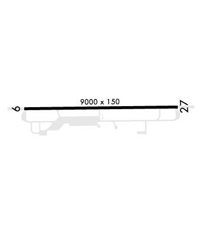
| Lat: N 4356.4 Long: W 09015.2 Elev: 912 Var: -00 Longest Runway: 9000 | ||
| Dept. ATIS: 134.35 Arr. ATIS: 134.35 Ground: 121.9 Tower: 127.5 | ||
| ||||||
| ||||||
|
| Rwy | Rwy | |||||||
| 9000x150 | 9000' | 9000x150 | 9000' | 108.50 - 269° | ||||
| Runway ID | Single Wheel | Double Wheel | Double Tandem Wheel | Dual Double Wheel |
| 09/27 | N/A | N/A | N/A | N/A |
| These numbers are Advisory and are not limits. The Airport Manager should have more accurate Weight Limits | ||||
 Airport Diagram might not be current. | |
| Facility Name: | VOLK FLD |
| City Name: | CAMP DOUGLAS |
| County: | JUNEAU |
| State abbrev: | WI |
| State Name: | WISCONSIN |
| Ownership: | AIR FORCE OWNED |
| Use: | PRIVATE |
| Owner's Name: | USAF |
| Address: | HDQTRS WI ANG VOLK FLD CAMP |
| CAMP DOUGLAS, WI 54618 | |
| Owner's Phone: | 608-427-1205 |
| Manager's Name: | BASE OPERATIONS |
| Address: | HDQTRS WI ANG VOLK FLD CAMP |
| CAMP DOUGLAS, WI 54618 | |
| Phone: | 608-427-1205; DSN 871-1205. |
| FAA Region: | GREAT LAKES |
| FAA Field Office: | CHI |
| Date | Sunrise | Sunset |
|---|---|---|
| 09/24/21 Friday | 6:50 | 18:55 |
| 09/25/21 Saturday | 6:51 | 18:53 |
| 09/26/21 Sunday | 6:53 | 18:51 |
| 09/27/21 Monday | 6:54 | 18:50 |
| 09/28/21 Tuesday | 6:55 | 18:48 |
| 09/29/21 Wednesday | 6:56 | 18:46 |
| 09/30/21 Thursday | 6:57 | 18:44 |
| 10/01/21 Friday | 6:58 | 18:42 |
| 10/02/21 Saturday | 7:00 | 18:40 |
| 10/03/21 Sunday | 7:01 | 18:39 |
| 10/04/21 Monday | 7:02 | 18:37 |
| 10/05/21 Tuesday | 7:03 | 18:35 |
| 10/06/21 Wednesday | 7:04 | 18:33 |
| 10/07/21 Thursday | 7:05 | 18:31 |
| Airport Attendance Schedule | MON-FRI 1400-2200Z++; EXC HOL, CK NOTAM FOR CURRENT AFLD HR. |
| Airport Status | OPERATIONAL (This Status can change at any time - please check NOTAMS) |
| Airport Lighting Schedule | ACTVT ALSF1 RWY 27; PAPI RWY 09, 27; HIRL RWY 09/27 - CTAF OR 239.5.; SS-SR. ROTG BCN SCHED SS-SR WHEN TWR OPERATIONAL. |
| Airport Storage Available | NONE |
| Extra Services Available | Cargo Handling |
| Wind Indicator | YES - (unlit) |
| Control Tower | YES |
| CTAF Frequency | 127.500 |
| Unicom Frequency | |
| Rotating Beacon Color | CLEAR-GREEN (Light Land Airport) |
| Segmented Circle | NO |
| Landing Fee |
| Airport Inspected | No Inspection Data Available performed by the OWNER |
| Inspection Date | Unknown |
| Type of Fuel Available | None |
| Airframe Repair Service | NONE |
| Power Plant Repair Service | NONE |
| Latitude | N4356.4 |
| Longitude | W09015.2 (ESTIMATED) |
| Arpt Elevation | 912ft (ESTIMATED) |
| Magnetic Variation | 00E |
| 1 miles N | of CAMP DOUGLAS |
| Traffic Pattern Altitude | |
| Sectional Chart | CHICAGO |
| Operations (Reported) | Yearly | Avg. Daily |
|---|---|---|
| General Aviation Transient | 0 | 0 |
| General Aviation Local | 0 | 0 |
| Air Taxi | 0 | 0 |
| Commerical | 0 | 0 |
| Commuter | 0 | 0 |
| Military | 0 | 0 |
| Aircraft based on Field | |
|---|---|
| General Aviation Singles | 0 |
| General Aviation Multi | 0 |
| Jet Aircraft | 0 |
| General Aviation Helicopters | 0 |
| Military Aircraft | 0 |
| Gliders | 0 |
| Ultralights | 0 |
| FSS on field | NO |
| FSS tie-in | GREEN BAY |
| FSS Phone | 1-800-WX-BRIEF |
| Who issues Notams | GRB |
| Notam D service at airport | YES |
| ARTCC Name | CHICAGO |
| Airport Certification | |
| Aircraft Rescue & Firefighting Index | CAUTION: TRAN CREWS BE ADVS ARFF IS AT CRITICAL LEVEL OF SVC. |
| Airport of Entry | No |
| Custom Landing Rights | No |
| Joint Civil/Military | No |
| Military Landing rights | No |
| JASU - (AM32A-60A) 6(A/M32A-86). |
| FUEL: A++ AVBL LTD, EXP POSSIBLE GND DELAY FOR REQ EXCEEDING 10,000 GAL. |
| FLUID - LPOX LOX. |
| TRAN ALERT - EXTREMELY LTD. |
| MILITARY USE: OPR 1400-2200Z++ MON-FRI EXC HOL, OY IN SUPPORT OF NGB VALIDATED FLYING. SEE FLIP AP/1 SUPPLEMENTARY ARPT |
| RSTD: PPR CTC VOLK FLD DSN 871-1205, C608-427-1205. ISSUED PPR VALID FOR ETA +/- 1 HR. EARLY/LATE ARR/DEP MUST BE COORD. AFTER HR RE-COORD OR CNL WILL BE PASSED TO BASE OPS SBY PERS C608-343-0104. |
| CAUTION - WHEN WIND IS FR S/SW EXP POSSIBLE LOW LEVEL WIND SHEAR 1 TO 3 NM ON FINAL TO RWY 27. DUE TO TACTICAL ACFT RQR, BAK-12 CABLE MAY BE IN POSN FOR RWY 09-27 SIMULTANEOUSLY. |
| CAUTION: TWY E, F AND G UNLGTD, UNLTD DAYTIME VFR USE, FOLLOW ME RQR FOR DAY IFR AND NGT IFR/VFR USE. |
| TFC PAT: COPTER RECTANGULAR 1500'. |
| MISC: FIRST 1600 FT RY 09 AND FIRST 1600 FT RY 27 GROOVED CONCRETE, MID 5800 GROOVED ASPHALT. STD USAF RSRS APPLIED. |
| RSTD: PPR MUST BE RCV NLT 48 HR IN ADVANCE OF ACFT ARR OR BY 2200Z++ ON FRI FOR THE FOLLOWING MON. |
| REMARKS-MISC: BASE OPS DSN 871-1205, C608-427-1205. |
| CAUTION: USE EXTREME CAUTION FOR EXTENSIVE UNMANNED AERIAL SYSTEMS (UAS) OPS IN VCNTY. |
| REMARKS-CAUTION: BASH PHASE I- ALL DATES NOT DESIGNATED AS PHASE II. PHASE II IN EFFECT 1 SEP TO 30 NOV AND 1 MAR TO 31 MAY. |
| CAUTION: NSTD AFLD PAINT MRK NEAR BAK-12 TAPE CONNECTORS FOR RWY 09/27. THE MRK IS A 4 IN WIDE YELLOW HALF- MOON ARC AROUND THE SHEAVE, WITH ONE MRK AT EACH ENTRANCE. |
| MISC: LAVATORY SVC UNAVBL. |
| CAUTION: TRAN CREWS BE ADVS ARFF IS AT CRITICAL LEVEL OF SVC. |
| WHEN ATCT CLSD, FOR CD CTC CHICAGO ARTCC AT 630-906-8921. |
| RSTD: RECOMMEND USE AS EMERG ARPT ONLY WHEN RQR TO LAND AS SOON AS POSSIBLE. |
| BEARING STRENGTH RY 09/27: ST175, SBTT500,TDT820 & DDT710. |
| LGT: RY 27 PAPI NSTD LCTD RGT SIDE. |
| A-GEAR - NML BAK-12B(B) CONFIGURATION: APCH END DOWN, DEP END UP; 20 MIN PN TO RECONNECT APCH END CABLE. |
Airport Communications & Frequencies:
| |||||||||||||||||||||||||||||||
| Runway: 09 | Runway: 27 | ||
| Mag heading: | 89° | Mag heading: | 269° |
| Rwy Slope: | -.09% Down | Rwy Slope: | .09% Up |
| Approach: | Approach: | ILS | |
| Pattern: | Left Traffic | Pattern: | Right Traffic |
| Markings: | Markings: | ||
| Marking Condition: | Marking Condition: | ||
| Arresting Dev: | BAK-12; HOOK BAK12B(B)(1260') | Arresting Dev: | BAK-12; HOOK BAK-12B(B)(1250') |
| Lat & Long: | N4356.3 W09016.2 | Lat. & Long.: | N4356.4 W09014.2 |
| Elev: | 912.0 ft. MSL | Elev: | 903.7 ft. MSL |
| TCH: | 53 ft. AGL | TCH: | 53 ft. AGL |
| Visual Glide Path: | 3.00 degrees | Visual Glide Path: | 2.85 degrees |
| Displaced Threshold: | No | Displaced Threshold: | No |
| Touchdown Zone: | YES | Touchdown Zone: | YES |
| Touchdown Elev.: | 912.0 feet | Touchdown Elev.: | 904.8 feet |
| Visual Glide Slope: | 4-Light PAPI on LEFT side of Runway | Visual Glide Slope: | 4-Light PAPI on RIGHT side of Runway |
| RVR Equipment: | RVR Equipment: | ||
| RVV Equipment: | NO | RVV Equipment: | NO |
| Approach Lights: | MALSR - 1,400 foot medium intensity approach lighting system with runway alignment indicator lights | Approach Lights: | ALSF1 - standard 2,400 foot high intensity approach lighting system with sequenced flashers, Category I; SFL NOT AVAILABLE ON PCL, AVAILABLE UPON REQUEST WITH TWR/BASE OPS. |
| REIL: | NO | REIL: | NO |
| Centerline Lights: | NO | Centerline Lights: | NO |
| Touchdown lights: | NO | Touchdown lights: | NO |
| Runway Category: | Precision Instrument Runway | Runway Category: | Precision Instrument Runway |
| Declared Distances: | Declared Distances: |
Thanks for using FltPlan.com
all rights reserved © 1999-2021 by Flight Plan LLC
