
| ABERDEEN MUNI ABERDEEN ID |
| |
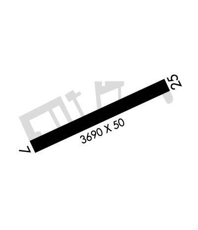
| Lat: N 4255.3 Long: W 11252.9 Elev: 4474 Var: -16 Longest Runway: 3690 | ||
| CTAF: 122.9 | ||
| ||||||||||||||||||||||||||||||||
| ||||||||||||||||||||||||||||||||
| Rwy | Rwy | |||||||
| 3690x50 | 3548' | 3690x50 | 3178' | |||||
| Runway ID | Single Wheel | Double Wheel | Double Tandem Wheel | Dual Double Wheel |
| 07/25 | N/A | N/A | N/A | N/A |
| These numbers are Advisory and are not limits. The Airport Manager should have more accurate Weight Limits | ||||
| FltPlan does not have IFR approach charts available for KU36. |
 Airport Diagram might not be current. | |
| Facility Name: | ABERDEEN MUNI |
| City Name: | ABERDEEN |
| County: | BINGHAM |
| State abbrev: | ID |
| State Name: | IDAHO |
| Ownership: | PUBLICLY OWNED |
| Use: | OPEN TO THE PUBLIC |
| Owner's Name: | CITY OF ABERDEEN |
| Address: | P O BOX 190 |
| ABERDEEN, ID 83210 | |
| Owner's Phone: | 208-397-4161 |
| Manager's Name: | ROBERT GOSS |
| Address: | P.O. BOX 190 |
| ABERDEEN, ID 83210 | |
| Phone: | 208-244-1885 |
| FAA Region: | NORTHWEST MOUNTAIN |
| FAA Field Office: | HLN |
| Date | Sunrise | Sunset |
|---|---|---|
| 09/24/21 Friday | 7:21 | 19:26 |
| 09/25/21 Saturday | 7:22 | 19:24 |
| 09/26/21 Sunday | 7:23 | 19:22 |
| 09/27/21 Monday | 7:24 | 19:20 |
| 09/28/21 Tuesday | 7:25 | 19:18 |
| 09/29/21 Wednesday | 7:26 | 19:17 |
| 09/30/21 Thursday | 7:27 | 19:15 |
| 10/01/21 Friday | 7:29 | 19:13 |
| 10/02/21 Saturday | 7:30 | 19:11 |
| 10/03/21 Sunday | 7:31 | 19:10 |
| 10/04/21 Monday | 7:32 | 19:08 |
| 10/05/21 Tuesday | 7:33 | 19:06 |
| 10/06/21 Wednesday | 7:34 | 19:04 |
| 10/07/21 Thursday | 7:35 | 19:03 |
| Airport Attendance Schedule | JAN-DEC MON-SUN DALGT |
| Airport Status | OPERATIONAL (This Status can change at any time - please check NOTAMS) |
| Airport Lighting Schedule | ACTVT MIRL RY 07/25 - CTAF. |
| Airport Storage Available | Tie Downs |
| Extra Services Available | Crop Dusting |
| Wind Indicator | YES - (lighted) |
| Control Tower | NO |
| CTAF Frequency | 122.900 |
| Unicom Frequency | |
| Rotating Beacon Color | CLEAR-GREEN (Light Land Airport) |
| Segmented Circle | YES |
| Landing Fee | NO |
| Airport Inspected | STATE - performed by STATE AERONAUTICAL PERSONNEL |
| Inspection Date | 06/09/2021 |
| Type of Fuel Available | None |
| Airframe Repair Service | None |
| Power Plant Repair Service | None |
| Latitude | N4255.3 |
| Longitude | W11252.9 (ESTIMATED) |
| Arpt Elevation | 4473ft (ESTIMATED) |
| Magnetic Variation | 16E |
| 2 miles SW | of ABERDEEN |
| Traffic Pattern Altitude | |
| Sectional Chart | SALT LAKE CITY |
| Operations (Reported) | Yearly | Avg. Daily |
|---|---|---|
| General Aviation Transient | 4500 | 12 |
| General Aviation Local | 3000 | 8 |
| Air Taxi | 0 | 0 |
| Commerical | 0 | 0 |
| Commuter | 0 | 0 |
| Military | 0 | 0 |
| Aircraft based on Field | |
|---|---|
| General Aviation Singles | 11 |
| General Aviation Multi | 1 |
| Jet Aircraft | 0 |
| General Aviation Helicopters | 0 |
| Military Aircraft | 0 |
| Gliders | 0 |
| Ultralights | 0 |
| FSS on field | NO |
| FSS tie-in | BOISE |
| FSS Phone | 1-800-WX-BRIEF |
| Who issues Notams | BOI |
| Notam D service at airport | YES |
| ARTCC Name | SALT LAKE CITY |
| Airport Certification | |
| Aircraft Rescue & Firefighting Index | None |
| Airport of Entry | No |
| Custom Landing Rights | No |
| Joint Civil/Military | No |
| Military Landing rights | No |
| NATIONAL PLAN OF INTEGRATED AIRPORT SYSTEMS (NPIAS) |
| IREG WINTER MAINTENANCE. |
| CONSIDERABLE AGRICULTURE OPS DURING GROWING SEASON. |
| +30 FT SPRINKLER AND TERRAIN AT 230 FT FM SW END OF RY MAY BE IN POSITION. |
| FOR CD CTC SALT LAKE ARTCC AT 801-320-2568. |
| Runway: 07 | Runway: 25 | ||
| Mag heading: | N/A | Mag heading: | N/A |
| Rwy Slope: | -.82% Down | Rwy Slope: | .82% Up |
| Approach: | Approach: | ||
| Pattern: | Left Traffic | Pattern: | Left Traffic |
| Markings: | BASIC | Markings: | BASIC |
| Marking Condition: | FAIR | Marking Condition: | FAIR |
| Arresting Dev: | Arresting Dev: | ||
| Lat & Long: | N4255.2 W11253.3 | Lat. & Long.: | N4255.3 W11252.4 |
| Elev: | 4473.5 ft. MSL | Elev: | 4443.4 ft. MSL |
| TCH: | TCH: | ||
| Visual Glide Path: | Visual Glide Path: | ||
| Displaced Threshold: | 142 feet | Displaced Threshold: | 512 feet |
| Touchdown Zone: | NO | Touchdown Zone: | NO |
| Touchdown Elev.: | Touchdown Elev.: | ||
| Visual Glide Slope: | Visual Glide Slope: | ||
| RVR Equipment: | RVR Equipment: | ||
| RVV Equipment: | NO | RVV Equipment: | NO |
| Approach Lights: | Approach Lights: | ||
| REIL: | NO | REIL: | NO |
| Centerline Lights: | NO | Centerline Lights: | NO |
| Touchdown lights: | NO | Touchdown lights: | NO |
| Runway Category: | Runway with a Visual Approach | Runway Category: | Runway with a Visual Approach |
| Declared Distances: | TORA:3690' TODA:3690' ASDA:3466' LDA:3324' | Declared Distances: | TORA:3458' TODA:3458' ASDA:3624' LDA:3112' |
| Obstructions: | ROAD; +70 FT PLINE & TERRAIN AT 3000 FT ON CNTRLN. | Obstructions: | FENCE; +50 FT TREE AT 400 FT; 125 FT LEFT. |
| Marked: | NOT Marked/Lighted | Marked: | NOT Marked/Lighted |
| Clearance slope: | Clearance slope: | ||
| Obstruction height: | 15 feet AGL | Obstruction height: | 2 feet AGL |
| Dist. from runway: | 210 feet | Dist. from runway: | 200 feet |
| Centerline offset: | Centerline offset: | ||
| Comments: | +4' FENCE AT 0', 100' RIGHT. | Comments: | +3 FT FENCE AT 0 FT, 90 FT R. +18 FT ROAD AT 0 FT 100 FT R. |
Thanks for using FltPlan.com
all rights reserved © 1999-2021 by Flight Plan LLC
