
| NEPHI MUNI NEPHI UT |
| |
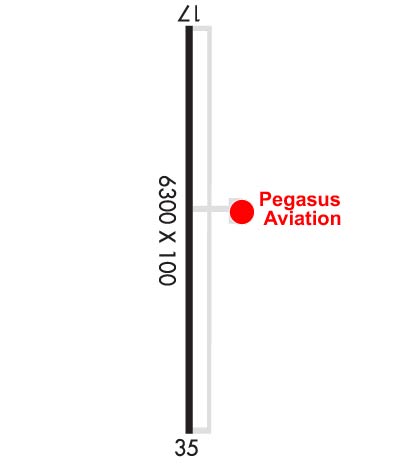
| Lat: N 3944.2 Long: W 11152.2 Elev: 5022 Var: -12 Longest Runway: 6300 | ||
| AWOS: 118.27 CTAF: 123.07 | ||
| ||||||||||||||||||||||||||||||||||||||||||||
| ||||||||||||||||||||||||||||||||||||||||||||
| ||||||||||||||||||||||||||||||||||||||||||||
| Rwy | Rwy | |||||||
| 6300x100 | 6300' | 6300x100 | 6300' | |||||
| Runway ID | Single Wheel | Double Wheel | Double Tandem Wheel | Dual Double Wheel |
| 17/35 | 21,000 | 30,000 | N/A | N/A |
| These numbers are Advisory and are not limits. The Airport Manager should have more accurate Weight Limits | ||||
 Airport Diagram might not be current. | |
| Facility Name: | NEPHI MUNI |
| City Name: | NEPHI |
| County: | JUAB |
| State abbrev: | UT |
| State Name: | UTAH |
| Ownership: | PUBLICLY OWNED |
| Use: | OPEN TO THE PUBLIC |
| Owner's Name: | CITY OF NEPHI |
| Address: | 21 EAST 100 NORTH |
| NEPHI, UT 84648 | |
| Owner's Phone: | 435-623-0822 |
| Manager's Name: | SETH ATKINSON |
| Address: | 21 EAST 100 NORTH |
| NEPHI, UT 84648 | |
| Phone: | (503) 750-5530 |
| FAA Region: | NORTHWEST MOUNTAIN |
| FAA Field Office: | DEN |
| Date | Sunrise | Sunset |
|---|---|---|
| 09/24/21 Friday | 7:17 | 19:22 |
| 09/25/21 Saturday | 7:18 | 19:20 |
| 09/26/21 Sunday | 7:19 | 19:18 |
| 09/27/21 Monday | 7:20 | 19:17 |
| 09/28/21 Tuesday | 7:21 | 19:15 |
| 09/29/21 Wednesday | 7:22 | 19:13 |
| 09/30/21 Thursday | 7:23 | 19:12 |
| 10/01/21 Friday | 7:23 | 19:10 |
| 10/02/21 Saturday | 7:24 | 19:09 |
| 10/03/21 Sunday | 7:25 | 19:07 |
| 10/04/21 Monday | 7:26 | 19:05 |
| 10/05/21 Tuesday | 7:27 | 19:04 |
| 10/06/21 Wednesday | 7:28 | 19:02 |
| 10/07/21 Thursday | 7:29 | 19:01 |
| Airport Attendance Schedule | UNATNND |
| Airport Status | OPERATIONAL (This Status can change at any time - please check NOTAMS) |
| Airport Lighting Schedule | ACTVT MIRL, PAPI, REIL RWY 17/35 - CTAF. |
| Airport Storage Available | Tie Downs |
| Extra Services Available | Glider |
| Wind Indicator | YES - (lighted) |
| Control Tower | NO |
| CTAF Frequency | 123.075 |
| Unicom Frequency | 123.075 |
| Rotating Beacon Color | CLEAR-GREEN (Light Land Airport) |
| Segmented Circle | NO |
| Landing Fee | NO |
| Airport Inspected | STATE - performed by STATE AERONAUTICAL PERSONNEL |
| Inspection Date | 06/30/2017 |
| Type of Fuel Available | Grade 100LL, JET A (freeze point -40C); -A FUEL AVAILABLE 24 HOURS, SELF SERVICE CREDIT CARD SYSTEM. |
| Airframe Repair Service | NONE |
| Power Plant Repair Service | NONE |
| Latitude | N3944.2 |
| Longitude | W11152.2 (ESTIMATED) |
| Arpt Elevation | 5022ft (SURVEYED) |
| Magnetic Variation | 12E |
| 3 miles NW | of NEPHI |
| Traffic Pattern Altitude | |
| Sectional Chart | LAS VEGAS |
| Operations (Reported) | Yearly | Avg. Daily |
|---|---|---|
| General Aviation Transient | 1373 | 4 |
| General Aviation Local | 2081 | 6 |
| Air Taxi | 0 | 0 |
| Commerical | 0 | 0 |
| Commuter | 0 | 0 |
| Military | 0 | 0 |
| Aircraft based on Field | |
|---|---|
| General Aviation Singles | 12 |
| General Aviation Multi | 2 |
| Jet Aircraft | 0 |
| General Aviation Helicopters | 5 |
| Military Aircraft | 0 |
| Gliders | 6 |
| Ultralights | 0 |
| FSS on field | NO |
| FSS tie-in | CEDAR CITY |
| FSS Phone | 1-800-WX-BRIEF |
| Who issues Notams | CDC |
| Notam D service at airport | YES |
| ARTCC Name | SALT LAKE CITY |
| Airport Certification | |
| Aircraft Rescue & Firefighting Index | None |
| Airport of Entry | No |
| Custom Landing Rights | No |
| Joint Civil/Military | No |
| Military Landing rights | YES |
| NATIONAL PLAN OF INTEGRATED AIRPORT SYSTEMS (NPIAS) |
| GRANT AGREEMENT HAS EXPIRED; HOWEVER, AGREEMENT REMAINS IN EFFECT FOR THIS FACILITY AS LONG AS IT IS PUBLIC USE. |
| GLIDER OPERATIONS ON INVOF ARPT APR-NOV. 1000 - SS |
| FOR CD CTC SALT LAKE ARTCC AT 801-320-2568. |
Airport Communications & Frequencies:
| |||||||||
| Runway: 17 | Runway: 35 | ||
| Mag heading: | 167° | Mag heading: | 347° |
| Rwy Slope: | .56% Up | Rwy Slope: | -.56% Down |
| Approach: | Approach: | ||
| Pattern: | Left Traffic | Pattern: | Left Traffic |
| Markings: | PRECISION INSTRUMENT | Markings: | PRECISION INSTRUMENT |
| Marking Condition: | GOOD | Marking Condition: | GOOD |
| Arresting Dev: | Arresting Dev: | ||
| Lat & Long: | N3944.7 W11152.2 | Lat. & Long.: | N3943.7 W11152.2 |
| Elev: | 4987.0 ft. MSL | Elev: | 5022.1 ft. MSL |
| TCH: | 40 ft. AGL | TCH: | 40 ft. AGL |
| Visual Glide Path: | 3.00 degrees | Visual Glide Path: | 3.00 degrees |
| Displaced Threshold: | No | Displaced Threshold: | No |
| Touchdown Zone: | YES | Touchdown Zone: | YES |
| Touchdown Elev.: | 5005.0 feet | Touchdown Elev.: | 5022.1 feet |
| Visual Glide Slope: | 2-Light PAPI on LEFT side of Runway | Visual Glide Slope: | 2-Light PAPI on LEFT side of Runway |
| RVR Equipment: | RVR Equipment: | ||
| RVV Equipment: | NO | RVV Equipment: | NO |
| Approach Lights: | Approach Lights: | ||
| REIL: | YES | REIL: | YES |
| Centerline Lights: | NO | Centerline Lights: | NO |
| Touchdown lights: | NO | Touchdown lights: | NO |
| Runway Category: | Runway with a Non-precision Approach | Runway Category: | Runway with a Non-precision Approach |
| Declared Distances: | Declared Distances: |
Thanks for using FltPlan.com
all rights reserved © 1999-2021 by Flight Plan LLC
