
| MCCARLEY FLD BLACKFOOT ID |
| |
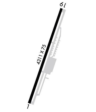
| Lat: N 4312.6 Long: W 11221.0 Elev: 4492 Var: -15 Longest Runway: 4314 | ||
| CTAF: 122.8 | ||
| ||||||||||||||||||||||||||||||||||||||||||||
| ||||||||||||||||||||||||||||||||||||||||||||
| Rwy | Rwy | |||||||
| 4314x75 | 4314' | 4314x75 | 4314' | |||||
| Runway ID | Single Wheel | Double Wheel | Double Tandem Wheel | Dual Double Wheel |
| 01/19 | 12,500 | N/A | N/A | N/A |
| These numbers are Advisory and are not limits. The Airport Manager should have more accurate Weight Limits | ||||
 Airport Diagram might not be current. | |
| Facility Name: | MCCARLEY FLD |
| City Name: | BLACKFOOT |
| County: | BINGHAM |
| State abbrev: | ID |
| State Name: | IDAHO |
| Ownership: | PUBLICLY OWNED |
| Use: | OPEN TO THE PUBLIC |
| Owner's Name: | CITY OF BLACKFOOT |
| Address: | 157 NORTH BROADWAY |
| BLACKFOOT, ID 83221 | |
| Owner's Phone: | 208-785-8600 |
| Manager's Name: | RANDY WAREING |
| Address: | 1311 AIRPORT RD. |
| BLACKFOOT, ID 83221 | |
| Phone: | (208) 709-9719 |
| FAA Region: | NORTHWEST MOUNTAIN |
| FAA Field Office: | HLN |
| Date | Sunrise | Sunset |
|---|---|---|
| 06/08/26 Monday | 5:50 | 21:07 |
| 06/09/26 Tuesday | 5:49 | 21:08 |
| 06/10/26 Wednesday | 5:49 | 21:09 |
| 06/11/26 Thursday | 5:49 | 21:09 |
| 06/12/26 Friday | 5:49 | 21:10 |
| 06/13/26 Saturday | 5:49 | 21:10 |
| 06/14/26 Sunday | 5:49 | 21:11 |
| 06/15/26 Monday | 5:49 | 21:11 |
| 06/16/26 Tuesday | 5:49 | 21:11 |
| 06/17/26 Wednesday | 5:49 | 21:12 |
| 06/18/26 Thursday | 5:49 | 21:12 |
| 06/19/26 Friday | 5:49 | 21:12 |
| 06/20/26 Saturday | 5:49 | 21:13 |
| 06/21/26 Sunday | 5:49 | 21:13 |
| Airport Attendance Schedule | MON-SAT 0800-1700 |
| Airport Status | OPERATIONAL (This Status can change at any time - please check NOTAMS) |
| Airport Lighting Schedule | SS-SR |
| Airport Storage Available | Tie Downs |
| Extra Services Available | Crop Dusting, Flight Instruction |
| Wind Indicator | YES - (lighted) |
| Control Tower | NO |
| CTAF Frequency | 122.800 |
| Unicom Frequency | 122.800 |
| Rotating Beacon Color | WG |
| Segmented Circle | YES |
| Landing Fee | NO |
| Airport Inspected | STATE - performed by STATE AERONAUTICAL PERSONNEL |
| Inspection Date | 04/23/2024 |
| Type of Fuel Available | Grade 100LL |
| Airframe Repair Service | MINOR |
| Power Plant Repair Service | MAJOR |
| Latitude | N4312.6 |
| Longitude | W11221.0 (ESTIMATED) |
| Arpt Elevation | 4491ft (SURVEYED) |
| Magnetic Variation | 15E |
| 1 miles N | of BLACKFOOT |
| Traffic Pattern Altitude | |
| Sectional Chart | SALT LAKE CITY |
| Operations (Reported) | Yearly | Avg. Daily |
|---|---|---|
| General Aviation Transient | 0 | 0 |
| General Aviation Local | 0 | 0 |
| Air Taxi | 0 | 0 |
| Commerical | 0 | 0 |
| Commuter | 0 | 0 |
| Military | 0 | 0 |
| Aircraft based on Field | |
|---|---|
| General Aviation Singles | 0 |
| General Aviation Multi | 0 |
| Jet Aircraft | 0 |
| General Aviation Helicopters | 0 |
| Military Aircraft | 0 |
| Gliders | 0 |
| Ultralights | 0 |
| FSS on field | NO |
| FSS tie-in | BOISE |
| FSS Phone | 1-800-WX-BRIEF |
| Who issues Notams | BOI |
| Notam D service at airport | YES |
| ARTCC Name | SALT LAKE CITY |
| Airport Certification | |
| Aircraft Rescue & Firefighting Index | None |
| Airport of Entry | No |
| Custom Landing Rights | No |
| Joint Civil/Military | No |
| Military Landing rights | No |
| NATIONAL PLAN OF INTEGRATED AIRPORT SYSTEMS (NPIAS) |
| GRANT AGREEMENTS UNDER FAAP/ADAP/AIP |
| CONVEYANCE UNDER SCETION 16, FEDERAL AIRPORT ACT OF 1946 OR SECTION 23, AIRPORT AND AIRWAY DEVELOPMENT ACT OF 1970 |
| ASSURANCES PURSUANT TO TITLE VI, CIVIL RIGHTS ACT OF 1964 |
| CONSIDERABLE AG OPERATIONS DURING GROWING SEASON. |
| BIRD ACTIVITY ON AND INVOF RY 01 THRESHOLD. |
| FOR CD CTC SALT LAKE ARTCC AT 801-320-2568. |
Airport Communications & Frequencies:
| |||||||||
| Runway: 01 | Runway: 19 | ||
| Mag heading: | 9° | Mag heading: | 189° |
| Rwy Slope: | .15% Up | Rwy Slope: | -.15% Down |
| Approach: | Approach: | ||
| Pattern: | Left Traffic | Pattern: | Left Traffic |
| Markings: | NONPRECISION INSTRUMENT | Markings: | NONPRECISION INSTRUMENT |
| Marking Condition: | GOOD | Marking Condition: | GOOD |
| Arresting Dev: | Arresting Dev: | ||
| Lat & Long: | N4312.2 W11221.2 | Lat. & Long.: | N4312.9 W11220.8 |
| Elev: | 4484.9 ft. MSL | Elev: | 4491.5 ft. MSL |
| TCH: | 39 ft. AGL | TCH: | 39 ft. AGL |
| Visual Glide Path: | 3.00 degrees | Visual Glide Path: | 3.25 degrees |
| Displaced Threshold: | No | Displaced Threshold: | No |
| Touchdown Zone: | YES | Touchdown Zone: | YES |
| Touchdown Elev.: | 4490.9 feet | Touchdown Elev.: | 4491.6 feet |
| Visual Glide Slope: | 2-Light PAPI on LEFT side of Runway | Visual Glide Slope: | 2-Light PAPI on LEFT side of Runway; RWY 01 PAPI SYS IS INOP. |
| RVR Equipment: | RVR Equipment: | ||
| RVV Equipment: | NO | RVV Equipment: | NO |
| Approach Lights: | Approach Lights: | ||
| REIL: | NO | REIL: | NO |
| Centerline Lights: | NO | Centerline Lights: | NO |
| Touchdown lights: | NO | Touchdown lights: | NO |
| Runway Category: | Runway with a Visual Approach | Runway Category: | Runway with a Visual Approach |
| Declared Distances: | Declared Distances: | ||
| Obstructions: | FENCE | Obstructions: | TREE |
| Marked: | NOT Marked/Lighted | Marked: | NOT Marked/Lighted |
| Clearance slope: | Clearance slope: | 12:1 | |
| Obstruction height: | 6 feet AGL | Obstruction height: | 40 feet AGL |
| Dist. from runway: | 200 feet | Dist. from runway: | 700 feet |
| Centerline offset: | 110 left of centerline | Centerline offset: | |
| Comments: | RWY 01 HAS +6 FT FENCE AT 0 FT, 120 FT L. | Comments: |
Thanks for using FltPlan.com
all rights reserved © 1999-2026 by Flight Plan LLC
