
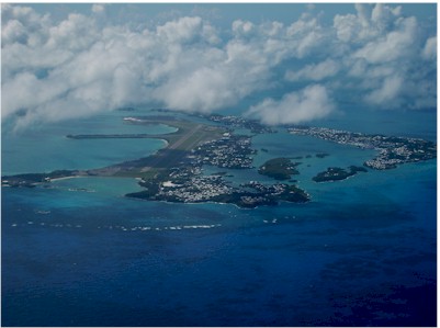
| LF WADE INTL (BDA) ST GEORGE BM |
| |
| Lat: N 3221.8 Long: W 06440.7 Elev: 18 Var: +15 Longest Runway: 9706 | ||
| Clr Del: 124.5/128.5 Dept. ATIS: 119.6 Arr. ATIS: 119.6 AWOS: 119.6 Ground: 124.5 Tower: 118.1 | ||
| ||||||||||||||||||||||
| ||||||||||||||||||||||
| ||||||||||||||||||||||
| ||||||||||||||||||||||
| ||||||||||||||||||||||
| ||||||||||||||||||||||
| ||||||||||||||||||||||
| Rwy | Rwy | |||||||
| 9706x150 | 9127' | 9706x150 | 9706' | |||||
| Runway ID | Single Wheel | Double Wheel | Double Tandem Wheel | Dual Double Wheel |
| 12/30 | N/A | N/A | N/A | N/A |
| These numbers are Advisory and are not limits. The Airport Manager should have more accurate Weight Limits | ||||
| FltPlan does not have IFR approach charts available for TXKF. |
| Facility Name: | L F WADE INTL |
| City Name: | HAMILTON |
| County: | BERMUDA |
| State abbrev: | |
| State Name: | |
| Ownership: | PUBLICLY OWNED |
| Use: | OPEN TO THE PUBLIC; FOREIGN CIV GOVT. LNDG FEES & DIPLOMATIC CLNC MAY BE RQR. |
| Owner's Name: | |
| Address: | |
| Owner's Phone: | |
| Manager's Name: | AIRPORT GENERAL MANAGER |
| Address: | DEPARTMENT OF AERODROME OPERATIONS, 3 CAHOW WAY |
| ST GEORGES GE CX | |
| Phone: | 1-800-441-293-2470 |
| FAA Region: | |
| FAA Field Office: | NONE |
| Date | Sunrise | Sunset |
|---|---|---|
| 09/24/21 Friday | 7:08 | 19:13 |
| 09/25/21 Saturday | 7:09 | 19:12 |
| 09/26/21 Sunday | 7:09 | 19:10 |
| 09/27/21 Monday | 7:10 | 19:09 |
| 09/28/21 Tuesday | 7:11 | 19:08 |
| 09/29/21 Wednesday | 7:11 | 19:06 |
| 09/30/21 Thursday | 7:12 | 19:05 |
| 10/01/21 Friday | 7:13 | 19:04 |
| 10/02/21 Saturday | 7:13 | 19:03 |
| 10/03/21 Sunday | 7:14 | 19:01 |
| 10/04/21 Monday | 7:15 | 19:00 |
| 10/05/21 Tuesday | 7:15 | 18:59 |
| 10/06/21 Wednesday | 7:16 | 18:57 |
| 10/07/21 Thursday | 7:17 | 18:56 |
| Airport Attendance Schedule | CONTINUOUS |
| Airport Status | OPERATIONAL (This Status can change at any time - please check NOTAMS) |
| Airport Lighting Schedule | WHEN ATCT CLSD, ACTVT MIRL RY 12/30, PAPI RYS 12 & 30, REIL RY 12, SALS RY 12 & ALSF-1 RY 30 - 122.8. |
| Airport Storage Available | NONE |
| Extra Services Available | Cargo Handling |
| Wind Indicator | YES - (unlit) |
| Control Tower | YES |
| CTAF Frequency | |
| Unicom Frequency | 122.800 |
| Rotating Beacon Color | |
| Segmented Circle | NO |
| Landing Fee |
| Airport Inspected | No Inspection Data Available performed by the OWNER |
| Inspection Date | Unknown |
| Type of Fuel Available | JET A-1 (freeze point -50C) |
| Airframe Repair Service | None |
| Power Plant Repair Service | None |
| Latitude | N3221.8 |
| Longitude | W06440.7 (ESTIMATED) |
| Arpt Elevation | 18ft (SURVEYED) |
| Magnetic Variation | 15W |
| 6 miles NE | of HAMILTON |
| Traffic Pattern Altitude | |
| Sectional Chart |
| Operations (Reported) | Yearly | Avg. Daily |
|---|---|---|
| General Aviation Transient | 0 | 0 |
| General Aviation Local | 0 | 0 |
| Air Taxi | 0 | 0 |
| Commerical | 0 | 0 |
| Commuter | 0 | 0 |
| Military | 0 | 0 |
| Aircraft based on Field | |
|---|---|
| General Aviation Singles | 0 |
| General Aviation Multi | 0 |
| Jet Aircraft | 0 |
| General Aviation Helicopters | 0 |
| Military Aircraft | 0 |
| Gliders | 0 |
| Ultralights | 0 |
| FSS on field | NO |
| FSS tie-in | NEW YORK; LCL AIS BRF ON APRT. |
| FSS Phone | 1-800-WX-BRIEF |
| Who issues Notams | |
| Notam D service at airport | No |
| ARTCC Name | NEW YORK |
| Airport Certification | |
| Aircraft Rescue & Firefighting Index | None |
| Airport of Entry | YES |
| Custom Landing Rights | No |
| Joint Civil/Military | No |
| Military Landing rights | No |
| 180 DEG TURNS ON RY 12/30 PROHIBITED UNLESS INSTRUCTED BY ATC. |
| ACFT MOVEMENTS ON APRON ARE UNCONTROLLED. |
| ACFT FLT PROHIBITED WI 3NM OF RSTR AREA R-3017. |
| FIREFIGHT EQUIP: FOUR FOAM VEHICLES: EACH, 3,000 GALS WATER, 420 GALS FOAM, 500 LBS DRY CHEM; ONE FOAM VEHICLE, 1,500 GALS WATER, 210 GALS FOAM; ONE LIGHT RESCUE VEHICLE & ONE COMMAND VEHICLE AVBL 1100-0300Z++ UTC-4 (-3DT). |
| WILDLIFE CTL SVC UNAVBL 0300-1100Z++ UTC-4(-3DT). |
| POTENTIAL FOR LGT TO MOD TURBULENCE AND/OR WIND SHEAR ON APCH RY 30. |
Airport Communications & Frequencies:
| |||||||||||||||
| Runway: 12 | Runway: 30 | ||
| Mag heading: | 116° | Mag heading: | 296° |
| Rwy Slope: | .00% Up | Rwy Slope: | .00% Down |
| Approach: | Approach: | ||
| Pattern: | Left Traffic | Pattern: | Left Traffic |
| Markings: | Markings: | ||
| Marking Condition: | Marking Condition: | ||
| Arresting Dev: | Arresting Dev: | ||
| Lat & Long: | N3222.0 W06441.6 | Lat. & Long.: | N3221.7 W06439.8 |
| Elev: | 17.8 ft. MSL | Elev: | 18.0 ft. MSL |
| TCH: | 50 ft. AGL | TCH: | 65 ft. AGL |
| Visual Glide Path: | 3.40 degrees | Visual Glide Path: | 3.00 degrees |
| Displaced Threshold: | 579 feet | Displaced Threshold: | No |
| Touchdown Zone: | YES | Touchdown Zone: | YES |
| Touchdown Elev.: | 18.1 feet | Touchdown Elev.: | 18.4 feet |
| Visual Glide Slope: | 4-Light PAPI on RIGHT side of Runway; RY 12 PAPI UNUSBL 9 DEG RIGHT AND 9 DEG LEFT OF CNTRLN. | Visual Glide Slope: | 4-Light PAPI on LEFT side of Runway |
| RVR Equipment: | RVR Equipment: | ||
| RVV Equipment: | NO | RVV Equipment: | NO |
| Approach Lights: | SALS | Approach Lights: | ALSF1 - standard 2,400 foot high intensity approach lighting system with sequenced flashers, Category I |
| REIL: | YES | REIL: | NO |
| Centerline Lights: | YES | Centerline Lights: | YES |
| Touchdown lights: | YES | Touchdown lights: | YES |
| Runway Category: | Runway Category: | ||
| Declared Distances: | TORA:9669' TODA:10620' ASDA:9669' LDA:9669' | Declared Distances: | TORA:9669' TODA:10243' ASDA:9669' LDA:9669' |
Thanks for using FltPlan.com
all rights reserved © 1999-2021 by Flight Plan LLC