
| BOLINDER FIELD-TOOELE VALLEY TOOELE UT |
| |
| Lat: N 4036.8 Long: W 11221.0 Elev: 4322 Var: -13 Longest Runway: 6100 | ||
| Clr Del: 124.4 AWOS: 119.72 CTAF: 123.0 | ||
| ||||||||||||||||||||||||||||||||||||||||||||
| ||||||||||||||||||||||||||||||||||||||||||||
| ||||||||||||||||||||||||||||||||||||||||||||
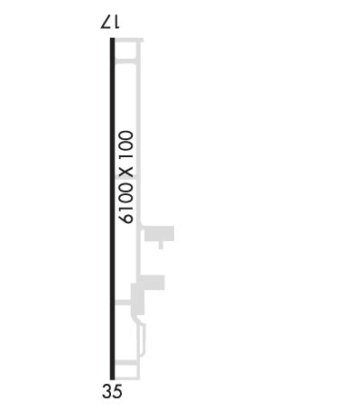
| Rwy | Rwy | |||||||
| 6100x100 | 6100' | 111.15 - 166° | 6100x100 | 6050' | ||||
| Runway ID | Single Wheel | Double Wheel | Double Tandem Wheel | Dual Double Wheel |
| 17/35 | 30,000 | 43,000 | N/A | N/A |
| These numbers are Advisory and are not limits. The Airport Manager should have more accurate Weight Limits | ||||
 Airport Diagram might not be current. | |
| Facility Name: | BOLINDER FLD-TOOELE VALLEY |
| City Name: | TOOELE |
| County: | TOOELE |
| State abbrev: | UT |
| State Name: | UTAH |
| Ownership: | PUBLICLY OWNED |
| Use: | OPEN TO THE PUBLIC |
| Owner's Name: | SALT LAKE CITY DEPT OF AIRPORTS |
| Address: | PO BOX 145550 |
| SALT LAKE CITY, UT 84114-5550 | |
| Owner's Phone: | 801-575-2401 |
| Manager's Name: | DAVE TEGGINS |
| Address: | PO BOX 145550 |
| SALT LAKE CITY, UT 84114-5550 | |
| Phone: | (801) 556-4082 |
| FAA Region: | NORTHWEST MOUNTAIN |
| FAA Field Office: | DEN |
| Date | Sunrise | Sunset |
|---|---|---|
| 09/24/21 Friday | 7:19 | 19:23 |
| 09/25/21 Saturday | 7:20 | 19:22 |
| 09/26/21 Sunday | 7:21 | 19:20 |
| 09/27/21 Monday | 7:22 | 19:18 |
| 09/28/21 Tuesday | 7:23 | 19:17 |
| 09/29/21 Wednesday | 7:24 | 19:15 |
| 09/30/21 Thursday | 7:25 | 19:13 |
| 10/01/21 Friday | 7:26 | 19:12 |
| 10/02/21 Saturday | 7:27 | 19:10 |
| 10/03/21 Sunday | 7:28 | 19:08 |
| 10/04/21 Monday | 7:29 | 19:07 |
| 10/05/21 Tuesday | 7:30 | 19:05 |
| 10/06/21 Wednesday | 7:31 | 19:04 |
| 10/07/21 Thursday | 7:32 | 19:02 |
| Airport Attendance Schedule | UNATTENDED |
| Airport Status | OPERATIONAL (This Status can change at any time - please check NOTAMS) |
| Airport Lighting Schedule | ACTVT MIRL RY 17/35, MALSR RY 17, REIL RY 35 & PAPI RYS 17 & 35 - CTAF. |
| Airport Storage Available | Tie Downs |
| Extra Services Available | Parachute Jumping |
| Wind Indicator | YES - (lighted) |
| Control Tower | NO |
| CTAF Frequency | 123.000 |
| Unicom Frequency | 123.000 |
| Rotating Beacon Color | CLEAR-GREEN (Light Land Airport) |
| Segmented Circle | YES |
| Landing Fee | NO |
| Airport Inspected | STATE - performed by STATE AERONAUTICAL PERSONNEL |
| Inspection Date | 11/19/2014 |
| Type of Fuel Available | Grade 100LL |
| Airframe Repair Service | NONE |
| Power Plant Repair Service | NONE |
| Latitude | N4036.8 |
| Longitude | W11221.0 (ESTIMATED) |
| Arpt Elevation | 4321ft (SURVEYED) |
| Magnetic Variation | 13E |
| 5 miles NW | of TOOELE |
| Traffic Pattern Altitude | |
| Sectional Chart | SALT LAKE CITY |
| Operations (Reported) | Yearly | Avg. Daily |
|---|---|---|
| General Aviation Transient | 44774 | 123 |
| General Aviation Local | 24647 | 68 |
| Air Taxi | 1003 | 3 |
| Commerical | 0 | 0 |
| Commuter | 0 | 0 |
| Military | 0 | 0 |
| Aircraft based on Field | |
|---|---|
| General Aviation Singles | 14 |
| General Aviation Multi | 0 |
| Jet Aircraft | 0 |
| General Aviation Helicopters | 0 |
| Military Aircraft | 0 |
| Gliders | 0 |
| Ultralights | 0 |
| FSS on field | NO |
| FSS tie-in | CEDAR CITY |
| FSS Phone | 1-800-WX-BRIEF |
| Who issues Notams | CDC |
| Notam D service at airport | YES |
| ARTCC Name | SALT LAKE CITY |
| Airport Certification | |
| Aircraft Rescue & Firefighting Index | None |
| Airport of Entry | No |
| Custom Landing Rights | No |
| Joint Civil/Military | No |
| Military Landing rights | YES |
| NATIONAL PLAN OF INTEGRATED AIRPORT SYSTEMS (NPIAS) |
| GRANT AGREEMENTS UNDER FAAP/ADAP/AIP |
| ASSURANCES PURSUANT TO TITLE VI, CIVIL RIGHTS ACT OF 1964 |
| EXTENSIVE FLIGHT TRAINING IN VICINITY |
| FOR CD CTC SALT LAKE CITY APCH AT 801-325-9670/9671/9672. |
Airport Communications & Frequencies:
| ||||||||||||||||||||||||
| Runway: 17 | Runway: 35 | ||
| Mag heading: | 166° | Mag heading: | 346° |
| Rwy Slope: | .80% Up | Rwy Slope: | -.80% Down |
| Approach: | ILS/DME | Approach: | |
| Pattern: | Left Traffic | Pattern: | Left Traffic |
| Markings: | PRECISION INSTRUMENT | Markings: | BASIC |
| Marking Condition: | GOOD | Marking Condition: | GOOD |
| Arresting Dev: | Arresting Dev: | ||
| Lat & Long: | N4037.3 W11221.1 | Lat. & Long.: | N4036.3 W11221.0 |
| Elev: | 4273.3 ft. MSL | Elev: | 4321.8 ft. MSL |
| TCH: | 55 ft. AGL | TCH: | 45 ft. AGL |
| Visual Glide Path: | 3.00 degrees | Visual Glide Path: | 3.00 degrees |
| Displaced Threshold: | No | Displaced Threshold: | 50 feet |
| Touchdown Zone: | YES | Touchdown Zone: | YES |
| Touchdown Elev.: | 4296.9 feet | Touchdown Elev.: | 4321.8 feet |
| Visual Glide Slope: | 4-Light PAPI on RIGHT side of Runway | Visual Glide Slope: | 4-Light PAPI on LEFT side of Runway |
| RVR Equipment: | RVR Equipment: | ||
| RVV Equipment: | NO | RVV Equipment: | NO |
| Approach Lights: | MALSR - 1,400 foot medium intensity approach lighting system with runway alignment indicator lights | Approach Lights: | |
| REIL: | NO | REIL: | YES |
| Centerline Lights: | NO | Centerline Lights: | NO |
| Touchdown lights: | NO | Touchdown lights: | NO |
| Runway Category: | Runway with a Non-precision Approach having visibility minimums greater than 3/4 mile | Runway Category: | Runway with a Visual Approach |
| Declared Distances: | TORA:6100' TODA:6100' ASDA:6100' LDA:6100' | Declared Distances: | TORA:6100' TODA:6100' ASDA:6100' LDA:5980' |
| Obstructions: | Obstructions: | ROAD | |
| Marked: | Marked: | NOT Marked/Lighted | |
| Clearance slope: | 50:1 | Clearance slope: | 39:1 |
| Obstruction height: | Obstruction height: | 22 feet AGL | |
| Dist. from runway: | Dist. from runway: | 1059 feet | |
| Centerline offset: | Centerline offset: | B | |
| Comments: | Comments: |
Thanks for using FltPlan.com
all rights reserved © 1999-2021 by Flight Plan LLC
