
| DADE-COLLIER TRAINING AND TRAN MIAMI FL |
| |
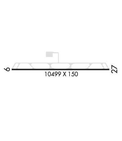
| Lat: N 2551.7 Long: W 08053.8 Elev: 13 Var: +05 Longest Runway: 10499 | ||
| AWOS: 119.07 CTAF: 123.0 | ||
| ||||||||||||||||||||||||||||||||
| ||||||||||||||||||||||||||||||||
| ||||||||||||||||||||||||||||||||
| Rwy | Rwy | |||||||
| 10499x150 | 10499' | 108.30 - 095° | 10499x150 | 10499' | ||||
| Runway ID | Single Wheel | Double Wheel | Double Tandem Wheel | Dual Double Wheel |
| 09/27 | 130,000 | 200,000 | 400,000 | 800,000 |
| These numbers are Advisory and are not limits. The Airport Manager should have more accurate Weight Limits | ||||
 Airport Diagram might not be current. | |
| Facility Name: | DADE-COLLIER TRAINING AND TRANSITION |
| City Name: | MIAMI |
| County: | DADE; AND COLLIER CO. |
| State abbrev: | FL |
| State Name: | FLORIDA |
| Ownership: | PUBLICLY OWNED |
| Use: | OPEN TO THE PUBLIC; ARPT CLSD TO PUBLIC EXCP BY ARRANGEMENT WITH MIAMI-DADE AVIATION DEPT MIAMI 305-869-1660. |
| Owner's Name: | MIAMI-DADE COUNTY |
| Address: | MIAMI-DADE AVIATION DEPARTMENT, PO BOX 025504 |
| MIAMI, FL 33102-5504 | |
| Owner's Phone: | (305) 876-0464 |
| Manager's Name: | ELVIN HERNANDEZ; AIRPORT PHYSICAL ADDRESS: 54757 EAST TAMIAMI TRAIL, OCHOPPI, FL 34141 239-695-3300, FAX: 305-876-0565 |
| Address: | 14201 NW LEJEUNE RD |
| OPA-LOCKA, FL 33054 | |
| Phone: | (305) 869-1662 |
| FAA Region: | SOUTHERN |
| FAA Field Office: | ORL |
| Date | Sunrise | Sunset |
|---|---|---|
| 09/24/21 Friday | 7:13 | 19:18 |
| 09/25/21 Saturday | 7:13 | 19:17 |
| 09/26/21 Sunday | 7:14 | 19:16 |
| 09/27/21 Monday | 7:14 | 19:15 |
| 09/28/21 Tuesday | 7:14 | 19:14 |
| 09/29/21 Wednesday | 7:15 | 19:13 |
| 09/30/21 Thursday | 7:15 | 19:11 |
| 10/01/21 Friday | 7:16 | 19:10 |
| 10/02/21 Saturday | 7:16 | 19:09 |
| 10/03/21 Sunday | 7:17 | 19:08 |
| 10/04/21 Monday | 7:17 | 19:07 |
| 10/05/21 Tuesday | 7:18 | 19:06 |
| 10/06/21 Wednesday | 7:18 | 19:05 |
| 10/07/21 Thursday | 7:18 | 19:04 |
| Airport Attendance Schedule | 7 Days A Week 0830-1730 |
| Airport Status | OPERATIONAL (This Status can change at any time - please check NOTAMS) |
| Airport Lighting Schedule | |
| Airport Storage Available | NONE |
| Extra Services Available | NONE |
| Wind Indicator | YES - (lighted) |
| Control Tower | NO |
| CTAF Frequency | 123.000 |
| Unicom Frequency | 123.000 |
| Rotating Beacon Color | CLEAR-GREEN (Light Land Airport) |
| Segmented Circle | Y-L |
| Landing Fee | YES |
| Airport Inspected | STATE - performed by STATE AERONAUTICAL PERSONNEL |
| Inspection Date | 10/10/2018 |
| Type of Fuel Available | None |
| Airframe Repair Service | NONE |
| Power Plant Repair Service | NONE |
| Latitude | N2551.7 |
| Longitude | W08053.8 (ESTIMATED) |
| Arpt Elevation | 12ft (SURVEYED) |
| Magnetic Variation | 05W |
| 36 miles W | of MIAMI |
| Traffic Pattern Altitude | |
| Sectional Chart | MIAMI |
| Operations (Reported) | Yearly | Avg. Daily |
|---|---|---|
| General Aviation Transient | 14468 | 40 |
| General Aviation Local | 0 | 0 |
| Air Taxi | 0 | 0 |
| Commerical | 0 | 0 |
| Commuter | 0 | 0 |
| Military | 0 | 0 |
| Aircraft based on Field | |
|---|---|
| General Aviation Singles | 0 |
| General Aviation Multi | 0 |
| Jet Aircraft | 0 |
| General Aviation Helicopters | 0 |
| Military Aircraft | 0 |
| Gliders | 0 |
| Ultralights | 0 |
| FSS on field | NO |
| FSS tie-in | MIAMI |
| FSS Phone | 1-800-WX-BRIEF |
| Who issues Notams | MIA |
| Notam D service at airport | YES |
| ARTCC Name | MIAMI |
| Airport Certification | |
| Aircraft Rescue & Firefighting Index | None |
| Airport of Entry | No |
| Custom Landing Rights | No |
| Joint Civil/Military | No |
| Military Landing rights | YES |
| NATIONAL PLAN OF INTEGRATED AIRPORT SYSTEMS (NPIAS) |
| GRANT AGREEMENTS UNDER FAAP/ADAP/AIP |
| ASSURANCES PURSUANT TO TITLE VI, CIVIL RIGHTS ACT OF 1964 |
| THREE 8IN WELLS FLUSH MTD BTN RWY AND TWY. |
| FEE FOR USE FOR ACFT OVER 12500 LBS. |
| MAEW IN BUFFER ISLAND BTN RY 09/27 & TWY. |
| WILDLIFE OCCASIONALLY ON & INVOF ARPT. |
| BE ALERT TO LOW FLYING NATIONAL PARK SVC ACFT ALL QUADRANTS. |
| NO NGT TIME OPNS EXC WITH PRIOR PMSN FM MIAMI-DADE AVN DEPT 305-869-1660. |
| FOR CD IF UNA TO CTC ON FSS FREQ, CTC MIAMI APCH AT 305-869-5432. |
Airport Communications & Frequencies:
| |||||||||||||||||
| Runway: 09 | Runway: 27 | ||
| Mag heading: | 95° | Mag heading: | 275° |
| Rwy Slope: | .00% Down | Rwy Slope: | .00% Up |
| Approach: | ILS | Approach: | |
| Pattern: | Left Traffic | Pattern: | Right Traffic |
| Markings: | PRECISION INSTRUMENT | Markings: | PRECISION INSTRUMENT |
| Marking Condition: | FAIR | Marking Condition: | FAIR |
| Arresting Dev: | Arresting Dev: | ||
| Lat & Long: | N2551.7 W08054.8 | Lat. & Long.: | N2551.7 W08052.9 |
| Elev: | 12.6 ft. MSL | Elev: | 12.4 ft. MSL |
| TCH: | TCH: | ||
| Visual Glide Path: | Visual Glide Path: | ||
| Displaced Threshold: | No | Displaced Threshold: | No |
| Touchdown Zone: | YES | Touchdown Zone: | YES |
| Touchdown Elev.: | 12.7 feet | Touchdown Elev.: | 12.6 feet |
| Visual Glide Slope: | Visual Glide Slope: | ||
| RVR Equipment: | RVR Equipment: | ||
| RVV Equipment: | NO | RVV Equipment: | NO |
| Approach Lights: | Approach Lights: | ||
| REIL: | NO | REIL: | NO |
| Centerline Lights: | NO | Centerline Lights: | NO |
| Touchdown lights: | NO | Touchdown lights: | NO |
| Runway Category: | Runway with a Non-precision Approach having visibility minimums greater than 3/4 mile | Runway Category: | Runway with a Visual Approach |
| Declared Distances: | Declared Distances: | ||
| Obstructions: | Obstructions: | TREES | |
| Marked: | Marked: | NOT Marked/Lighted | |
| Clearance slope: | 50:1 | Clearance slope: | 34:1 |
| Obstruction height: | Obstruction height: | 26 feet AGL | |
| Dist. from runway: | Dist. from runway: | 1075 feet | |
| Centerline offset: | Centerline offset: | 290 feet right of centerline | |
| Comments: | Comments: |
Thanks for using FltPlan.com
all rights reserved © 1999-2021 by Flight Plan LLC
