| TELLURIDE RGNL TELLURIDE CO |
| |
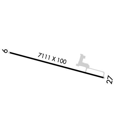
| Lat: N 3757.2 Long: W 10754.5 Elev: 9070 Var: -09 Longest Runway: 7111 | ||
| AWOS: 118.32 CTAF: 123.0 | ||
| |||||||||||||||||||||||||||||||
| |||||||||||||||||||||||||||||||
| |||||||||||||||||||||||||||||||
| FBOs at nearby airports who want your business: | |||||||||||
| |||||||||||
| Rwy | Rwy | |||||||
| 7111x100 | 6911' | 109.30 - 092° | 7111x100 | 6911' | ||||
| Runway ID | Single Wheel | Double Wheel | Double Tandem Wheel | Dual Double Wheel |
| 09/27 | 45,000 | 89,000 | N/A | N/A |
| These numbers are Advisory and are not limits. The Airport Manager should have more accurate Weight Limits | ||||
 Airport Diagram might not be current. | |
| Facility Name: | TELLURIDE RGNL |
| City Name: | TELLURIDE |
| County: | SAN MIGUEL |
| State abbrev: | CO |
| State Name: | COLORADO |
| Ownership: | PUBLICLY OWNED |
| Use: | OPEN TO THE PUBLIC |
| Owner's Name: | TELLURIDE REGIONAL ARPT AUTH |
| Address: | 1500 LAST DALLAR RD. SUITE 1 |
| TELLURIDE, CO 81435 | |
| Owner's Phone: | 970-728-8600 |
| Manager's Name: | KENNETH E. MAENPA |
| Address: | 1500 LAST DOLLAR RD. SUITE 1 |
| TELLURIDE, CO 81435 | |
| Phone: | (970) 728-8601; FOR SVC CALL TELLURIDE REGIONAL ARPT AT 970-728-8600. |
| FAA Region: | NORTHWEST MOUNTAIN |
| FAA Field Office: | DEN |

| Date | Sunrise | Sunset |
|---|---|---|
| 09/24/21 Friday | 7:01 | 19:06 |
| 09/25/21 Saturday | 7:02 | 19:04 |
| 09/26/21 Sunday | 7:03 | 19:03 |
| 09/27/21 Monday | 7:04 | 19:01 |
| 09/28/21 Tuesday | 7:04 | 19:00 |
| 09/29/21 Wednesday | 7:05 | 18:58 |
| 09/30/21 Thursday | 7:06 | 18:56 |
| 10/01/21 Friday | 7:07 | 18:55 |
| 10/02/21 Saturday | 7:08 | 18:53 |
| 10/03/21 Sunday | 7:09 | 18:52 |
| 10/04/21 Monday | 7:10 | 18:50 |
| 10/05/21 Tuesday | 7:11 | 18:49 |
| 10/06/21 Wednesday | 7:12 | 18:47 |
| 10/07/21 Thursday | 7:13 | 18:46 |
| Airport Attendance Schedule | APR-OCT 7 Days A Week 0700-2100, NOV-MAR 7 Days A Week 0700-1800; ARPT CLSD 2100-0600 (LOCAL). |
| Airport Status | OPERATIONAL (This Status can change at any time - please check NOTAMS) |
| Airport Lighting Schedule | ACTVT HIRL RY 09/27; PAPI RYS 09 & 27; REIL RY 09/27 - CTAF. ALS EMERGENCY USE ONLY 2100-0600. |
| Airport Storage Available | Tie Downs, Hanger |
| Extra Services Available | Air Freight, Charter, Glider |
| Wind Indicator | YES - (lighted) |
| Control Tower | NO |
| CTAF Frequency | 123.000 |
| Unicom Frequency | 123.000 |
| Rotating Beacon Color | CLEAR-GREEN (Light Land Airport) |
| Segmented Circle | YES |
| Landing Fee | YES |
| Airport Inspected | STATE - performed by FAA AIRPORTS FIELD PERSONNEL |
| Inspection Date | 07/20/2021 |
| Type of Fuel Available | Grade 100LL, JET A (freeze point -40C) |
| Airframe Repair Service | None |
| Power Plant Repair Service | None |
| Latitude | N3757.2 |
| Longitude | W10754.5 (ESTIMATED) |
| Arpt Elevation | 9069ft (SURVEYED) |
| Magnetic Variation | 09E |
| 5 miles W | of TELLURIDE |
| Traffic Pattern Altitude | 1414 |
| Sectional Chart | DENVER |
| Operations (Reported) | Yearly | Avg. Daily |
|---|---|---|
| General Aviation Transient | 9370 | 26 |
| General Aviation Local | 0 | 0 |
| Air Taxi | 0 | 0 |
| Commerical | 32 | 0 |
| Commuter | 0 | 0 |
| Military | 0 | 0 |
| Aircraft based on Field | |
|---|---|
| General Aviation Singles | 18 |
| General Aviation Multi | 3 |
| Jet Aircraft | 4 |
| General Aviation Helicopters | 1 |
| Military Aircraft | 0 |
| Gliders | 1 |
| Ultralights | 0 |
| FSS on field | NO |
| FSS tie-in | DENVER |
| FSS Phone | 1-800-WX-BRIEF |
| Who issues Notams | TEX |
| Notam D service at airport | YES |
| ARTCC Name | DENVER |
| Airport Certification | AIRPORT RECEIVING SCHEDULED AIR CARRIER SERVICE FROM CARRIERS CERTIFICATED BY THE CIVIL AERONAUTICS BOARD; RSTD TO FAR 139 DESIGN GROUPS AI - CIII. |
| Aircraft Rescue & Firefighting Index | AIRPORT HAS A CERTIFICATE UNDER CFR PART 139 |
| Airport of Entry | No |
| Custom Landing Rights | No |
| Joint Civil/Military | No |
| Military Landing rights | No |
| NATIONAL PLAN OF INTEGRATED AIRPORT SYSTEMS (NPIAS) |
| TEX RWY 27 PAPI BEYOND 2.5NM UNUSBL |
| FOR CD CONTACT DENVER ARTCC AT 303-651-4814. IF UNA TO CTC DENVER ARTCC, CTC DENVER RADIO. |
| COLD TEMPERATURE AIRPORT. ALTITUDE CORRECTION REQUIRED AT OR BELOW -18C. |
| GLIDER; HANG GLIDER & HELICOPTER OPNS ON & INVOF ARPT. |
| NOISE ABATEMENT PROCEDURES IN EFFECT. FOR MORE INFO CONTACT TEX CUSTOMER SERVICE 970-728-8600. |
| RISING TERRAIN ALL QUADRANTS. |
| ARPT ON 1000 FT MESA; STRONG VERTICAL TURBULENCE IN AREA OF MESA EDGE. |
| ACR OPNS DURG UNATNDD HRS MUST NTFY TEX CUSTOMER SVC AT 970-728-8603 24 HRS IN ADVN FOR PROVISION OF ADQT ARFF PSNL. |
| RWY 09/2 7 RY 09/27 RCMD TKOF RY 27; LAND RY 09 AND AVOID POPULATED AREAS. RY 09/27 GRADE -.08 ON RY ENDS, -1.3 TO APPROX MIDPOINT THEN +.75. |
Airport Communications & Frequencies:
| |||||||||
| Runway: 09 | Runway: 27 | ||
| Mag heading: | 96° | Mag heading: | 276° |
| Rwy Slope: | .44% Up | Rwy Slope: | -.44% Down |
| Approach: | LDA/DME | Approach: | |
| Pattern: | Right Traffic | Pattern: | Left Traffic |
| Markings: | NONPRECISION INSTRUMENT | Markings: | NONPRECISION INSTRUMENT |
| Marking Condition: | GOOD | Marking Condition: | GOOD |
| Arresting Dev: | EMAS; ENGINEERED MATERIALS ARRESTING SYSTEM (EMAS) 292 FT IN LENGTH BY 122 FT IN WIDTH LCTD AT THE DER 09. | Arresting Dev: | EMAS; ENGINEERED MATERIALS ARRESTING SYSTEM (EMAS) 292 FT IN LENGTH BY 122 FT IN WIDTH LCTD AT THE DER 27. |
| Lat & Long: | N3757.4 W10755.2 | Lat. & Long.: | N3757.1 W10753.8 |
| Elev: | 9038.1 ft. MSL | Elev: | 9069.7 ft. MSL |
| TCH: | 46 ft. AGL | TCH: | 40 ft. AGL |
| Visual Glide Path: | 3.55 degrees | Visual Glide Path: | 4.00 degrees |
| Displaced Threshold: | 200 feet | Displaced Threshold: | 200 feet |
| Touchdown Zone: | YES | Touchdown Zone: | YES |
| Touchdown Elev.: | 9036.7 feet | Touchdown Elev.: | 9068.1 feet |
| Visual Glide Slope: | 4-Light PAPI on LEFT side of Runway | Visual Glide Slope: | 4-Light PAPI on LEFT side of Runway; RWY27 PAPI LGTS UNUSBL BYD 2.5 NM DUE TO TRRN. |
| RVR Equipment: | RVR Equipment: | ||
| RVV Equipment: | NO | RVV Equipment: | NO |
| Approach Lights: | Approach Lights: | ||
| REIL: | YES | REIL: | YES |
| Centerline Lights: | NO | Centerline Lights: | NO |
| Touchdown lights: | NO | Touchdown lights: | NO |
| Runway Category: | Runway with a Non-precision Approach having visibility minimums greater than 3/4 mile | Runway Category: | Runway with a Visual Approach |
| Declared Distances: | TORA:7111' TODA:7111' ASDA:7111' LDA:6911' | Declared Distances: | TORA:7111' TODA:7111' ASDA:7111' LDA:6911' |
Thanks for using FltPlan.com
all rights reserved © 1999-2021 by Flight Plan LLC