
| MASON COUNTY MASON TX |
| |
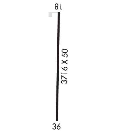
| Lat: N 3043.9 Long: W 09911.0 Elev: 1514 Var: -05 Longest Runway: 3716 | ||
| CTAF: 122.9 | ||
| ||||||||||||||||||||||||||||||||||||||||||||
| ||||||||||||||||||||||||||||||||||||||||||||
| Rwy | Rwy | |||||||
| 3716x50 | 3716' | 3716x50 | 3716' | |||||
| Runway ID | Single Wheel | Double Wheel | Double Tandem Wheel | Dual Double Wheel |
| 18/36 | N/A | N/A | N/A | N/A |
| These numbers are Advisory and are not limits. The Airport Manager should have more accurate Weight Limits | ||||
 Airport Diagram might not be current. | |
| Facility Name: | MASON COUNTY |
| City Name: | MASON |
| County: | MASON |
| State abbrev: | TX |
| State Name: | TEXAS |
| Ownership: | PUBLICLY OWNED |
| Use: | OPEN TO THE PUBLIC |
| Owner's Name: | MASON COUNTY |
| Address: | COURTHOUSE |
| MASON, TX 76856 | |
| Owner's Phone: | 325-347-5556 |
| Manager's Name: | JERRY BEARDEN; COUNTY JUDGE/ARPT MGR. |
| Address: | COUNTY COURTHOUSE |
| MASON, TX 76856 | |
| Phone: | 325-347-5556 |
| FAA Region: | SOUTHWEST |
| FAA Field Office: | TEX |
| Date | Sunrise | Sunset |
|---|---|---|
| 09/24/21 Friday | 7:26 | 19:31 |
| 09/25/21 Saturday | 7:27 | 19:30 |
| 09/26/21 Sunday | 7:27 | 19:28 |
| 09/27/21 Monday | 7:28 | 19:27 |
| 09/28/21 Tuesday | 7:28 | 19:26 |
| 09/29/21 Wednesday | 7:29 | 19:25 |
| 09/30/21 Thursday | 7:30 | 19:23 |
| 10/01/21 Friday | 7:30 | 19:22 |
| 10/02/21 Saturday | 7:31 | 19:21 |
| 10/03/21 Sunday | 7:31 | 19:20 |
| 10/04/21 Monday | 7:32 | 19:18 |
| 10/05/21 Tuesday | 7:33 | 19:17 |
| 10/06/21 Wednesday | 7:33 | 19:16 |
| 10/07/21 Thursday | 7:34 | 19:15 |
| Airport Attendance Schedule | UNATTENDED |
| Airport Status | OPERATIONAL (This Status can change at any time - please check NOTAMS) |
| Airport Lighting Schedule | SS-SR |
| Airport Storage Available | Tie Downs |
| Extra Services Available | NONE |
| Wind Indicator | YES - (lighted) |
| Control Tower | NO |
| CTAF Frequency | 122.900 |
| Unicom Frequency | |
| Rotating Beacon Color | CLEAR-GREEN (Light Land Airport) |
| Segmented Circle | YES |
| Landing Fee | NO |
| Airport Inspected | STATE - performed by PRIVATE CONTRACT PERSONNEL |
| Inspection Date | 05/14/2020 |
| Type of Fuel Available | Grade 100LL; -10FUEL AVBL 24 HRS WITH CREDIT CARD. FOR ASSITANCE CALL 325-347-5252. |
| Airframe Repair Service | None |
| Power Plant Repair Service | None |
| Latitude | N3043.9 |
| Longitude | W09911.0 (ESTIMATED) |
| Arpt Elevation | 1514ft (SURVEYED) |
| Magnetic Variation | 05E |
| 3 miles SE | of MASON |
| Traffic Pattern Altitude | |
| Sectional Chart | SAN ANTONIO |
| Operations (Reported) | Yearly | Avg. Daily |
|---|---|---|
| General Aviation Transient | 1200 | 3 |
| General Aviation Local | 800 | 2 |
| Air Taxi | 0 | 0 |
| Commerical | 0 | 0 |
| Commuter | 0 | 0 |
| Military | 0 | 0 |
| Aircraft based on Field | |
|---|---|
| General Aviation Singles | 5 |
| General Aviation Multi | 0 |
| Jet Aircraft | 0 |
| General Aviation Helicopters | 0 |
| Military Aircraft | 0 |
| Gliders | 0 |
| Ultralights | 0 |
| FSS on field | NO |
| FSS tie-in | SAN ANGELO |
| FSS Phone | 1-800-WX-BRIEF |
| Who issues Notams | SJT |
| Notam D service at airport | YES |
| ARTCC Name | HOUSTON |
| Airport Certification | |
| Aircraft Rescue & Firefighting Index | None |
| Airport of Entry | No |
| Custom Landing Rights | No |
| Joint Civil/Military | No |
| Military Landing rights | No |
| ASSURANCES PURSUANT TO TITLE VI, CIVIL RIGHTS ACT OF 1964 |
| GRANT AGREEMENT HAS EXPIRED; HOWEVER, AGREEMENT REMAINS IN EFFECT FOR THIS FACILITY AS LONG AS IT IS PUBLIC USE. |
| HEAVY TRANSIENT TFC NOV-JAN. |
| DEER ON AND IN VICINITY OF RWY. |
| FOR CD CTC HOUSTON ARTCC AT 281-230-5622. |
Airport Communications & Frequencies:
| |||||||
| Runway: 18 | Runway: 36 | ||
| Mag heading: | 176° | Mag heading: | 356° |
| Rwy Slope: | -.10% Down | Rwy Slope: | .10% Up |
| Approach: | Approach: | ||
| Pattern: | Left Traffic | Pattern: | Left Traffic |
| Markings: | NONPRECISION INSTRUMENT | Markings: | NONPRECISION INSTRUMENT |
| Marking Condition: | POOR | Marking Condition: | POOR |
| Arresting Dev: | Arresting Dev: | ||
| Lat & Long: | N3044.2 W09911.1 | Lat. & Long.: | N3043.6 W09911.1 |
| Elev: | 1501.8 ft. MSL | Elev: | 1497.9 ft. MSL |
| TCH: | TCH: | ||
| Visual Glide Path: | Visual Glide Path: | ||
| Displaced Threshold: | No | Displaced Threshold: | No |
| Touchdown Zone: | YES | Touchdown Zone: | YES |
| Touchdown Elev.: | 1501.8 feet | Touchdown Elev.: | 1498.0 feet |
| Visual Glide Slope: | Visual Glide Slope: | ||
| RVR Equipment: | RVR Equipment: | ||
| RVV Equipment: | NO | RVV Equipment: | NO |
| Approach Lights: | Approach Lights: | ||
| REIL: | NO | REIL: | NO |
| Centerline Lights: | NO | Centerline Lights: | NO |
| Touchdown lights: | NO | Touchdown lights: | NO |
| Runway Category: | Runway with a Non-precision Approach | Runway Category: | Runway with a Non-precision Approach |
| Declared Distances: | Declared Distances: | ||
| Obstructions: | TREES | Obstructions: | BRUSH |
| Marked: | NOT Marked/Lighted | Marked: | NOT Marked/Lighted |
| Clearance slope: | 26:1 | Clearance slope: | |
| Obstruction height: | 29 feet AGL | Obstruction height: | 12 feet AGL |
| Dist. from runway: | 965 feet | Dist. from runway: | 200 feet |
| Centerline offset: | Centerline offset: | 162 feet right of centerline | |
| Comments: | Comments: | +14-23 FT TREES 0-200 FT DSTC 240 FT R OF CNTRLN. |
Thanks for using FltPlan.com
all rights reserved © 1999-2021 by Flight Plan LLC
