
| STONEWALL COUNTY ASPERMONT TX |
| |
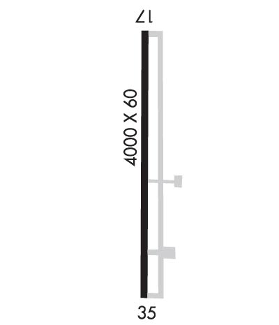
| Lat: N 3310.2 Long: W 10011.8 Elev: 1744 Var: -08 Longest Runway: 4000 | ||
| CTAF: 122.9 | ||
| ||||||||||||||||||||||||||||||||
| ||||||||||||||||||||||||||||||||
| Rwy | Rwy | |||||||
| 4000x60 | 4000' | 4000x60 | 4000' | |||||
| Runway ID | Single Wheel | Double Wheel | Double Tandem Wheel | Dual Double Wheel |
| 17/35 | 12,500 | N/A | N/A | N/A |
| These numbers are Advisory and are not limits. The Airport Manager should have more accurate Weight Limits | ||||
| FltPlan does not have IFR approach charts available for KT60. |
 Airport Diagram might not be current. | |
| Facility Name: | STONEWALL COUNTY |
| City Name: | ASPERMONT |
| County: | STONEWALL |
| State abbrev: | TX |
| State Name: | TEXAS |
| Ownership: | PUBLICLY OWNED |
| Use: | OPEN TO THE PUBLIC |
| Owner's Name: | STONEWALL COUNTY |
| Address: | 128 TOWN SQUARE LANE, PO BOX 366 |
| ASPERMONT, TX 79502 | |
| Owner's Phone: | 940-989-3393 |
| Manager's Name: | RONNIE MOORHEAD; CO. JUDGE/AMGR. |
| Address: | 128 TOWN SQUARE LANE, PO BOX 366 |
| ASPERMONT, TX 79502 | |
| Phone: | 940-989-3393; EMERGENCY PHONE: 940-989-3333 (CENTRAL DISPATCH). |
| FAA Region: | SOUTHWEST |
| FAA Field Office: | TEX |
| Date | Sunrise | Sunset |
|---|---|---|
| 06/08/26 Monday | 6:31 | 20:48 |
| 06/09/26 Tuesday | 6:31 | 20:49 |
| 06/10/26 Wednesday | 6:31 | 20:49 |
| 06/11/26 Thursday | 6:31 | 20:50 |
| 06/12/26 Friday | 6:31 | 20:50 |
| 06/13/26 Saturday | 6:31 | 20:51 |
| 06/14/26 Sunday | 6:31 | 20:51 |
| 06/15/26 Monday | 6:31 | 20:51 |
| 06/16/26 Tuesday | 6:31 | 20:52 |
| 06/17/26 Wednesday | 6:31 | 20:52 |
| 06/18/26 Thursday | 6:32 | 20:52 |
| 06/19/26 Friday | 6:32 | 20:53 |
| 06/20/26 Saturday | 6:32 | 20:53 |
| 06/21/26 Sunday | 6:32 | 20:53 |
| Airport Attendance Schedule | UNATTENDED |
| Airport Status | OPERATIONAL (This Status can change at any time - please check NOTAMS) |
| Airport Lighting Schedule | SS-SR |
| Airport Storage Available | Tie Downs |
| Extra Services Available | NONE |
| Wind Indicator | YES - (lighted) |
| Control Tower | NO |
| CTAF Frequency | 122.900 |
| Unicom Frequency | |
| Rotating Beacon Color | WG |
| Segmented Circle | YES |
| Landing Fee |
| Airport Inspected | STATE - performed by PRIVATE CONTRACT PERSONNEL |
| Inspection Date | 11/18/2023 |
| Type of Fuel Available | None |
| Airframe Repair Service | None |
| Power Plant Repair Service | None |
| Latitude | N3310.2 |
| Longitude | W10011.8 (ESTIMATED) |
| Arpt Elevation | 1744ft (ESTIMATED) |
| Magnetic Variation | 08E |
| 1 miles NE | of ASPERMONT |
| Traffic Pattern Altitude | |
| Sectional Chart | DALLAS-FT WORTH |
| Operations (Reported) | Yearly | Avg. Daily |
|---|---|---|
| General Aviation Transient | 0 | 0 |
| General Aviation Local | 0 | 0 |
| Air Taxi | 0 | 0 |
| Commerical | 0 | 0 |
| Commuter | 0 | 0 |
| Military | 0 | 0 |
| Aircraft based on Field | |
|---|---|
| General Aviation Singles | 0 |
| General Aviation Multi | 0 |
| Jet Aircraft | 0 |
| General Aviation Helicopters | 0 |
| Military Aircraft | 0 |
| Gliders | 0 |
| Ultralights | 0 |
| FSS on field | NO |
| FSS tie-in | FORT WORTH |
| FSS Phone | 1-800-WX-BRIEF |
| Who issues Notams | FTW |
| Notam D service at airport | YES |
| ARTCC Name | FORT WORTH |
| Airport Certification | |
| Aircraft Rescue & Firefighting Index | None |
| Airport of Entry | No |
| Custom Landing Rights | No |
| Joint Civil/Military | No |
| Military Landing rights | No |
| NATIONAL PLAN OF INTEGRATED AIRPORT SYSTEMS (NPIAS) |
| GRANT AGREEMENTS UNDER FAAP/ADAP/AIP |
| ASSURANCES PURSUANT TO TITLE VI, CIVIL RIGHTS ACT OF 1964 |
| GATE LOCKED. CALL AMGR FOR COMBINATION OR ACCESS. |
| AGRICULTURAL ACTIVITY MAY-SEP. |
| FOR CD CTC FORT WORTH ARTCC AT 817-858-7584. |
| 940-200-0894 AMGR CELL. |
| Runway: 17 | Runway: 35 | ||
| Mag heading: | 173° | Mag heading: | 353° |
| Rwy Slope: | .73% Up | Rwy Slope: | -.73% Down |
| Approach: | Approach: | ||
| Pattern: | Left Traffic | Pattern: | Left Traffic |
| Markings: | NONPRECISION INSTRUMENT | Markings: | NONPRECISION INSTRUMENT |
| Marking Condition: | GOOD | Marking Condition: | GOOD |
| Arresting Dev: | Arresting Dev: | ||
| Lat & Long: | N3310.6 W10011.8 | Lat. & Long.: | N3309.9 W10011.8 |
| Elev: | 1715.0 ft. MSL | Elev: | 1744.0 ft. MSL |
| TCH: | TCH: | ||
| Visual Glide Path: | Visual Glide Path: | ||
| Displaced Threshold: | No | Displaced Threshold: | No |
| Touchdown Zone: | NO | Touchdown Zone: | NO |
| Touchdown Elev.: | Touchdown Elev.: | ||
| Visual Glide Slope: | Visual Glide Slope: | ||
| RVR Equipment: | RVR Equipment: | ||
| RVV Equipment: | NO | RVV Equipment: | NO |
| Approach Lights: | Approach Lights: | ||
| REIL: | NO | REIL: | NO |
| Centerline Lights: | NO | Centerline Lights: | NO |
| Touchdown lights: | NO | Touchdown lights: | NO |
| Runway Category: | Runway with a Visual Approach | Runway Category: | Runway with a Visual Approach |
| Declared Distances: | Declared Distances: | ||
| Obstructions: | Obstructions: | PLINE | |
| Marked: | Marked: | MARKED | |
| Clearance slope: | 20:1 | Clearance slope: | 34:1 |
| Obstruction height: | Obstruction height: | 20 feet AGL | |
| Dist. from runway: | Dist. from runway: | 895 feet | |
| Centerline offset: | Centerline offset: | ||
| Comments: | Comments: |
Thanks for using FltPlan.com
all rights reserved © 1999-2026 by Flight Plan LLC
