
| SPRINGHILL SPRINGHILL LA |
| |
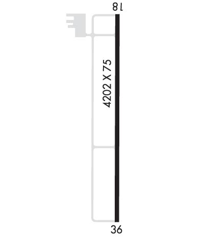
| Lat: N 3259.0 Long: W 09324.6 Elev: 218 Var: -02 Longest Runway: 4202 | ||
| CTAF: 122.8 | ||
| ||||||||||||||||||||||||||||||||||||||||||||
| ||||||||||||||||||||||||||||||||||||||||||||
| Rwy | Rwy | |||||||
| 4202x75 | 4202' | 4202x75 | 4202' | |||||
| Runway ID | Single Wheel | Double Wheel | Double Tandem Wheel | Dual Double Wheel |
| 18/36 | N/A | N/A | N/A | N/A |
| These numbers are Advisory and are not limits. The Airport Manager should have more accurate Weight Limits | ||||
 Airport Diagram might not be current. | |
| Facility Name: | SPRINGHILL |
| City Name: | SPRINGHILL |
| County: | WEBSTER |
| State abbrev: | LA |
| State Name: | LOUISIANA |
| Ownership: | PUBLICLY OWNED |
| Use: | OPEN TO THE PUBLIC |
| Owner's Name: | CITY OF SPRINGHILL |
| Address: | MAYOR'S OFFICE, P.O. BOX 398 |
| SPRINGHILL, LA 71075 | |
| Owner's Phone: | 318-539-5681 |
| Manager's Name: | STEVEN BURDEAUX |
| Address: | P.O BOX 398 |
| SPRINGHILL, LA 71075 | |
| Phone: | 318-453-7727 |
| FAA Region: | SOUTHWEST |
| FAA Field Office: | LNM |
| Date | Sunrise | Sunset |
|---|---|---|
| 09/24/21 Friday | 7:03 | 19:08 |
| 09/25/21 Saturday | 7:04 | 19:07 |
| 09/26/21 Sunday | 7:04 | 19:05 |
| 09/27/21 Monday | 7:05 | 19:04 |
| 09/28/21 Tuesday | 7:06 | 19:02 |
| 09/29/21 Wednesday | 7:06 | 19:01 |
| 09/30/21 Thursday | 7:07 | 19:00 |
| 10/01/21 Friday | 7:08 | 18:58 |
| 10/02/21 Saturday | 7:08 | 18:57 |
| 10/03/21 Sunday | 7:09 | 18:56 |
| 10/04/21 Monday | 7:10 | 18:55 |
| 10/05/21 Tuesday | 7:10 | 18:53 |
| 10/06/21 Wednesday | 7:11 | 18:52 |
| 10/07/21 Thursday | 7:12 | 18:51 |
| Airport Attendance Schedule | UNATTENDED |
| Airport Status | OPERATIONAL (This Status can change at any time - please check NOTAMS) |
| Airport Lighting Schedule | MIRL RWY 18/36 PRESET LOW INTST DUSK-DAWN; TO INCR INTST ACTVT - CTAF. |
| Airport Storage Available | Tie Downs |
| Extra Services Available | NONE |
| Wind Indicator | YES - (lighted) |
| Control Tower | NO |
| CTAF Frequency | 122.800 |
| Unicom Frequency | 122.800 |
| Rotating Beacon Color | CLEAR-GREEN (Light Land Airport); AIRPORT BEACON LOCATED .52 MILES FROM THE APPROACH END RWY 18 RIGHT OF CENTERLINE |
| Segmented Circle | NO |
| Landing Fee | NO |
| Airport Inspected | STATE - performed by STATE AERONAUTICAL PERSONNEL |
| Inspection Date | 11/18/2020 |
| Type of Fuel Available | None |
| Airframe Repair Service | NONE |
| Power Plant Repair Service | NONE |
| Latitude | N3259.0 |
| Longitude | W09324.6 (ESTIMATED) |
| Arpt Elevation | 217ft (SURVEYED) |
| Magnetic Variation | 02E |
| 3 miles E | of SPRINGHILL |
| Traffic Pattern Altitude | |
| Sectional Chart | MEMPHIS |
| Operations (Reported) | Yearly | Avg. Daily |
|---|---|---|
| General Aviation Transient | 2500 | 7 |
| General Aviation Local | 3750 | 10 |
| Air Taxi | 0 | 0 |
| Commerical | 0 | 0 |
| Commuter | 0 | 0 |
| Military | 0 | 0 |
| Aircraft based on Field | |
|---|---|
| General Aviation Singles | 5 |
| General Aviation Multi | 0 |
| Jet Aircraft | 0 |
| General Aviation Helicopters | 0 |
| Military Aircraft | 0 |
| Gliders | 0 |
| Ultralights | 0 |
| FSS on field | NO |
| FSS tie-in | DE RIDDER |
| FSS Phone | 1-800-WX-BRIEF |
| Who issues Notams | DRI |
| Notam D service at airport | YES |
| ARTCC Name | FORT WORTH |
| Airport Certification | |
| Aircraft Rescue & Firefighting Index | None |
| Airport of Entry | No |
| Custom Landing Rights | No |
| Joint Civil/Military | No |
| Military Landing rights | No |
| NATIONAL PLAN OF INTEGRATED AIRPORT SYSTEMS (NPIAS) |
| FOR CD CTC FORT WORTH ARTCC AT 817-858-7584. |
| ULTRALIGHT ACTIVITY ON AND IN VICINITY OF AIRPORT |
Airport Communications & Frequencies:
| ||||||||||||||
| Runway: 18 | Runway: 36 | ||
| Mag heading: | 178° | Mag heading: | 358° |
| Rwy Slope: | .30% Up | Rwy Slope: | -.30% Down |
| Approach: | Approach: | ||
| Pattern: | Left Traffic | Pattern: | Left Traffic |
| Markings: | NONPRECISION INSTRUMENT | Markings: | NONPRECISION INSTRUMENT |
| Marking Condition: | GOOD | Marking Condition: | GOOD |
| Arresting Dev: | Arresting Dev: | ||
| Lat & Long: | N3259.4 W09324.6 | Lat. & Long.: | N3258.7 W09324.5 |
| Elev: | 205.1 ft. MSL | Elev: | 217.5 ft. MSL |
| TCH: | 49 ft. AGL | TCH: | 54 ft. AGL |
| Visual Glide Path: | 3.00 degrees | Visual Glide Path: | 3.00 degrees |
| Displaced Threshold: | No | Displaced Threshold: | No |
| Touchdown Zone: | YES | Touchdown Zone: | YES |
| Touchdown Elev.: | 217.0 feet | Touchdown Elev.: | 217.6 feet |
| Visual Glide Slope: | 2-Light PAPI on LEFT side of Runway; PAPI UNUSBL BYD 9 DEGS RIGHT OF CNTRLN. | Visual Glide Slope: | 2-Light PAPI on LEFT side of Runway |
| RVR Equipment: | RVR Equipment: | ||
| RVV Equipment: | NO | RVV Equipment: | NO |
| Approach Lights: | Approach Lights: | ||
| REIL: | NO | REIL: | NO |
| Centerline Lights: | NO | Centerline Lights: | NO |
| Touchdown lights: | NO | Touchdown lights: | NO |
| Runway Category: | Runway with a Non-precision Approach | Runway Category: | Runway with a Non-precision Approach |
| Declared Distances: | Declared Distances: | ||
| Obstructions: | TREES | Obstructions: | TREES |
| Marked: | NOT Marked/Lighted | Marked: | NOT Marked/Lighted |
| Clearance slope: | 20:1 | Clearance slope: | 26:1 |
| Obstruction height: | 95 feet AGL | Obstruction height: | 90 feet AGL |
| Dist. from runway: | 2158 feet | Dist. from runway: | 2543 feet |
| Centerline offset: | Centerline offset: | 292 feet right of centerline | |
| Comments: | Comments: |
Thanks for using FltPlan.com
all rights reserved © 1999-2021 by Flight Plan LLC
