
| SULLIVAN COUNTY SULLIVAN IN |
| |
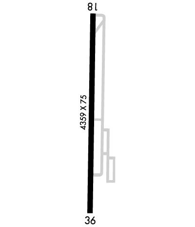
| Lat: N 3906.9 Long: W 08726.9 Elev: 539 Var: +02 Longest Runway: 4359 | ||
| CTAF: 122.8 | ||
| ||||||||||||||||||||||||||||||||||||||||||||
| ||||||||||||||||||||||||||||||||||||||||||||
| Rwy | Rwy | |||||||
| 4359x75 | 4359' | 4359x75 | 4359' | |||||
| Runway ID | Single Wheel | Double Wheel | Double Tandem Wheel | Dual Double Wheel |
| 18/36 | 27,000 | 35,000 | N/A | N/A |
| These numbers are Advisory and are not limits. The Airport Manager should have more accurate Weight Limits | ||||
 Airport Diagram might not be current. | |
| Facility Name: | SULLIVAN COUNTY |
| City Name: | SULLIVAN |
| County: | SULLIVAN |
| State abbrev: | IN |
| State Name: | INDIANA |
| Ownership: | PUBLICLY OWNED |
| Use: | OPEN TO THE PUBLIC |
| Owner's Name: | SULLIVAN COUNTY BOAC |
| Address: | P.O. BOX 351 |
| SULLIVAN, IN 47882 | |
| Owner's Phone: | 812-268-6959 |
| Manager's Name: | PAT HARMON |
| Address: | 2001 N CR 200 W |
| SULLIVAN, IN 47882 | |
| Phone: | 812-268-6959 |
| FAA Region: | GREAT LAKES |
| FAA Field Office: | CHI |
| Date | Sunrise | Sunset |
|---|---|---|
| 06/08/26 Monday | 6:24 | 21:14 |
| 06/09/26 Tuesday | 6:23 | 21:15 |
| 06/10/26 Wednesday | 6:23 | 21:15 |
| 06/11/26 Thursday | 6:23 | 21:16 |
| 06/12/26 Friday | 6:23 | 21:16 |
| 06/13/26 Saturday | 6:23 | 21:17 |
| 06/14/26 Sunday | 6:23 | 21:17 |
| 06/15/26 Monday | 6:23 | 21:17 |
| 06/16/26 Tuesday | 6:23 | 21:18 |
| 06/17/26 Wednesday | 6:23 | 21:18 |
| 06/18/26 Thursday | 6:23 | 21:18 |
| 06/19/26 Friday | 6:24 | 21:19 |
| 06/20/26 Saturday | 6:24 | 21:19 |
| 06/21/26 Sunday | 6:24 | 21:19 |
| Airport Attendance Schedule | MON-SAT 0800-1700, SUN 1300-1700; UNATNDD JULY 4TH, MEMORIAL, THANKSGIVING, CHRISTMAS & NEW YEARS DAY. |
| Airport Status | OPERATIONAL (This Status can change at any time - please check NOTAMS) |
| Airport Lighting Schedule | ACTVT REILS RWYS 18 & 36; MIRL RWY 18/36 - CTAF. PAPI RWY 18 & 36 OPR CONSLY.; 24 HR. |
| Airport Storage Available | Tie Downs, Hanger |
| Extra Services Available | Aircraft Rental |
| Wind Indicator | YES - (lighted) |
| Control Tower | NO |
| CTAF Frequency | 122.800 |
| Unicom Frequency | 122.800 |
| Rotating Beacon Color | WG |
| Segmented Circle | NO |
| Landing Fee | NO |
| Airport Inspected | STATE - performed by STATE AERONAUTICAL PERSONNEL |
| Inspection Date | 04/14/2025 |
| Type of Fuel Available | Grade 100LL, JET A (freeze point -40C) |
| Airframe Repair Service | MINOR |
| Power Plant Repair Service | MINOR |
| Latitude | N3906.9 |
| Longitude | W08726.9 (ESTIMATED) |
| Arpt Elevation | 539ft (SURVEYED) |
| Magnetic Variation | 02W |
| 3 miles NW | of SULLIVAN |
| Traffic Pattern Altitude | 800 |
| Sectional Chart | ST LOUIS |
| Operations (Reported) | Yearly | Avg. Daily |
|---|---|---|
| General Aviation Transient | 0 | 0 |
| General Aviation Local | 0 | 0 |
| Air Taxi | 0 | 0 |
| Commerical | 0 | 0 |
| Commuter | 0 | 0 |
| Military | 0 | 0 |
| Aircraft based on Field | |
|---|---|
| General Aviation Singles | 0 |
| General Aviation Multi | 0 |
| Jet Aircraft | 0 |
| General Aviation Helicopters | 0 |
| Military Aircraft | 0 |
| Gliders | 0 |
| Ultralights | 0 |
| FSS on field | NO |
| FSS tie-in | TERRE HAUTE |
| FSS Phone | 1-800-WX-BRIEF |
| Who issues Notams | HUF |
| Notam D service at airport | YES |
| ARTCC Name | INDIANAPOLIS |
| Airport Certification | |
| Aircraft Rescue & Firefighting Index | None |
| Airport of Entry | No |
| Custom Landing Rights | No |
| Joint Civil/Military | No |
| Military Landing rights | YES |
| NATIONAL PLAN OF INTEGRATED AIRPORT SYSTEMS (NPIAS) |
| GRANT AGREEMENTS UNDER FAAP/ADAP/AIP |
| ASSURANCES PURSUANT TO TITLE VI, CIVIL RIGHTS ACT OF 1964 |
| 153 FT TWR 6600 FT SE. |
| MOORED BALLOON 2 MI E 1600 FT & BLW. |
| FOR CD CTC HULMAN APCH AT 812-877-7581. |
Airport Communications & Frequencies:
| ||||||||||||||
| Runway: 18 | Runway: 36 | ||
| Mag heading: | 183° | Mag heading: | 3° |
| Rwy Slope: | -.05% Down | Rwy Slope: | .05% Up |
| Approach: | Approach: | ||
| Pattern: | Left Traffic | Pattern: | Left Traffic |
| Markings: | NONPRECISION INSTRUMENT | Markings: | NONPRECISION INSTRUMENT |
| Marking Condition: | GOOD | Marking Condition: | GOOD |
| Arresting Dev: | Arresting Dev: | ||
| Lat & Long: | N3907.2 W08726.9 | Lat. & Long.: | N3906.5 W08726.9 |
| Elev: | 536.9 ft. MSL | Elev: | 534.6 ft. MSL |
| TCH: | 40 ft. AGL | TCH: | 40 ft. AGL |
| Visual Glide Path: | 3.00 degrees | Visual Glide Path: | 3.00 degrees |
| Displaced Threshold: | No | Displaced Threshold: | No |
| Touchdown Zone: | YES | Touchdown Zone: | YES |
| Touchdown Elev.: | 539.2 feet | Touchdown Elev.: | 539.2 feet |
| Visual Glide Slope: | 2-Light PAPI on LEFT side of Runway | Visual Glide Slope: | 2-Light PAPI on LEFT side of Runway |
| RVR Equipment: | RVR Equipment: | ||
| RVV Equipment: | NO | RVV Equipment: | NO |
| Approach Lights: | Approach Lights: | ||
| REIL: | YES | REIL: | YES |
| Centerline Lights: | NO | Centerline Lights: | NO |
| Touchdown lights: | NO | Touchdown lights: | NO |
| Runway Category: | Runway with a Non-precision Approach | Runway Category: | Runway with a Non-precision Approach |
| Declared Distances: | Declared Distances: | ||
| Obstructions: | CROPS | Obstructions: | CROPS |
| Marked: | NOT Marked/Lighted | Marked: | NOT Marked/Lighted |
| Clearance slope: | 18:1 | Clearance slope: | 18:1 |
| Obstruction height: | 10 feet AGL | Obstruction height: | 10 feet AGL |
| Dist. from runway: | 380 feet | Dist. from runway: | 380 feet |
| Centerline offset: | Centerline offset: | ||
| Comments: | Comments: |
Thanks for using FltPlan.com
all rights reserved © 1999-2026 by Flight Plan LLC
