
| WILLIAMSON-SODUS WILLIAMSON/SODUS NY |
| |
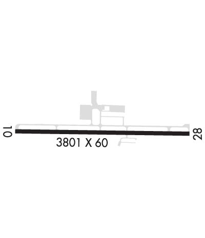
| Lat: N 4314.1 Long: W 07707.2 Elev: 424 Var: +12 Longest Runway: 3803 | ||
| AWOS: 124.2 CTAF: 122.8 | ||
| ||||||||||||||||||||||||||||||||||||||||||||
| ||||||||||||||||||||||||||||||||||||||||||||
| ||||||||||||||||||||||||||||||||||||||||||||
| Rwy | Rwy | |||||||
| 3803x60 | 3803' | 3803x60 | 3803' | |||||
| Runway ID | Single Wheel | Double Wheel | Double Tandem Wheel | Dual Double Wheel |
| 10/28 | 12,000 | N/A | N/A | N/A |
| These numbers are Advisory and are not limits. The Airport Manager should have more accurate Weight Limits | ||||
 Airport Diagram might not be current. | |
| Facility Name: | WILLIAMSON/SODUS |
| City Name: | WILLIAMSON/SODUS |
| County: | WAYNE |
| State abbrev: | NY |
| State Name: | NEW YORK |
| Ownership: | PRIVATELY OWNED |
| Use: | OPEN TO THE PUBLIC |
| Owner's Name: | WILLIAMSON FLYING CLUB INC |
| Address: | PO BOX 148 |
| WILLIAMSON, NY 14589 | |
| Owner's Phone: | 315-483-6011 |
| Manager's Name: | MIKE BJERGA |
| Address: | PO BOX 148 |
| WILLIAMSON, NY 14589 | |
| Phone: | 315-483-6011 |
| FAA Region: | EASTERN |
| FAA Field Office: | NYC |
| Date | Sunrise | Sunset |
|---|---|---|
| 06/08/26 Monday | 5:29 | 20:46 |
| 06/09/26 Tuesday | 5:28 | 20:47 |
| 06/10/26 Wednesday | 5:28 | 20:48 |
| 06/11/26 Thursday | 5:28 | 20:48 |
| 06/12/26 Friday | 5:28 | 20:49 |
| 06/13/26 Saturday | 5:28 | 20:49 |
| 06/14/26 Sunday | 5:28 | 20:50 |
| 06/15/26 Monday | 5:28 | 20:50 |
| 06/16/26 Tuesday | 5:28 | 20:51 |
| 06/17/26 Wednesday | 5:28 | 20:51 |
| 06/18/26 Thursday | 5:28 | 20:51 |
| 06/19/26 Friday | 5:28 | 20:51 |
| 06/20/26 Saturday | 5:28 | 20:52 |
| 06/21/26 Sunday | 5:28 | 20:52 |
| Airport Attendance Schedule | MON-FRI 0830-1700 |
| Airport Status | OPERATIONAL (This Status can change at any time - please check NOTAMS) |
| Airport Lighting Schedule | ACTIVATE REIL RWY 10 & 28; MIRL RWY 10/28 - CTAF. |
| Airport Storage Available | Tie Downs |
| Extra Services Available | Air Ambulance, Flight Instruction |
| Wind Indicator | YES - (lighted) |
| Control Tower | NO |
| CTAF Frequency | 122.800 |
| Unicom Frequency | 122.800 |
| Rotating Beacon Color | WG |
| Segmented Circle | YES |
| Landing Fee | NO |
| Airport Inspected | STATE - performed by STATE AERONAUTICAL PERSONNEL |
| Inspection Date | 06/02/2022 |
| Type of Fuel Available | Grade 100LL; -10CREDIT CARD FUEL AVBL 24 HRS. |
| Airframe Repair Service | MAJOR |
| Power Plant Repair Service | MAJOR |
| Latitude | N4314.1 |
| Longitude | W07707.2 (ESTIMATED) |
| Arpt Elevation | 424ft (SURVEYED) |
| Magnetic Variation | 12W |
| 3 miles W | of WILLIAMSON/SODUS |
| Traffic Pattern Altitude | 976 |
| Sectional Chart | DETROIT |
| Operations (Reported) | Yearly | Avg. Daily |
|---|---|---|
| General Aviation Transient | 0 | 0 |
| General Aviation Local | 0 | 0 |
| Air Taxi | 0 | 0 |
| Commerical | 0 | 0 |
| Commuter | 0 | 0 |
| Military | 0 | 0 |
| Aircraft based on Field | |
|---|---|
| General Aviation Singles | 0 |
| General Aviation Multi | 0 |
| Jet Aircraft | 0 |
| General Aviation Helicopters | 0 |
| Military Aircraft | 0 |
| Gliders | 0 |
| Ultralights | 0 |
| FSS on field | NO |
| FSS tie-in | BUFFALO |
| FSS Phone | 1-800-WX-BRIEF |
| Who issues Notams | BUF |
| Notam D service at airport | YES |
| ARTCC Name | CLEVELAND |
| Airport Certification | |
| Aircraft Rescue & Firefighting Index | None |
| Airport of Entry | No |
| Custom Landing Rights | No |
| Joint Civil/Military | No |
| Military Landing rights | No |
| NATIONAL PLAN OF INTEGRATED AIRPORT SYSTEMS (NPIAS) |
| AREAS OTHER THAN RWY & TWY MAY BE VERY SOFT IN FALL, WINTER & SPRING. |
| GEESE & DEER ON & INVOF ARPT. |
| FOR CD CTC CLEVELAND ARTCC AT 440-774-0490. |
Airport Communications & Frequencies:
| ||||||||||||||
| Runway: 10 | Runway: 28 | ||
| Mag heading: | 100° | Mag heading: | 280° |
| Rwy Slope: | -.14% Down | Rwy Slope: | .14% Up |
| Approach: | Approach: | ||
| Pattern: | Left Traffic | Pattern: | Left Traffic |
| Markings: | NONPRECISION INSTRUMENT | Markings: | NONPRECISION INSTRUMENT |
| Marking Condition: | GOOD | Marking Condition: | GOOD |
| Arresting Dev: | Arresting Dev: | ||
| Lat & Long: | N4314.1 W07707.6 | Lat. & Long.: | N4314.1 W07706.7 |
| Elev: | 424.2 ft. MSL | Elev: | 418.8 ft. MSL |
| TCH: | 40 ft. AGL | TCH: | 42 ft. AGL |
| Visual Glide Path: | 3.00 degrees | Visual Glide Path: | 3.20 degrees |
| Displaced Threshold: | No | Displaced Threshold: | No |
| Touchdown Zone: | YES | Touchdown Zone: | YES |
| Touchdown Elev.: | 424.3 feet | Touchdown Elev.: | 421.7 feet |
| Visual Glide Slope: | 2-Light PAPI on LEFT side of Runway | Visual Glide Slope: | 2-Light PAPI on RIGHT side of Runway |
| RVR Equipment: | RVR Equipment: | ||
| RVV Equipment: | NO | RVV Equipment: | NO |
| Approach Lights: | Approach Lights: | ||
| REIL: | YES | REIL: | YES |
| Centerline Lights: | NO | Centerline Lights: | NO |
| Touchdown lights: | NO | Touchdown lights: | NO |
| Runway Category: | Runway with a Non-precision Approach | Runway Category: | Runway with a Non-precision Approach |
| Declared Distances: | Declared Distances: | ||
| Obstructions: | TREES | Obstructions: | TREE |
| Marked: | NOT Marked/Lighted | Marked: | NOT Marked/Lighted |
| Clearance slope: | 2:1 | Clearance slope: | 2:1 |
| Obstruction height: | 30 feet AGL | Obstruction height: | 70 feet AGL |
| Dist. from runway: | 261 feet | Dist. from runway: | 401 feet |
| Centerline offset: | 177 left of centerline | Centerline offset: | 277 feet right of centerline |
| Comments: | +8 FT FENCE 131 FT FROM THLD 226 FT L OF CNTLN. | Comments: |
Thanks for using FltPlan.com
all rights reserved © 1999-2026 by Flight Plan LLC