
| SAWYER INTL MARQUETTE MI |
| |
| Lat: N 4620.9 Long: W 08723.8 Elev: 1205 Var: +04 Longest Runway: 9072 | ||
| AWOS: 118.37 Ground: 121.65 Tower: 119.97 | ||
| ||||||||||||||||||||||||||||||||||||||||||||
| ||||||||||||||||||||||||||||||||||||||||||||
| ||||||||||||||||||||||||||||||||||||||||||||
| Rwy | Rwy | |||||||
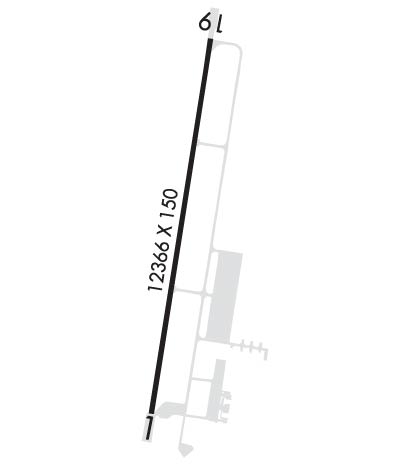
| 9072x150 | 9072' | 110.10 - 012° | 9072x150 | 9072' | ||||
| Runway ID | Single Wheel | Double Wheel | Double Tandem Wheel | Dual Double Wheel |
| 01/19 | 114,000 | 181,000 | 317,000 | 741,000 |
| These numbers are Advisory and are not limits. The Airport Manager should have more accurate Weight Limits | ||||
 Airport Diagram might not be current. | |
| Facility Name: | SAWYER INTL |
| City Name: | MARQUETTE |
| County: | MARQUETTE |
| State abbrev: | MI |
| State Name: | MICHIGAN |
| Ownership: | PUBLICLY OWNED |
| Use: | OPEN TO THE PUBLIC |
| Owner's Name: | MARQUETTE COUNTY |
| Address: | 125 AVENUE G |
| GWINN, MI 49841-3108 | |
| Owner's Phone: | 906-346-3308 |
| Manager's Name: | DUANE DURAY |
| Address: | SAWYER INTL AIRPORT, 125 AVENUE G |
| GWINN, MI 49841-3108 | |
| Phone: | 906-346-3308; EXTN 222; CELL 906-364-0939. |
| FAA Region: | GREAT LAKES |
| FAA Field Office: | DET |
| Date | Sunrise | Sunset |
|---|---|---|
| 09/24/21 Friday | 7:39 | 19:44 |
| 09/25/21 Saturday | 7:40 | 19:42 |
| 09/26/21 Sunday | 7:41 | 19:40 |
| 09/27/21 Monday | 7:43 | 19:38 |
| 09/28/21 Tuesday | 7:44 | 19:36 |
| 09/29/21 Wednesday | 7:45 | 19:34 |
| 09/30/21 Thursday | 7:46 | 19:32 |
| 10/01/21 Friday | 7:48 | 19:30 |
| 10/02/21 Saturday | 7:49 | 19:28 |
| 10/03/21 Sunday | 7:50 | 19:26 |
| 10/04/21 Monday | 7:52 | 19:24 |
| 10/05/21 Tuesday | 7:53 | 19:22 |
| 10/06/21 Wednesday | 7:54 | 19:20 |
| 10/07/21 Thursday | 7:56 | 19:18 |
| Airport Attendance Schedule | 7 Days A Week 0500-2000; FOR SVCS AFT HRS CALL 906-222-3062 (PAGER). |
| Airport Status | OPERATIONAL (This Status can change at any time - please check NOTAMS) |
| Airport Lighting Schedule | WHEN ATCT CLSD, ACTVT MALSR RWY 01; REIL RWY 19; PAPI RWYS 01 & 19; HIRL RWY 01/19 - CTAF. |
| Airport Storage Available | Tie Downs, Hanger |
| Extra Services Available | Air Freight, Avionics, Cargo Handling, Flight Instruction, Aircraft Rental |
| Wind Indicator | YES - (lighted) |
| Control Tower | YES |
| CTAF Frequency | 119.975 |
| Unicom Frequency | 122.700 |
| Rotating Beacon Color | CLEAR-GREEN (Light Land Airport) |
| Segmented Circle | YES |
| Landing Fee | YES |
| Airport Inspected | FEDERAL - performed by FAA AIRPORTS FIELD PERSONNEL |
| Inspection Date | 08/01/2019 |
| Type of Fuel Available | Grade 100LL, JET A (freeze point -40C) |
| Airframe Repair Service | MAJOR |
| Power Plant Repair Service | MAJOR |
| Latitude | N4620.9 |
| Longitude | W08723.8 (ESTIMATED) |
| Arpt Elevation | 1204ft (SURVEYED) |
| Magnetic Variation | 04W |
| 17 miles S | of MARQUETTE |
| Traffic Pattern Altitude | |
| Sectional Chart | GREEN BAY |
| Operations (Reported) | Yearly | Avg. Daily |
|---|---|---|
| General Aviation Transient | 4476 | 12 |
| General Aviation Local | 3809 | 10 |
| Air Taxi | 5304 | 15 |
| Commerical | 2219 | 6 |
| Commuter | 0 | 0 |
| Military | 1358 | 4 |
| Aircraft based on Field | |
|---|---|
| General Aviation Singles | 36 |
| General Aviation Multi | 4 |
| Jet Aircraft | 1 |
| General Aviation Helicopters | 0 |
| Military Aircraft | 0 |
| Gliders | 0 |
| Ultralights | 0 |
| FSS on field | NO |
| FSS tie-in | GREEN BAY |
| FSS Phone | 1-800-WX-BRIEF |
| Who issues Notams | SAW |
| Notam D service at airport | YES |
| ARTCC Name | MINNEAPOLIS |
| Airport Certification | AIRPORT RECEIVING SCHEDULED AIR CARRIER SERVICE FROM CARRIERS CERTIFICATED BY THE CIVIL AERONAUTICS BOARD; ACR OPS ARE NOT AUZD IN EXCESS OF 15 MINS BFR OR AFT SKED ARR/DEP TIMES WO PRIOR COORD WITH AMGR. UNSKED ACR OPNS WITH MORE THAN 30 PSGR SEATS REQ 48 HR PRIOR PMSN , CALL AMGR 906-346-3308 OR 906-364-0939. INDEX C ARFF AVBL WITH 48 HR PRIOR PMSN, CALL AMGR 906-346-3308 OR 906-364-0939. |
| Aircraft Rescue & Firefighting Index | AIRPORT HAS A CERTIFICATE UNDER CFR PART 139 |
| Airport of Entry | No |
| Custom Landing Rights | No |
| Joint Civil/Military | No |
| Military Landing rights | YES |
| NATIONAL PLAN OF INTEGRATED AIRPORT SYSTEMS (NPIAS) |
| GRANT AGREEMENTS UNDER FAAP/ADAP/AIP |
| ASSURANCES PURSUANT TO TITLE VI, CIVIL RIGHTS ACT OF 1964 |
| SURPLUS PROPERTY AGREEMENT UNDER PUBLIC LAW 289 |
| BIRDS & DEER ON & INVOF ARPT. |
| RAMP FEES IN EFFECT. RAMP FEES MAY BE WAIVED WITH FUEL PURCHASE.FBO SERVICE AFTER HOURS CONTACT 906-222-3062 (PAGER). |
| FOR CD WHEN ATCT IS CLSD CTC FSS VIA RCO, IF UNA CTC MINNEAPOLIS ARTCC AT 651-463-5588. |
| GA & CHARTER ACFT PARKING AVBL AT GA TERMINAL ONLY, LCTD SE CORNER OF ARPT. |
| S HALF OF ACR TERMINAL RAMP NOT PLOWED OCT-APR. |
| FREQUENT SNOW REMOVAL OPNS IN PROGRESS VARIOUS TIMES OCT-APR. MONITOR CTAF. |
| PAEW ON ARPT MONITOR 119.975 (CTAF). |
Airport Communications & Frequencies:
| |||||||||||||
| Runway: 01 | Runway: 19 | ||
| Mag heading: | 13° | Mag heading: | 193° |
| Rwy Slope: | .29% Up | Rwy Slope: | -.29% Down |
| Approach: | ILS | Approach: | |
| Pattern: | Left Traffic | Pattern: | Left Traffic |
| Markings: | PRECISION INSTRUMENT | Markings: | PRECISION INSTRUMENT |
| Marking Condition: | GOOD | Marking Condition: | GOOD |
| Arresting Dev: | Arresting Dev: | ||
| Lat & Long: | N4620.2 W08724.0 | Lat. & Long.: | N4621.7 W08723.6 |
| Elev: | 1178.6 ft. MSL | Elev: | 1204.5 ft. MSL |
| TCH: | 51 ft. AGL | TCH: | 53 ft. AGL |
| Visual Glide Path: | 3.00 degrees | Visual Glide Path: | 3.00 degrees |
| Displaced Threshold: | No | Displaced Threshold: | No |
| Touchdown Zone: | YES | Touchdown Zone: | YES |
| Touchdown Elev.: | 1180.1 feet | Touchdown Elev.: | 1204.5 feet |
| Visual Glide Slope: | 4-Light PAPI on LEFT side of Runway | Visual Glide Slope: | 4-Light PAPI on LEFT side of Runway |
| RVR Equipment: | RVR Equipment: | ||
| RVV Equipment: | NO | RVV Equipment: | NO |
| Approach Lights: | MALSR - 1,400 foot medium intensity approach lighting system with runway alignment indicator lights | Approach Lights: | |
| REIL: | NO | REIL: | YES |
| Centerline Lights: | NO | Centerline Lights: | NO |
| Touchdown lights: | NO | Touchdown lights: | NO |
| Runway Category: | Precision Instrument Runway | Runway Category: | D |
| Declared Distances: | TORA:9072' TODA:9072' ASDA:9072' LDA:9072' | Declared Distances: | TORA:9072' TODA:9072' ASDA:9072' LDA:9072' |
Thanks for using FltPlan.com
all rights reserved © 1999-2021 by Flight Plan LLC
