
| METHOW VALLEY STATE WINTHROP WA |
| |
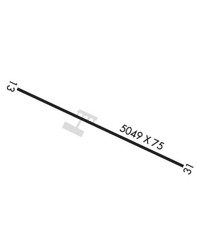
| Lat: N 4825.5 Long: W 12008.8 Elev: 1706 Var: -20 Longest Runway: 5049 | ||
| AWOS: 118.42 CTAF: 122.8 | ||
| ||||||||||||||||||||||||||||||||
| ||||||||||||||||||||||||||||||||
| ||||||||||||||||||||||||||||||||
| Rwy | Rwy | |||||||
| 5049x75 | 4920' | 5049x75 | 4818' | |||||
| Runway ID | Single Wheel | Double Wheel | Double Tandem Wheel | Dual Double Wheel |
| 13/31 | 30,000 | N/A | N/A | N/A |
| These numbers are Advisory and are not limits. The Airport Manager should have more accurate Weight Limits | ||||
| FltPlan does not have IFR approach charts available for KS52. |
 Airport Diagram might not be current. | |
| Facility Name: | METHOW VALLEY STATE |
| City Name: | WINTHROP |
| County: | OKANOGAN |
| State abbrev: | WA |
| State Name: | WASHINGTON |
| Ownership: | PUBLICLY OWNED |
| Use: | OPEN TO THE PUBLIC |
| Owner's Name: | WSDOT AVIATION DIVISION |
| Address: | 7702 TERMINAL STREET SW |
| TUMWATER, WA 98501-7264 | |
| Owner's Phone: | (800) 552-0666; 800 NUMBER FOR WA STATE CALLS ONLY. |
| Manager's Name: | G. PAUL WOLF |
| Address: | 7702 TERMINAL STREET SW |
| TUMWATER, WA 98501-7264 | |
| Phone: | (360) 618-2477 |
| FAA Region: | NORTHWEST MOUNTAIN |
| FAA Field Office: | SEA |
| Date | Sunrise | Sunset |
|---|---|---|
| 09/24/21 Friday | 6:50 | 18:55 |
| 09/25/21 Saturday | 6:51 | 18:52 |
| 09/26/21 Sunday | 6:53 | 18:50 |
| 09/27/21 Monday | 6:54 | 18:48 |
| 09/28/21 Tuesday | 6:55 | 18:46 |
| 09/29/21 Wednesday | 6:57 | 18:44 |
| 09/30/21 Thursday | 6:58 | 18:42 |
| 10/01/21 Friday | 7:00 | 18:40 |
| 10/02/21 Saturday | 7:01 | 18:38 |
| 10/03/21 Sunday | 7:03 | 18:36 |
| 10/04/21 Monday | 7:04 | 18:34 |
| 10/05/21 Tuesday | 7:05 | 18:32 |
| 10/06/21 Wednesday | 7:07 | 18:30 |
| 10/07/21 Thursday | 7:08 | 18:28 |
| Airport Attendance Schedule | UNATTENDED |
| Airport Status | OPERATIONAL (This Status can change at any time - please check NOTAMS) |
| Airport Lighting Schedule | ACTVT MIRL RY 13/31 - CTAF.; ACTVT ROTG BCN - CTAF. |
| Airport Storage Available | Tie Downs |
| Extra Services Available | NONE |
| Wind Indicator | YES - (unlit) |
| Control Tower | NO |
| CTAF Frequency | 122.800 |
| Unicom Frequency | 122.800; USDA FOREST SVC SMOKE JUMP BASE UNICOM. LTD ADVISORIES RELATED TO BASE OPS MOSTLY DURING SUMMER FIRE SEASON. |
| Rotating Beacon Color | CLEAR-GREEN (Light Land Airport) |
| Segmented Circle | YES |
| Landing Fee | NO |
| Airport Inspected | STATE - performed by STATE AERONAUTICAL PERSONNEL |
| Inspection Date | 08/21/2018 |
| Type of Fuel Available | Grade 100LL, JET A (freeze point -40C); -10100LL & JET A AVBL 24 HRS. LCTD 100 YDS N OF SMOKE JUMPER BASE. NO GA TFC SHUD OPER ON THE SMOKE JUMPER BASE RAMP. |
| Airframe Repair Service | NONE |
| Power Plant Repair Service | NONE |
| Latitude | N4825.5 |
| Longitude | W12008.8 (ESTIMATED) |
| Arpt Elevation | 1706ft (ESTIMATED) |
| Magnetic Variation | 20E |
| 3 miles SE | of WINTHROP |
| Traffic Pattern Altitude | |
| Sectional Chart | SEATTLE |
| Operations (Reported) | Yearly | Avg. Daily |
|---|---|---|
| General Aviation Transient | 7000 | 19 |
| General Aviation Local | 300 | 1 |
| Air Taxi | 300 | 1 |
| Commerical | 0 | 0 |
| Commuter | 0 | 0 |
| Military | 50 | 0 |
| Aircraft based on Field | |
|---|---|
| General Aviation Singles | 4 |
| General Aviation Multi | 3 |
| Jet Aircraft | 1 |
| General Aviation Helicopters | 1 |
| Military Aircraft | 0 |
| Gliders | 1 |
| Ultralights | 0 |
| FSS on field | NO |
| FSS tie-in | SEATTLE |
| FSS Phone | 1-800-WX-BRIEF |
| Who issues Notams | SEA |
| Notam D service at airport | YES |
| ARTCC Name | SEATTLE |
| Airport Certification | |
| Aircraft Rescue & Firefighting Index | None |
| Airport of Entry | No |
| Custom Landing Rights | No |
| Joint Civil/Military | No |
| Military Landing rights | No |
| NATIONAL PLAN OF INTEGRATED AIRPORT SYSTEMS (NPIAS) |
| GRANT AGREEMENTS UNDER FAAP/ADAP/AIP |
| CONVEYANCE UNDER SCETION 16, FEDERAL AIRPORT ACT OF 1946 OR SECTION 23, AIRPORT AND AIRWAY DEVELOPMENT ACT OF 1970 |
| ASSURANCES PURSUANT TO TITLE VI, CIVIL RIGHTS ACT OF 1964 |
| MOUNTAINOUS TRRN SURROUNDS ARPT. |
| SOME OBSTNS IN PRIMARY AND TRANSITIONAL SFCS. |
| HEAVILY LOADED ACFT MAY BE MAKING STRAIGHT OUT DEPS AND LONG FINAL APCH ALL DALGT HRS TO INCL FOREST FIRE HELIBASE OPS, MAY-SEP. |
| PEDESTRIANS, VEHICLES, AND ANIMALS ON AND INVOF RY. |
| CTC WA STATE AVIATION DIVISION 360-709-8015 OR 1-800-552-0666 WA AREA FOR FACILITY INFO PRIOR TO USE. |
| FOR ACFT ACCIDENTS/INCIDENTS CTC WA STATE EMERGENCY OPERATIONS CENTER 800-258-5990. |
| FOR CD CTC SEATTLE ARTCC AT 253-351-3694. |
| Runway: 13 | Runway: 31 | ||
| Mag heading: | N/A | Mag heading: | N/A |
| Approach: | Approach: | ||
| Pattern: | Left Traffic | Pattern: | Left Traffic |
| Markings: | BASIC | Markings: | BASIC |
| Marking Condition: | GOOD | Marking Condition: | GOOD |
| Arresting Dev: | Arresting Dev: | ||
| Lat & Long: | N4825.8 W12009.1 | Lat. & Long.: | N4825.1 W12008.4 |
| Elev: | 1694.0 ft. MSL | Elev: | N/A |
| TCH: | 43 ft. AGL | TCH: | |
| Visual Glide Path: | 3.50 degrees | Visual Glide Path: | |
| Displaced Threshold: | 129 feet | Displaced Threshold: | 231 feet |
| Touchdown Zone: | NO | Touchdown Zone: | NO |
| Touchdown Elev.: | Touchdown Elev.: | ||
| Visual Glide Slope: | 2-Light PAPI on LEFT side of Runway | Visual Glide Slope: | |
| RVR Equipment: | RVR Equipment: | ||
| RVV Equipment: | NO | RVV Equipment: | NO |
| Approach Lights: | Approach Lights: | ||
| REIL: | NO | REIL: | NO |
| Centerline Lights: | NO | Centerline Lights: | NO |
| Touchdown lights: | NO | Touchdown lights: | NO |
| Runway Category: | Runway with a Visual Approach | Runway Category: | Runway with a Visual Approach |
| Declared Distances: | TORA:5049' TODA:5049' ASDA:4749' LDA:4619' | Declared Distances: | TORA:5049' TODA:5049' ASDA:4919' LDA:4619' |
| Obstructions: | OTHER; AGRI-IRRIGATION SYSTEM | Obstructions: | TREES |
| Marked: | NOT Marked/Lighted | Marked: | NOT Marked/Lighted |
| Clearance slope: | CENTER PIVOT IRRIGATION. RWY 13 APCH SLOPE 0:1 TO +13' SERVICE ROAD @ 0', 92' R FROM DSPLCD THR. | Clearance slope: | 9:1; RWY 31 APCH SLOPE TO DSPLCD +65 FT TREE 538 FT FM THLD, 39 FT RIGHT OF CENTERLINE. |
| Obstruction height: | 4 feet AGL; CENTER PIVOT. | Obstruction height: | 39 feet AGL; MOST RESTRICTIVE TREE. |
| Dist. from runway: | 200 feet; IRRIGATION CENTER PIVOT. DISTANCE FROM END VARIES FROM 200 FEET TO 280 FEET FROM RY END. DISTANCE FROM THRESHOLD VARIES FROM 330 FEET TO 410 FEET. | Dist. from runway: | 538 feet; MULTIPLE TREES. DISTANCE FROM END VARIES FROM 425 TO 730 FEET FROM RY END. DISTANCE FROM THRESHOLD 725 FEET TO 1030 FEET. |
| Centerline offset: | 175 right of centerline | Centerline offset: | 33 feet right of centerline |
| Comments: | ROAD AT 0 FT. | Comments: | ROAD 0 FT, 125 FT L, ROAD 182 FT, +5 FT STEEL POST & FENCE AT 78 FT, 80 FT L. |
Thanks for using FltPlan.com
all rights reserved © 1999-2021 by Flight Plan LLC
