
| MC CORMICK COUNTY MC CORMICK SC |
| |
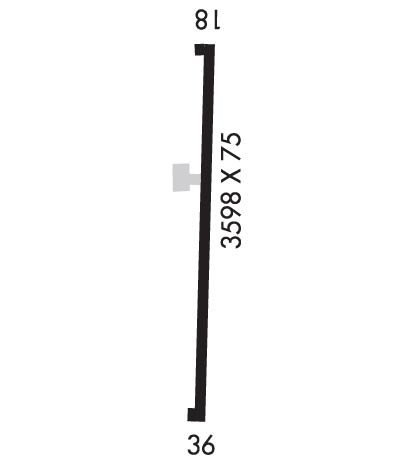
| Lat: N 3354.5 Long: W 08216.0 Elev: 459 Var: +04 Longest Runway: 3598 | ||
| CTAF: 122.9 | ||
| ||||||||||||||||||||||||||||||||
| ||||||||||||||||||||||||||||||||
| Rwy | Rwy | |||||||
| 3598x75 | 3598' | 3598x75 | 3598' | |||||
| Runway ID | Single Wheel | Double Wheel | Double Tandem Wheel | Dual Double Wheel |
| 18/36 | 12,500 | N/A | N/A | N/A |
| These numbers are Advisory and are not limits. The Airport Manager should have more accurate Weight Limits | ||||
| FltPlan does not have IFR approach charts available for KS19. |
 Airport Diagram might not be current. | |
| Facility Name: | MC CORMICK COUNTY |
| City Name: | MC CORMICK |
| County: | MC CORMICK |
| State abbrev: | SC |
| State Name: | SOUTH CAROLINA |
| Ownership: | PUBLICLY OWNED |
| Use: | OPEN TO THE PUBLIC |
| Owner's Name: | MC CORMICK COUNTY |
| Address: | RT 2 BOX 84AA |
| MC CORMICK, SC 29835 | |
| Owner's Phone: | 864-852-2231 |
| Manager's Name: | MARK WARNER; COUNTY ADMIR. |
| Address: | 610 S. MINE STREET |
| MC CORMICK, SC 29835 | |
| Phone: | 864-602-9082 |
| FAA Region: | SOUTHERN |
| FAA Field Office: | ATL |
| Date | Sunrise | Sunset |
|---|---|---|
| 06/08/26 Monday | 6:18 | 20:39 |
| 06/09/26 Tuesday | 6:18 | 20:39 |
| 06/10/26 Wednesday | 6:18 | 20:40 |
| 06/11/26 Thursday | 6:17 | 20:40 |
| 06/12/26 Friday | 6:17 | 20:40 |
| 06/13/26 Saturday | 6:17 | 20:41 |
| 06/14/26 Sunday | 6:17 | 20:41 |
| 06/15/26 Monday | 6:18 | 20:42 |
| 06/16/26 Tuesday | 6:18 | 20:42 |
| 06/17/26 Wednesday | 6:18 | 20:42 |
| 06/18/26 Thursday | 6:18 | 20:42 |
| 06/19/26 Friday | 6:18 | 20:43 |
| 06/20/26 Saturday | 6:18 | 20:43 |
| 06/21/26 Sunday | 6:18 | 20:43 |
| Airport Attendance Schedule | UNATTENDED |
| Airport Status | OPERATIONAL (This Status can change at any time - please check NOTAMS) |
| Airport Lighting Schedule | BCN O/S. |
| Airport Storage Available | Tie Downs |
| Extra Services Available | NONE |
| Wind Indicator | YES - (unlit) |
| Control Tower | NO |
| CTAF Frequency | 122.900 |
| Unicom Frequency | |
| Rotating Beacon Color | WG; BCN O/S. |
| Segmented Circle | YES |
| Landing Fee | NO |
| Airport Inspected | STATE - performed by STATE AERONAUTICAL PERSONNEL |
| Inspection Date | 07/11/2024 |
| Type of Fuel Available | None |
| Airframe Repair Service | NONE |
| Power Plant Repair Service | NONE |
| Latitude | N3354.5 |
| Longitude | W08216.0 (ESTIMATED) |
| Arpt Elevation | 459ft (SURVEYED) |
| Magnetic Variation | 04W |
| 1 miles SE | of MC CORMICK |
| Traffic Pattern Altitude | |
| Sectional Chart | ATLANTA |
| Operations (Reported) | Yearly | Avg. Daily |
|---|---|---|
| General Aviation Transient | 0 | 0 |
| General Aviation Local | 0 | 0 |
| Air Taxi | 0 | 0 |
| Commerical | 0 | 0 |
| Commuter | 0 | 0 |
| Military | 0 | 0 |
| Aircraft based on Field | |
|---|---|
| General Aviation Singles | 0 |
| General Aviation Multi | 0 |
| Jet Aircraft | 0 |
| General Aviation Helicopters | 0 |
| Military Aircraft | 0 |
| Gliders | 0 |
| Ultralights | 0 |
| FSS on field | NO |
| FSS tie-in | ANDERSON |
| FSS Phone | 1-800-WX-BRIEF |
| Who issues Notams | AND |
| Notam D service at airport | YES |
| ARTCC Name | ATLANTA |
| Airport Certification | |
| Aircraft Rescue & Firefighting Index | None |
| Airport of Entry | No |
| Custom Landing Rights | No |
| Joint Civil/Military | No |
| Military Landing rights | YES |
| ASSURANCES PURSUANT TO TITLE VI, CIVIL RIGHTS ACT OF 1964 |
| GRANT AGREEMENT HAS EXPIRED; HOWEVER, AGREEMENT REMAINS IN EFFECT FOR THIS FACILITY AS LONG AS IT IS PUBLIC USE. |
| NO NGT OPS. |
| FOR CD CTC AUGUSTA APCH AT 706-771-1777. WHEN AUGUSTA APCH CLSD, FOR CD CTC ATLANTA ARTCC AT 770-210-7692. |
| Runway: 18 | Runway: 36 | ||
| Mag heading: | 181° | Mag heading: | 1° |
| Rwy Slope: | .23% Up | Rwy Slope: | -.23% Down |
| Approach: | Approach: | ||
| Pattern: | Left Traffic | Pattern: | Right Traffic |
| Markings: | BASIC | Markings: | BASIC |
| Marking Condition: | GOOD | Marking Condition: | GOOD |
| Arresting Dev: | Arresting Dev: | ||
| Lat & Long: | N3354.8 W08216.0 | Lat. & Long.: | N3354.2 W08216.0 |
| Elev: | 451.3 ft. MSL | Elev: | 459.4 ft. MSL |
| TCH: | TCH: | ||
| Visual Glide Path: | Visual Glide Path: | ||
| Displaced Threshold: | No | Displaced Threshold: | No |
| Touchdown Zone: | YES | Touchdown Zone: | YES |
| Touchdown Elev.: | 454.6 feet | Touchdown Elev.: | 459.4 feet |
| Visual Glide Slope: | Visual Glide Slope: | ||
| RVR Equipment: | RVR Equipment: | ||
| RVV Equipment: | NO | RVV Equipment: | NO |
| Approach Lights: | Approach Lights: | ||
| REIL: | NO | REIL: | NO |
| Centerline Lights: | NO | Centerline Lights: | NO |
| Touchdown lights: | NO | Touchdown lights: | NO |
| Runway Category: | Runway with a Visual Approach | Runway Category: | Runway with a Visual Approach |
| Declared Distances: | Declared Distances: | ||
| Obstructions: | TREE | Obstructions: | TREE |
| Marked: | NOT Marked/Lighted | Marked: | NOT Marked/Lighted |
| Clearance slope: | 17:1 | Clearance slope: | 12:1 |
| Obstruction height: | 32 feet AGL | Obstruction height: | 70 feet AGL |
| Dist. from runway: | 766 feet | Dist. from runway: | 1062 feet |
| Centerline offset: | 110 left of centerline | Centerline offset: | 174 feet left of centerline |
| Comments: | TRRN 15 FT HYR THAN RWY THLD 82 FT L OF CNTRLN. | Comments: |
Thanks for using FltPlan.com
all rights reserved © 1999-2026 by Flight Plan LLC
