
| ARENS FIELD WINAMAC IN |
| |
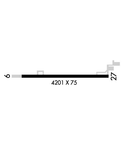
| Lat: N 4105.5 Long: W 08636.8 Elev: 708 Var: +03 Longest Runway: 4201 | ||
| CTAF: 122.8 | ||
| |||||||||||||||||||||||||||||||||||||||||||||||||||||||||||||
| |||||||||||||||||||||||||||||||||||||||||||||||||||||||||||||
| Rwy | Rwy | |||||||
| 4201x75 | 4201' | 4201x75 | 3641' | |||||
| Runway ID | Single Wheel | Double Wheel | Double Tandem Wheel | Dual Double Wheel |
| 09/27 | N/A | N/A | N/A | N/A |
| These numbers are Advisory and are not limits. The Airport Manager should have more accurate Weight Limits | ||||
 Airport Diagram might not be current. | |
| Facility Name: | ARENS FLD |
| City Name: | WINAMAC |
| County: | PULASKI |
| State abbrev: | IN |
| State Name: | INDIANA |
| Ownership: | PUBLICLY OWNED |
| Use: | OPEN TO THE PUBLIC |
| Owner's Name: | WINAMAC-PULASKI CO BOAC |
| Address: | 2595N. US 35 |
| WINAMAC, IN 46996 | |
| Owner's Phone: | 574-946-6785 |
| Manager's Name: | DARYN WILDER |
| Address: | 2595 N. US 35 |
| WINAMAC, IN 46996 | |
| Phone: | 574-946-6785 |
| FAA Region: | GREAT LAKES |
| FAA Field Office: | CHI |
| Date | Sunrise | Sunset |
|---|---|---|
| 06/08/26 Monday | 6:14 | 21:17 |
| 06/09/26 Tuesday | 6:14 | 21:18 |
| 06/10/26 Wednesday | 6:14 | 21:18 |
| 06/11/26 Thursday | 6:14 | 21:19 |
| 06/12/26 Friday | 6:13 | 21:19 |
| 06/13/26 Saturday | 6:13 | 21:20 |
| 06/14/26 Sunday | 6:13 | 21:20 |
| 06/15/26 Monday | 6:13 | 21:21 |
| 06/16/26 Tuesday | 6:13 | 21:21 |
| 06/17/26 Wednesday | 6:13 | 21:21 |
| 06/18/26 Thursday | 6:14 | 21:22 |
| 06/19/26 Friday | 6:14 | 21:22 |
| 06/20/26 Saturday | 6:14 | 21:22 |
| 06/21/26 Sunday | 6:14 | 21:22 |
| Airport Attendance Schedule | MON-FRI 0900-1700 |
| Airport Status | OPERATIONAL (This Status can change at any time - please check NOTAMS) |
| Airport Lighting Schedule | ACTVT REIL RWY 09 & 27; PAPI RWY 09 & 27; MIRL RWY 09/27 - CTAF. |
| Airport Storage Available | Tie Downs, Hanger |
| Extra Services Available | NONE |
| Wind Indicator | YES - (lighted) |
| Control Tower | NO |
| CTAF Frequency | 122.800 |
| Unicom Frequency | 122.800 |
| Rotating Beacon Color | |
| Segmented Circle | NO |
| Landing Fee | NO |
| Airport Inspected | STATE - performed by STATE AERONAUTICAL PERSONNEL |
| Inspection Date | 06/06/2022 |
| Type of Fuel Available | Grade 100LL, JET A (freeze point -40C); -A SELF SERVICE. |
| Airframe Repair Service | NONE |
| Power Plant Repair Service | NONE |
| Latitude | N4105.5 |
| Longitude | W08636.8 (ESTIMATED) |
| Arpt Elevation | 708ft (SURVEYED) |
| Magnetic Variation | 03W |
| 3 miles N | of WINAMAC |
| Traffic Pattern Altitude | |
| Sectional Chart | CHICAGO |
| Operations (Reported) | Yearly | Avg. Daily |
|---|---|---|
| General Aviation Transient | 0 | 0 |
| General Aviation Local | 0 | 0 |
| Air Taxi | 0 | 0 |
| Commerical | 0 | 0 |
| Commuter | 0 | 0 |
| Military | 0 | 0 |
| Aircraft based on Field | |
|---|---|
| General Aviation Singles | 0 |
| General Aviation Multi | 0 |
| Jet Aircraft | 0 |
| General Aviation Helicopters | 0 |
| Military Aircraft | 0 |
| Gliders | 0 |
| Ultralights | 0 |
| FSS on field | NO |
| FSS tie-in | TERRE HAUTE |
| FSS Phone | 1-800-WX-BRIEF |
| Who issues Notams | HUF |
| Notam D service at airport | YES |
| ARTCC Name | CHICAGO |
| Airport Certification | |
| Aircraft Rescue & Firefighting Index | None |
| Airport of Entry | No |
| Custom Landing Rights | No |
| Joint Civil/Military | No |
| Military Landing rights | No |
| NATIONAL PLAN OF INTEGRATED AIRPORT SYSTEMS (NPIAS) |
| FOR CD CTC SOUTH BEND APCH AT 574-251-2609. WHEN SOUTH BEND APCH CLSD, FOR CD CTC CHICAGO ARTCC AT 630-906-8921. |
| (CONTACT TITLE) JIM MCDANIEL. |
| RWY 09/2 7 300 FT STWY ON WEST END. |
| RWY 09/2 7 EST SINGLE WHEEL PAVEMENT STRENGTH 12000 LBS. |
Airport Communications & Frequencies:
| |||||||||||||||||
| Runway: 09 | Runway: 27 | ||
| Mag heading: | 93° | Mag heading: | 273° |
| Rwy Slope: | .03% Up | Rwy Slope: | -.03% Down |
| Approach: | Approach: | ||
| Pattern: | Left Traffic | Pattern: | Left Traffic |
| Markings: | NONPRECISION INSTRUMENT | Markings: | NONPRECISION INSTRUMENT |
| Marking Condition: | GOOD | Marking Condition: | GOOD |
| Arresting Dev: | Arresting Dev: | ||
| Lat & Long: | N4105.5 W08637.2 | Lat. & Long.: | N4105.5 W08636.3 |
| Elev: | 705.6 ft. MSL | Elev: | 706.7 ft. MSL |
| TCH: | 25 ft. AGL | TCH: | 23 ft. AGL |
| Visual Glide Path: | 3.00 degrees | Visual Glide Path: | 3.50 degrees |
| Displaced Threshold: | No | Displaced Threshold: | 560 feet |
| Touchdown Zone: | YES | Touchdown Zone: | YES |
| Touchdown Elev.: | 708.3 feet | Touchdown Elev.: | 708.3 feet |
| Visual Glide Slope: | 2-Light PAPI on LEFT side of Runway | Visual Glide Slope: | 2-Light PAPI on LEFT side of Runway |
| RVR Equipment: | RVR Equipment: | ||
| RVV Equipment: | NO | RVV Equipment: | NO |
| Approach Lights: | Approach Lights: | ||
| REIL: | YES; REIL OTS INDEFLY. | REIL: | YES |
| Centerline Lights: | NO | Centerline Lights: | NO |
| Touchdown lights: | NO | Touchdown lights: | NO |
| Runway Category: | Runway with a Non-precision Approach | Runway Category: | Runway with a Non-precision Approach |
| Declared Distances: | Declared Distances: | ||
| Obstructions: | ROAD | Obstructions: | TREE |
| Marked: | NOT Marked/Lighted | Marked: | NOT Marked/Lighted |
| Clearance slope: | 23:1; 35:1 CLEARANCE SLOPE TO DISPLACED THRESHOLD | Clearance slope: | 5:1 |
| Obstruction height: | 10 feet AGL | Obstruction height: | 26 feet AGL |
| Dist. from runway: | 430 feet | Dist. from runway: | 350 feet |
| Centerline offset: | Centerline offset: | 170 feet left of centerline | |
| Comments: | 4 FT FENCE 200 FT N. | Comments: |
Thanks for using FltPlan.com
all rights reserved © 1999-2026 by Flight Plan LLC

