
| ROGERS MUNI-CARTER FIELD ROGERS AR |
| |
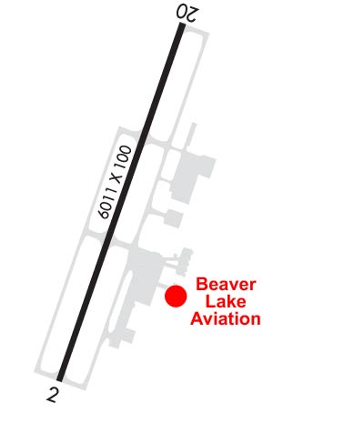
| Lat: N 3622.3 Long: W 09406.4 Elev: 1359 Var: -01 Longest Runway: 6011 | ||
| Clr Del: 121.75 tw cld AWOS: 134.37 Ground: 118.0 Tower: 119.37 | ||
| |||||||||||||||||||||||||||||||||||||||||||||||||||||||||||||||||||||
| |||||||||||||||||||||||||||||||||||||||||||||||||||||||||||||||||||||
| |||||||||||||||||||||||||||||||||||||||||||||||||||||||||||||||||||||
| FBOs at nearby airports who want your business: | |||||||||||||||||
| |||||||||||||||||
| Rwy | Rwy | |||||||
| 6011x100 | 6011' | 6011x100 | 6011' | 111.50 - 198° | ||||
| Runway ID | Single Wheel | Double Wheel | Double Tandem Wheel | Dual Double Wheel |
| 02/20 | 45,000 | 100,000 | N/A | N/A |
| These numbers are Advisory and are not limits. The Airport Manager should have more accurate Weight Limits | ||||
 Airport Diagram might not be current. | |
| Facility Name: | ROGERS EXEC - CARTER FLD |
| City Name: | ROGERS |
| County: | BENTON |
| State abbrev: | AR |
| State Name: | ARKANSAS |
| Ownership: | PUBLICLY OWNED |
| Use: | OPEN TO THE PUBLIC |
| Owner's Name: | CITY OF ROGERS |
| Address: | 301 WEST CHESTNUT |
| ROGERS, AR 72756 | |
| Owner's Phone: | (479) 631-1400 |
| Manager's Name: | DAVID KRUTSCH |
| Address: | #3 SOUTH AIRPORT DRIVE |
| ROGERS, AR 72756 | |
| Phone: | 479-631-1400 |
| FAA Region: | SOUTHWEST |
| FAA Field Office: | AOK |
| Date | Sunrise | Sunset |
|---|---|---|
| 06/08/26 Monday | 5:58 | 20:33 |
| 06/09/26 Tuesday | 5:58 | 20:33 |
| 06/10/26 Wednesday | 5:58 | 20:34 |
| 06/11/26 Thursday | 5:58 | 20:34 |
| 06/12/26 Friday | 5:58 | 20:35 |
| 06/13/26 Saturday | 5:58 | 20:35 |
| 06/14/26 Sunday | 5:58 | 20:35 |
| 06/15/26 Monday | 5:58 | 20:36 |
| 06/16/26 Tuesday | 5:58 | 20:36 |
| 06/17/26 Wednesday | 5:58 | 20:36 |
| 06/18/26 Thursday | 5:58 | 20:37 |
| 06/19/26 Friday | 5:58 | 20:37 |
| 06/20/26 Saturday | 5:59 | 20:37 |
| 06/21/26 Sunday | 5:59 | 20:37 |
| Airport Attendance Schedule | MON-FRI 0400-2100, SAT-SUN 0700-1900 |
| Airport Status | OPERATIONAL (This Status can change at any time - please check NOTAMS) |
| Airport Lighting Schedule | WHEN ATCT CLSD ACTVT HIRL RY 02/20, REIL RY 02, TWY LGTS & MALSR RY 20, PAPI RY 02&20- CTAF. |
| Airport Storage Available | Tie Downs, Hanger |
| Extra Services Available | Air Freight, Air Ambulance, Charter, Flight Instruction, Aircraft Sales |
| Wind Indicator | YES - (lighted) |
| Control Tower | YES |
| CTAF Frequency | 119.375 |
| Unicom Frequency | |
| Rotating Beacon Color | WG |
| Segmented Circle | YES |
| Landing Fee | NO |
| Airport Inspected | STATE - performed by STATE AERONAUTICAL PERSONNEL |
| Inspection Date | 03/28/2023 |
| Type of Fuel Available | Grade 100LL, JET A (freeze point -40C); -10FOR FUEL AFT HRS CALL 479-636-9400; FEE CHARGED. |
| Airframe Repair Service | MAJOR |
| Power Plant Repair Service | MAJOR |
| Latitude | N3622.3 |
| Longitude | W09406.4 (ESTIMATED) |
| Arpt Elevation | 1358ft (SURVEYED) |
| Magnetic Variation | 01E |
| 2 miles N | of ROGERS |
| Traffic Pattern Altitude | 999 |
| Sectional Chart | KANSAS CITY |
| Operations (Reported) | Yearly | Avg. Daily |
|---|---|---|
| General Aviation Transient | 0 | 0 |
| General Aviation Local | 0 | 0 |
| Air Taxi | 0 | 0 |
| Commerical | 0 | 0 |
| Commuter | 0 | 0 |
| Military | 0 | 0 |
| Aircraft based on Field | |
|---|---|
| General Aviation Singles | 0 |
| General Aviation Multi | 0 |
| Jet Aircraft | 0 |
| General Aviation Helicopters | 0 |
| Military Aircraft | 0 |
| Gliders | 0 |
| Ultralights | 0 |
| FSS on field | NO |
| FSS tie-in | JONESBORO |
| FSS Phone | 1-800-WX-BRIEF |
| Who issues Notams | ROG |
| Notam D service at airport | YES |
| ARTCC Name | MEMPHIS |
| Airport Certification | |
| Aircraft Rescue & Firefighting Index | ARFF AVBL UPON REQUEST. |
| Airport of Entry | No |
| Custom Landing Rights | No; US CUSTOMS USER FEE ARPT. |
| Joint Civil/Military | No |
| Military Landing rights | YES |
| NATIONAL PLAN OF INTEGRATED AIRPORT SYSTEMS (NPIAS) |
| GRANT AGREEMENTS UNDER FAAP/ADAP/AIP |
| ASSURANCES PURSUANT TO TITLE VI, CIVIL RIGHTS ACT OF 1964 |
| ARFF AVBL UPON REQUEST. |
| RY 20 DESIGNATED CALM WIND RY. |
| BIRD ACTIVITY ON & INVOF ARPT. |
| DEER AND COYOTE ON & INVOF ARPT. |
| FOR CD WHEN UNA VIA FREQ CTC RAZORBACK APCH 479-649-2416, WHEN APCH CLSD CTC MEMPHIS ARTCC AT 901-368-8453/8449. |
Airport Communications & Frequencies:
| |||||||||||||||||||||||
| Runway: 02 | Runway: 20 | ||
| Mag heading: | 18° | Mag heading: | 198° |
| Rwy Slope: | -.31% Down | Rwy Slope: | .31% Up |
| Approach: | Approach: | ILS/DME | |
| Pattern: | Left Traffic | Pattern: | Left Traffic |
| Markings: | PRECISION INSTRUMENT | Markings: | PRECISION INSTRUMENT |
| Marking Condition: | GOOD | Marking Condition: | GOOD |
| Arresting Dev: | Arresting Dev: | ||
| Lat & Long: | N3621.9 W09406.6 | Lat. & Long.: | N3622.8 W09406.2 |
| Elev: | 1358.7 ft. MSL | Elev: | 1339.9 ft. MSL |
| TCH: | 55 ft. AGL | TCH: | 55 ft. AGL |
| Visual Glide Path: | 3.00 degrees | Visual Glide Path: | 3.00 degrees |
| Displaced Threshold: | No | Displaced Threshold: | No |
| Touchdown Zone: | YES | Touchdown Zone: | YES |
| Touchdown Elev.: | 1358.8 feet | Touchdown Elev.: | 1353.8 feet |
| Visual Glide Slope: | 4-Light PAPI on LEFT side of Runway | Visual Glide Slope: | 4-Light PAPI on LEFT side of Runway |
| RVR Equipment: | RVR Equipment: | ||
| RVV Equipment: | NO | RVV Equipment: | NO |
| Approach Lights: | Approach Lights: | MALSR - 1,400 foot medium intensity approach lighting system with runway alignment indicator lights | |
| REIL: | YES | REIL: | NO |
| Centerline Lights: | NO | Centerline Lights: | NO |
| Touchdown lights: | NO | Touchdown lights: | NO |
| Runway Category: | Runway with a Non-precision Approach having visibility minimums greater than 3/4 mile | Runway Category: | Precision Instrument Runway |
| Declared Distances: | Declared Distances: |
Thanks for using FltPlan.com
all rights reserved © 1999-2026 by Flight Plan LLC