
| GARFIELD COUNTY RGNL RIFLE CO |
| |
| Lat: N 3931.6 Long: W 10743.7 Elev: 5537 Var: -10 Longest Runway: 7000 | ||
| AWOS: 135.27 CTAF: 122.8 | ||
| ||||||||||||||||||||||||||||||||||||||||||||||||||||||||||||||||||||
| ||||||||||||||||||||||||||||||||||||||||||||||||||||||||||||||||||||
| ||||||||||||||||||||||||||||||||||||||||||||||||||||||||||||||||||||
| Rwy | Rwy | |||||||
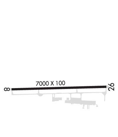
| 7000x100 | 7000' | 7000x100 | 7000' | 110.90 - 258° | ||||
| Runway ID | Single Wheel | Double Wheel | Double Tandem Wheel | Dual Double Wheel |
| 08/26 | 90,000 | 200,000 | 250,000 | N/A |
| These numbers are Advisory and are not limits. The Airport Manager should have more accurate Weight Limits | ||||
 Airport Diagram might not be current. | |
| Facility Name: | RIFLE GARFIELD COUNTY |
| City Name: | RIFLE |
| County: | GARFIELD |
| State abbrev: | CO |
| State Name: | COLORADO |
| Ownership: | PUBLICLY OWNED |
| Use: | OPEN TO THE PUBLIC |
| Owner's Name: | GARFIELD COUNTY |
| Address: | 0375 COUNTY RD 352 BLDG 2060 |
| RIFLE, CO 81650 | |
| Owner's Phone: | 970-625-1091 |
| Manager's Name: | BRIAN CONDIE |
| Address: | 0375 COUNTY RD 352 BLDG 2060 |
| RIFLE, CO 81650 | |
| Phone: | 970-625-1091 |
| FAA Region: | NORTHWEST MOUNTAIN |
| FAA Field Office: | DEN |
| Date | Sunrise | Sunset |
|---|---|---|
| 09/24/21 Friday | 7:00 | 19:05 |
| 09/25/21 Saturday | 7:01 | 19:03 |
| 09/26/21 Sunday | 7:02 | 19:02 |
| 09/27/21 Monday | 7:03 | 19:00 |
| 09/28/21 Tuesday | 7:04 | 18:58 |
| 09/29/21 Wednesday | 7:05 | 18:57 |
| 09/30/21 Thursday | 7:06 | 18:55 |
| 10/01/21 Friday | 7:07 | 18:54 |
| 10/02/21 Saturday | 7:08 | 18:52 |
| 10/03/21 Sunday | 7:09 | 18:50 |
| 10/04/21 Monday | 7:10 | 18:49 |
| 10/05/21 Tuesday | 7:11 | 18:47 |
| 10/06/21 Wednesday | 7:12 | 18:46 |
| 10/07/21 Thursday | 7:13 | 18:44 |
| Airport Attendance Schedule | CONTINUOUS |
| Airport Status | OPERATIONAL (This Status can change at any time - please check NOTAMS) |
| Airport Lighting Schedule | ACTVT ODALS RWY 26; REIL RWY 08 & 26; HIRL RWY 08/26 - CTAF. PAPI RWY 08 & 26 ON CONSLY. |
| Airport Storage Available | Tie Downs, Hanger |
| Extra Services Available | Air Freight, Air Ambulance, Charter, Flight Instruction, Aircraft Rental |
| Wind Indicator | YES - (lighted) |
| Control Tower | NO |
| CTAF Frequency | 122.800 |
| Unicom Frequency | 122.800 |
| Rotating Beacon Color | CLEAR-GREEN (Light Land Airport) |
| Segmented Circle | YES |
| Landing Fee | NO |
| Airport Inspected | STATE - performed by STATE AERONAUTICAL PERSONNEL |
| Inspection Date | 06/18/2019 |
| Type of Fuel Available | Grade 100LL, JET A (freeze point -40C); -10FUEL AVBL 24 HRS: 100LL SELF-SVC WITH CREDIT CARD; JET A AFT HRS - CALL 970-625-4833. |
| Airframe Repair Service | MAJOR |
| Power Plant Repair Service | MAJOR |
| Latitude | N3931.6 |
| Longitude | W10743.7 (ESTIMATED) |
| Arpt Elevation | 5536ft (SURVEYED) |
| Magnetic Variation | 10E |
| 3 miles E | of RIFLE |
| Traffic Pattern Altitude | |
| Sectional Chart | DENVER |
| Operations (Reported) | Yearly | Avg. Daily |
|---|---|---|
| General Aviation Transient | 7292 | 20 |
| General Aviation Local | 4760 | 13 |
| Air Taxi | 2300 | 6 |
| Commerical | 0 | 0 |
| Commuter | 0 | 0 |
| Military | 30 | 0 |
| Aircraft based on Field | |
|---|---|
| General Aviation Singles | 16 |
| General Aviation Multi | 3 |
| Jet Aircraft | 2 |
| General Aviation Helicopters | 0 |
| Military Aircraft | 0 |
| Gliders | 1 |
| Ultralights | 0 |
| FSS on field | NO |
| FSS tie-in | DENVER |
| FSS Phone | 1-800-WX-BRIEF |
| Who issues Notams | RIL |
| Notam D service at airport | YES |
| ARTCC Name | DENVER |
| Airport Certification | |
| Aircraft Rescue & Firefighting Index | None |
| Airport of Entry | No |
| Custom Landing Rights | No; US CUSTOMS USER FEE ARPT. |
| Joint Civil/Military | No |
| Military Landing rights | YES |
| NATIONAL PLAN OF INTEGRATED AIRPORT SYSTEMS (NPIAS) |
| GRANT AGREEMENTS UNDER FAAP/ADAP/AIP |
| ASSURANCES PURSUANT TO TITLE VI, CIVIL RIGHTS ACT OF 1964 |
| AFTER WINTER SNOW STORMS AIRPORT OPENS BEFORE ALL TAXIWAYS ARE CLEARED. |
| OVERNIGHT PARKING FEE. |
| COLD TEMPERATURE AIRPORT. ALTITUDE CORRECTION REQUIRED AT OR BELOW -14C. |
| FOR CD IF UNA TO CTC ON FSS FREQ, CTC DENVER ARTCC AT 303-651-4257. |
| GLD OPS INVOF ARPT. |
Airport Communications & Frequencies:
| |||||||||
| Runway: 08 | Runway: 26 | ||
| Mag heading: | 78° | Mag heading: | 258° |
| Rwy Slope: | .95% Up | Rwy Slope: | -.95% Down |
| Approach: | Approach: | ILS/DME | |
| Pattern: | Left Traffic | Pattern: | Right Traffic |
| Markings: | NONPRECISION INSTRUMENT | Markings: | PRECISION INSTRUMENT |
| Marking Condition: | GOOD | Marking Condition: | GOOD |
| Arresting Dev: | Arresting Dev: | ||
| Lat & Long: | N3931.6 W10744.4 | Lat. & Long.: | N3931.6 W10742.9 |
| Elev: | 5470.2 ft. MSL | Elev: | 5536.8 ft. MSL |
| TCH: | 47 ft. AGL | TCH: | 58 ft. AGL |
| Visual Glide Path: | 3.00 degrees | Visual Glide Path: | 3.60 degrees |
| Displaced Threshold: | No | Displaced Threshold: | No |
| Touchdown Zone: | YES | Touchdown Zone: | YES |
| Touchdown Elev.: | 5497.8 feet | Touchdown Elev.: | 5536.8 feet |
| Visual Glide Slope: | 4-Light PAPI on LEFT side of Runway | Visual Glide Slope: | 4-Light PAPI on LEFT side of Runway |
| RVR Equipment: | RVR Equipment: | ||
| RVV Equipment: | NO | RVV Equipment: | NO |
| Approach Lights: | Approach Lights: | ODALS - omnidirectional approach lighting system | |
| REIL: | YES | REIL: | YES |
| Centerline Lights: | NO | Centerline Lights: | NO |
| Touchdown lights: | NO | Touchdown lights: | NO |
| Runway Category: | Runway with a Non-precision Approach having visibility minimums greater than 3/4 mile | Runway Category: | Precision Instrument Runway |
| Declared Distances: | Declared Distances: |
Thanks for using FltPlan.com
all rights reserved © 1999-2021 by Flight Plan LLC


