
| RED LODGE RED LODGE MT |
| |
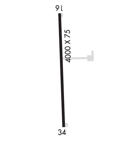
| Lat: N 4511.1 Long: W 10915.5 Elev: 5762 Var: -15 Longest Runway: 4000 | ||
| CTAF: 122.9 | ||
| ||||||||||||||||||||||||||||||||
| ||||||||||||||||||||||||||||||||
| Rwy | Rwy | |||||||
| 4000x75 | 4000' | 4000x75 | 4000' | |||||
| Runway ID | Single Wheel | Double Wheel | Double Tandem Wheel | Dual Double Wheel |
| 16/34 | 4,000 | 6,000 | N/A | N/A |
| These numbers are Advisory and are not limits. The Airport Manager should have more accurate Weight Limits | ||||
| FltPlan does not have IFR approach charts available for KRED. |
 Airport Diagram might not be current. | |
| Facility Name: | RED LODGE |
| City Name: | RED LODGE |
| County: | CARBON |
| State abbrev: | MT |
| State Name: | MONTANA |
| Ownership: | PUBLICLY OWNED |
| Use: | OPEN TO THE PUBLIC |
| Owner's Name: | CITY OF RED LODGE- CARBON CO |
| Address: | P.O. BOX 887 |
| RED LODGE, MT 59068 | |
| Owner's Phone: | 406-446-1595 |
| Manager's Name: | JIM CHITTICK |
| Address: | PO BOX 1053 |
| RED LODGE, MT 59068 | |
| Phone: | (252) 259-5624 |
| FAA Region: | NORTHWEST MOUNTAIN |
| FAA Field Office: | HLN |
| Date | Sunrise | Sunset |
|---|---|---|
| 09/24/21 Friday | 7:06 | 19:11 |
| 09/25/21 Saturday | 7:07 | 19:09 |
| 09/26/21 Sunday | 7:09 | 19:07 |
| 09/27/21 Monday | 7:10 | 19:05 |
| 09/28/21 Tuesday | 7:11 | 19:03 |
| 09/29/21 Wednesday | 7:12 | 19:02 |
| 09/30/21 Thursday | 7:14 | 19:00 |
| 10/01/21 Friday | 7:15 | 18:58 |
| 10/02/21 Saturday | 7:16 | 18:56 |
| 10/03/21 Sunday | 7:17 | 18:54 |
| 10/04/21 Monday | 7:19 | 18:52 |
| 10/05/21 Tuesday | 7:20 | 18:50 |
| 10/06/21 Wednesday | 7:21 | 18:48 |
| 10/07/21 Thursday | 7:22 | 18:47 |
| Airport Attendance Schedule | UNATTENDED |
| Airport Status | OPERATIONAL (This Status can change at any time - please check NOTAMS) |
| Airport Lighting Schedule | ACTVT MIRL RY 16/34 & VASI RY 16 - CTAF. |
| Airport Storage Available | Tie Downs |
| Extra Services Available | Flight Instruction |
| Wind Indicator | YES - (lighted) |
| Control Tower | NO |
| CTAF Frequency | 122.900 |
| Unicom Frequency | |
| Rotating Beacon Color | CLEAR-GREEN (Light Land Airport) |
| Segmented Circle | YES |
| Landing Fee | NO |
| Airport Inspected | STATE - performed by STATE AERONAUTICAL PERSONNEL |
| Inspection Date | 07/20/2019 |
| Type of Fuel Available | Grade 100LL |
| Airframe Repair Service | None |
| Power Plant Repair Service | None |
| Latitude | N4511.1 |
| Longitude | W10915.5 (ESTIMATED) |
| Arpt Elevation | 5762ft (SURVEYED) |
| Magnetic Variation | 15E |
| 1 miles NW | of RED LODGE |
| Traffic Pattern Altitude | |
| Sectional Chart | GREAT FALLS |
| Operations (Reported) | Yearly | Avg. Daily |
|---|---|---|
| General Aviation Transient | 2000 | 5 |
| General Aviation Local | 3700 | 10 |
| Air Taxi | 200 | 1 |
| Commerical | 0 | 0 |
| Commuter | 0 | 0 |
| Military | 50 | 0 |
| Aircraft based on Field | |
|---|---|
| General Aviation Singles | 11 |
| General Aviation Multi | 0 |
| Jet Aircraft | 0 |
| General Aviation Helicopters | 0 |
| Military Aircraft | 0 |
| Gliders | 0 |
| Ultralights | 0 |
| FSS on field | NO |
| FSS tie-in | GREAT FALLS |
| FSS Phone | 1-800-WX-BRIEF |
| Who issues Notams | GTF |
| Notam D service at airport | YES |
| ARTCC Name | SALT LAKE CITY |
| Airport Certification | |
| Aircraft Rescue & Firefighting Index | None |
| Airport of Entry | No |
| Custom Landing Rights | No |
| Joint Civil/Military | No |
| Military Landing rights | YES |
| NATIONAL PLAN OF INTEGRATED AIRPORT SYSTEMS (NPIAS) |
| GRANT AGREEMENTS UNDER FAAP/ADAP/AIP |
| ASSURANCES PURSUANT TO TITLE VI, CIVIL RIGHTS ACT OF 1964 |
| WILDLIFE ON & INVOF ARPT. |
| DIGIWX WX - 2 CLICKS ON 122.725. |
| FOR CD CTC SALT LAKE ARTCC AT 801-320-2568. |
| Runway: 16 | Runway: 34 | ||
| Mag heading: | 162° | Mag heading: | 342° |
| Rwy Slope: | 1.63% Up | Rwy Slope: | -1.63% Down |
| Approach: | Approach: | ||
| Pattern: | Left Traffic | Pattern: | Left Traffic |
| Markings: | BASIC | Markings: | BASIC |
| Marking Condition: | GOOD | Marking Condition: | GOOD |
| Arresting Dev: | Arresting Dev: | ||
| Lat & Long: | N4511.4 W10915.5 | Lat. & Long.: | N4510.8 W10915.4 |
| Elev: | 5696.8 ft. MSL | Elev: | 5762.0 ft. MSL |
| TCH: | 27 ft. AGL | TCH: | |
| Visual Glide Path: | 3.00 degrees | Visual Glide Path: | |
| Displaced Threshold: | No | Displaced Threshold: | No |
| Touchdown Zone: | YES | Touchdown Zone: | YES |
| Touchdown Elev.: | 5696.8 feet | Touchdown Elev.: | 5762.0 feet |
| Visual Glide Slope: | 2-Box VASI on LEFT side of Runway | Visual Glide Slope: | |
| RVR Equipment: | RVR Equipment: | ||
| RVV Equipment: | NO | RVV Equipment: | NO |
| Approach Lights: | Approach Lights: | ||
| REIL: | NO | REIL: | NO |
| Centerline Lights: | NO | Centerline Lights: | NO |
| Touchdown lights: | NO | Touchdown lights: | NO |
| Runway Category: | Runway with a Visual Approach | Runway Category: | Runway with a Visual Approach |
| Declared Distances: | Declared Distances: | ||
| Obstructions: | ROAD | Obstructions: | ROAD |
| Marked: | NOT Marked/Lighted | Marked: | NOT Marked/Lighted |
| Clearance slope: | 19:1 | Clearance slope: | 8:1 |
| Obstruction height: | 15 feet AGL | Obstruction height: | 10 feet AGL |
| Dist. from runway: | 490 feet | Dist. from runway: | 288 feet |
| Centerline offset: | Centerline offset: | ||
| Comments: | Comments: | +10 FT RD 115 FT R; +4 FT FENCE 111 FT R; BOTH CROSS EXTNDD RY CNTRLN 288 FT FM THR. ALSO STEEP TERRAIN DROPOFF TO -400 FT APROXLY 127 FT R. |
Thanks for using FltPlan.com
all rights reserved © 1999-2021 by Flight Plan LLC
