
| FERRY COUNTY REPUBLIC WA |
| |
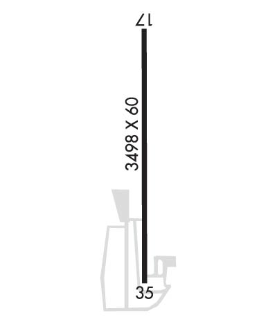
| Lat: N 4843.1 Long: W 11839.4 Elev: 2522 Var: -20 Longest Runway: 3498 | ||
| CTAF: 122.9 | ||
| ||||||||||||||||||||||||||||||||
| ||||||||||||||||||||||||||||||||
| Rwy | Rwy | |||||||
| 3498x60 | 3498' | 3498x60 | 3498' | |||||
| Runway ID | Single Wheel | Double Wheel | Double Tandem Wheel | Dual Double Wheel |
| 17/35 | N/A | N/A | N/A | N/A |
| H1 | N/A | N/A | N/A | N/A |
| H2 | N/A | N/A | N/A | N/A |
| These numbers are Advisory and are not limits. The Airport Manager should have more accurate Weight Limits | ||||
| FltPlan does not have IFR approach charts available for KR49. |
 Airport Diagram might not be current. | |
| Facility Name: | FERRY COUNTY |
| City Name: | REPUBLIC |
| County: | FERRY |
| State abbrev: | WA |
| State Name: | WASHINGTON |
| Ownership: | PUBLICLY OWNED |
| Use: | OPEN TO THE PUBLIC |
| Owner's Name: | FERRY COUNTY |
| Address: | 350 EAST DELAWARE #8 |
| REPUBLIC, WA 99166 | |
| Owner's Phone: | (509) 775-5225 |
| Manager's Name: | TERRY THIELE |
| Address: | 350 EAST DELAWARE #8 |
| REPUBLIC, WA 99166 | |
| Phone: | 616 822-0483; SHERIFF OFC 509-775-3132. |
| FAA Region: | NORTHWEST MOUNTAIN |
| FAA Field Office: | SEA |
| Date | Sunrise | Sunset |
|---|---|---|
| 06/12/26 Friday | 4:51 | 20:58 |
| 06/13/26 Saturday | 4:51 | 20:58 |
| 06/14/26 Sunday | 4:51 | 20:59 |
| 06/15/26 Monday | 4:51 | 20:59 |
| 06/16/26 Tuesday | 4:51 | 21:00 |
| 06/17/26 Wednesday | 4:51 | 21:00 |
| 06/18/26 Thursday | 4:51 | 21:00 |
| 06/19/26 Friday | 4:51 | 21:01 |
| 06/20/26 Saturday | 4:51 | 21:01 |
| 06/21/26 Sunday | 4:52 | 21:01 |
| 06/22/26 Monday | 4:52 | 21:01 |
| 06/23/26 Tuesday | 4:52 | 21:02 |
| 06/24/26 Wednesday | 4:52 | 21:02 |
| 06/25/26 Thursday | 4:53 | 21:02 |
| Airport Attendance Schedule | UNATTENDED |
| Airport Status | OPERATIONAL (This Status can change at any time - please check NOTAMS) |
| Airport Lighting Schedule | ACTVT PAPI RWY 35; MIRL RWY 17/35 - 122.8. |
| Airport Storage Available | Tie Downs |
| Extra Services Available | NONE |
| Wind Indicator | YES - (lighted) |
| Control Tower | NO |
| CTAF Frequency | 122.900 |
| Unicom Frequency | |
| Rotating Beacon Color | WG |
| Segmented Circle | NO |
| Landing Fee | NO |
| Airport Inspected | STATE - performed by STATE AERONAUTICAL PERSONNEL |
| Inspection Date | 07/23/2025 |
| Type of Fuel Available | None |
| Airframe Repair Service | NONE |
| Power Plant Repair Service | NONE |
| Latitude | N4843.1 |
| Longitude | W11839.4 (ESTIMATED) |
| Arpt Elevation | 2522ft (ESTIMATED) |
| Magnetic Variation | 20E |
| 6 miles NE | of REPUBLIC |
| Traffic Pattern Altitude | 800 |
| Sectional Chart | SEATTLE |
| Operations (Reported) | Yearly | Avg. Daily |
|---|---|---|
| General Aviation Transient | 0 | 0 |
| General Aviation Local | 0 | 0 |
| Air Taxi | 0 | 0 |
| Commerical | 0 | 0 |
| Commuter | 0 | 0 |
| Military | 0 | 0 |
| Aircraft based on Field | |
|---|---|
| General Aviation Singles | 0 |
| General Aviation Multi | 0 |
| Jet Aircraft | 0 |
| General Aviation Helicopters | 0 |
| Military Aircraft | 0 |
| Gliders | 0 |
| Ultralights | 0 |
| FSS on field | NO |
| FSS tie-in | SEATTLE |
| FSS Phone | 1-800-WX-BRIEF |
| Who issues Notams | SEA |
| Notam D service at airport | YES |
| ARTCC Name | SEATTLE |
| Airport Certification | |
| Aircraft Rescue & Firefighting Index | None |
| Airport of Entry | No |
| Custom Landing Rights | No |
| Joint Civil/Military | No |
| Military Landing rights | No |
| SUGGEST NGT LNDGS BE MADE ON RY 35. |
| RY 17/35 TREES LCTD ON UNLGTD UNMKD MOUNTAINOUS TRRN. |
| PLINES NE OF RY 17 LGTD DUSK-DAWN. |
| WILDLIFE INVOF OF RUNWAY. |
| FOR CD CTC SEATTLE ARTCC AT 253-351-3694. |
| Runway: 17 | Runway: 35 | ||
| Mag heading: | N/A | Mag heading: | N/A |
| Approach: | Approach: | ||
| Pattern: | Right Traffic | Pattern: | Left Traffic |
| Markings: | BASIC | Markings: | BASIC |
| Marking Condition: | POOR; RWY MRKGS FADED. | Marking Condition: | POOR; RWY MRKGS FADED. |
| Arresting Dev: | Arresting Dev: | ||
| Lat & Long: | N4843.4 W11839.3 | Lat. & Long.: | N4842.8 W11839.4 |
| Elev: | N/A | Elev: | N/A |
| TCH: | TCH: | 40 ft. AGL | |
| Visual Glide Path: | Visual Glide Path: | 4.00 degrees | |
| Displaced Threshold: | No | Displaced Threshold: | No |
| Touchdown Zone: | NO | Touchdown Zone: | NO |
| Touchdown Elev.: | Touchdown Elev.: | ||
| Visual Glide Slope: | Visual Glide Slope: | 2-Light PAPI on LEFT side of Runway | |
| RVR Equipment: | RVR Equipment: | ||
| RVV Equipment: | NO | RVV Equipment: | NO |
| Approach Lights: | Approach Lights: | ||
| REIL: | NO | REIL: | NO |
| Centerline Lights: | NO | Centerline Lights: | NO |
| Touchdown lights: | NO | Touchdown lights: | NO |
| Runway Category: | Runway with a Visual Approach | Runway Category: | Runway with a Visual Approach |
| Declared Distances: | Declared Distances: | ||
| Obstructions: | TREES | Obstructions: | TREES |
| Marked: | NOT Marked/Lighted | Marked: | NOT Marked/Lighted |
| Clearance slope: | 13:1 | Clearance slope: | 10:1 |
| Obstruction height: | 61 feet AGL | Obstruction height: | 23 feet AGL |
| Dist. from runway: | 1022 feet | Dist. from runway: | 432 feet |
| Centerline offset: | Centerline offset: | ||
| Comments: | Comments: | RWY 35, SLOPE 69 FT R AND 59 FT L FM EDGE OF RWY. |
Thanks for using FltPlan.com
all rights reserved © 1999-2026 by Flight Plan LLC
