
| POPLAR BLUFF MUNI POPLAR BLUFF MO |
| |
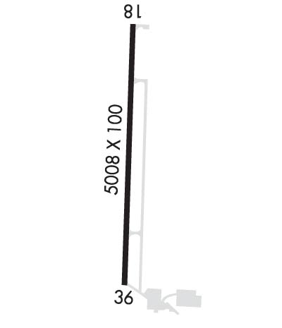
| Lat: N 3646.4 Long: W 09019.5 Elev: 331 Var: +00 Longest Runway: 5008 | ||
| AWOS: 124.22 CTAF: 123.0 | ||
| ||||||||||||||||||||||||||||||||||||||||||||
| ||||||||||||||||||||||||||||||||||||||||||||
| ||||||||||||||||||||||||||||||||||||||||||||
| Rwy | Rwy | |||||||
| 5008x100 | 5008' | 5008x100 | 4718' | 108.70 - 358° | ||||
| Runway ID | Single Wheel | Double Wheel | Double Tandem Wheel | Dual Double Wheel |
| 18/36 | 16,000 | N/A | N/A | N/A |
| These numbers are Advisory and are not limits. The Airport Manager should have more accurate Weight Limits | ||||
 Airport Diagram might not be current. | |
| Facility Name: | POPLAR BLUFF RGNL BUSINESS |
| City Name: | POPLAR BLUFF |
| County: | BUTLER |
| State abbrev: | MO |
| State Name: | MISSOURI |
| Ownership: | PUBLICLY OWNED |
| Use: | OPEN TO THE PUBLIC |
| Owner's Name: | CITY OF POPLAR BLUFF |
| Address: | 101 OAK ST |
| POPLAR BLUFF, MO 63901 | |
| Owner's Phone: | 573-686-8620 |
| Manager's Name: | GARY PRIDE |
| Address: | 101 OAK STREET |
| POPLAR BLUFF, MO 63901 | |
| Phone: | 573-686-8669 |
| FAA Region: | CENTRAL |
| FAA Field Office: | NONE |
| Date | Sunrise | Sunset |
|---|---|---|
| 09/24/21 Friday | 6:51 | 18:55 |
| 09/25/21 Saturday | 6:51 | 18:54 |
| 09/26/21 Sunday | 6:52 | 18:52 |
| 09/27/21 Monday | 6:53 | 18:51 |
| 09/28/21 Tuesday | 6:54 | 18:49 |
| 09/29/21 Wednesday | 6:55 | 18:48 |
| 09/30/21 Thursday | 6:56 | 18:46 |
| 10/01/21 Friday | 6:56 | 18:45 |
| 10/02/21 Saturday | 6:57 | 18:44 |
| 10/03/21 Sunday | 6:58 | 18:42 |
| 10/04/21 Monday | 6:59 | 18:41 |
| 10/05/21 Tuesday | 7:00 | 18:39 |
| 10/06/21 Wednesday | 7:01 | 18:38 |
| 10/07/21 Thursday | 7:01 | 18:36 |
| Airport Attendance Schedule | 7 Days A Week 0700-1600 |
| Airport Status | OPERATIONAL (This Status can change at any time - please check NOTAMS) |
| Airport Lighting Schedule | MIRL RWY 18/36, SS-SR; CTAF TO CHG INTST; 7 CLICKS FOR HIGH, 5 CLICKS FOR MED OR LWR INTST. VASI RWY 36 & PAPI RWY 18 - CTAF. |
| Airport Storage Available | Tie Downs, Hanger |
| Extra Services Available | Air Freight, Charter, Flight Instruction, Aircraft Rental, Aircraft Sales, Annual Surveying |
| Wind Indicator | YES - (lighted) |
| Control Tower | NO |
| CTAF Frequency | 123.000 |
| Unicom Frequency | 123.000 |
| Rotating Beacon Color | CLEAR-GREEN (Light Land Airport) |
| Segmented Circle | YES |
| Landing Fee | NO |
| Airport Inspected | STATE - performed by STATE AERONAUTICAL PERSONNEL |
| Inspection Date | 09/12/2018 |
| Type of Fuel Available | Grade 100LL, JET A (freeze point -40C) |
| Airframe Repair Service | MAJOR |
| Power Plant Repair Service | MAJOR |
| Latitude | N3646.4 |
| Longitude | W09019.5 (ESTIMATED) |
| Arpt Elevation | 330ft (SURVEYED) |
| Magnetic Variation | 00W |
| 3 miles E | of POPLAR BLUFF |
| Traffic Pattern Altitude | 769 |
| Sectional Chart | ST LOUIS |
| Operations (Reported) | Yearly | Avg. Daily |
|---|---|---|
| General Aviation Transient | 12000 | 33 |
| General Aviation Local | 3000 | 8 |
| Air Taxi | 1500 | 4 |
| Commerical | 0 | 0 |
| Commuter | 0 | 0 |
| Military | 200 | 1 |
| Aircraft based on Field | |
|---|---|
| General Aviation Singles | 23 |
| General Aviation Multi | 5 |
| Jet Aircraft | 0 |
| General Aviation Helicopters | 1 |
| Military Aircraft | 0 |
| Gliders | 0 |
| Ultralights | 0 |
| FSS on field | NO |
| FSS tie-in | SAINT LOUIS |
| FSS Phone | 1-800-WX-BRIEF |
| Who issues Notams | POF |
| Notam D service at airport | YES |
| ARTCC Name | MEMPHIS |
| Airport Certification | |
| Aircraft Rescue & Firefighting Index | None |
| Airport of Entry | No |
| Custom Landing Rights | No |
| Joint Civil/Military | No |
| Military Landing rights | No |
| NATIONAL PLAN OF INTEGRATED AIRPORT SYSTEMS (NPIAS) |
| GRANT AGREEMENTS UNDER FAAP/ADAP/AIP |
| ASSURANCES PURSUANT TO TITLE VI, CIVIL RIGHTS ACT OF 1964 |
| CROP DUSTING ACFT ON & INVOF ARPT FM MARCH TO AUGUST. |
| FOR CD CTC MEMPHIS ARTCC AT 901-368-8453/8449. |
| RWY 18/3 6 FIRST 1000 FT OF RY 18 IS CONC; REMAINDER IS ASPH. |
Airport Communications & Frequencies:
| |||||||||
| Runway: 18 | Runway: 36 | ||
| Mag heading: | 181° | Mag heading: | 1° |
| Rwy Slope: | -.06% Down | Rwy Slope: | .06% Up |
| Approach: | Approach: | SDF | |
| Pattern: | Left Traffic | Pattern: | Left Traffic |
| Markings: | NONPRECISION INSTRUMENT | Markings: | NONPRECISION INSTRUMENT |
| Marking Condition: | GOOD | Marking Condition: | GOOD |
| Arresting Dev: | Arresting Dev: | ||
| Lat & Long: | N3646.8 W09019.5 | Lat. & Long.: | N3646.0 W09019.5 |
| Elev: | 330.5 ft. MSL | Elev: | 327.5 ft. MSL |
| TCH: | 30 ft. AGL | TCH: | 40 ft. AGL |
| Visual Glide Path: | 3.00 degrees | Visual Glide Path: | 3.00 degrees |
| Displaced Threshold: | No | Displaced Threshold: | 290 feet |
| Touchdown Zone: | YES | Touchdown Zone: | YES |
| Touchdown Elev.: | 330.8 feet | Touchdown Elev.: | 330.4 feet |
| Visual Glide Slope: | 4-Light PAPI on LEFT side of Runway | Visual Glide Slope: | 4-BOX VASI ON LEFT SIDE OF RUNWAY |
| RVR Equipment: | RVR Equipment: | ||
| RVV Equipment: | NO | RVV Equipment: | NO |
| Approach Lights: | Approach Lights: | ||
| REIL: | YES | REIL: | YES |
| Centerline Lights: | NO | Centerline Lights: | NO |
| Touchdown lights: | NO | Touchdown lights: | NO |
| Runway Category: | Runway with a Non-precision Approach having visibility minimums greater than 3/4 mile | Runway Category: | Runway with a Non-precision Approach having visibility minimums greater than 3/4 mile |
| Declared Distances: | Declared Distances: | ||
| Obstructions: | TREES | Obstructions: | TREES |
| Marked: | NOT Marked/Lighted | Marked: | NOT Marked/Lighted |
| Clearance slope: | 22:1 | Clearance slope: | 18:1; RWY 36 APCH SLOPE 30:1 TO DSPLCD THLD. |
| Obstruction height: | 45 feet AGL | Obstruction height: | 42 feet AGL |
| Dist. from runway: | 1196 feet | Dist. from runway: | 962 feet |
| Centerline offset: | 268 right of centerline | Centerline offset: | 100 feet right of centerline |
| Comments: | Comments: |
Thanks for using FltPlan.com
all rights reserved © 1999-2021 by Flight Plan LLC
