
| GRIDER FIELD PINE BLUFF AR |
| |
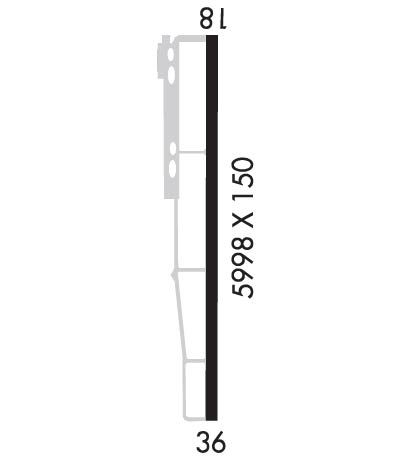
| Lat: N 3410.5 Long: W 09156.1 Elev: 206 Var: -02 Longest Runway: 5998 | ||
| Clr Del: 119.85 AWOS: 120.77 CTAF: 123.0 | ||
| ||||||||||||||||||||||||||||||||||||||||||||
| ||||||||||||||||||||||||||||||||||||||||||||
| ||||||||||||||||||||||||||||||||||||||||||||
| Rwy | Rwy | |||||||
| 5998x150 | 5998' | 111.70 - 177° | 5998x150 | 5998' | ||||
| Runway ID | Single Wheel | Double Wheel | Double Tandem Wheel | Dual Double Wheel |
| 18/36 | 40,000 | 56,000 | 90,000 | N/A |
| These numbers are Advisory and are not limits. The Airport Manager should have more accurate Weight Limits | ||||
 Airport Diagram might not be current. | |
| Facility Name: | PINEBLUFF RGNL/GRIDER FLD |
| City Name: | PINE BLUFF |
| County: | JEFFERSON |
| State abbrev: | AR |
| State Name: | ARKANSAS |
| Ownership: | PUBLICLY OWNED |
| Use: | OPEN TO THE PUBLIC |
| Owner's Name: | CITY OF PINE BLUFF |
| Address: | 200 E. 8TH ST. |
| PINE BLUFF, AR 71601 | |
| Owner's Phone: | 870-730-2000 |
| Manager's Name: | JOHN HALE |
| Address: | PO BOX 7625, 709 HANGAR ROW |
| PINE BLUFF, AR 71611-7625 | |
| Phone: | 870-534-4131 |
| FAA Region: | SOUTHWEST |
| FAA Field Office: | AOK |
| Date | Sunrise | Sunset |
|---|---|---|
| 06/08/26 Monday | 5:56 | 20:18 |
| 06/09/26 Tuesday | 5:56 | 20:18 |
| 06/10/26 Wednesday | 5:55 | 20:19 |
| 06/11/26 Thursday | 5:55 | 20:19 |
| 06/12/26 Friday | 5:55 | 20:20 |
| 06/13/26 Saturday | 5:55 | 20:20 |
| 06/14/26 Sunday | 5:55 | 20:21 |
| 06/15/26 Monday | 5:55 | 20:21 |
| 06/16/26 Tuesday | 5:56 | 20:21 |
| 06/17/26 Wednesday | 5:56 | 20:22 |
| 06/18/26 Thursday | 5:56 | 20:22 |
| 06/19/26 Friday | 5:56 | 20:22 |
| 06/20/26 Saturday | 5:56 | 20:22 |
| 06/21/26 Sunday | 5:56 | 20:23 |
| Airport Attendance Schedule | NOV-MAR 7 Days A Week 0700-1500, APR-OCT 7 Days A Week 0800-1800; FOR ARPT ATTENDANT AFT HRS CALL 870-540-9439. |
| Airport Status | OPERATIONAL (This Status can change at any time - please check NOTAMS) |
| Airport Lighting Schedule | DUSK-DAWN. ACTVT MIRL RY 18/36 AND MALSR RY 18 - CTAF. |
| Airport Storage Available | Tie Downs, Hanger |
| Extra Services Available | Crop Dusting, Avionics, Flight Instruction |
| Wind Indicator | YES - (lighted) |
| Control Tower | NO |
| CTAF Frequency | 123.000 |
| Unicom Frequency | 123.000 |
| Rotating Beacon Color | WG |
| Segmented Circle | YES |
| Landing Fee | NO |
| Airport Inspected | STATE - performed by STATE AERONAUTICAL PERSONNEL |
| Inspection Date | 02/08/2022 |
| Type of Fuel Available | Grade 100LL, JET A (freeze point -40C); -10SELF SERVICE FUEL AVBL 24 HRS WITH CREDIT CARD (100LL & JET A). |
| Airframe Repair Service | MAJOR |
| Power Plant Repair Service | MAJOR |
| Latitude | N3410.5 |
| Longitude | W09156.1 (ESTIMATED) |
| Arpt Elevation | 205ft (SURVEYED) |
| Magnetic Variation | 02E |
| 4 miles SE | of PINE BLUFF |
| Traffic Pattern Altitude | 994 |
| Sectional Chart | MEMPHIS |
| Operations (Reported) | Yearly | Avg. Daily |
|---|---|---|
| General Aviation Transient | 0 | 0 |
| General Aviation Local | 0 | 0 |
| Air Taxi | 0 | 0 |
| Commerical | 0 | 0 |
| Commuter | 0 | 0 |
| Military | 0 | 0 |
| Aircraft based on Field | |
|---|---|
| General Aviation Singles | 0 |
| General Aviation Multi | 0 |
| Jet Aircraft | 0 |
| General Aviation Helicopters | 0 |
| Military Aircraft | 0 |
| Gliders | 0 |
| Ultralights | 0 |
| FSS on field | NO |
| FSS tie-in | JONESBORO |
| FSS Phone | 1-800-WX-BRIEF |
| Who issues Notams | PBF |
| Notam D service at airport | YES |
| ARTCC Name | MEMPHIS |
| Airport Certification | |
| Aircraft Rescue & Firefighting Index | None |
| Airport of Entry | No |
| Custom Landing Rights | No |
| Joint Civil/Military | No |
| Military Landing rights | YES |
| NATIONAL PLAN OF INTEGRATED AIRPORT SYSTEMS (NPIAS) |
| GRANT AGREEMENTS UNDER FAAP/ADAP/AIP |
| SURPLUS PROPERTY AGREEMENT UNDER REGULATION 16-WAA |
| ASSURANCES PURSUANT TO TITLE VI, CIVIL RIGHTS ACT OF 1964 |
| AGREEMENT UNDER DLAND OR DCLA HAS EXPIRED. |
| ARPT CLSD TO ACFT WITH 30 OR MORE PSGRS. |
| MIGRATORY BIRDS INVOF ARPT. |
| NUMEROUS AGRICULTURAL OPNS ON & INVOF ARPT YEAR ROUND. |
| FOR CD CTC MEMPHIS ARTCC AT 901-368-8453/8449. |
Airport Communications & Frequencies:
| |||||||||||||||||||
| Runway: 18 | Runway: 36 | ||
| Mag heading: | 178° | Mag heading: | 358° |
| Rwy Slope: | -.08% Down | Rwy Slope: | .08% Up |
| Approach: | ILS | Approach: | |
| Pattern: | Left Traffic | Pattern: | Left Traffic |
| Markings: | PRECISION INSTRUMENT | Markings: | PRECISION INSTRUMENT |
| Marking Condition: | GOOD | Marking Condition: | GOOD |
| Arresting Dev: | Arresting Dev: | ||
| Lat & Long: | N3411.0 W09156.1 | Lat. & Long.: | N3410.0 W09156.1 |
| Elev: | 203.2 ft. MSL | Elev: | 198.7 ft. MSL |
| TCH: | 52 ft. AGL | TCH: | 52 ft. AGL |
| Visual Glide Path: | 3.00 degrees | Visual Glide Path: | 3.00 degrees |
| Displaced Threshold: | No | Displaced Threshold: | No |
| Touchdown Zone: | YES | Touchdown Zone: | YES |
| Touchdown Elev.: | 205.7 feet | Touchdown Elev.: | 202.0 feet |
| Visual Glide Slope: | 4-BOX VASI ON LEFT SIDE OF RUNWAY | Visual Glide Slope: | 4-BOX VASI ON LEFT SIDE OF RUNWAY |
| RVR Equipment: | RVR Equipment: | ||
| RVV Equipment: | NO | RVV Equipment: | NO |
| Approach Lights: | MALSR - 1,400 foot medium intensity approach lighting system with runway alignment indicator lights | Approach Lights: | |
| REIL: | NO | REIL: | NO |
| Centerline Lights: | NO | Centerline Lights: | NO |
| Touchdown lights: | NO | Touchdown lights: | NO |
| Runway Category: | Precision Instrument Runway | Runway Category: | Runway with a Non-precision Approach having visibility minimums greater than 3/4 mile |
| Declared Distances: | Declared Distances: | ||
| Comments: | Comments: | TWO +3 FT POSTS 180 FT FM RY END 180 FT R. |
Thanks for using FltPlan.com
all rights reserved © 1999-2026 by Flight Plan LLC
