
| OXNARD OXNARD CA |
| |
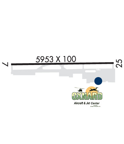
| Lat: N 3412.0 Long: W 11912.4 Elev: 45 Var: -15 Longest Runway: 5953 | ||
| Dept. ATIS: 118.05 Arr. ATIS: 118.05 AWOS: 118.05 Ground: 121.9 Tower: 134.95 | ||
| |||||||||||||||||||||||||||||||||||||||||||||||||||||||||||||||||||||
| |||||||||||||||||||||||||||||||||||||||||||||||||||||||||||||||||||||
| |||||||||||||||||||||||||||||||||||||||||||||||||||||||||||||||||||||
| |||||||||||||||||||||||||||||||||||||||||||||||||||||||||||||||||||||
| |||||||||||||||||||||||||||||||||||||||||||||||||||||||||||||||||||||
| Rwy | Rwy | |||||||
| 5953x100 | 5953' | 5953x100 | 5500' | 108.70 - 255° | ||||
| Runway ID | Single Wheel | Double Wheel | Double Tandem Wheel | Dual Double Wheel |
| 07/25 | 91,000 | 126,000 | 174,000 | 117,000 |
| These numbers are Advisory and are not limits. The Airport Manager should have more accurate Weight Limits | ||||
 Airport Diagram might not be current. | |
| Facility Name: | OXNARD |
| City Name: | OXNARD |
| County: | VENTURA |
| State abbrev: | CA |
| State Name: | CALIFORNIA |
| Ownership: | PUBLICLY OWNED |
| Use: | OPEN TO THE PUBLIC |
| Owner's Name: | COUNTY OF VENTURA |
| Address: | 555 AIRPORT WAY |
| CAMARILLO, CA 93010 | |
| Owner's Phone: | 805-388-4372 |
| Manager's Name: | KEITH FREITAS; ARPT OPNS SUPVR. ADDNL CTC DIR OF ARPTS - KEITH FREITAS 805-388-4200. |
| Address: | 2889 W 5TH ST |
| OXNARD, CA 93030 | |
| Phone: | 805-388-4372 |
| FAA Region: | WESTERN-PACIFIC |
| FAA Field Office: | LAX |

| Date | Sunrise | Sunset |
|---|---|---|
| 06/08/26 Monday | 5:45 | 20:07 |
| 06/09/26 Tuesday | 5:45 | 20:08 |
| 06/10/26 Wednesday | 5:44 | 20:08 |
| 06/11/26 Thursday | 5:44 | 20:09 |
| 06/12/26 Friday | 5:44 | 20:09 |
| 06/13/26 Saturday | 5:44 | 20:09 |
| 06/14/26 Sunday | 5:44 | 20:10 |
| 06/15/26 Monday | 5:45 | 20:10 |
| 06/16/26 Tuesday | 5:45 | 20:10 |
| 06/17/26 Wednesday | 5:45 | 20:11 |
| 06/18/26 Thursday | 5:45 | 20:11 |
| 06/19/26 Friday | 5:45 | 20:11 |
| 06/20/26 Saturday | 5:45 | 20:12 |
| 06/21/26 Sunday | 5:45 | 20:12 |
| Airport Attendance Schedule | 7 Days A Week 0500-0030 |
| Airport Status | OPERATIONAL (This Status can change at any time - please check NOTAMS) |
| Airport Lighting Schedule | WHEN ATCT CLSD, ACTVT MALSF RWY 25, REIL RWY 07, MIRL RWY 07-25 - CTAF. |
| Airport Storage Available | Tie Downs |
| Extra Services Available | Air Freight, Crop Dusting, Cargo Handling, Charter, Flight Instruction, Parachute Jumping, Aircraft Rental, Aircraft Sales |
| Wind Indicator | YES - (lighted) |
| Control Tower | YES |
| CTAF Frequency | 134.950 |
| Unicom Frequency | |
| Rotating Beacon Color | WG |
| Segmented Circle | YES |
| Landing Fee |
| Airport Inspected | FEDERAL - performed by FAA AIRPORTS FIELD PERSONNEL |
| Inspection Date | 03/08/2023 |
| Type of Fuel Available | Grade 100LL, JET A (freeze point -40C) |
| Airframe Repair Service | MAJOR |
| Power Plant Repair Service | MAJOR |
| Latitude | N3412.0 |
| Longitude | W11912.4 (ESTIMATED) |
| Arpt Elevation | 44ft (SURVEYED) |
| Magnetic Variation | 15E |
| 1 miles W | of OXNARD |
| Traffic Pattern Altitude | TPA 1000 AGL SNGL ENG; 1400 AGL MULTI-ENG & JETS. |
| Sectional Chart | LOS ANGELES |
| Operations (Reported) | Yearly | Avg. Daily |
|---|---|---|
| General Aviation Transient | 0 | 0 |
| General Aviation Local | 0 | 0 |
| Air Taxi | 0 | 0 |
| Commerical | 0 | 0 |
| Commuter | 0 | 0 |
| Military | 0 | 0 |
| Aircraft based on Field | |
|---|---|
| General Aviation Singles | 0 |
| General Aviation Multi | 0 |
| Jet Aircraft | 0 |
| General Aviation Helicopters | 0 |
| Military Aircraft | 0 |
| Gliders | 0 |
| Ultralights | 0 |
| FSS on field | NO |
| FSS tie-in | HAWTHORNE |
| FSS Phone | 1-800-WX-BRIEF |
| Who issues Notams | OXR |
| Notam D service at airport | YES |
| ARTCC Name | LOS ANGELES |
| Airport Certification | UNSKED ACR OPNS INVOLVING ACFT WITH MORE THAN 9 PAX SEATS ARE NOT AUTHD WO PRIOR COORD WITH ARPT AND CFMN THAT ARFF SVCS ARE AVBL PRIOR TO LDG OR TKOF, CTC 805-947-6804. |
| Aircraft Rescue & Firefighting Index | AIRPORT HAS A CERTIFICATE UNDER CFR PART 139 |
| Airport of Entry | No |
| Custom Landing Rights | No |
| Joint Civil/Military | No |
| Military Landing rights | YES |
| NATIONAL PLAN OF INTEGRATED AIRPORT SYSTEMS (NPIAS) |
| GRANT AGREEMENTS UNDER FAAP/ADAP/AIP |
| ASSURANCES PURSUANT TO TITLE VI, CIVIL RIGHTS ACT OF 1964 |
| AGREEMENT UNDER DLAND OR DCLA HAS EXPIRED. |
| NO TOUCH & GO, STOP & GO, OR TAXI BACK OPNS 2000-0700 LCL AFTER THREE CONSECUTIVE PATS, THEN TAXI BACK ONLY. |
| ARPT OPNS LCTD AT BASE OF ATCT; CTC ON 134.95 WHEN ATCT CLSD OR CALL 805-947-6804. |
| FLY FRIENDLY PROCS IN EFCT. AVOID HIGH PWR SETTINGS OVER RESIDENTIAL AREA. KEEP DNWND NORTH OF WOOLEY RD. TURN LEFT CROSSWIND LEG BFR CANAL OR FLY 1/2 MILE PAST SHORELINE. EXP RIGHT TFC RWY 25. SEE ARPT WEBSITE FOR FULL PROC. |
| WILDLIFE ON AND INVOF AIRPORT. |
| ARPT OPNS SUPVR ADDNL CTC DIR OF ARPTS - (805) 388-4200. |
| PRCHT JUMPING SW CORNER OF ARPT. |
| RWY 07/2 5 PCR VALUE: 371/F/D/X/T |
Airport Communications & Frequencies:
| |||||||||||||||||||||||
| Runway: 07 | Runway: 25 | ||
| Mag heading: | 76° | Mag heading: | 256° |
| Rwy Slope: | .19% Up | Rwy Slope: | -.19% Down |
| Approach: | Approach: | ILS | |
| Pattern: | Left Traffic; UPON REQUEST. | Pattern: | Left Traffic |
| Markings: | NONPRECISION INSTRUMENT | Markings: | PRECISION INSTRUMENT |
| Marking Condition: | FAIR | Marking Condition: | FAIR |
| Arresting Dev: | Arresting Dev: | ||
| Lat & Long: | N3412.1 W11913.0 | Lat. & Long.: | N3412.0 W11911.8 |
| Elev: | 33.5 ft. MSL | Elev: | 44.7 ft. MSL |
| TCH: | 40 ft. AGL | TCH: | 59 ft. AGL |
| Visual Glide Path: | 3.00 degrees | Visual Glide Path: | 3.00 degrees |
| Displaced Threshold: | No | Displaced Threshold: | 453 feet |
| Touchdown Zone: | YES | Touchdown Zone: | YES |
| Touchdown Elev.: | 37.2 feet | Touchdown Elev.: | 43.7 feet |
| Visual Glide Slope: | 4-Light PAPI on RIGHT side of Runway | Visual Glide Slope: | 4-Light PAPI on LEFT side of Runway |
| RVR Equipment: | RVR Equipment: | ||
| RVV Equipment: | NO | RVV Equipment: | NO |
| Approach Lights: | Approach Lights: | MALSF - 1,400 foot medium intensity approach lighting system with sequenced flashers | |
| REIL: | YES | REIL: | NO |
| Centerline Lights: | NO | Centerline Lights: | NO |
| Touchdown lights: | NO | Touchdown lights: | NO |
| Runway Category: | Runway with a Non-precision Approach having visibility minimums greater than 3/4 mile | Runway Category: | Precision Instrument Runway |
| Declared Distances: | TORA:5953' TODA:5953' ASDA:5654' LDA:5654' | Declared Distances: | TORA:5953' TODA:5953' ASDA:5953' LDA:5500' |
| Obstructions: | Obstructions: | POLE | |
| Marked: | Marked: | NOT Marked/Lighted | |
| Clearance slope: | 50:1 | Clearance slope: | 30:1; 45:1 DSPLCD THR. 123 FT AGL SPIRE DSPLCD 200 FT LEFT. |
| Obstruction height: | Obstruction height: | 70 feet AGL | |
| Dist. from runway: | Dist. from runway: | 2300 feet | |
| Centerline offset: | Centerline offset: | 210 feet left of centerline | |
| Comments: | Comments: |
Thanks for using FltPlan.com
all rights reserved © 1999-2026 by Flight Plan LLC


