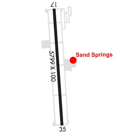
| WILLIAM R. POGUE MUNI SAND SPRINGS OK |
| |
| Lat: N 3610.5 Long: W 09609.1 Elev: 892 Var: -06 Longest Runway: 5799 | ||
| AWOS: 118.32 CTAF: 122.7 | ||
| ||||||||||||||||||||||||||||||
| ||||||||||||||||||||||||||||||
| ||||||||||||||||||||||||||||||
| Rwy | Rwy | |||||||
| 5799x100 | 5799' | 5799x100 | 5799' | |||||
| Runway ID | Single Wheel | Double Wheel | Double Tandem Wheel | Dual Double Wheel |
| 17/35 | 30,000 | 58,000 | N/A | N/A |
| These numbers are Advisory and are not limits. The Airport Manager should have more accurate Weight Limits | ||||
 Airport Diagram might not be current. | |
| Facility Name: | WILLIAM R POGUE MUNI |
| City Name: | SAND SPRINGS |
| County: | OSAGE |
| State abbrev: | OK |
| State Name: | OKLAHOMA |
| Ownership: | PUBLICLY OWNED |
| Use: | OPEN TO THE PUBLIC |
| Owner's Name: | CITY OF SAND SPRINGS |
| Address: | CITY HALL, 100 E. BROADWAY |
| SAND SPRINGS, OK 74063 | |
| Owner's Phone: | 918-246-2500 |
| Manager's Name: | KEN MADISON |
| Address: | 3200 N AIRPORT RD |
| SAND SPRINGS, OK 74063 | |
| Phone: | 918-246-2605; AFTER HOURS OR EMERGENCY: 918-638-6895. |
| FAA Region: | SOUTHWEST |
| FAA Field Office: | AOK |
| Date | Sunrise | Sunset |
|---|---|---|
| 09/24/21 Friday | 7:14 | 19:19 |
| 09/25/21 Saturday | 7:15 | 19:17 |
| 09/26/21 Sunday | 7:15 | 19:16 |
| 09/27/21 Monday | 7:16 | 19:14 |
| 09/28/21 Tuesday | 7:17 | 19:13 |
| 09/29/21 Wednesday | 7:18 | 19:11 |
| 09/30/21 Thursday | 7:19 | 19:10 |
| 10/01/21 Friday | 7:20 | 19:08 |
| 10/02/21 Saturday | 7:20 | 19:07 |
| 10/03/21 Sunday | 7:21 | 19:06 |
| 10/04/21 Monday | 7:22 | 19:04 |
| 10/05/21 Tuesday | 7:23 | 19:03 |
| 10/06/21 Wednesday | 7:24 | 19:01 |
| 10/07/21 Thursday | 7:24 | 19:00 |
| Airport Attendance Schedule | MON-SAT 0800-1700, SUN 1000-1700; ARPT UNATENDED THANKSGIVING, CHRISTMAS & NEW YEAR'S DAY. FOR ASSISTANCE AND FOR ARPT ATTENDANT AFT HRS CALL 918-638-6895. |
| Airport Status | OPERATIONAL (This Status can change at any time - please check NOTAMS) |
| Airport Lighting Schedule | ODALS RWY 35; PAPI RWY 17 & 35; MIRL RWY 17/35 - OPR CONSLY. |
| Airport Storage Available | Tie Downs |
| Extra Services Available | Flight Instruction, Aircraft Rental |
| Wind Indicator | YES - (lighted) |
| Control Tower | NO |
| CTAF Frequency | 122.700 |
| Unicom Frequency | 122.700 |
| Rotating Beacon Color | CLEAR-GREEN (Light Land Airport) |
| Segmented Circle | YES |
| Landing Fee | NO |
| Airport Inspected | STATE - performed by STATE AERONAUTICAL PERSONNEL |
| Inspection Date | 03/28/2019 |
| Type of Fuel Available | Grade 100LL; -10FUEL AVBL 24 HRS WITH MAJOR CREDIT CARD. |
| Airframe Repair Service | NONE |
| Power Plant Repair Service | NONE |
| Latitude | N3610.5 |
| Longitude | W09609.1 (ESTIMATED) |
| Arpt Elevation | 892ft (SURVEYED) |
| Magnetic Variation | 06E |
| 3 miles NW | of SAND SPRINGS |
| Traffic Pattern Altitude | |
| Sectional Chart | KANSAS CITY |
| Operations (Reported) | Yearly | Avg. Daily |
|---|---|---|
| General Aviation Transient | 19950 | 55 |
| General Aviation Local | 10000 | 27 |
| Air Taxi | 0 | 0 |
| Commerical | 0 | 0 |
| Commuter | 0 | 0 |
| Military | 50 | 0 |
| Aircraft based on Field | |
|---|---|
| General Aviation Singles | 50 |
| General Aviation Multi | 5 |
| Jet Aircraft | 0 |
| General Aviation Helicopters | 0 |
| Military Aircraft | 0 |
| Gliders | 0 |
| Ultralights | 0 |
| FSS on field | NO |
| FSS tie-in | MC ALESTER |
| FSS Phone | 1-800-WX-BRIEF |
| Who issues Notams | MLC |
| Notam D service at airport | YES |
| ARTCC Name | KANSAS CITY |
| Airport Certification | |
| Aircraft Rescue & Firefighting Index | None |
| Airport of Entry | No |
| Custom Landing Rights | No |
| Joint Civil/Military | No |
| Military Landing rights | YES |
| NATIONAL PLAN OF INTEGRATED AIRPORT SYSTEMS (NPIAS) |
| GRANT AGREEMENTS UNDER FAAP/ADAP/AIP |
| ASSURANCES PURSUANT TO TITLE VI, CIVIL RIGHTS ACT OF 1964 |
| DEER INVOF ARPT. |
| HELICOPTER TRNG WEST TWY & WEST RAMP. |
| FOR CD CTC TULSA APCH AT 918-831-6714/6720. |
Airport Communications & Frequencies:
| ||||||||||||||
| Runway: 17 | Runway: 35 | ||
| Mag heading: | 169° | Mag heading: | 349° |
| Rwy Slope: | .02% Up | Rwy Slope: | -.02% Down |
| Approach: | Approach: | ||
| Pattern: | Left Traffic; RIGHT TRAFFIC FOR HELICOPTERS. | Pattern: | Left Traffic |
| Markings: | NONPRECISION INSTRUMENT | Markings: | NONPRECISION INSTRUMENT |
| Marking Condition: | GOOD | Marking Condition: | GOOD |
| Arresting Dev: | Arresting Dev: | ||
| Lat & Long: | N3611.0 W09609.2 | Lat. & Long.: | N3610.0 W09609.1 |
| Elev: | 889.0 ft. MSL | Elev: | 890.1 ft. MSL |
| TCH: | 31 ft. AGL | TCH: | 33 ft. AGL |
| Visual Glide Path: | 3.00 degrees | Visual Glide Path: | 3.00 degrees |
| Displaced Threshold: | No | Displaced Threshold: | No |
| Touchdown Zone: | YES | Touchdown Zone: | YES |
| Touchdown Elev.: | 889.4 feet | Touchdown Elev.: | 892.2 feet |
| Visual Glide Slope: | 4-Light PAPI on LEFT side of Runway | Visual Glide Slope: | 4-Light PAPI on LEFT side of Runway; PAPI UNUSBL BYD 8 DEGS LEFT, RIGHT OF RCL. |
| RVR Equipment: | RVR Equipment: | ||
| RVV Equipment: | NO | RVV Equipment: | NO |
| Approach Lights: | Approach Lights: | ODALS - omnidirectional approach lighting system | |
| REIL: | NO | REIL: | NO |
| Centerline Lights: | NO | Centerline Lights: | NO |
| Touchdown lights: | NO | Touchdown lights: | NO |
| Runway Category: | Runway with a Non-precision Approach having visibility minimums greater than 3/4 mile | Runway Category: | Runway with a Non-precision Approach having visibility minimums greater than 3/4 mile |
| Declared Distances: | Declared Distances: | ||
| Obstructions: | TREES | Obstructions: | |
| Marked: | NOT Marked/Lighted | Marked: | |
| Clearance slope: | 11:1 | Clearance slope: | 34:1 |
| Obstruction height: | 17 feet AGL | Obstruction height: | |
| Dist. from runway: | 390 feet | Dist. from runway: | |
| Centerline offset: | 143 right of centerline | Centerline offset: | |
| Comments: | Comments: |
Thanks for using FltPlan.com
all rights reserved © 1999-2021 by Flight Plan LLC