
| NOGALES INTL NOGALES AZ |
| |
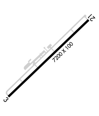
| Lat: N 3125.1 Long: W 11050.9 Elev: 3955 Var: -12 Longest Runway: 7200 | ||
| AWOS: 121.12 CTAF: 122.8 | ||
| ||||||||||||||||||||||||||||||||||||||||||||
| ||||||||||||||||||||||||||||||||||||||||||||
| ||||||||||||||||||||||||||||||||||||||||||||
| Rwy | Rwy | |||||||
| 7200x100 | 7200' | 7200x100 | 6301' | |||||
| Runway ID | Single Wheel | Double Wheel | Double Tandem Wheel | Dual Double Wheel |
| 03/21 | 21,000 | N/A | N/A | N/A |
| H1 | 22,000 | N/A | N/A | N/A |
| These numbers are Advisory and are not limits. The Airport Manager should have more accurate Weight Limits | ||||
 Airport Diagram might not be current. | |
| Facility Name: | NOGALES INTL |
| City Name: | NOGALES |
| County: | SANTA CRUZ |
| State abbrev: | AZ |
| State Name: | ARIZONA |
| Ownership: | PUBLICLY OWNED |
| Use: | OPEN TO THE PUBLIC |
| Owner's Name: | SANTA CRUZ COUNTY |
| Address: | COUNTY COURTHOUSE |
| NOGALES, AZ 85621 | |
| Owner's Phone: | 520-375-7930 |
| Manager's Name: | MARY DAHL; CELL (520) 604-0396. |
| Address: | 275 RIO RICO DRIVE |
| RIO RICO, AZ 85648 | |
| Phone: | 520-841-0111 |
| FAA Region: | WESTERN-PACIFIC |
| FAA Field Office: | PHX |
| Date | Sunrise | Sunset |
|---|---|---|
| 09/24/21 Friday | 6:13 | 18:18 |
| 09/25/21 Saturday | 6:13 | 18:16 |
| 09/26/21 Sunday | 6:14 | 18:15 |
| 09/27/21 Monday | 6:15 | 18:14 |
| 09/28/21 Tuesday | 6:15 | 18:12 |
| 09/29/21 Wednesday | 6:16 | 18:11 |
| 09/30/21 Thursday | 6:16 | 18:10 |
| 10/01/21 Friday | 6:17 | 18:09 |
| 10/02/21 Saturday | 6:18 | 18:07 |
| 10/03/21 Sunday | 6:18 | 18:06 |
| 10/04/21 Monday | 6:19 | 18:05 |
| 10/05/21 Tuesday | 6:20 | 18:04 |
| 10/06/21 Wednesday | 6:20 | 18:02 |
| 10/07/21 Thursday | 6:21 | 18:01 |
| Airport Attendance Schedule | 7 Days A Week 0700-1900 |
| Airport Status | OPERATIONAL (This Status can change at any time - please check NOTAMS) |
| Airport Lighting Schedule | ACTVT MIRL RWY 03/21 - CTAF. |
| Airport Storage Available | Tie Downs, Hanger |
| Extra Services Available | Charter, Flight Instruction, Aircraft Rental, Aircraft Sales |
| Wind Indicator | YES - (lighted) |
| Control Tower | NO |
| CTAF Frequency | 122.800 |
| Unicom Frequency | 122.800 |
| Rotating Beacon Color | CLEAR-GREEN (Light Land Airport) |
| Segmented Circle | YES |
| Landing Fee | NO |
| Airport Inspected | STATE - performed by PRIVATE CONTRACT PERSONNEL |
| Inspection Date | 03/29/2020 |
| Type of Fuel Available | Grade 100LL, JET A (freeze point -40C) |
| Airframe Repair Service | MAJOR |
| Power Plant Repair Service | MAJOR |
| Latitude | N3125.1 |
| Longitude | W11050.9 (ESTIMATED) |
| Arpt Elevation | 3955ft (SURVEYED) |
| Magnetic Variation | 12E |
| 7 miles NE | of NOGALES |
| Traffic Pattern Altitude | |
| Sectional Chart | PHOENIX |
| Operations (Reported) | Yearly | Avg. Daily |
|---|---|---|
| General Aviation Transient | 11000 | 30 |
| General Aviation Local | 30000 | 82 |
| Air Taxi | 1750 | 5 |
| Commerical | 0 | 0 |
| Commuter | 0 | 0 |
| Military | 4100 | 11 |
| Aircraft based on Field | |
|---|---|
| General Aviation Singles | 9 |
| General Aviation Multi | 6 |
| Jet Aircraft | 0 |
| General Aviation Helicopters | 0 |
| Military Aircraft | 0 |
| Gliders | 0 |
| Ultralights | 0 |
| FSS on field | NO |
| FSS tie-in | PRESCOTT |
| FSS Phone | 1-800-WX-BRIEF |
| Who issues Notams | OLS |
| Notam D service at airport | YES |
| ARTCC Name | ALBUQUERQUE |
| Airport Certification | |
| Aircraft Rescue & Firefighting Index | None |
| Airport of Entry | YES |
| Custom Landing Rights | YES |
| Joint Civil/Military | No |
| Military Landing rights | YES |
| NATIONAL PLAN OF INTEGRATED AIRPORT SYSTEMS (NPIAS) |
| GRANT AGREEMENTS UNDER FAAP/ADAP/AIP |
| ASSURANCES PURSUANT TO TITLE VI, CIVIL RIGHTS ACT OF 1964 |
| RWY 21 DESIGNATED CALM WIND RWY. |
| CALL PRESCOTT RADIO ON 122.4 TO CLOSE ALL FLIGHT PLANS. |
| RWY 03 CLSD TO TGL. |
| STRAIGHT-IN APPROACHES NOT RECOMMENDED. |
| WILDLIFE ON OR INVOF ARPT. |
| FOR CD CTC TUCSON APCH AT 520-829-6121. |
| RWY 03/2 1 GWT S-21 FOR CNTR 90 FT, REMAINDER OF RWY WIDTH IS S-7. |
Airport Communications & Frequencies:
| ||||||||||||||
| Runway: 03 | Runway: 21 | ||
| Mag heading: | 34° | Mag heading: | 214° |
| Rwy Slope: | 1.61% Up | Rwy Slope: | -1.61% Down |
| Approach: | Approach: | ||
| Pattern: | Left Traffic | Pattern: | Left Traffic |
| Markings: | NONPRECISION INSTRUMENT | Markings: | NONPRECISION INSTRUMENT |
| Marking Condition: | POOR; RWY 03 NUMBERS & CNTRLN FADED. | Marking Condition: | GOOD; RWY 21 NUMBERS AND CENTERLINE FADED. |
| Arresting Dev: | Arresting Dev: | ||
| Lat & Long: | N3124.7 W11051.4 | Lat. & Long.: | N3125.5 W11050.4 |
| Elev: | 3838.9 ft. MSL | Elev: | 3955.1 ft. MSL |
| TCH: | 68 ft. AGL | TCH: | 17 ft. AGL |
| Visual Glide Path: | 3.00 degrees | Visual Glide Path: | 4.00 degrees |
| Displaced Threshold: | No | Displaced Threshold: | 899 feet |
| Touchdown Zone: | YES | Touchdown Zone: | YES |
| Touchdown Elev.: | 3884.4 feet | Touchdown Elev.: | 3940.8 feet |
| Visual Glide Slope: | 4-Light PAPI on LEFT side of Runway; RWY 03 PAPI OTS INDEF. | Visual Glide Slope: | 4-Light PAPI on LEFT side of Runway |
| RVR Equipment: | RVR Equipment: | ||
| RVV Equipment: | NO | RVV Equipment: | NO |
| Approach Lights: | Approach Lights: | ||
| REIL: | NO | REIL: | NO |
| Centerline Lights: | NO | Centerline Lights: | NO |
| Touchdown lights: | NO | Touchdown lights: | NO |
| Runway Category: | Runway with a Visual Approach | Runway Category: | Runway with a Visual Approach |
| Declared Distances: | Declared Distances: | ||
| Obstructions: | BRUSH | Obstructions: | |
| Marked: | NOT Marked/Lighted | Marked: | |
| Clearance slope: | 2:1 | Clearance slope: | 20:1; APCH SLOPE 6:1 TO DISPL THLD DUE TO 5 FT BRUSH 30 FT FROM DISPL THLD, 110 FT LEFT OF CENTERLINE. |
| Obstruction height: | 4 feet AGL | Obstruction height: | |
| Dist. from runway: | 210 feet | Dist. from runway: | |
| Centerline offset: | 30 right of centerline | Centerline offset: | |
| Comments: | RWY 03 +8 FT BRUSH 0-200 FT FM END OF RWY, 30-125 FT LEFT AND RIGHT OF CNTRLN. | Comments: | RWY 21 +4 FT BRUSH 50-200 FT FROM THLD, 30-125 FT LEFT OF CENTERLINE. |
Thanks for using FltPlan.com
all rights reserved © 1999-2021 by Flight Plan LLC
