
| LT WARREN EATON NORWICH NY |
| |
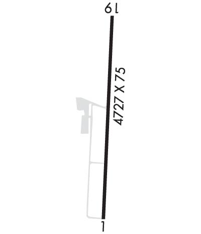
| Lat: N 4234.0 Long: W 07531.4 Elev: 1024 Var: +11 Longest Runway: 4727 | ||
| AWOS: 119.02 CTAF: 122.8 | ||
| ||||||||||||||||||||||||||||||||||||||||||||
| ||||||||||||||||||||||||||||||||||||||||||||
| ||||||||||||||||||||||||||||||||||||||||||||
| Rwy | Rwy | |||||||
| 4727x75 | 4452' | 4727x75 | 4394' | |||||
| Runway ID | Single Wheel | Double Wheel | Double Tandem Wheel | Dual Double Wheel |
| 01/19 | 48,500 | 68,000 | N/A | N/A |
| These numbers are Advisory and are not limits. The Airport Manager should have more accurate Weight Limits | ||||
 Airport Diagram might not be current. | |
| Facility Name: | LT WARREN EATON |
| City Name: | NORWICH |
| County: | CHENANGO |
| State abbrev: | NY |
| State Name: | NEW YORK |
| Ownership: | PUBLICLY OWNED |
| Use: | OPEN TO THE PUBLIC |
| Owner's Name: | CHENANGO COUNTY |
| Address: | 5 COURT ST. |
| NORWICH, NY 13815 | |
| Owner's Phone: | 607-337-1498 |
| Manager's Name: | SHANE H. BUTLER |
| Address: | 6390 STATE HWY 12 |
| NORWICH, NY 13815 | |
| Phone: | 607-334-9430 |
| FAA Region: | EASTERN |
| FAA Field Office: | NYC |
| Date | Sunrise | Sunset |
|---|---|---|
| 09/24/21 Friday | 6:51 | 18:56 |
| 09/25/21 Saturday | 6:52 | 18:55 |
| 09/26/21 Sunday | 6:53 | 18:53 |
| 09/27/21 Monday | 6:55 | 18:51 |
| 09/28/21 Tuesday | 6:56 | 18:49 |
| 09/29/21 Wednesday | 6:57 | 18:47 |
| 09/30/21 Thursday | 6:58 | 18:46 |
| 10/01/21 Friday | 6:59 | 18:44 |
| 10/02/21 Saturday | 7:00 | 18:42 |
| 10/03/21 Sunday | 7:01 | 18:40 |
| 10/04/21 Monday | 7:02 | 18:39 |
| 10/05/21 Tuesday | 7:03 | 18:37 |
| 10/06/21 Wednesday | 7:05 | 18:35 |
| 10/07/21 Thursday | 7:06 | 18:34 |
| Airport Attendance Schedule | MON-FRI 0700-1500; UNATNDD CHRISTMAS. |
| Airport Status | OPERATIONAL (This Status can change at any time - please check NOTAMS) |
| Airport Lighting Schedule | ACTVT REIL RWY 19; PAPI RWY 01 & 19; HIRL RWY 01/19 - CTAF. |
| Airport Storage Available | Tie Downs, Hanger |
| Extra Services Available | Air Ambulance |
| Wind Indicator | YES - (lighted) |
| Control Tower | NO |
| CTAF Frequency | 122.800 |
| Unicom Frequency | 122.800 |
| Rotating Beacon Color | CLEAR-GREEN (Light Land Airport) |
| Segmented Circle | YES |
| Landing Fee | NO; OVNGT TIE-DOWN FEE; FEE WAIVED WITH FUEL PURCHASE. |
| Airport Inspected | STATE - performed by STATE AERONAUTICAL PERSONNEL |
| Inspection Date | 09/03/2020 |
| Type of Fuel Available | Grade 100LL, JET A (freeze point -40C), JET A; -10SELF-SVC FUEL AVBL 24/7 WITH CREDIT CARD. |
| Airframe Repair Service | NONE |
| Power Plant Repair Service | NONE |
| Latitude | N4234.0 |
| Longitude | W07531.4 (ESTIMATED) |
| Arpt Elevation | 1024ft (SURVEYED) |
| Magnetic Variation | 11W |
| 2 miles N | of NORWICH |
| Traffic Pattern Altitude | |
| Sectional Chart | NEW YORK |
| Operations (Reported) | Yearly | Avg. Daily |
|---|---|---|
| General Aviation Transient | 4500 | 12 |
| General Aviation Local | 9500 | 26 |
| Air Taxi | 3200 | 9 |
| Commerical | 0 | 0 |
| Commuter | 0 | 0 |
| Military | 100 | 0 |
| Aircraft based on Field | |
|---|---|
| General Aviation Singles | 14 |
| General Aviation Multi | 1 |
| Jet Aircraft | 0 |
| General Aviation Helicopters | 0 |
| Military Aircraft | 0 |
| Gliders | 0 |
| Ultralights | 0 |
| FSS on field | NO |
| FSS tie-in | BUFFALO |
| FSS Phone | 1-800-WX-BRIEF |
| Who issues Notams | OIC |
| Notam D service at airport | YES |
| ARTCC Name | BOSTON |
| Airport Certification | |
| Aircraft Rescue & Firefighting Index | None |
| Airport of Entry | No |
| Custom Landing Rights | No |
| Joint Civil/Military | No |
| Military Landing rights | YES |
| NATIONAL PLAN OF INTEGRATED AIRPORT SYSTEMS (NPIAS) |
| GRANT AGREEMENTS UNDER FAAP/ADAP/AIP |
| ASSURANCES PURSUANT TO TITLE VI, CIVIL RIGHTS ACT OF 1964 |
| NUMEROUS MTNS PIERCE CONICAL SFC AROUND ARPT. |
| RY 19 HAS 15 FT DROPOFF 30 FT FM THLD ON WEST SIDE. |
| RY SAFETY AREAS HAVE DEPRESSIONS IN SFC. |
| GEESE & DEER ON & INVOF ARPT. |
| FOR CD CTC BOSTON ARTCC AT 603-879-6859. |
Airport Communications & Frequencies:
| |||||||||
| Runway: 01 | Runway: 19 | ||
| Mag heading: | 14° | Mag heading: | 194° |
| Rwy Slope: | .32% Up | Rwy Slope: | -.32% Down |
| Approach: | Approach: | ||
| Pattern: | Left Traffic | Pattern: | Left Traffic |
| Markings: | NONPRECISION INSTRUMENT | Markings: | NONPRECISION INSTRUMENT |
| Marking Condition: | GOOD | Marking Condition: | FAIR |
| Arresting Dev: | Arresting Dev: | ||
| Lat & Long: | N4233.6 W07531.5 | Lat. & Long.: | N4234.4 W07531.4 |
| Elev: | 1009.0 ft. MSL | Elev: | 1024.2 ft. MSL |
| TCH: | 34 ft. AGL | TCH: | 50 ft. AGL |
| Visual Glide Path: | 4.00 degrees | Visual Glide Path: | 3.75 degrees |
| Displaced Threshold: | 275 feet | Displaced Threshold: | 333 feet |
| Touchdown Zone: | YES | Touchdown Zone: | YES |
| Touchdown Elev.: | 1022.8 feet | Touchdown Elev.: | 1023.7 feet |
| Visual Glide Slope: | 2-Light PAPI on LEFT side of Runway; UNUSBL BYD 4 DEGS LEFT OF CNTRLN. | Visual Glide Slope: | 2-Light PAPI on LEFT side of Runway; UNUSBL BYD 3 NM AND BYD 4 DEGS LEFT OF CNTRLN. |
| RVR Equipment: | RVR Equipment: | ||
| RVV Equipment: | NO | RVV Equipment: | NO |
| Approach Lights: | Approach Lights: | ||
| REIL: | NO | REIL: | YES |
| Centerline Lights: | NO | Centerline Lights: | NO |
| Touchdown lights: | NO | Touchdown lights: | NO |
| Runway Category: | Runway with a Non-precision Approach having visibility minimums greater than 3/4 mile | Runway Category: | Runway with a Non-precision Approach having visibility minimums greater than 3/4 mile |
| Declared Distances: | TORA:4727' TODA:4727' ASDA:4394' LDA:4119' | Declared Distances: | TORA:4727' TODA:4727' ASDA:4452' LDA:4119' |
| Obstructions: | TREES | Obstructions: | ROAD |
| Marked: | NOT Marked/Lighted | Marked: | NOT Marked/Lighted |
| Clearance slope: | 13:1; RWY 01 6:1 CLOSE IN SLP TO DTHR +45 FT TREE 11 FT FM RWY END 216 FT RIGHT. | Clearance slope: | 4:1; RWY 19 - 50:1 SLP TO DTHR. |
| Obstruction height: | 21 feet AGL | Obstruction height: | 3 feet AGL |
| Dist. from runway: | 488 feet | Dist. from runway: | 213 feet |
| Centerline offset: | 60 right of centerline | Centerline offset: | 185 feet left of centerline |
| Comments: | RWY 01 46 FT TREES, 0-200 FT FM RWY END, 222 FT RIGHT OF CNTRLN. | Comments: | RWY 19 +6 FT TREE 154 FT FM RWY END 75 FT RIGHT. |
Thanks for using FltPlan.com
all rights reserved © 1999-2021 by Flight Plan LLC