
| LAVERNE MUNI LAVERNE OK |
| |
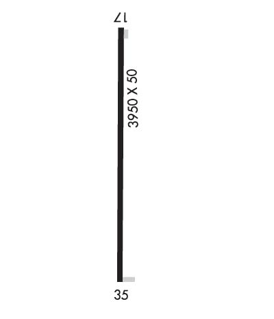
| Lat: N 3644.7 Long: W 09954.5 Elev: 2112 Var: -08 Longest Runway: 3950 | ||
| CTAF: 122.9 | ||
| ||||||||||||||||||||||||||||||||
| ||||||||||||||||||||||||||||||||
| Rwy | Rwy | |||||||
| 3950x50 | 3806' | 3950x50 | 3597' | |||||
| Runway ID | Single Wheel | Double Wheel | Double Tandem Wheel | Dual Double Wheel |
| These numbers are Advisory and are not limits. The Airport Manager should have more accurate Weight Limits | ||||
| FltPlan does not have IFR approach charts available for KO51. |
 Airport Diagram might not be current. | |
| Facility Name: | LAVERNE MUNI |
| City Name: | LAVERNE |
| County: | HARPER |
| State abbrev: | OK |
| State Name: | OKLAHOMA |
| Ownership: | PUBLICLY OWNED |
| Use: | OPEN TO THE PUBLIC |
| Owner's Name: | CITY OF LAVERNE |
| Address: | P.O. BOX 430 |
| LAVERNE, OK 73848 | |
| Owner's Phone: | 580-921-5121 |
| Manager's Name: | JEFF HOWARD; TOWN SUPERINTENDENT |
| Address: | 7TH & OKLAHOMA AVE., SUITE #6, SUITE #1 |
| LAVERNE, OK 73848 | |
| Phone: | 580-921-5121 |
| FAA Region: | SOUTHWEST |
| FAA Field Office: | AOK |
| Date | Sunrise | Sunset |
|---|---|---|
| 04/26/18 Thursday | 6:52 | 20:24 |
| 04/27/18 Friday | 6:51 | 20:25 |
| 04/28/18 Saturday | 6:49 | 20:25 |
| 04/29/18 Sunday | 6:48 | 20:26 |
| 04/30/18 Monday | 6:47 | 20:27 |
| 05/01/18 Tuesday | 6:46 | 20:28 |
| 05/02/18 Wednesday | 6:45 | 20:29 |
| 05/03/18 Thursday | 6:44 | 20:30 |
| 05/04/18 Friday | 6:43 | 20:31 |
| 05/05/18 Saturday | 6:42 | 20:32 |
| 05/06/18 Sunday | 6:41 | 20:32 |
| 05/07/18 Monday | 6:40 | 20:33 |
| 05/08/18 Tuesday | 6:39 | 20:34 |
| 05/09/18 Wednesday | 6:38 | 20:35 |
| Airport Attendance Schedule | UNATTENDED |
| Airport Status | OPERATIONAL (This Status can change at any time - please check NOTAMS) |
| Airport Lighting Schedule | SS-SR |
| Airport Storage Available | NONE |
| Extra Services Available | Crop Dusting |
| Wind Indicator | YES - (unlit) |
| Control Tower | NO |
| CTAF Frequency | 122.900 |
| Unicom Frequency | |
| Rotating Beacon Color | |
| Segmented Circle | NO |
| Landing Fee | NO |
| Airport Inspected | STATE - performed by STATE AERONAUTICAL PERSONNEL |
| Inspection Date | 11/15/2017 |
| Type of Fuel Available | None |
| Airframe Repair Service | NONE |
| Power Plant Repair Service | NONE |
| Latitude | N3644.7 |
| Longitude | W09954.5 (ESTIMATED) |
| Arpt Elevation | 2112ft (ESTIMATED) |
| Magnetic Variation | 08E |
| 3 miles NW | of LAVERNE |
| Traffic Pattern Altitude | |
| Sectional Chart | WICHITA |
| Operations (Reported) | Yearly | Avg. Daily |
|---|---|---|
| General Aviation Transient | 50 | 0 |
| General Aviation Local | 1750 | 5 |
| Air Taxi | 0 | 0 |
| Commerical | 0 | 0 |
| Commuter | 0 | 0 |
| Military | 0 | 0 |
| Aircraft based on Field | |
|---|---|
| General Aviation Singles | 3 |
| General Aviation Multi | 1 |
| Jet Aircraft | 0 |
| General Aviation Helicopters | 1 |
| Military Aircraft | 0 |
| Gliders | 0 |
| Ultralights | 0 |
| FSS on field | NO |
| FSS tie-in | MC ALESTER |
| FSS Phone | 1-800-WX-BRIEF |
| Who issues Notams | MLC |
| Notam D service at airport | YES |
| ARTCC Name | KANSAS CITY |
| Airport Certification | |
| Aircraft Rescue & Firefighting Index | None |
| Airport of Entry | No |
| Custom Landing Rights | No |
| Joint Civil/Military | No |
| Military Landing rights | No |
| RWY 17/3 5 NSTD LIRL. NO THR LGTS. |
| Runway: 17 | Runway: 35 | ||
| Mag heading: | N/A | Mag heading: | N/A |
| Approach: | Approach: | ||
| Pattern: | Left Traffic | Pattern: | Left Traffic |
| Markings: | BASIC | Markings: | BASIC |
| Marking Condition: | GOOD | Marking Condition: | GOOD |
| Arresting Dev: | Arresting Dev: | ||
| Lat & Long: | Lat. & Long.: | ||
| Elev: | N/A | Elev: | N/A |
| TCH: | TCH: | ||
| Visual Glide Path: | Visual Glide Path: | ||
| Displaced Threshold: | 144 feet | Displaced Threshold: | 353 feet |
| Touchdown Zone: | NO | Touchdown Zone: | NO |
| Touchdown Elev.: | Touchdown Elev.: | ||
| Visual Glide Slope: | Visual Glide Slope: | ||
| RVR Equipment: | RVR Equipment: | ||
| RVV Equipment: | NO | RVV Equipment: | NO |
| Approach Lights: | Approach Lights: | ||
| REIL: | NO | REIL: | NO |
| Centerline Lights: | NO | Centerline Lights: | NO |
| Touchdown lights: | NO | Touchdown lights: | NO |
| Runway Category: | Runway with a Visual Approach | Runway Category: | Runway with a Visual Approach |
| Declared Distances: | Declared Distances: | ||
| Obstructions: | Obstructions: | PLINE | |
| Marked: | Marked: | NOT Marked/Lighted | |
| Clearance slope: | 20:1 | Clearance slope: | 8:1; APCH SLOPE 19:1 DUE TO 20 FT POLE 386 FT FROM DISPLACED THRESHOLD AND 150 FT R OF CENTERLINE. |
| Obstruction height: | Obstruction height: | 28 feet AGL | |
| Dist. from runway: | Dist. from runway: | 444 feet | |
| Centerline offset: | Centerline offset: | 161 feet left of centerline | |
| Comments: | 2 FT FENCE 55 FT FM END, 199 FT FM DSPLCD THLD. | Comments: | 15 FT ROAD 78 FT FM RUNWAY END. |
Thanks for using FltPlan.com
all rights reserved © 1999-2018 by Flight Plan LLC
