
| ONEONTA MUNI ONEONTA NY |
| |
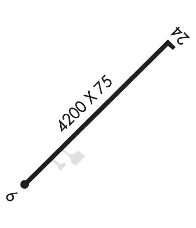
| Lat: N 4231.5 Long: W 07503.9 Elev: 1763 Var: +13 Longest Runway: 4199 | ||
| AWOS: 119.57 CTAF: 122.8 | ||
| ||||||||||||||||||||||||||||||||||||||||||||
| ||||||||||||||||||||||||||||||||||||||||||||
| ||||||||||||||||||||||||||||||||||||||||||||
| Rwy | Rwy | |||||||
| 4199x75 | 4199' | 4199x75 | 4199' | 108.90 - 237° | ||||
| Runway ID | Single Wheel | Double Wheel | Double Tandem Wheel | Dual Double Wheel |
| 06/24 | 12,000 | N/A | N/A | N/A |
| These numbers are Advisory and are not limits. The Airport Manager should have more accurate Weight Limits | ||||
 Airport Diagram might not be current. | |
| Facility Name: | ALBERT S NADER RGNL |
| City Name: | ONEONTA |
| County: | OTSEGO |
| State abbrev: | NY |
| State Name: | NEW YORK |
| Ownership: | PUBLICLY OWNED |
| Use: | OPEN TO THE PUBLIC |
| Owner's Name: | CITY OF ONEONTA |
| Address: | 258 MAIN STREET |
| ONEONTA, NY 13820 | |
| Owner's Phone: | 607-431-1076 |
| Manager's Name: | KERRIANN HARRINGTON |
| Address: | 391 AIRPORT RD |
| ONEONTA, NY 13820 | |
| Phone: | (607) 431-1076 |
| FAA Region: | EASTERN |
| FAA Field Office: | NYC |
| Date | Sunrise | Sunset |
|---|---|---|
| 06/08/26 Monday | 5:23 | 20:36 |
| 06/09/26 Tuesday | 5:23 | 20:36 |
| 06/10/26 Wednesday | 5:23 | 20:37 |
| 06/11/26 Thursday | 5:22 | 20:37 |
| 06/12/26 Friday | 5:22 | 20:38 |
| 06/13/26 Saturday | 5:22 | 20:38 |
| 06/14/26 Sunday | 5:22 | 20:39 |
| 06/15/26 Monday | 5:22 | 20:39 |
| 06/16/26 Tuesday | 5:22 | 20:40 |
| 06/17/26 Wednesday | 5:22 | 20:40 |
| 06/18/26 Thursday | 5:22 | 20:40 |
| 06/19/26 Friday | 5:22 | 20:41 |
| 06/20/26 Saturday | 5:23 | 20:41 |
| 06/21/26 Sunday | 5:23 | 20:41 |
| Airport Attendance Schedule | MON-FRI 0900-1700 |
| Airport Status | OPERATIONAL (This Status can change at any time - please check NOTAMS) |
| Airport Lighting Schedule | ACTVT MALS RWY 24; REIL 06/24; PAPI RWY 24; MIRL RWY 06/24 - CTAF. |
| Airport Storage Available | Tie Downs, Hanger |
| Extra Services Available | Air Ambulance, Cargo Handling, Charter, Flight Instruction, Aircraft Rental |
| Wind Indicator | YES - (lighted) |
| Control Tower | NO |
| CTAF Frequency | 122.800 |
| Unicom Frequency | 122.800 |
| Rotating Beacon Color | WG; BCN TWR PARTIALLY OBSCURED BY TREES. |
| Segmented Circle | YES |
| Landing Fee | YES |
| Airport Inspected | STATE - performed by STATE AERONAUTICAL PERSONNEL |
| Inspection Date | 08/10/2023 |
| Type of Fuel Available | Grade 100LL, JET A (freeze point -40C), JET A |
| Airframe Repair Service | MAJOR |
| Power Plant Repair Service | MAJOR |
| Latitude | N4231.5 |
| Longitude | W07503.9 (ESTIMATED) |
| Arpt Elevation | 1763ft (SURVEYED) |
| Magnetic Variation | 13W |
| 3 miles N | of ONEONTA |
| Traffic Pattern Altitude | |
| Sectional Chart | NEW YORK |
| Operations (Reported) | Yearly | Avg. Daily |
|---|---|---|
| General Aviation Transient | 0 | 0 |
| General Aviation Local | 0 | 0 |
| Air Taxi | 0 | 0 |
| Commerical | 0 | 0 |
| Commuter | 0 | 0 |
| Military | 0 | 0 |
| Aircraft based on Field | |
|---|---|
| General Aviation Singles | 0 |
| General Aviation Multi | 0 |
| Jet Aircraft | 0 |
| General Aviation Helicopters | 0 |
| Military Aircraft | 0 |
| Gliders | 0 |
| Ultralights | 0 |
| FSS on field | NO |
| FSS tie-in | BUFFALO |
| FSS Phone | 1-800-WX-BRIEF |
| Who issues Notams | BUF |
| Notam D service at airport | YES |
| ARTCC Name | BOSTON |
| Airport Certification | |
| Aircraft Rescue & Firefighting Index | None |
| Airport of Entry | No |
| Custom Landing Rights | YES |
| Joint Civil/Military | No |
| Military Landing rights | YES |
| NATIONAL PLAN OF INTEGRATED AIRPORT SYSTEMS (NPIAS) |
| GRANT AGREEMENTS UNDER FAAP/ADAP/AIP |
| ASSURANCES PURSUANT TO TITLE VI, CIVIL RIGHTS ACT OF 1964 |
| THIS AIRPORT HAS BEEN SURVEYED BY THE NATIONAL GEODETIC SURVEY. |
| (E94) SAWRS |
| FOR CD CTC BOSTON ARTCC AT 603-879-6859. |
Airport Communications & Frequencies:
| |||||||||
| Runway: 06 | Runway: 24 | ||
| Mag heading: | 57° | Mag heading: | 237° |
| Rwy Slope: | -.30% Down | Rwy Slope: | .30% Up |
| Approach: | Approach: | LOCALIZER | |
| Pattern: | Left Traffic | Pattern: | Left Traffic |
| Markings: | NONPRECISION INSTRUMENT | Markings: | NONPRECISION INSTRUMENT |
| Marking Condition: | GOOD | Marking Condition: | GOOD |
| Arresting Dev: | Arresting Dev: | ||
| Lat & Long: | N4231.2 W07504.2 | Lat. & Long.: | N4231.7 W07503.5 |
| Elev: | 1762.8 ft. MSL | Elev: | 1750.1 ft. MSL |
| TCH: | TCH: | 51 ft. AGL | |
| Visual Glide Path: | Visual Glide Path: | 3.00 degrees | |
| Displaced Threshold: | No | Displaced Threshold: | No |
| Touchdown Zone: | YES | Touchdown Zone: | YES |
| Touchdown Elev.: | 1763.3 feet | Touchdown Elev.: | 1758.4 feet |
| Visual Glide Slope: | Visual Glide Slope: | 2-Light PAPI on LEFT side of Runway | |
| RVR Equipment: | RVR Equipment: | ||
| RVV Equipment: | NO | RVV Equipment: | NO |
| Approach Lights: | Approach Lights: | MALS - 1,400 foot medium intensity approach lighting system | |
| REIL: | YES | REIL: | YES; RWY 24 REILS OTS |
| Centerline Lights: | NO | Centerline Lights: | NO |
| Touchdown lights: | NO | Touchdown lights: | NO |
| Runway Category: | Runway with a Non-precision Approach | Runway Category: | Runway with a Non-precision Approach |
| Declared Distances: | Declared Distances: | ||
| Obstructions: | TREE | Obstructions: | FENCE |
| Marked: | NOT Marked/Lighted | Marked: | MARKED |
| Clearance slope: | 9:1 | Clearance slope: | 18:1 |
| Obstruction height: | 68 feet AGL | Obstruction height: | 121 feet AGL |
| Dist. from runway: | 818 feet | Dist. from runway: | 2442 feet |
| Centerline offset: | 315 right of centerline | Centerline offset: | 518 feet left of centerline |
| Comments: | 7 FT BERM 150 FT RIGHT AND PARALLEL TO RY 6 PRIMARY SURFACE. | Comments: |
Thanks for using FltPlan.com
all rights reserved © 1999-2026 by Flight Plan LLC
