
| SIDNEY MUNI SIDNEY NY |
| |
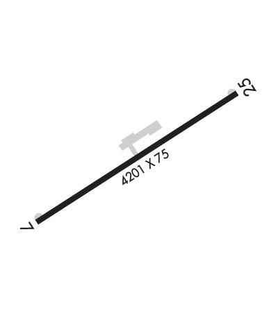
| Lat: N 4218.2 Long: W 07525.0 Elev: 1027 Var: +13 Longest Runway: 4201 | ||
| AWOS: 118.27 CTAF: 122.8 | ||
| ||||||
| ||||||
|
| Rwy | Rwy | |||||||
| 4201x75 | 4201' | 4201x75 | 4201' | |||||
| Runway ID | Single Wheel | Double Wheel | Double Tandem Wheel | Dual Double Wheel |
| 07/25 | 25,000 | 45,000 | N/A | N/A |
| These numbers are Advisory and are not limits. The Airport Manager should have more accurate Weight Limits | ||||
 Airport Diagram might not be current. | |
| Facility Name: | SIDNEY MUNI |
| City Name: | SIDNEY |
| County: | DELAWARE |
| State abbrev: | NY |
| State Name: | NEW YORK |
| Ownership: | PUBLICLY OWNED |
| Use: | OPEN TO THE PUBLIC |
| Owner's Name: | VILLAGE OF SIDNEY |
| Address: | 21 LIBERTY ST. |
| SIDNEY, NY 13838 | |
| Owner's Phone: | 607-561-2324 |
| Manager's Name: | GARY KLINDT, JR. |
| Address: | 199 RIVER ST |
| SIDNEY, NY 13838 | |
| Phone: | 607-561-2346 |
| FAA Region: | EASTERN |
| FAA Field Office: | NYC |
| Date | Sunrise | Sunset |
|---|---|---|
| 09/24/21 Friday | 6:51 | 18:56 |
| 09/25/21 Saturday | 6:52 | 18:54 |
| 09/26/21 Sunday | 6:53 | 18:52 |
| 09/27/21 Monday | 6:54 | 18:51 |
| 09/28/21 Tuesday | 6:55 | 18:49 |
| 09/29/21 Wednesday | 6:56 | 18:47 |
| 09/30/21 Thursday | 6:57 | 18:45 |
| 10/01/21 Friday | 6:58 | 18:44 |
| 10/02/21 Saturday | 7:00 | 18:42 |
| 10/03/21 Sunday | 7:01 | 18:40 |
| 10/04/21 Monday | 7:02 | 18:38 |
| 10/05/21 Tuesday | 7:03 | 18:37 |
| 10/06/21 Wednesday | 7:04 | 18:35 |
| 10/07/21 Thursday | 7:05 | 18:33 |
| Airport Attendance Schedule | 7 Days A Week 0800-1700; FOR ATTENDANT OTHER TIMES CALL 607-561-2346. |
| Airport Status | OPERATIONAL (This Status can change at any time - please check NOTAMS) |
| Airport Lighting Schedule | ACTVT MIRL RY 07/25 & REIL RYS 07 & 25 - CTAF. |
| Airport Storage Available | Tie Downs, Hanger |
| Extra Services Available | Air Freight, Air Ambulance, Cargo Handling, Charter, Flight Instruction, Aircraft Rental, Aircraft Sales |
| Wind Indicator | YES - (lighted) |
| Control Tower | NO |
| CTAF Frequency | 122.800 |
| Unicom Frequency | 122.800 |
| Rotating Beacon Color | CLEAR-GREEN (Light Land Airport) |
| Segmented Circle | YES |
| Landing Fee | NO |
| Airport Inspected | STATE - performed by STATE AERONAUTICAL PERSONNEL |
| Inspection Date | 05/05/2020 |
| Type of Fuel Available | Grade 100LL, JET A (freeze point -40C) |
| Airframe Repair Service | MAJOR |
| Power Plant Repair Service | MAJOR |
| Latitude | N4218.2 |
| Longitude | W07525.0 (ESTIMATED) |
| Arpt Elevation | 1026ft (SURVEYED) |
| Magnetic Variation | 13W |
| 1 miles W | of SIDNEY |
| Traffic Pattern Altitude | |
| Sectional Chart | NEW YORK |
| Operations (Reported) | Yearly | Avg. Daily |
|---|---|---|
| General Aviation Transient | 3000 | 8 |
| General Aviation Local | 4000 | 11 |
| Air Taxi | 800 | 2 |
| Commerical | 0 | 0 |
| Commuter | 0 | 0 |
| Military | 0 | 0 |
| Aircraft based on Field | |
|---|---|
| General Aviation Singles | 18 |
| General Aviation Multi | 2 |
| Jet Aircraft | 1 |
| General Aviation Helicopters | 1 |
| Military Aircraft | 0 |
| Gliders | 0 |
| Ultralights | 0 |
| FSS on field | NO |
| FSS tie-in | BUFFALO |
| FSS Phone | 1-800-WX-BRIEF |
| Who issues Notams | BUF |
| Notam D service at airport | YES |
| ARTCC Name | BOSTON |
| Airport Certification | |
| Aircraft Rescue & Firefighting Index | None |
| Airport of Entry | No |
| Custom Landing Rights | No |
| Joint Civil/Military | No |
| Military Landing rights | YES |
| NATIONAL PLAN OF INTEGRATED AIRPORT SYSTEMS (NPIAS) |
| GRANT AGREEMENTS UNDER FAAP/ADAP/AIP |
| ASSURANCES PURSUANT TO TITLE VI, CIVIL RIGHTS ACT OF 1964 |
| NUMEROUS HILLS SURROUND ARPT UP TO +800 FT ABV ARPT ELEV. |
| HIGH TENSION LINES +1 MI FROM AER 07. |
| AWOS 118.275 |
| FOR CD CTC BOSTON ARTCC AT 603-879-6859. |
| TWO FT HIGH CEMENT FIXTURES IN PRIM SFC IN DITCHES 130 FT W OF RWY. |
| FENCE 7 FT ABV RWY END 325 FT RIGHT OF CNTRLN. |
| COLD TEMPERATURE AIRPORT. ALTITUDE CORRECTION REQUIRED AT OR BELOW -21C. |
Airport Communications & Frequencies:
| |||||||||
| Runway: 07 | Runway: 25 | ||
| Mag heading: | 71° | Mag heading: | 251° |
| Rwy Slope: | -.06% Down | Rwy Slope: | .06% Up |
| Approach: | Approach: | ||
| Pattern: | Left Traffic | Pattern: | Right Traffic |
| Markings: | BASIC | Markings: | NONPRECISION INSTRUMENT |
| Marking Condition: | GOOD | Marking Condition: | GOOD |
| Arresting Dev: | Arresting Dev: | ||
| Lat & Long: | N4218.0 W07525.4 | Lat. & Long.: | N4218.3 W07524.6 |
| Elev: | 1024.7 ft. MSL | Elev: | 1022.1 ft. MSL |
| TCH: | TCH: | 48 ft. AGL | |
| Visual Glide Path: | Visual Glide Path: | 3.66 degrees | |
| Displaced Threshold: | No | Displaced Threshold: | No |
| Touchdown Zone: | YES | Touchdown Zone: | YES |
| Touchdown Elev.: | 1026.9 feet | Touchdown Elev.: | 1026.9 feet |
| Visual Glide Slope: | Visual Glide Slope: | 2-Light PAPI on RIGHT side of Runway | |
| RVR Equipment: | RVR Equipment: | ||
| RVV Equipment: | NO | RVV Equipment: | NO |
| Approach Lights: | Approach Lights: | ||
| REIL: | YES | REIL: | YES |
| Centerline Lights: | NO | Centerline Lights: | NO |
| Touchdown lights: | NO | Touchdown lights: | NO |
| Runway Category: | Runway with a Non-precision Approach having visibility minimums greater than 3/4 mile | Runway Category: | Runway with a Non-precision Approach having visibility minimums greater than 3/4 mile |
| Declared Distances: | Declared Distances: | ||
| Obstructions: | TREE | Obstructions: | TREE; RY 25 NUMEROUS 28-80 FT. TREES, 300 FT. 'R', EXTENDING TO 1500 FT FM THRESHOLD. |
| Marked: | NOT Marked/Lighted | Marked: | NOT Marked/Lighted |
| Clearance slope: | 7:1 | Clearance slope: | 17:1 |
| Obstruction height: | 21 feet AGL | Obstruction height: | 65 feet AGL |
| Dist. from runway: | 348 feet | Dist. from runway: | 1343 feet |
| Centerline offset: | 92 right of centerline | Centerline offset: | 350 feet right of centerline |
| Comments: | 5 FT GND AT 160 FT 'R'; 51 FT TREE 13 FT FM RY END 249 FT 'L'. | Comments: | 11 FT BRUSH, 92 FT FROM THRESHOLD, 122 FT LEFT |
Thanks for using FltPlan.com
all rights reserved © 1999-2021 by Flight Plan LLC