
| LAUREL LAUREL DE |
| |
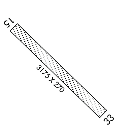
| Lat: N 3832.5 Long: W 07535.7 Elev: 30 Var: +12 Longest Runway: 3175 | ||
| CTAF: 122.8 | ||
| ||||||||||||||||||||||||||||||||
| ||||||||||||||||||||||||||||||||
| Rwy | Rwy | |||||||
| 3175x270 | 3175' | 3175x270 | 2905' | |||||
| Runway ID | Single Wheel | Double Wheel | Double Tandem Wheel | Dual Double Wheel |
| 15/33 | N/A | N/A | N/A | N/A |
| These numbers are Advisory and are not limits. The Airport Manager should have more accurate Weight Limits | ||||
 Airport Diagram might not be current. | |
| Facility Name: | LAUREL |
| City Name: | LAUREL |
| County: | SUSSEX |
| State abbrev: | DE |
| State Name: | DELAWARE |
| Ownership: | PRIVATELY OWNED |
| Use: | OPEN TO THE PUBLIC |
| Owner's Name: | DEST INC; DEST INC. |
| Address: | 106 STUART DRIVE |
| DOVER, DE 19901 | |
| Owner's Phone: | 302-697-6020 |
| Manager's Name: | JEFF CHORMAN |
| Address: | 30475 EAST MILL RUN |
| MILTON, DE 19968 | |
| Phone: | 302-349-5055 |
| FAA Region: | EASTERN |
| FAA Field Office: | HAR |
| Date | Sunrise | Sunset |
|---|---|---|
| 09/24/21 Friday | 6:52 | 18:57 |
| 09/25/21 Saturday | 6:52 | 18:55 |
| 09/26/21 Sunday | 6:53 | 18:53 |
| 09/27/21 Monday | 6:54 | 18:52 |
| 09/28/21 Tuesday | 6:55 | 18:50 |
| 09/29/21 Wednesday | 6:56 | 18:49 |
| 09/30/21 Thursday | 6:57 | 18:47 |
| 10/01/21 Friday | 6:58 | 18:46 |
| 10/02/21 Saturday | 6:59 | 18:44 |
| 10/03/21 Sunday | 7:00 | 18:42 |
| 10/04/21 Monday | 7:01 | 18:41 |
| 10/05/21 Tuesday | 7:02 | 18:39 |
| 10/06/21 Wednesday | 7:03 | 18:38 |
| 10/07/21 Thursday | 7:04 | 18:36 |
| Airport Attendance Schedule | 7 Days A Week 0800-DUSK |
| Airport Status | OPERATIONAL (This Status can change at any time - please check NOTAMS) |
| Airport Lighting Schedule | ACTVT LIRL - CTAF.; ACTVT ROTG BCN - CTAF. |
| Airport Storage Available | Tie Downs, Hanger |
| Extra Services Available | Crop Dusting, Parachute Jumping |
| Wind Indicator | YES - (unlit) |
| Control Tower | NO |
| CTAF Frequency | 122.800 |
| Unicom Frequency | 122.800 |
| Rotating Beacon Color | CLEAR-GREEN (Light Land Airport) |
| Segmented Circle | NO |
| Landing Fee | NO |
| Airport Inspected | STATE - performed by STATE AERONAUTICAL PERSONNEL |
| Inspection Date | 07/14/2020 |
| Type of Fuel Available | None |
| Airframe Repair Service | MAJOR |
| Power Plant Repair Service | MAJOR |
| Latitude | N3832.5 |
| Longitude | W07535.7 (ESTIMATED) |
| Arpt Elevation | 30ft (ESTIMATED) |
| Magnetic Variation | 12W |
| 1 miles SW | of LAUREL |
| Traffic Pattern Altitude | |
| Sectional Chart | WASHINGTON |
| Operations (Reported) | Yearly | Avg. Daily |
|---|---|---|
| General Aviation Transient | 1400 | 4 |
| General Aviation Local | 6100 | 17 |
| Air Taxi | 0 | 0 |
| Commerical | 0 | 0 |
| Commuter | 0 | 0 |
| Military | 0 | 0 |
| Aircraft based on Field | |
|---|---|
| General Aviation Singles | 7 |
| General Aviation Multi | 0 |
| Jet Aircraft | 0 |
| General Aviation Helicopters | 0 |
| Military Aircraft | 0 |
| Gliders | 0 |
| Ultralights | 0 |
| FSS on field | NO |
| FSS tie-in | MILLVILLE |
| FSS Phone | 1-800-WX-BRIEF |
| Who issues Notams | MIV |
| Notam D service at airport | YES |
| ARTCC Name | WASHINGTON |
| Airport Certification | |
| Aircraft Rescue & Firefighting Index | None |
| Airport of Entry | No |
| Custom Landing Rights | No |
| Joint Civil/Military | No |
| Military Landing rights | No |
| FOR CD WHEN NHK APCH IS CLSD CTC POTOMAC APCH AT 866-640-4124. |
| ARPT NO LONGER HOSTS SKYDIVING OPS. |
Airport Communications & Frequencies:
| |||||||||||||||||||||||||
| Runway: 15 | Runway: 33 | ||
| Mag heading: | 148° | Mag heading: | 328° |
| Rwy Slope: | .04% Up | Rwy Slope: | -.04% Down |
| Approach: | Approach: | ||
| Pattern: | Left Traffic | Pattern: | Left Traffic |
| Markings: | Markings: | ||
| Marking Condition: | Marking Condition: | DSPLCD THLD MKD WITH 3 LARGE ORANGE CONES EACH SIDE. | |
| Arresting Dev: | Arresting Dev: | ||
| Lat & Long: | N3832.7 W07535.9 | Lat. & Long.: | N3832.4 W07535.4 |
| Elev: | 28.9 ft. MSL | Elev: | 30.1 ft. MSL |
| TCH: | TCH: | ||
| Visual Glide Path: | Visual Glide Path: | ||
| Displaced Threshold: | No | Displaced Threshold: | 270 feet |
| Touchdown Zone: | YES | Touchdown Zone: | YES |
| Touchdown Elev.: | 28.9 feet | Touchdown Elev.: | 30.1 feet |
| Visual Glide Slope: | Visual Glide Slope: | ||
| RVR Equipment: | RVR Equipment: | ||
| RVV Equipment: | NO | RVV Equipment: | NO |
| Approach Lights: | Approach Lights: | ||
| REIL: | NO | REIL: | NO |
| Centerline Lights: | NO | Centerline Lights: | NO |
| Touchdown lights: | NO | Touchdown lights: | NO |
| Runway Category: | Runway with a Visual Approach | Runway Category: | Runway with a Visual Approach |
| Declared Distances: | Declared Distances: | ||
| Obstructions: | TREES | Obstructions: | TREE |
| Marked: | NOT Marked/Lighted | Marked: | NOT Marked/Lighted |
| Clearance slope: | 2:1 | Clearance slope: | 1:1; RWY 33 APCH SLP 6:1 TO DSPLCD THLD. |
| Obstruction height: | 61 feet AGL | Obstruction height: | 53 feet AGL |
| Dist. from runway: | 140 feet | Dist. from runway: | 10 feet |
| Centerline offset: | 60 right of centerline | Centerline offset: | 167 feet right of centerline |
| Comments: | Comments: |
Thanks for using FltPlan.com
all rights reserved © 1999-2021 by Flight Plan LLC
