
| SELFRIDGE ANGB (PRIVATE) MOUNT CLEMENS MI |
| |
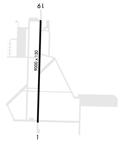
| Lat: N 4236.8 Long: W 08250.2 Elev: 580 Var: +06 Longest Runway: 9000 | ||
| Clr Del: 128.3 Dept. ATIS: 125.32 Arr. ATIS: 125.32 Ground: 128.3 Tower: 120.15 | ||
| ||||||
| ||||||
|
| Rwy | Rwy | |||||||
| 9000x150 | 9000' | 110.10 - 007° | 9000x150 | 9000' | 110.10 - 187° | |||
| Runway ID | Single Wheel | Double Wheel | Double Tandem Wheel | Dual Double Wheel |
| 01/19 | N/A | N/A | N/A | N/A |
| These numbers are Advisory and are not limits. The Airport Manager should have more accurate Weight Limits | ||||
 Airport Diagram might not be current. | |
| Facility Name: | SELFRIDGE ANGB |
| City Name: | MOUNT CLEMENS |
| County: | MACOMB |
| State abbrev: | MI |
| State Name: | MICHIGAN |
| Ownership: | AIR FORCE OWNED |
| Use: | PRIVATE |
| Owner's Name: | USAF |
| Address: | MI ANG, SELFRIDGE ANGB |
| MT CLEMENS, MI 48045 | |
| Owner's Phone: | 586-239-5322 |
| Manager's Name: | CHIEF OF AFLD MANAGEMENT |
| Address: | MI ANG, SELFRIDGE ANGB |
| MT CLEMENS, MI 48045 | |
| Phone: | 586-239-4115 |
| FAA Region: | GREAT LAKES |
| FAA Field Office: | DET |
| Date | Sunrise | Sunset |
|---|---|---|
| 09/24/21 Friday | 7:21 | 19:26 |
| 09/25/21 Saturday | 7:22 | 19:24 |
| 09/26/21 Sunday | 7:23 | 19:22 |
| 09/27/21 Monday | 7:24 | 19:20 |
| 09/28/21 Tuesday | 7:25 | 19:18 |
| 09/29/21 Wednesday | 7:26 | 19:17 |
| 09/30/21 Thursday | 7:27 | 19:15 |
| 10/01/21 Friday | 7:28 | 19:13 |
| 10/02/21 Saturday | 7:29 | 19:11 |
| 10/03/21 Sunday | 7:30 | 19:10 |
| 10/04/21 Monday | 7:32 | 19:08 |
| 10/05/21 Tuesday | 7:33 | 19:06 |
| 10/06/21 Wednesday | 7:34 | 19:04 |
| 10/07/21 Thursday | 7:35 | 19:03 |
| Airport Attendance Schedule | 7 Days A Week 1230-0400Z++; EXC HOL, OT UNCTL FOR DHS, ARNG, USCG OR EMEGENCY OPS. |
| Airport Status | OPERATIONAL (This Status can change at any time - please check NOTAMS) |
| Airport Lighting Schedule | ACTVT HIRL, REIL, PAPI RY 01/19, SALS RY 01, ALSF RY 19 - 120.15. |
| Airport Storage Available | Hanger |
| Extra Services Available | Cargo Handling |
| Wind Indicator | YES - (unlit) |
| Control Tower | YES |
| CTAF Frequency | |
| Unicom Frequency | |
| Rotating Beacon Color | CLEAR-GREEN (Light Land Airport) |
| Segmented Circle | NO |
| Landing Fee |
| Airport Inspected | No Inspection Data Available performed by the OWNER |
| Inspection Date | Unknown |
| Type of Fuel Available | JET B (wide-cut turbine fuel, icing inhibitor, freeze point -50C) |
| Airframe Repair Service | MAJOR |
| Power Plant Repair Service | MAJOR |
| Latitude | N4236.8 |
| Longitude | W08250.2 (ESTIMATED) |
| Arpt Elevation | 579ft (SURVEYED) |
| Magnetic Variation | 06W |
| 2 miles NE | of MOUNT CLEMENS |
| Traffic Pattern Altitude | OVERHEAD TFC PAT 2500'. TRANS VFR JET ACFT NOT AUTH RECT TFC PAT. |
| Sectional Chart | DETROIT |
| Operations (Reported) | Yearly | Avg. Daily |
|---|---|---|
| General Aviation Transient | 0 | 0 |
| General Aviation Local | 0 | 0 |
| Air Taxi | 0 | 0 |
| Commerical | 0 | 0 |
| Commuter | 0 | 0 |
| Military | 37200 | 102 |
| Aircraft based on Field | |
|---|---|
| General Aviation Singles | 0 |
| General Aviation Multi | 0 |
| Jet Aircraft | 0 |
| General Aviation Helicopters | 0 |
| Military Aircraft | 1 |
| Gliders | 0 |
| Ultralights | 0 |
| FSS on field | NO |
| FSS tie-in | LANSING |
| FSS Phone | 1-800-WX-BRIEF |
| Who issues Notams | MTC |
| Notam D service at airport | YES |
| ARTCC Name | CLEVELAND |
| Airport Certification | |
| Aircraft Rescue & Firefighting Index | None |
| Airport of Entry | No |
| Custom Landing Rights | No |
| Joint Civil/Military | No |
| Military Landing rights | No |
| WX BRIEFING AVBL 1115-0315Z++, 1115-2015Z++ HOLS. |
| SNOW REMOVAL 1215-2100Z++ MON THRU FRI. |
| A++ FUEL AVBL 1200-0300Z++ MON-FRI 1430-2100Z++ SAT-SUN, CLSD HOL. |
| FLUID: SP PRESAIR LPOX LOX HPOX. |
| OIL; O-128-133-148 (SOAP 1215-2115++ MON FRI, OT DSN 273-5777.) |
| TRAN ALERT; OPR 1230-0130Z++. TRAN ALERT & FUELS CLSD HOL. |
| NOISE ABTMT; SEE FLIP AP/1 ARPT |
| MISC; VIP ACFT CTC PTS 30 MIN PRIOR TO ARR WITH FIRM CHOCK TIME. BASE OPS DSN 273-5322, C586-239-5322, FAX DSN273-5814, C586-239-5814, NOTAM DSN 273-4069 C586-239-4069. |
| MISC; SNOW REMOVAL ACCOMPLISHED 1215-2100Z++ WKD. |
| MISC; TRAN ACFT REQ USE OF SELFRIDGE ANGB DROP ZONE (DZS). |
| MISC: STD USAF RSRS APPLIED. CLASS D AIRSPACE CONT. |
| MISC; RY 01-19 TRANSVERSELY GROOVED. RY 01-19 S 1500' CONCRETE, CNTR 5700' ASPHALT, N 1800' CONCRETE. RY 01-19 S OVRN HARDENED MAY BE USED FOR TKOF , DAY VFR ONLY. |
| BEARING STRENGTH; RY 01-19; ST 175. |
| CAUTION: MODERATE BIRD ACT COMMON. |
| PPR ALL ACFT, DSN 273-5322/4402. |
| HAZ CARGO PAD CAN ACCOM C-130, DAY ONLY & LTD C-17 USE. NO TIE DOWN, NOR LONG TERM PARKING ON PAD. |
| CAUTION: RWYCC NOT RPT. |
| FIGHTER RECTANGULAR & CLSD TRAFFIC PATTERN IS 2200 FT; ALL OTHERS TPS 1700 FT. JASU 1(M32A-60); 1(A/M32-86D) 1(MC-11). |
| RWY 01/1 9 500' ASPHALT OVERRUN EACH END RWY 01-19. |
| RWY 01/1 9 S 1500 FT CONC, CNTR 5700 FT ASPH, N 1800 FT CON. |
Airport Communications & Frequencies:
| |||||||||||||||||||||||||||||||||||||||||
| Runway: 01 | Runway: 19 | ||
| Mag heading: | 8° | Mag heading: | 188° |
| Rwy Slope: | -.01% Down | Rwy Slope: | .01% Up |
| Approach: | LOC/GS | Approach: | ILS |
| Pattern: | Right Traffic | Pattern: | Right Traffic |
| Markings: | PRECISION INSTRUMENT | Markings: | PRECISION INSTRUMENT |
| Marking Condition: | GOOD | Marking Condition: | GOOD |
| Arresting Dev: | Arresting Dev: | ||
| Lat & Long: | N4236.1 W08250.2 | Lat. & Long.: | N4237.6 W08250.2 |
| Elev: | 579.4 ft. MSL | Elev: | 578.8 ft. MSL |
| TCH: | 52 ft. AGL | TCH: | 51 ft. AGL |
| Visual Glide Path: | 3.00 degrees | Visual Glide Path: | 3.00 degrees |
| Displaced Threshold: | No | Displaced Threshold: | No |
| Touchdown Zone: | YES | Touchdown Zone: | YES |
| Touchdown Elev.: | 579.5 feet | Touchdown Elev.: | 578.9 feet |
| Visual Glide Slope: | 4-Light PAPI on LEFT side of Runway | Visual Glide Slope: | 4-Light PAPI on LEFT side of Runway |
| RVR Equipment: | TOUCHDOWN | RVR Equipment: | TOUCHDOWN |
| RVV Equipment: | NO | RVV Equipment: | NO |
| Approach Lights: | SALS | Approach Lights: | ALSF1 - standard 2,400 foot high intensity approach lighting system with sequenced flashers, Category I |
| REIL: | YES | REIL: | YES |
| Centerline Lights: | NO | Centerline Lights: | NO |
| Touchdown lights: | NO | Touchdown lights: | NO |
| Runway Category: | Runway Category: | ||
| Declared Distances: | Declared Distances: |
Thanks for using FltPlan.com
all rights reserved © 1999-2021 by Flight Plan LLC
