
| MALAD CITY MALAD CITY ID |
| |
| Lat: N 4210.2 Long: W 11217.6 Elev: 4503 Var: -15 Longest Runway: 4946 | ||
| CTAF: 122.9 | ||
| ||||||
|
| Rwy | Rwy | |||||||
| 3918x75 | 3918' | 3918x75 | 3918' | |||||
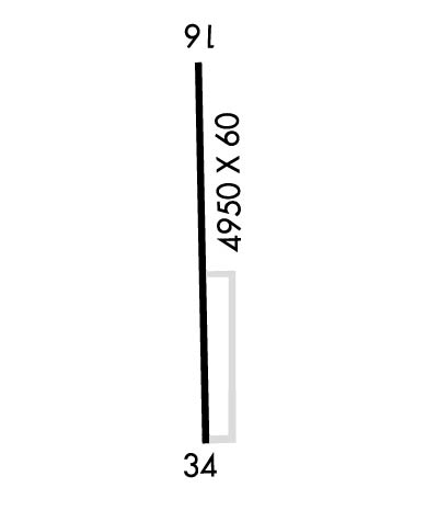
| 4946x60 | 4946' | 4946x60 | 4946' | |||||
| Runway ID | Single Wheel | Double Wheel | Double Tandem Wheel | Dual Double Wheel |
| 08/26 | N/A | N/A | N/A | N/A |
| 17/35 | N/A | N/A | N/A | N/A |
| These numbers are Advisory and are not limits. The Airport Manager should have more accurate Weight Limits | ||||
| FltPlan does not have IFR approach charts available for KMLD. |
 Airport Diagram might not be current. | |
| Facility Name: | MALAD CITY |
| City Name: | MALAD CITY |
| County: | ONEIDA |
| State abbrev: | ID |
| State Name: | IDAHO |
| Ownership: | PUBLICLY OWNED |
| Use: | OPEN TO THE PUBLIC |
| Owner's Name: | ONEIDA COUNTY |
| Address: | 10 COURT ST |
| MALAD CITY, ID 83252 | |
| Owner's Phone: | 208-766-4116 |
| Manager's Name: | CHASE ALBRETSEN; ROXANNE@HESSPUMICE.COM |
| Address: | 368 N MAIN ST |
| MALAD CITY, ID 83252 | |
| Phone: | 208-604-3680 |
| FAA Region: | NORTHWEST MOUNTAIN |
| FAA Field Office: | HLN |
| Date | Sunrise | Sunset |
|---|---|---|
| 06/08/26 Monday | 5:53 | 21:04 |
| 06/09/26 Tuesday | 5:53 | 21:04 |
| 06/10/26 Wednesday | 5:53 | 21:05 |
| 06/11/26 Thursday | 5:53 | 21:05 |
| 06/12/26 Friday | 5:52 | 21:06 |
| 06/13/26 Saturday | 5:52 | 21:06 |
| 06/14/26 Sunday | 5:52 | 21:07 |
| 06/15/26 Monday | 5:52 | 21:07 |
| 06/16/26 Tuesday | 5:52 | 21:07 |
| 06/17/26 Wednesday | 5:52 | 21:08 |
| 06/18/26 Thursday | 5:53 | 21:08 |
| 06/19/26 Friday | 5:53 | 21:08 |
| 06/20/26 Saturday | 5:53 | 21:09 |
| 06/21/26 Sunday | 5:53 | 21:09 |
| Airport Attendance Schedule | UNATTENDED |
| Airport Status | OPERATIONAL (This Status can change at any time - please check NOTAMS) |
| Airport Lighting Schedule | ACTVT MIRL RWY 17/35 - CTAF. |
| Airport Storage Available | Tie Downs |
| Extra Services Available | NONE |
| Wind Indicator | YES - (lighted) |
| Control Tower | NO |
| CTAF Frequency | 122.900 |
| Unicom Frequency | |
| Rotating Beacon Color | WG |
| Segmented Circle | YES |
| Landing Fee | NO |
| Airport Inspected | STATE - performed by STATE AERONAUTICAL PERSONNEL |
| Inspection Date | 04/24/2025 |
| Type of Fuel Available | Grade 100LL; -10FOR FUEL CALL 208-221-9031. GAS PUMP IS CREDIT CARD OPR. |
| Airframe Repair Service | NONE |
| Power Plant Repair Service | NONE |
| Latitude | N4210.2 |
| Longitude | W11217.6 (ESTIMATED) |
| Arpt Elevation | 4503ft (ESTIMATED) |
| Magnetic Variation | 15E |
| 3 miles SW | of MALAD CITY |
| Traffic Pattern Altitude | |
| Sectional Chart | SALT LAKE CITY |
| Operations (Reported) | Yearly | Avg. Daily |
|---|---|---|
| General Aviation Transient | 0 | 0 |
| General Aviation Local | 0 | 0 |
| Air Taxi | 0 | 0 |
| Commerical | 0 | 0 |
| Commuter | 0 | 0 |
| Military | 0 | 0 |
| Aircraft based on Field | |
|---|---|
| General Aviation Singles | 0 |
| General Aviation Multi | 0 |
| Jet Aircraft | 0 |
| General Aviation Helicopters | 0 |
| Military Aircraft | 0 |
| Gliders | 0 |
| Ultralights | 0 |
| FSS on field | NO |
| FSS tie-in | BOISE |
| FSS Phone | 1-800-WX-BRIEF |
| Who issues Notams | MLD |
| Notam D service at airport | YES |
| ARTCC Name | SALT LAKE CITY |
| Airport Certification | |
| Aircraft Rescue & Firefighting Index | None |
| Airport of Entry | No |
| Custom Landing Rights | No |
| Joint Civil/Military | No |
| Military Landing rights | No |
| REFLECTORS ON TWY AND RAMP. |
| FOR CD IF UNA TO CTC ON FSS FREQ, CTC SALT LAKE ARTCC AT 801-320-2568. |
| RWY 17/3 5 ASPH PAVEMENT IS 60 FT WIDE, 45 FT WIDE ASPH-TRTD SHOULDERS ON EACH SIDE OF PAVEMENT. |
| Runway: 08 | Runway: 26 | ||
| Mag heading: | N/A | Mag heading: | N/A |
| Rwy Slope: | .00% | Rwy Slope: | .00% |
| Approach: | Approach: | ||
| Pattern: | Left Traffic | Pattern: | Left Traffic |
| Markings: | Markings: | ||
| Marking Condition: | Marking Condition: | ||
| Arresting Dev: | Arresting Dev: | ||
| Lat & Long: | N4210.2 W11218.3 | Lat. & Long.: | N4210.2 W11217.4 |
| Elev: | 4490.0 ft. MSL | Elev: | 4490.0 ft. MSL |
| TCH: | TCH: | ||
| Visual Glide Path: | Visual Glide Path: | ||
| Displaced Threshold: | No | Displaced Threshold: | No |
| Touchdown Zone: | NO | Touchdown Zone: | NO |
| Touchdown Elev.: | Touchdown Elev.: | ||
| Visual Glide Slope: | Visual Glide Slope: | ||
| RVR Equipment: | RVR Equipment: | ||
| RVV Equipment: | NO | RVV Equipment: | NO |
| Approach Lights: | Approach Lights: | ||
| REIL: | NO | REIL: | NO |
| Centerline Lights: | NO | Centerline Lights: | NO |
| Touchdown lights: | NO | Touchdown lights: | NO |
| Runway Category: | Runway with a Visual Approach | Runway Category: | Runway with a Visual Approach |
| Declared Distances: | Declared Distances: |
| Runway: 17 | Runway: 35 | ||
| Mag heading: | N/A | Mag heading: | N/A |
| Rwy Slope: | -.57% Down | Rwy Slope: | .57% Up |
| Approach: | Approach: | ||
| Pattern: | Left Traffic | Pattern: | Left Traffic |
| Markings: | BASIC | Markings: | BASIC |
| Marking Condition: | GOOD | Marking Condition: | GOOD |
| Arresting Dev: | Arresting Dev: | ||
| Lat & Long: | N4210.6 W11217.4 | Lat. & Long.: | N4209.8 W11217.4 |
| Elev: | 4503.0 ft. MSL | Elev: | 4475.0 ft. MSL |
| TCH: | TCH: | ||
| Visual Glide Path: | Visual Glide Path: | ||
| Displaced Threshold: | No | Displaced Threshold: | No |
| Touchdown Zone: | NO | Touchdown Zone: | NO |
| Touchdown Elev.: | Touchdown Elev.: | ||
| Visual Glide Slope: | Visual Glide Slope: | ||
| RVR Equipment: | RVR Equipment: | ||
| RVV Equipment: | NO | RVV Equipment: | NO |
| Approach Lights: | Approach Lights: | ||
| REIL: | NO | REIL: | NO |
| Centerline Lights: | NO | Centerline Lights: | NO |
| Touchdown lights: | NO | Touchdown lights: | NO |
| Runway Category: | Runway with a Visual Approach | Runway Category: | Runway with a Visual Approach |
| Declared Distances: | Declared Distances: | ||
| Obstructions: | OTHER; PERM +20 FT SPRINKLER LINE. | Obstructions: | |
| Marked: | NOT Marked/Lighted | Marked: | |
| Clearance slope: | 26:1 | Clearance slope: | 20:1 |
| Obstruction height: | 15 feet AGL | Obstruction height: | |
| Dist. from runway: | 600 feet | Dist. from runway: | |
| Centerline offset: | 180 right of centerline | Centerline offset: | B |
| Comments: | RWY 17 + 3 FT FENCE AT 100 FT & 180 FT ON CNTRLN; 15 FT ROAD AT 160 FT ON CNTRLN. | Comments: | +4 FT FENCE AT 60 FT ON CNTRLN; 15 FT ROAD AT 80 FT ON CNTRLN. |
Thanks for using FltPlan.com
all rights reserved © 1999-2026 by Flight Plan LLC
