
| MIAMI MUNI MIAMI OK |
| |
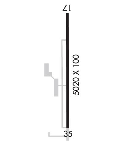
| Lat: N 3654.6 Long: W 09453.3 Elev: 806. Var: -05 Longest Runway: 5020 | ||
| CTAF: 122.8 | ||
| ||||||
|
| Rwy | Rwy | |||||||
| 5020x100 | 5020' | 5020x100 | 5020' | |||||
| Runway ID | Single Wheel | Double Wheel | Double Tandem Wheel | Dual Double Wheel |
| 17/35 | 23,000 | N/A | N/A | N/A |
| These numbers are Advisory and are not limits. The Airport Manager should have more accurate Weight Limits | ||||
 Airport Diagram might not be current. | |
| Facility Name: | MIAMI RGNL |
| City Name: | MIAMI |
| County: | OTTAWA |
| State abbrev: | OK |
| State Name: | OKLAHOMA |
| Ownership: | PUBLICLY OWNED |
| Use: | OPEN TO THE PUBLIC |
| Owner's Name: | CITY OF MIAMI |
| Address: | CITY HALL PO BOX 1288 |
| MIAMI, OK 74355 | |
| Owner's Phone: | 918-542-6685 |
| Manager's Name: | JILL FITZGIBBON |
| Address: | 2600 REX PLOTT DR |
| MIAMI, OK 74355 | |
| Phone: | 918-541-2349; ALT PHONE # 918-961-0959. |
| FAA Region: | SOUTHWEST |
| FAA Field Office: | AOK |
| Date | Sunrise | Sunset |
|---|---|---|
| 06/08/26 Monday | 6:00 | 20:37 |
| 06/09/26 Tuesday | 6:00 | 20:38 |
| 06/10/26 Wednesday | 6:00 | 20:38 |
| 06/11/26 Thursday | 6:00 | 20:39 |
| 06/12/26 Friday | 6:00 | 20:39 |
| 06/13/26 Saturday | 6:00 | 20:40 |
| 06/14/26 Sunday | 6:00 | 20:40 |
| 06/15/26 Monday | 6:00 | 20:40 |
| 06/16/26 Tuesday | 6:00 | 20:41 |
| 06/17/26 Wednesday | 6:00 | 20:41 |
| 06/18/26 Thursday | 6:00 | 20:41 |
| 06/19/26 Friday | 6:00 | 20:42 |
| 06/20/26 Saturday | 6:00 | 20:42 |
| 06/21/26 Sunday | 6:00 | 20:42 |
| Airport Attendance Schedule | MON-FRI 0800-1630; EXCL CITY HOLIDAYS |
| Airport Status | OPERATIONAL (This Status can change at any time - please check NOTAMS) |
| Airport Lighting Schedule | DUSK-DAWN. ACTVT ODALS RWY 17; REIL RWY 35; MIRL RWY 17/35 - CTAF. |
| Airport Storage Available | Tie Downs, Hanger |
| Extra Services Available | Crop Dusting, Flight Instruction |
| Wind Indicator | YES - (lighted) |
| Control Tower | NO |
| CTAF Frequency | 122.800 |
| Unicom Frequency | 122.800 |
| Rotating Beacon Color | WG |
| Segmented Circle | YES |
| Landing Fee | NO |
| Airport Inspected | STATE - performed by STATE AERONAUTICAL PERSONNEL |
| Inspection Date | 05/19/2025 |
| Type of Fuel Available | Grade 100LL, JET A; -10FUEL AVBL 24 HRS WITH CC. |
| Airframe Repair Service | NONE |
| Power Plant Repair Service | NONE |
| Latitude | N3654.6 |
| Longitude | W09453.3 (ESTIMATED) |
| Arpt Elevation | 806ft (SURVEYED) |
| Magnetic Variation | 05E |
| 2 miles NW | of MIAMI |
| Traffic Pattern Altitude | |
| Sectional Chart | KANSAS CITY |
| Operations (Reported) | Yearly | Avg. Daily |
|---|---|---|
| General Aviation Transient | 0 | 0 |
| General Aviation Local | 0 | 0 |
| Air Taxi | 0 | 0 |
| Commerical | 0 | 0 |
| Commuter | 0 | 0 |
| Military | 0 | 0 |
| Aircraft based on Field | |
|---|---|
| General Aviation Singles | 0 |
| General Aviation Multi | 0 |
| Jet Aircraft | 0 |
| General Aviation Helicopters | 0 |
| Military Aircraft | 0 |
| Gliders | 0 |
| Ultralights | 0 |
| FSS on field | NO |
| FSS tie-in | MC ALESTER |
| FSS Phone | 1-800-WX-BRIEF |
| Who issues Notams | MLC |
| Notam D service at airport | YES |
| ARTCC Name | KANSAS CITY |
| Airport Certification | |
| Aircraft Rescue & Firefighting Index | None |
| Airport of Entry | No |
| Custom Landing Rights | No |
| Joint Civil/Military | No |
| Military Landing rights | YES |
| NATIONAL PLAN OF INTEGRATED AIRPORT SYSTEMS (NPIAS) |
| GRANT AGREEMENTS UNDER FAAP/ADAP/AIP |
| SURPLUS PROPERTY AGREEMENT UNDER REGULATION 16-WAA |
| ASSURANCES PURSUANT TO TITLE VI, CIVIL RIGHTS ACT OF 1964 |
| FOR CD CTC KANSAS CITY ARTCC AT 913-254-8508. |
Airport Communications & Frequencies:
| |||||||||
| Runway: 17 | Runway: 35 | ||
| Mag heading: | 175° | Mag heading: | 355° |
| Rwy Slope: | -.13% Down | Rwy Slope: | .13% Up |
| Approach: | Approach: | ||
| Pattern: | Right Traffic | Pattern: | Left Traffic |
| Markings: | NONPRECISION INSTRUMENT | Markings: | NONPRECISION INSTRUMENT |
| Marking Condition: | GOOD | Marking Condition: | GOOD |
| Arresting Dev: | Arresting Dev: | ||
| Lat & Long: | N3655.0 W09453.2 | Lat. & Long.: | N3654.1 W09453.3 |
| Elev: | 806.3 ft. MSL | Elev: | 799.6 ft. MSL |
| TCH: | 42 ft. AGL | TCH: | 42 ft. AGL |
| Visual Glide Path: | 3.00 degrees | Visual Glide Path: | 3.00 degrees |
| Displaced Threshold: | No | Displaced Threshold: | No |
| Touchdown Zone: | YES | Touchdown Zone: | YES |
| Touchdown Elev.: | 806.4 feet | Touchdown Elev.: | 805.5 feet |
| Visual Glide Slope: | 4-Light PAPI on LEFT side of Runway | Visual Glide Slope: | 4-Light PAPI on LEFT side of Runway |
| RVR Equipment: | RVR Equipment: | ||
| RVV Equipment: | NO | RVV Equipment: | NO |
| Approach Lights: | ODALS - omnidirectional approach lighting system | Approach Lights: | |
| REIL: | NO | REIL: | YES |
| Centerline Lights: | NO | Centerline Lights: | NO |
| Touchdown lights: | NO | Touchdown lights: | NO |
| Runway Category: | Runway with a Non-precision Approach having visibility minimums greater than 3/4 mile | Runway Category: | Runway with a Visual Approach |
| Declared Distances: | Declared Distances: | ||
| Obstructions: | TREES | Obstructions: | |
| Marked: | NOT Marked/Lighted | Marked: | |
| Clearance slope: | 14:1 | Clearance slope: | 20:1 |
| Obstruction height: | 38 feet AGL | Obstruction height: | |
| Dist. from runway: | 735 feet | Dist. from runway: | |
| Centerline offset: | 115 left of centerline | Centerline offset: | |
| Comments: | Comments: |
Thanks for using FltPlan.com
all rights reserved © 1999-2026 by Flight Plan LLC
