
| HUNTSVILLE EXECUTIVE AIRPORT HUNTSVILLE AL |
| |
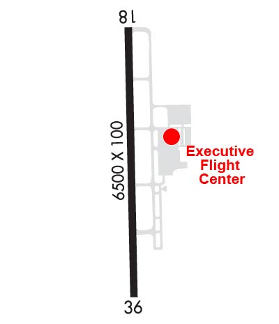
| Lat: N 3451.6 Long: W 08633.5 Elev: 763 Var: +04 Longest Runway: 6500 | ||
| AWOS: 120.0 CTAF: 123.0 | ||
| |||||||||||||||||||||||||||||||
| |||||||||||||||||||||||||||||||
| |||||||||||||||||||||||||||||||
| Rwy | Rwy | |||||||
| 6500x100 | 6500' | 109.75 - 184° | 6500x100 | 6500' | ||||
| Runway ID | Single Wheel | Double Wheel | Double Tandem Wheel | Dual Double Wheel |
| 18/36 | 60,000 | 75,000 | 140,000 | N/A |
| These numbers are Advisory and are not limits. The Airport Manager should have more accurate Weight Limits | ||||
 Airport Diagram might not be current. | |
| Facility Name: | HUNTSVILLE EXEC TOM SHARP JR FLD |
| City Name: | HUNTSVILLE |
| County: | MADISON |
| State abbrev: | AL |
| State Name: | ALABAMA |
| Ownership: | PUBLICLY OWNED |
| Use: | OPEN TO THE PUBLIC |
| Owner's Name: | MADISON CO EXEC ARPT AUTH; TOM SHARP. |
| Address: | PO BOX 110 |
| MERIDIANVILLE, AL 35759 | |
| Owner's Phone: | 256-828-3883 |
| Manager's Name: | RAY MEYER |
| Address: | 360 CLYDE SHELTON DRIVE |
| MERIDIANVILLE, AL 35759 | |
| Phone: | 256-828-1403 |
| FAA Region: | SOUTHERN |
| FAA Field Office: | JAN |

| Date | Sunrise | Sunset |
|---|---|---|
| 09/24/21 Friday | 6:36 | 18:40 |
| 09/25/21 Saturday | 6:36 | 18:39 |
| 09/26/21 Sunday | 6:37 | 18:38 |
| 09/27/21 Monday | 6:38 | 18:36 |
| 09/28/21 Tuesday | 6:38 | 18:35 |
| 09/29/21 Wednesday | 6:39 | 18:33 |
| 09/30/21 Thursday | 6:40 | 18:32 |
| 10/01/21 Friday | 6:41 | 18:31 |
| 10/02/21 Saturday | 6:42 | 18:29 |
| 10/03/21 Sunday | 6:42 | 18:28 |
| 10/04/21 Monday | 6:43 | 18:26 |
| 10/05/21 Tuesday | 6:44 | 18:25 |
| 10/06/21 Wednesday | 6:45 | 18:24 |
| 10/07/21 Thursday | 6:45 | 18:22 |
| Airport Attendance Schedule | SAT-SUN 0730-2000, MON-FRI 0730-2130; FOR SVC AFT HRS CALL 256-603-9345. |
| Airport Status | OPERATIONAL (This Status can change at any time - please check NOTAMS) |
| Airport Lighting Schedule | ACTVT REILS RWY 18 & 36; PAPI RWY 18 & 36; MIRL RWY 18/36 - CTAF. |
| Airport Storage Available | Tie Downs, Hanger |
| Extra Services Available | Flight Instruction, Aircraft Rental |
| Wind Indicator | YES - (lighted) |
| Control Tower | NO |
| CTAF Frequency | 123.000 |
| Unicom Frequency | 123.000 |
| Rotating Beacon Color | CLEAR-GREEN (Light Land Airport) |
| Segmented Circle | YES |
| Landing Fee | NO |
| Airport Inspected | STATE - performed by STATE AERONAUTICAL PERSONNEL |
| Inspection Date | 10/26/2020 |
| Type of Fuel Available | Grade 100LL, JET A (freeze point -40C) |
| Airframe Repair Service | MAJOR |
| Power Plant Repair Service | MAJOR |
| Latitude | N3451.6 |
| Longitude | W08633.5 (ESTIMATED) |
| Arpt Elevation | 763ft (SURVEYED) |
| Magnetic Variation | 04W |
| 1 miles NE | of HUNTSVILLE |
| Traffic Pattern Altitude | |
| Sectional Chart | ATLANTA |
| Operations (Reported) | Yearly | Avg. Daily |
|---|---|---|
| General Aviation Transient | 16800 | 46 |
| General Aviation Local | 15000 | 41 |
| Air Taxi | 1860 | 5 |
| Commerical | 0 | 0 |
| Commuter | 0 | 0 |
| Military | 600 | 2 |
| Aircraft based on Field | |
|---|---|
| General Aviation Singles | 94 |
| General Aviation Multi | 10 |
| Jet Aircraft | 2 |
| General Aviation Helicopters | 0 |
| Military Aircraft | 0 |
| Gliders | 0 |
| Ultralights | 0 |
| FSS on field | NO |
| FSS tie-in | ANNISTON |
| FSS Phone | 1-800-WX-BRIEF |
| Who issues Notams | MDQ |
| Notam D service at airport | YES |
| ARTCC Name | MEMPHIS |
| Airport Certification | |
| Aircraft Rescue & Firefighting Index | None |
| Airport of Entry | No |
| Custom Landing Rights | No |
| Joint Civil/Military | No |
| Military Landing rights | No |
| NATIONAL PLAN OF INTEGRATED AIRPORT SYSTEMS (NPIAS) |
| GRANT AGREEMENTS UNDER FAAP/ADAP/AIP |
| ASSURANCES PURSUANT TO TITLE VI, CIVIL RIGHTS ACT OF 1964 |
| GCO AVBL ON FREQ 121.725 THRU HUNTSVILLE APCH & ANNISTON FSS. |
| FOR CD IF UNA VIA GCO, CTC HUNTSVILLE APCH AT 256-542-2098. WHEN APCH CLSD CTC MEMPHIS ARTCC AT 901-368-8453/8449. |
Airport Communications & Frequencies:
| |||||||||||||||||
| Runway: 18 | Runway: 36 | ||
| Mag heading: | 185° | Mag heading: | 5° |
| Rwy Slope: | .68% Up | Rwy Slope: | -.68% Down |
| Approach: | ILS/DME | Approach: | |
| Pattern: | Left Traffic | Pattern: | Right Traffic |
| Markings: | PRECISION INSTRUMENT | Markings: | NONPRECISION INSTRUMENT |
| Marking Condition: | GOOD | Marking Condition: | GOOD |
| Arresting Dev: | Arresting Dev: | ||
| Lat & Long: | N3452.1 W08633.4 | Lat. & Long.: | N3451.0 W08633.5 |
| Elev: | 719.0 ft. MSL | Elev: | 763.2 ft. MSL |
| TCH: | 43 ft. AGL | TCH: | 43 ft. AGL |
| Visual Glide Path: | 3.00 degrees | Visual Glide Path: | 3.00 degrees |
| Displaced Threshold: | No | Displaced Threshold: | No |
| Touchdown Zone: | YES | Touchdown Zone: | YES |
| Touchdown Elev.: | 739.8 feet | Touchdown Elev.: | 763.2 feet |
| Visual Glide Slope: | 4-Light PAPI on LEFT side of Runway | Visual Glide Slope: | 4-Light PAPI on LEFT side of Runway |
| RVR Equipment: | RVR Equipment: | ||
| RVV Equipment: | NO | RVV Equipment: | NO |
| Approach Lights: | Approach Lights: | ||
| REIL: | YES | REIL: | YES |
| Centerline Lights: | NO | Centerline Lights: | NO |
| Touchdown lights: | NO | Touchdown lights: | NO |
| Runway Category: | Precision Instrument Runway | Runway Category: | D |
| Declared Distances: | Declared Distances: | ||
| Obstructions: | TREES | Obstructions: | |
| Marked: | NOT Marked/Lighted | Marked: | |
| Clearance slope: | 25:1 | Clearance slope: | 50:1 |
| Obstruction height: | 32 feet AGL | Obstruction height: | |
| Dist. from runway: | 1019 feet | Dist. from runway: | |
| Centerline offset: | 140 left of centerline | Centerline offset: | |
| Comments: | Comments: |
Thanks for using FltPlan.com
all rights reserved © 1999-2021 by Flight Plan LLC