| MCCOMB-PIKE COUNTY-LEWIS MC COMB MS |
| |
| Lat: N 3110.7 Long: W 09028.3 Elev: 413 Var: +01 Longest Runway: 5000 | ||
| CTAF: 123.05 | ||
| ||||||||||||||||||||||||||||||||||||||||||||||||||||||||||||||||||||
| ||||||||||||||||||||||||||||||||||||||||||||||||||||||||||||||||||||
| ||||||||||||||||||||||||||||||||||||||||||||||||||||||||||||||||||||
| Rwy | Rwy | |||||||
| 5000x100 | 5000' | 109.10 - 156° | 5000x100 | 5000' | ||||
| Runway ID | Single Wheel | Double Wheel | Double Tandem Wheel | Dual Double Wheel |
| 16/34 | 25,000 | 172,000 | 308,000 | N/A |
| These numbers are Advisory and are not limits. The Airport Manager should have more accurate Weight Limits | ||||
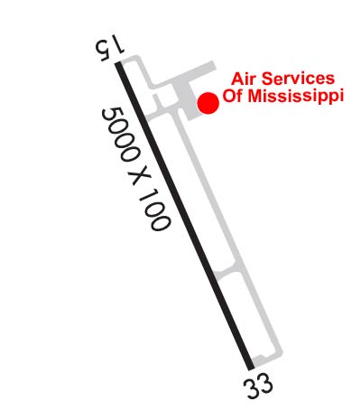 Airport Diagram might not be current. | |
| Facility Name: | MC COMB/PIKE COUNTY/JOHN E LEWIS FLD |
| City Name: | MC COMB |
| County: | PIKE |
| State abbrev: | MS |
| State Name: | MISSISSIPPI |
| Ownership: | PUBLICLY OWNED |
| Use: | OPEN TO THE PUBLIC |
| Owner's Name: | CITY OF MC COMB & PIKE COUNTY |
| Address: | 2051 JOHN E. LEWIS DR |
| MCCOMB, MS 39648 | |
| Owner's Phone: | 601-684-8950 |
| Manager's Name: | ADAM LOFTON |
| Address: | 2051 JOHN E. LEWIS DR |
| MCCOMB, MS 39648 | |
| Phone: | 601-684-8950 |
| FAA Region: | SOUTHERN |
| FAA Field Office: | JAN |

| Date | Sunrise | Sunset |
|---|---|---|
| 06/08/26 Monday | 5:57 | 20:05 |
| 06/09/26 Tuesday | 5:57 | 20:05 |
| 06/10/26 Wednesday | 5:57 | 20:05 |
| 06/11/26 Thursday | 5:57 | 20:06 |
| 06/12/26 Friday | 5:57 | 20:06 |
| 06/13/26 Saturday | 5:57 | 20:07 |
| 06/14/26 Sunday | 5:57 | 20:07 |
| 06/15/26 Monday | 5:57 | 20:07 |
| 06/16/26 Tuesday | 5:58 | 20:08 |
| 06/17/26 Wednesday | 5:58 | 20:08 |
| 06/18/26 Thursday | 5:58 | 20:08 |
| 06/19/26 Friday | 5:58 | 20:08 |
| 06/20/26 Saturday | 5:58 | 20:09 |
| 06/21/26 Sunday | 5:58 | 20:09 |
| Airport Attendance Schedule | 7 Days A Week 0730-1730 |
| Airport Status | OPERATIONAL (This Status can change at any time - please check NOTAMS) |
| Airport Lighting Schedule | ACTVT MALSF RWY 16 - CTAF. MIRL RWY 16/34 PRESET LOW INTST DUSK-0000, AFT 0000 INCR INTST - CTAF. |
| Airport Storage Available | Tie Downs, Hanger |
| Extra Services Available | NONE |
| Wind Indicator | YES - (lighted) |
| Control Tower | NO |
| CTAF Frequency | 123.050 |
| Unicom Frequency | 123.050 |
| Rotating Beacon Color | WG |
| Segmented Circle | YES |
| Landing Fee | NO |
| Airport Inspected | STATE - performed by STATE AERONAUTICAL PERSONNEL |
| Inspection Date | 02/25/2026 |
| Type of Fuel Available | Grade 100LL, JET A-1 (icing inhibitor, freeze point -50C); -10FOR ATTENDANT & FUEL AFT HRS CALL 601-684-8950. |
| Airframe Repair Service | MINOR |
| Power Plant Repair Service | MINOR |
| Latitude | N3110.7 |
| Longitude | W09028.3 (ESTIMATED) |
| Arpt Elevation | 413ft (SURVEYED) |
| Magnetic Variation | 01W |
| 4 miles S | of MC COMB |
| Traffic Pattern Altitude | |
| Sectional Chart | NEW ORLEANS |
| Operations (Reported) | Yearly | Avg. Daily |
|---|---|---|
| General Aviation Transient | 0 | 0 |
| General Aviation Local | 0 | 0 |
| Air Taxi | 0 | 0 |
| Commerical | 0 | 0 |
| Commuter | 0 | 0 |
| Military | 0 | 0 |
| Aircraft based on Field | |
|---|---|
| General Aviation Singles | 0 |
| General Aviation Multi | 0 |
| Jet Aircraft | 0 |
| General Aviation Helicopters | 0 |
| Military Aircraft | 0 |
| Gliders | 0 |
| Ultralights | 0 |
| FSS on field | NO |
| FSS tie-in | GREENWOOD |
| FSS Phone | 1-800-WX-BRIEF |
| Who issues Notams | MCB |
| Notam D service at airport | YES |
| ARTCC Name | HOUSTON |
| Airport Certification | |
| Aircraft Rescue & Firefighting Index | None |
| Airport of Entry | No |
| Custom Landing Rights | No |
| Joint Civil/Military | No |
| Military Landing rights | YES |
| NATIONAL PLAN OF INTEGRATED AIRPORT SYSTEMS (NPIAS) |
| GRANT AGREEMENTS UNDER FAAP/ADAP/AIP |
| ASSURANCES PURSUANT TO TITLE VI, CIVIL RIGHTS ACT OF 1964 |
| THIS AIRPORT HAS BEEN SURVEYED BY THE NATIONAL GEODETIC SURVEY. |
| COURTESY CAR AVBL. |
| FOR CD IF UNA TO CTC ON FSS FREQ, CTC HOUSTON ARTCC AT 281-230-5622. |
Airport Communications & Frequencies:
| |||||||||
| Runway: 16 | Runway: 34 | ||
| Mag heading: | 157° | Mag heading: | 337° |
| Rwy Slope: | -.48% Down | Rwy Slope: | .48% Up |
| Approach: | ILS | Approach: | |
| Pattern: | Left Traffic | Pattern: | Left Traffic |
| Markings: | PRECISION INSTRUMENT | Markings: | NONPRECISION INSTRUMENT |
| Marking Condition: | POOR; MARKINGS FADED. | Marking Condition: | POOR; MARKINGS FADED. |
| Arresting Dev: | Arresting Dev: | ||
| Lat & Long: | N3111.1 W09028.5 | Lat. & Long.: | N3110.3 W09028.1 |
| Elev: | 413.1 ft. MSL | Elev: | 389.0 ft. MSL |
| TCH: | 43 ft. AGL | TCH: | 40 ft. AGL |
| Visual Glide Path: | 3.00 degrees | Visual Glide Path: | 3.00 degrees |
| Displaced Threshold: | No | Displaced Threshold: | No |
| Touchdown Zone: | YES | Touchdown Zone: | YES |
| Touchdown Elev.: | 413.2 feet | Touchdown Elev.: | 406.4 feet |
| Visual Glide Slope: | 4-Light PAPI on LEFT side of Runway | Visual Glide Slope: | 2-Light PAPI on LEFT side of Runway |
| RVR Equipment: | RVR Equipment: | ||
| RVV Equipment: | NO | RVV Equipment: | NO |
| Approach Lights: | MALSF - 1,400 foot medium intensity approach lighting system with sequenced flashers | Approach Lights: | |
| REIL: | NO | REIL: | NO |
| Centerline Lights: | NO | Centerline Lights: | NO |
| Touchdown lights: | NO | Touchdown lights: | NO |
| Runway Category: | Precision Instrument Runway | Runway Category: | D |
| Declared Distances: | Declared Distances: |
Thanks for using FltPlan.com
all rights reserved © 1999-2026 by Flight Plan LLC