
| COVINGTON MUNI COVINGTON TN |
| |
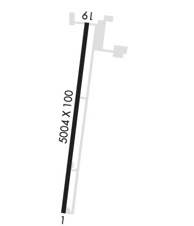
| Lat: N 3535.0 Long: W 08935.2 Elev: 280 Var: -02 Longest Runway: 5004 | ||
| AWOS: 118.57 CTAF: 123.0 | ||
| ||||||
| ||||||
|
| Rwy | Rwy | |||||||
| 5004x100 | 5004' | 5004x100 | 5004' | |||||
| Runway ID | Single Wheel | Double Wheel | Double Tandem Wheel | Dual Double Wheel |
| 01/19 | 15,000 | N/A | N/A | N/A |
| These numbers are Advisory and are not limits. The Airport Manager should have more accurate Weight Limits | ||||
 Airport Diagram might not be current. | |
| Facility Name: | COVINGTON MUNI |
| City Name: | COVINGTON |
| County: | TIPTON |
| State abbrev: | TN |
| State Name: | TENNESSEE |
| Ownership: | PUBLICLY OWNED |
| Use: | OPEN TO THE PUBLIC |
| Owner's Name: | CITY OF COVINGTON |
| Address: | CITY HALL 133 E PLEASANT |
| COVINGTON, TN 38019 | |
| Owner's Phone: | 901-476-9613 |
| Manager's Name: | ROBIN ANDERSON |
| Address: | 169 AIRPORT PARKWAY DR |
| COVINGTON, TN 38019 | |
| Phone: | 901-476-1392 |
| FAA Region: | SOUTHERN |
| FAA Field Office: | MEM |
| Date | Sunrise | Sunset |
|---|---|---|
| 09/24/21 Friday | 6:48 | 18:53 |
| 09/25/21 Saturday | 6:48 | 18:51 |
| 09/26/21 Sunday | 6:49 | 18:50 |
| 09/27/21 Monday | 6:50 | 18:48 |
| 09/28/21 Tuesday | 6:51 | 18:47 |
| 09/29/21 Wednesday | 6:51 | 18:45 |
| 09/30/21 Thursday | 6:52 | 18:44 |
| 10/01/21 Friday | 6:53 | 18:42 |
| 10/02/21 Saturday | 6:54 | 18:41 |
| 10/03/21 Sunday | 6:55 | 18:40 |
| 10/04/21 Monday | 6:55 | 18:38 |
| 10/05/21 Tuesday | 6:56 | 18:37 |
| 10/06/21 Wednesday | 6:57 | 18:35 |
| 10/07/21 Thursday | 6:58 | 18:34 |
| Airport Attendance Schedule | MON-FRI 0700-1700, SAT-SUN 0800-1700; ARPT UNATNDD CHRISTMAS & NEW YEAR'S DAY. |
| Airport Status | OPERATIONAL (This Status can change at any time - please check NOTAMS) |
| Airport Lighting Schedule | MIRL RY 01/19 PRESET LOW INTST; TO INCR INTST ACTVT - CTAF. |
| Airport Storage Available | Tie Downs |
| Extra Services Available | Crop Dusting |
| Wind Indicator | YES - (lighted) |
| Control Tower | NO |
| CTAF Frequency | 123.000 |
| Unicom Frequency | 123.000 |
| Rotating Beacon Color | CLEAR-GREEN (Light Land Airport) |
| Segmented Circle | YES |
| Landing Fee | NO |
| Airport Inspected | STATE - performed by STATE AERONAUTICAL PERSONNEL |
| Inspection Date | 06/17/2019 |
| Type of Fuel Available | Grade 100LL, JET A |
| Airframe Repair Service | NONE |
| Power Plant Repair Service | NONE |
| Latitude | N3535.0 |
| Longitude | W08935.2 (ESTIMATED) |
| Arpt Elevation | 280ft (SURVEYED) |
| Magnetic Variation | 02E |
| 3 miles NE | of COVINGTON |
| Traffic Pattern Altitude | |
| Sectional Chart | MEMPHIS |
| Operations (Reported) | Yearly | Avg. Daily |
|---|---|---|
| General Aviation Transient | 5400 | 15 |
| General Aviation Local | 7000 | 19 |
| Air Taxi | 500 | 1 |
| Commerical | 0 | 0 |
| Commuter | 0 | 0 |
| Military | 100 | 0 |
| Aircraft based on Field | |
|---|---|
| General Aviation Singles | 15 |
| General Aviation Multi | 1 |
| Jet Aircraft | 0 |
| General Aviation Helicopters | 0 |
| Military Aircraft | 0 |
| Gliders | 0 |
| Ultralights | 0 |
| FSS on field | NO |
| FSS tie-in | JACKSON |
| FSS Phone | 1-800-WX-BRIEF |
| Who issues Notams | MKL |
| Notam D service at airport | YES |
| ARTCC Name | MEMPHIS |
| Airport Certification | |
| Aircraft Rescue & Firefighting Index | None |
| Airport of Entry | No |
| Custom Landing Rights | No |
| Joint Civil/Military | No |
| Military Landing rights | YES |
| NATIONAL PLAN OF INTEGRATED AIRPORT SYSTEMS (NPIAS) |
| GRANT AGREEMENTS UNDER FAAP/ADAP/AIP |
| ASSURANCES PURSUANT TO TITLE VI, CIVIL RIGHTS ACT OF 1964 |
| THIS AIRPORT HAS BEEN SURVEYED BY THE NATIONAL GEODETIC SURVEY. |
| NMRS AGRICULTURAL ACFT OPS CONDUCTED ON AND INVOF ARPT MAY 1 - OCT 31. |
| FOR CD CTC MEMPHIS APCH AT 901-842-8457. |
| RWY 01/19 WIP MOWING AND MAINT VEHICLES. |
Airport Communications & Frequencies:
| ||||||||||||||||
| Runway: 01 | Runway: 19 | ||
| Mag heading: | 7° | Mag heading: | 187° |
| Rwy Slope: | -.16% Down | Rwy Slope: | .16% Up |
| Approach: | Approach: | ||
| Pattern: | Left Traffic | Pattern: | Left Traffic |
| Markings: | NONPRECISION INSTRUMENT | Markings: | NONPRECISION INSTRUMENT |
| Marking Condition: | GOOD | Marking Condition: | GOOD |
| Arresting Dev: | Arresting Dev: | ||
| Lat & Long: | N3534.6 W08935.3 | Lat. & Long.: | N3535.4 W08935.2 |
| Elev: | 279.8 ft. MSL | Elev: | 271.9 ft. MSL |
| TCH: | 25 ft. AGL | TCH: | 29 ft. AGL |
| Visual Glide Path: | 3.00 degrees | Visual Glide Path: | 3.00 degrees |
| Displaced Threshold: | No | Displaced Threshold: | No |
| Touchdown Zone: | YES | Touchdown Zone: | YES |
| Touchdown Elev.: | 280.1 feet | Touchdown Elev.: | 275.5 feet |
| Visual Glide Slope: | 4-Light PAPI on LEFT side of Runway | Visual Glide Slope: | 4-Light PAPI on LEFT side of Runway |
| RVR Equipment: | RVR Equipment: | ||
| RVV Equipment: | NO | RVV Equipment: | NO |
| Approach Lights: | Approach Lights: | ||
| REIL: | YES | REIL: | YES |
| Centerline Lights: | NO | Centerline Lights: | NO |
| Touchdown lights: | NO | Touchdown lights: | NO |
| Runway Category: | Runway with a Non-precision Approach having visibility minimums greater than 3/4 mile | Runway Category: | Runway with a Visual Approach |
| Declared Distances: | Declared Distances: | ||
| Obstructions: | TREE | Obstructions: | POLE |
| Marked: | NOT Marked/Lighted | Marked: | NOT Marked/Lighted |
| Clearance slope: | 18:1 | Clearance slope: | 23:1 |
| Obstruction height: | 86 feet AGL | Obstruction height: | 42 feet AGL |
| Dist. from runway: | 1780 feet | Dist. from runway: | 1157 feet |
| Centerline offset: | 212 left of centerline | Centerline offset: | 472 feet left of centerline |
| Comments: | Comments: |
Thanks for using FltPlan.com
all rights reserved © 1999-2021 by Flight Plan LLC
