
| DECATUR MUNI DECATUR TX |
| |
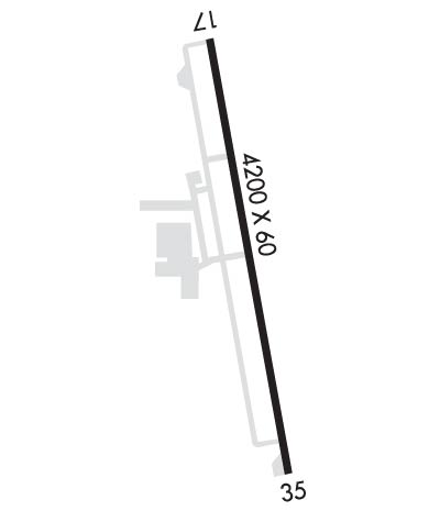
| Lat: N 3315.3 Long: W 09734.8 Elev: 1047 Var: -03 Longest Runway: 4200 | ||
| AWOS: 118.22 CTAF: 122.8 | ||
| ||||||||||||||||||||||||||||||||||||||||||||
| ||||||||||||||||||||||||||||||||||||||||||||
| ||||||||||||||||||||||||||||||||||||||||||||
| Rwy | Rwy | |||||||
| 4200x60 | 4200' | 4200x60 | 4200' | |||||
| Runway ID | Single Wheel | Double Wheel | Double Tandem Wheel | Dual Double Wheel |
| 17/35 | 12,500 | 17,000 | N/A | N/A |
| These numbers are Advisory and are not limits. The Airport Manager should have more accurate Weight Limits | ||||
 Airport Diagram might not be current. | |
| Facility Name: | DECATUR MUNI |
| City Name: | DECATUR |
| County: | WISE |
| State abbrev: | TX |
| State Name: | TEXAS |
| Ownership: | PUBLICLY OWNED |
| Use: | OPEN TO THE PUBLIC |
| Owner's Name: | CITY OF DECATUR |
| Address: | PO BOX 1299 |
| DECATUR, TX 76234 | |
| Owner's Phone: | 940-393-0200 |
| Manager's Name: | GREG HALL |
| Address: | 351 AIRPORT ROAD |
| DECATUR, TX 76234 | |
| Phone: | 940-627-2855; DIR OF PUBLIC WORKS/AMGR ADDNL PHONE: 940-393-0262. |
| FAA Region: | SOUTHWEST |
| FAA Field Office: | TEX |
| Date | Sunrise | Sunset |
|---|---|---|
| 06/07/26 Sunday | 6:21 | 20:38 |
| 06/08/26 Monday | 6:21 | 20:38 |
| 06/09/26 Tuesday | 6:21 | 20:39 |
| 06/10/26 Wednesday | 6:20 | 20:39 |
| 06/11/26 Thursday | 6:20 | 20:40 |
| 06/12/26 Friday | 6:20 | 20:40 |
| 06/13/26 Saturday | 6:20 | 20:40 |
| 06/14/26 Sunday | 6:20 | 20:41 |
| 06/15/26 Monday | 6:21 | 20:41 |
| 06/16/26 Tuesday | 6:21 | 20:41 |
| 06/17/26 Wednesday | 6:21 | 20:42 |
| 06/18/26 Thursday | 6:21 | 20:42 |
| 06/19/26 Friday | 6:21 | 20:42 |
| 06/20/26 Saturday | 6:21 | 20:43 |
| Airport Attendance Schedule | 7 Days A Week 0800-1700 |
| Airport Status | OPERATIONAL (This Status can change at any time - please check NOTAMS) |
| Airport Lighting Schedule | DUSK-DAWN. MIRL RWY 17/35 PRESET LOW INTST; TO INCR INTST ACTVT - CTAF. |
| Airport Storage Available | Tie Downs, Hanger |
| Extra Services Available | Flight Instruction, Aircraft Rental, Aircraft Sales |
| Wind Indicator | YES - (lighted) |
| Control Tower | NO |
| CTAF Frequency | 122.800 |
| Unicom Frequency | 122.800 |
| Rotating Beacon Color | WG |
| Segmented Circle | YES |
| Landing Fee | NO |
| Airport Inspected | STATE - performed by PRIVATE CONTRACT PERSONNEL |
| Inspection Date | 05/03/2024 |
| Type of Fuel Available | Grade 100LL, JET A (freeze point -40C) |
| Airframe Repair Service | MAJOR |
| Power Plant Repair Service | MAJOR |
| Latitude | N3315.3 |
| Longitude | W09734.8 (ESTIMATED) |
| Arpt Elevation | 1046ft (SURVEYED) |
| Magnetic Variation | 03E |
| 2 miles N | of DECATUR |
| Traffic Pattern Altitude | |
| Sectional Chart | DALLAS-FT WORTH |
| Operations (Reported) | Yearly | Avg. Daily |
|---|---|---|
| General Aviation Transient | 0 | 0 |
| General Aviation Local | 0 | 0 |
| Air Taxi | 0 | 0 |
| Commerical | 0 | 0 |
| Commuter | 0 | 0 |
| Military | 0 | 0 |
| Aircraft based on Field | |
|---|---|
| General Aviation Singles | 0 |
| General Aviation Multi | 0 |
| Jet Aircraft | 0 |
| General Aviation Helicopters | 0 |
| Military Aircraft | 0 |
| Gliders | 0 |
| Ultralights | 0 |
| FSS on field | NO |
| FSS tie-in | FORT WORTH |
| FSS Phone | 1-800-WX-BRIEF |
| Who issues Notams | LUD |
| Notam D service at airport | YES |
| ARTCC Name | FORT WORTH |
| Airport Certification | |
| Aircraft Rescue & Firefighting Index | None |
| Airport of Entry | No |
| Custom Landing Rights | No |
| Joint Civil/Military | No |
| Military Landing rights | YES |
| NATIONAL PLAN OF INTEGRATED AIRPORT SYSTEMS (NPIAS) |
| ASSURANCES PURSUANT TO TITLE VI, CIVIL RIGHTS ACT OF 1964 |
| GRANT AGREEMENT HAS EXPIRED; HOWEVER, AGREEMENT REMAINS IN EFFECT FOR THIS FACILITY AS LONG AS IT IS PUBLIC USE. |
| GND DROPS SHARPLY 160 FT NORTH OF RWY 17 THR. |
| DEER AND WILDLIFE ON & INVOF ARPT. |
| FOR CD CTC LONE STAR APCH AT 972-615-2799. |
| DUE TO RWY ELEV CHG, ACFT NOT VSB AT OPPOSITE END. |
Airport Communications & Frequencies:
| ||||||||||||||
| Runway: 17 | Runway: 35 | ||
| Mag heading: | 169° | Mag heading: | 349° |
| Rwy Slope: | -.10% Down | Rwy Slope: | .10% Up |
| Approach: | Approach: | ||
| Pattern: | Left Traffic | Pattern: | Right Traffic |
| Markings: | NONPRECISION INSTRUMENT | Markings: | NONPRECISION INSTRUMENT |
| Marking Condition: | FAIR | Marking Condition: | FAIR |
| Arresting Dev: | Arresting Dev: | ||
| Lat & Long: | N3315.6 W09734.9 | Lat. & Long.: | N3314.9 W09734.8 |
| Elev: | 1041.2 ft. MSL | Elev: | 1036.9 ft. MSL |
| TCH: | 23 ft. AGL | TCH: | 40 ft. AGL |
| Visual Glide Path: | 3.50 degrees | Visual Glide Path: | 3.50 degrees |
| Displaced Threshold: | No | Displaced Threshold: | No |
| Touchdown Zone: | YES | Touchdown Zone: | YES |
| Touchdown Elev.: | 1046.7 feet | Touchdown Elev.: | 1046.7 feet |
| Visual Glide Slope: | 2-Light PAPI on LEFT side of Runway | Visual Glide Slope: | 2-Light PAPI on LEFT side of Runway |
| RVR Equipment: | RVR Equipment: | ||
| RVV Equipment: | NO | RVV Equipment: | NO |
| Approach Lights: | Approach Lights: | ||
| REIL: | YES | REIL: | NO |
| Centerline Lights: | NO | Centerline Lights: | NO |
| Touchdown lights: | NO | Touchdown lights: | NO |
| Runway Category: | Runway with a Non-precision Approach | Runway Category: | Runway with a Non-precision Approach |
| Declared Distances: | Declared Distances: | ||
| Obstructions: | TREE; ALSO 30 FT MKD PLINE, 770 FT DSTC, ACRS APCH. | Obstructions: | PLINE |
| Marked: | NOT Marked/Lighted | Marked: | MARKED |
| Clearance slope: | 4:1 | Clearance slope: | 20:1 |
| Obstruction height: | 10 feet AGL | Obstruction height: | 28 feet AGL |
| Dist. from runway: | 243 feet | Dist. from runway: | 760 feet |
| Centerline offset: | 125 right of centerline | Centerline offset: | 230 feet right of centerline |
| Comments: | 30 FT TREES, 0-199 FT DSTC, 245 FT L, 151 FT R. | Comments: | 20 FT TREES, 140-199 FT DSTC, 150-250 FT R. |
Thanks for using FltPlan.com
all rights reserved © 1999-2026 by Flight Plan LLC
