
| LINCOLN RGNL LINCOLN ME |
| |
| Lat: N 4521.7 Long: W 06832.1 Elev: 208 Var: +19 Longest Runway: 2805 | ||
| CTAF: 122.8 | ||
| ||||||||||||||||||||||||||||||||
| ||||||||||||||||||||||||||||||||
| Rwy | Rwy | |||||||
| 2400x100 | 2400' | 2400x100 | 2400' | |||||
| 2805x60 | 2805' | 2805x60 | 2805' | |||||
| Runway ID | Single Wheel | Double Wheel | Double Tandem Wheel | Dual Double Wheel |
| 06W/24W | N/A | N/A | N/A | N/A |
| 16/34 | 25,000 | N/A | N/A | N/A |
| These numbers are Advisory and are not limits. The Airport Manager should have more accurate Weight Limits | ||||
 Airport Diagram might not be current. | |
| Facility Name: | LINCOLN RGNL |
| City Name: | LINCOLN |
| County: | PENOBSCOT |
| State abbrev: | ME |
| State Name: | MAINE |
| Ownership: | PUBLICLY OWNED |
| Use: | OPEN TO THE PUBLIC |
| Owner's Name: | TOWN OF LINCOLN |
| Address: | 29 MAIN ST |
| LINCOLN, ME 04457 | |
| Owner's Phone: | 207-794-3372 |
| Manager's Name: | STEW JACOBS |
| Address: | 29 MAIN ST |
| LINCOLN, ME 04457 | |
| Phone: | 207-403-0524; ALTN NR 207-290-7174, DENNIS BULLEN. |
| FAA Region: | NEW ENGLAND |
| FAA Field Office: | NONE |
| Date | Sunrise | Sunset |
|---|---|---|
| 06/08/26 Monday | 4:46 | 20:20 |
| 06/09/26 Tuesday | 4:46 | 20:21 |
| 06/10/26 Wednesday | 4:46 | 20:21 |
| 06/11/26 Thursday | 4:46 | 20:22 |
| 06/12/26 Friday | 4:46 | 20:23 |
| 06/13/26 Saturday | 4:45 | 20:23 |
| 06/14/26 Sunday | 4:45 | 20:24 |
| 06/15/26 Monday | 4:45 | 20:24 |
| 06/16/26 Tuesday | 4:45 | 20:24 |
| 06/17/26 Wednesday | 4:45 | 20:25 |
| 06/18/26 Thursday | 4:45 | 20:25 |
| 06/19/26 Friday | 4:45 | 20:25 |
| 06/20/26 Saturday | 4:46 | 20:26 |
| 06/21/26 Sunday | 4:46 | 20:26 |
| Airport Attendance Schedule | UNATTENDED |
| Airport Status | OPERATIONAL (This Status can change at any time - please check NOTAMS) |
| Airport Lighting Schedule | ACTVT REIL RWY 16 & 34; MIRL RWY 16/34 - CTAF. |
| Airport Storage Available | Tie Downs, Hanger |
| Extra Services Available | NONE |
| Wind Indicator | YES - (unlit) |
| Control Tower | NO |
| CTAF Frequency | 122.800 |
| Unicom Frequency | 122.800 |
| Rotating Beacon Color | WG |
| Segmented Circle | YES |
| Landing Fee | NO |
| Airport Inspected | STATE - performed by PRIVATE CONTRACT PERSONNEL |
| Inspection Date | 08/17/2024 |
| Type of Fuel Available | Grade 100LL; -1024 HR FUEL WITH MAJOR CREDIT CARD. |
| Airframe Repair Service | NONE |
| Power Plant Repair Service | NONE |
| Latitude | N4521.7 |
| Longitude | W06832.1 (ESTIMATED) |
| Arpt Elevation | 207ft (SURVEYED) |
| Magnetic Variation | 19W |
| 2 miles SW | of LINCOLN |
| Traffic Pattern Altitude | |
| Sectional Chart | HALIFAX |
| Operations (Reported) | Yearly | Avg. Daily |
|---|---|---|
| General Aviation Transient | 0 | 0 |
| General Aviation Local | 0 | 0 |
| Air Taxi | 0 | 0 |
| Commerical | 0 | 0 |
| Commuter | 0 | 0 |
| Military | 0 | 0 |
| Aircraft based on Field | |
|---|---|
| General Aviation Singles | 0 |
| General Aviation Multi | 0 |
| Jet Aircraft | 0 |
| General Aviation Helicopters | 0 |
| Military Aircraft | 0 |
| Gliders | 0 |
| Ultralights | 0 |
| FSS on field | NO |
| FSS tie-in | BANGOR |
| FSS Phone | 1-800-WX-BRIEF |
| Who issues Notams | BGR |
| Notam D service at airport | YES |
| ARTCC Name | BOSTON |
| Airport Certification | |
| Aircraft Rescue & Firefighting Index | None |
| Airport of Entry | No |
| Custom Landing Rights | No |
| Joint Civil/Military | No |
| Military Landing rights | YES |
| NATIONAL PLAN OF INTEGRATED AIRPORT SYSTEMS (NPIAS) |
| GRANT AGREEMENTS UNDER FAAP/ADAP/AIP |
| ASSURANCES PURSUANT TO TITLE VI, CIVIL RIGHTS ACT OF 1964 |
| 40 FT BRIDGE AT S END WATER LDG AREA. |
| WILDLIFE ON & INVOF ARPT. |
| RWY 6W-24W FOLLOW BUOYS UNDER BRIDGE DURING LOW WATER IN SUMMER. |
| FOR CD CTC BOSTON ARTCC AT 603-879-6859. |
Airport Communications & Frequencies:
| |||||||||
| Runway: 06W | Runway: 24W | ||
| Mag heading: | N/A | Mag heading: | N/A |
| Approach: | Approach: | ||
| Pattern: | Left Traffic | Pattern: | Left Traffic |
| Markings: | Markings: | ||
| Marking Condition: | Marking Condition: | ||
| Arresting Dev: | Arresting Dev: | ||
| Lat & Long: | Lat. & Long.: | ||
| Elev: | N/A | Elev: | N/A |
| TCH: | TCH: | ||
| Visual Glide Path: | Visual Glide Path: | ||
| Displaced Threshold: | No | Displaced Threshold: | No |
| Touchdown Zone: | YES | Touchdown Zone: | YES |
| Touchdown Elev.: | 207.7 feet | Touchdown Elev.: | 207.7 feet |
| Visual Glide Slope: | Visual Glide Slope: | ||
| RVR Equipment: | RVR Equipment: | ||
| RVV Equipment: | NO | RVV Equipment: | NO |
| Approach Lights: | Approach Lights: | ||
| REIL: | NO | REIL: | NO |
| Centerline Lights: | NO | Centerline Lights: | NO |
| Touchdown lights: | NO | Touchdown lights: | NO |
| Runway Category: | Runway Category: | ||
| Declared Distances: | Declared Distances: | ||
| Obstructions: | PLINE | Obstructions: | TREES |
| Marked: | MARKED | Marked: | NOT Marked/Lighted |
| Clearance slope: | 15:1 | Clearance slope: | 15:1 |
| Obstruction height: | 64 feet AGL | Obstruction height: | 94 feet AGL |
| Dist. from runway: | 960 feet | Dist. from runway: | 1410 feet |
| Centerline offset: | Centerline offset: | ||
| Comments: | Comments: |
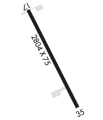
| Runway: 16 | Runway: 34 | ||
| Mag heading: | 166° | Mag heading: | 346° |
| Rwy Slope: | .35% Up | Rwy Slope: | -.35% Down |
| Approach: | Approach: | ||
| Pattern: | Left Traffic | Pattern: | Left Traffic |
| Markings: | NONPRECISION INSTRUMENT | Markings: | NONPRECISION INSTRUMENT |
| Marking Condition: | GOOD | Marking Condition: | GOOD |
| Arresting Dev: | Arresting Dev: | ||
| Lat & Long: | N4521.9 W06832.2 | Lat. & Long.: | N4521.5 W06831.9 |
| Elev: | 196.5 ft. MSL | Elev: | 206.4 ft. MSL |
| TCH: | TCH: | ||
| Visual Glide Path: | Visual Glide Path: | ||
| Displaced Threshold: | No | Displaced Threshold: | No |
| Touchdown Zone: | YES | Touchdown Zone: | YES |
| Touchdown Elev.: | 207.9 feet | Touchdown Elev.: | 207.9 feet |
| Visual Glide Slope: | Visual Glide Slope: | ||
| RVR Equipment: | RVR Equipment: | ||
| RVV Equipment: | NO | RVV Equipment: | NO |
| Approach Lights: | Approach Lights: | ||
| REIL: | YES | REIL: | YES |
| Centerline Lights: | NO | Centerline Lights: | NO |
| Touchdown lights: | NO | Touchdown lights: | NO |
| Runway Category: | Runway with a Non-precision Approach | Runway Category: | Runway with a Non-precision Approach |
| Declared Distances: | Declared Distances: |
Thanks for using FltPlan.com
all rights reserved © 1999-2026 by Flight Plan LLC
