
| CHALLIS CHALLIS ID |
| |
| Lat: N 4431.4 Long: W 11413.1 Elev: 5076 Var: -12 Longest Runway: 4601 | ||
| AWOS: 119.27 CTAF: 122.8 | ||
| ||||||||||||||||||||||||||||||||||||||||||||
| ||||||||||||||||||||||||||||||||||||||||||||
| ||||||||||||||||||||||||||||||||||||||||||||
| Rwy | Rwy | |||||||
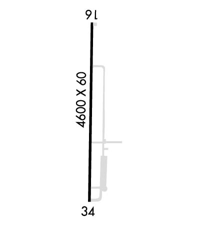
| 4601x60 | 4601' | 4601x60 | 4601' | |||||
| Runway ID | Single Wheel | Double Wheel | Double Tandem Wheel | Dual Double Wheel |
| 17/35 | 30,000 | N/A | N/A | N/A |
| These numbers are Advisory and are not limits. The Airport Manager should have more accurate Weight Limits | ||||
 Airport Diagram might not be current. | |
| Facility Name: | CHALLIS |
| City Name: | CHALLIS |
| County: | CUSTER |
| State abbrev: | ID |
| State Name: | IDAHO |
| Ownership: | PUBLICLY OWNED |
| Use: | OPEN TO THE PUBLIC |
| Owner's Name: | CITY OF CHALLIS |
| Address: | PO BOX 587 |
| CHALLIS, ID 83226 | |
| Owner's Phone: | 208-879-2386 |
| Manager's Name: | CAMERON DAVIS |
| Address: | PO BOX 587 |
| CHALLIS, ID 83226 | |
| Phone: | (208) 833-4617 |
| FAA Region: | NORTHWEST MOUNTAIN |
| FAA Field Office: | HLN |
| Date | Sunrise | Sunset |
|---|---|---|
| 06/08/26 Monday | 5:52 | 21:20 |
| 06/09/26 Tuesday | 5:52 | 21:20 |
| 06/10/26 Wednesday | 5:52 | 21:21 |
| 06/11/26 Thursday | 5:52 | 21:21 |
| 06/12/26 Friday | 5:52 | 21:22 |
| 06/13/26 Saturday | 5:51 | 21:23 |
| 06/14/26 Sunday | 5:51 | 21:23 |
| 06/15/26 Monday | 5:51 | 21:23 |
| 06/16/26 Tuesday | 5:51 | 21:24 |
| 06/17/26 Wednesday | 5:51 | 21:24 |
| 06/18/26 Thursday | 5:51 | 21:25 |
| 06/19/26 Friday | 5:52 | 21:25 |
| 06/20/26 Saturday | 5:52 | 21:25 |
| 06/21/26 Sunday | 5:52 | 21:25 |
| Airport Attendance Schedule | MON-FRI 0700-1700 |
| Airport Status | OPERATIONAL (This Status can change at any time - please check NOTAMS) |
| Airport Lighting Schedule | SS-SR |
| Airport Storage Available | Tie Downs |
| Extra Services Available | Charter, Flight Instruction |
| Wind Indicator | YES - (lighted) |
| Control Tower | NO |
| CTAF Frequency | 122.800 |
| Unicom Frequency | 122.800 |
| Rotating Beacon Color | WG |
| Segmented Circle | YES |
| Landing Fee | NO |
| Airport Inspected | STATE - performed by STATE AERONAUTICAL PERSONNEL |
| Inspection Date | 06/25/2024 |
| Type of Fuel Available | Grade 100, JET A (freeze point -40C) |
| Airframe Repair Service | MAJOR |
| Power Plant Repair Service | MAJOR |
| Latitude | N4431.4 |
| Longitude | W11413.1 (ESTIMATED) |
| Arpt Elevation | 5075ft (SURVEYED) |
| Magnetic Variation | 12E |
| 1 miles NE | of CHALLIS |
| Traffic Pattern Altitude | |
| Sectional Chart | GREAT FALLS |
| Operations (Reported) | Yearly | Avg. Daily |
|---|---|---|
| General Aviation Transient | 0 | 0 |
| General Aviation Local | 0 | 0 |
| Air Taxi | 0 | 0 |
| Commerical | 0 | 0 |
| Commuter | 0 | 0 |
| Military | 0 | 0 |
| Aircraft based on Field | |
|---|---|
| General Aviation Singles | 0 |
| General Aviation Multi | 0 |
| Jet Aircraft | 0 |
| General Aviation Helicopters | 0 |
| Military Aircraft | 0 |
| Gliders | 0 |
| Ultralights | 0 |
| FSS on field | NO |
| FSS tie-in | BOISE |
| FSS Phone | 1-800-WX-BRIEF |
| Who issues Notams | LLJ |
| Notam D service at airport | YES |
| ARTCC Name | SALT LAKE CITY |
| Airport Certification | |
| Aircraft Rescue & Firefighting Index | None |
| Airport of Entry | No |
| Custom Landing Rights | No |
| Joint Civil/Military | No |
| Military Landing rights | YES |
| NATIONAL PLAN OF INTEGRATED AIRPORT SYSTEMS (NPIAS) |
| GRANT AGREEMENTS UNDER FAAP/ADAP/AIP |
| ASSURANCES PURSUANT TO TITLE VI, CIVIL RIGHTS ACT OF 1964 |
| BE ALERT HELICOPTER OPNS ADJACENT SOUTHEAST END OF ARPT. |
| ASOS WX STN ON ARPT. |
| ARPT LCTD IN HIGH MTN VALLEY. |
| DEER ON & INVOF ARPT. |
| RWY 17/35 RECOMMEND LAND RWY 17; TKOF RWY 35 WHEN WND CONDITIONS PERMIT. |
| FOR CD CTC SALT LAKE ARTCC AT 801-320-2568. |
Airport Communications & Frequencies:
| |||||||||
| Runway: 17 | Runway: 35 | ||
| Mag heading: | 168° | Mag heading: | 348° |
| Rwy Slope: | 1.52% Up | Rwy Slope: | -1.52% Down |
| Approach: | Approach: | ||
| Pattern: | Left Traffic | Pattern: | Left Traffic |
| Markings: | BASIC | Markings: | BASIC |
| Marking Condition: | GOOD | Marking Condition: | GOOD |
| Arresting Dev: | Arresting Dev: | ||
| Lat & Long: | N4431.8 W11413.1 | Lat. & Long.: | N4431.0 W11413.1 |
| Elev: | 5005.8 ft. MSL | Elev: | 5075.9 ft. MSL |
| TCH: | 40 ft. AGL | TCH: | |
| Visual Glide Path: | 4.00 degrees | Visual Glide Path: | |
| Displaced Threshold: | No | Displaced Threshold: | No |
| Touchdown Zone: | YES | Touchdown Zone: | YES |
| Touchdown Elev.: | 5046.7 feet | Touchdown Elev.: | 5075.9 feet |
| Visual Glide Slope: | 2-Light PAPI on LEFT side of Runway; RWY 17 PAPI UNUSBL BYD 7 DEGS RIGHT & LEFT OF CNTRLN: RWY 17 PAPI UNUSBL BYD 2.5 NM FM THR DUE TO TRRN. | Visual Glide Slope: | |
| RVR Equipment: | RVR Equipment: | ||
| RVV Equipment: | NO | RVV Equipment: | NO |
| Approach Lights: | Approach Lights: | ||
| REIL: | NO | REIL: | NO |
| Centerline Lights: | NO | Centerline Lights: | NO |
| Touchdown lights: | NO | Touchdown lights: | NO |
| Runway Category: | Runway with a Visual Approach | Runway Category: | Runway with a Visual Approach |
| Declared Distances: | Declared Distances: | ||
| Obstructions: | Obstructions: | PLINE | |
| Marked: | Marked: | MARKED | |
| Clearance slope: | 20:1 | Clearance slope: | 31:1 |
| Obstruction height: | Obstruction height: | 40 feet AGL | |
| Dist. from runway: | Dist. from runway: | 1450 feet | |
| Centerline offset: | Centerline offset: | ||
| Comments: | Comments: |
Thanks for using FltPlan.com
all rights reserved © 1999-2026 by Flight Plan LLC
