
| BRAZORIA COUNTY ANGLETON/LK JACKSON TX |
| |
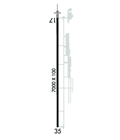
| Lat: N 2906.5 Long: W 09527.7 Elev: 25 Var: -05 Longest Runway: 7000 | ||
| Clr Del: 125.2 AWOS: 119.92 CTAF: 123.0 | ||
| ||||||||||||||||||||||||||||||||||||||||||||
| ||||||||||||||||||||||||||||||||||||||||||||
| ||||||||||||||||||||||||||||||||||||||||||||
| Rwy | Rwy | |||||||
| 7000x100 | 7000' | 109.10 - 174° | 7000x100 | 7000' | ||||
| Runway ID | Single Wheel | Double Wheel | Double Tandem Wheel | Dual Double Wheel |
| 17/35 | 60,000 | 95,000 | 120,000 | N/A |
| These numbers are Advisory and are not limits. The Airport Manager should have more accurate Weight Limits | ||||
 Airport Diagram might not be current. | |
| Facility Name: | TEXAS GULF COAST RGNL |
| City Name: | ANGLETON/LAKE JACKSON |
| County: | BRAZORIA |
| State abbrev: | TX |
| State Name: | TEXAS |
| Ownership: | PUBLICLY OWNED |
| Use: | OPEN TO THE PUBLIC |
| Owner's Name: | BRAZORIA COUNTY |
| Address: | BRAZORIA COUNTY COURTHOUSE |
| ANGLETON, TX 77515 | |
| Owner's Phone: | 979-849-5711 |
| Manager's Name: | JEFF BILYEU |
| Address: | 8000 AIRPORT WAY |
| ANGLETON, TX 77515 | |
| Phone: | 979-849-5755; ALSO 979-849-5756. |
| FAA Region: | SOUTHWEST |
| FAA Field Office: | TEX |
| Date | Sunrise | Sunset |
|---|---|---|
| 09/24/21 Friday | 7:11 | 19:16 |
| 09/25/21 Saturday | 7:12 | 19:15 |
| 09/26/21 Sunday | 7:12 | 19:14 |
| 09/27/21 Monday | 7:13 | 19:13 |
| 09/28/21 Tuesday | 7:13 | 19:11 |
| 09/29/21 Wednesday | 7:14 | 19:10 |
| 09/30/21 Thursday | 7:14 | 19:09 |
| 10/01/21 Friday | 7:15 | 19:08 |
| 10/02/21 Saturday | 7:15 | 19:07 |
| 10/03/21 Sunday | 7:16 | 19:05 |
| 10/04/21 Monday | 7:16 | 19:04 |
| 10/05/21 Tuesday | 7:17 | 19:03 |
| 10/06/21 Wednesday | 7:18 | 19:02 |
| 10/07/21 Thursday | 7:18 | 19:01 |
| Airport Attendance Schedule | SAT-SUN 0800-1830, MON-FRI 0630-1830 |
| Airport Status | OPERATIONAL (This Status can change at any time - please check NOTAMS) |
| Airport Lighting Schedule | MIRL RY 17/35 PRESET LOW INTST; TO INCR INTST & ACTVT MALSR RY 17 - CTAF. PAPI RYS 17 & 35 OPERATES CONTINUOUSLY. |
| Airport Storage Available | Tie Downs, Hanger |
| Extra Services Available | Charter, Flight Instruction, Aircraft Rental |
| Wind Indicator | YES - (lighted) |
| Control Tower | NO |
| CTAF Frequency | 123.000 |
| Unicom Frequency | 123.000 |
| Rotating Beacon Color | CLEAR-GREEN (Light Land Airport) |
| Segmented Circle | YES |
| Landing Fee | NO |
| Airport Inspected | STATE - performed by FAA AIRPORTS FIELD PERSONNEL |
| Inspection Date | 06/10/2021 |
| Type of Fuel Available | Grade 100LL, JET A (freeze point -40C); -10100LL FUEL AVBL 24 HRS SELF SERVICE. FOR JET A FUEL AFT HRS CALL 979-319-2740. |
| Airframe Repair Service | MINOR |
| Power Plant Repair Service | MAJOR |
| Latitude | N2906.5 |
| Longitude | W09527.7 (ESTIMATED) |
| Arpt Elevation | 25ft (SURVEYED) |
| Magnetic Variation | 05E |
| 4 miles SW; ARPT LCTD 4.6 NM NW OF LAKE JACKSON. | of ANGLETON/LAKE JACKSON |
| Traffic Pattern Altitude | |
| Sectional Chart | HOUSTON |
| Operations (Reported) | Yearly | Avg. Daily |
|---|---|---|
| General Aviation Transient | 45831 | 126 |
| General Aviation Local | 27740 | 76 |
| Air Taxi | 2890 | 8 |
| Commerical | 520 | 1 |
| Commuter | 0 | 0 |
| Military | 1000 | 3 |
| Aircraft based on Field | |
|---|---|
| General Aviation Singles | 63 |
| General Aviation Multi | 5 |
| Jet Aircraft | 1 |
| General Aviation Helicopters | 5 |
| Military Aircraft | 0 |
| Gliders | 0 |
| Ultralights | 0 |
| FSS on field | NO |
| FSS tie-in | MONTGOMERY COUNTY |
| FSS Phone | 1-800-WX-BRIEF |
| Who issues Notams | LBX |
| Notam D service at airport | YES |
| ARTCC Name | HOUSTON |
| Airport Certification | |
| Aircraft Rescue & Firefighting Index | AIRPORT HAS A CERTIFICATE UNDER CFR PART 139 |
| Airport of Entry | No |
| Custom Landing Rights | No |
| Joint Civil/Military | No |
| Military Landing rights | YES |
| NATIONAL PLAN OF INTEGRATED AIRPORT SYSTEMS (NPIAS) |
| GRANT AGREEMENTS UNDER FAAP/ADAP/AIP |
| ASSURANCES PURSUANT TO TITLE VI, CIVIL RIGHTS ACT OF 1964 |
| THIS AIRPORT HAS BEEN SURVEYED BY THE NATIONAL GEODETIC SURVEY. |
| ACR OPNS INVOLVING ACFT WITH MORE THAN 30 PSGRS ARE NOT AUZD IN EXCESS OF 15 MIN BEFORE OR AFT SKED ARR OR DEP TIMES WITHOUT PRIOR COORDINATION WITH AMGR & CONFIRMATION THAT ARFF SVCS ARE AVBL PRIOR TO LNDG OR TKOF. |
| FOR CD CTC HOUSTON APCH AT 281-443-5844. TO CNL IFR CTC HOUSTON APCH AT 281-443-5888. |
Airport Communications & Frequencies:
| ||||||||||||||||
| Runway: 17 | Runway: 35 | ||
| Mag heading: | 175° | Mag heading: | 355° |
| Rwy Slope: | -.01% Down | Rwy Slope: | .01% Up |
| Approach: | ILS/DME | Approach: | |
| Pattern: | Right Traffic | Pattern: | Left Traffic |
| Markings: | PRECISION INSTRUMENT | Markings: | NONPRECISION INSTRUMENT |
| Marking Condition: | GOOD | Marking Condition: | GOOD |
| Arresting Dev: | Arresting Dev: | ||
| Lat & Long: | N2907.1 W09527.7 | Lat. & Long.: | N2905.9 W09527.7 |
| Elev: | 24.9 ft. MSL | Elev: | 24.4 ft. MSL |
| TCH: | 52 ft. AGL | TCH: | 40 ft. AGL |
| Visual Glide Path: | 3.00 degrees | Visual Glide Path: | 3.00 degrees |
| Displaced Threshold: | No | Displaced Threshold: | No |
| Touchdown Zone: | YES | Touchdown Zone: | YES |
| Touchdown Elev.: | 25.2 feet | Touchdown Elev.: | 24.5 feet |
| Visual Glide Slope: | 4-Light PAPI on LEFT side of Runway | Visual Glide Slope: | 4-Light PAPI on LEFT side of Runway |
| RVR Equipment: | RVR Equipment: | ||
| RVV Equipment: | NO | RVV Equipment: | NO |
| Approach Lights: | MALSR - 1,400 foot medium intensity approach lighting system with runway alignment indicator lights | Approach Lights: | |
| REIL: | NO | REIL: | NO |
| Centerline Lights: | NO | Centerline Lights: | NO |
| Touchdown lights: | NO | Touchdown lights: | NO |
| Runway Category: | Precision Instrument Runway | Runway Category: | Runway with a Non-precision Approach having visibility minimums greater than 3/4 mile |
| Declared Distances: | TORA:7000' TODA:7000' ASDA:7000' LDA:7000' | Declared Distances: | TORA:7000' TODA:7000' ASDA:7000' LDA:7000' |
Thanks for using FltPlan.com
all rights reserved © 1999-2021 by Flight Plan LLC
